
Cheek, Oklahoma disappeared beneath Picher’s mining expansion decades ago, and now even Picher itself has been erased—abandoned in 2009 after catastrophic environmental contamination and tornado damage. You’ll find empty streets, towering chat piles, and rust-orange waterways coursing through the Tar Creek Superfund site, but proper protective equipment is essential due to lead contamination. Highway 77 leads to this haunting landscape where 14,000 mine shafts honeycomb the unstable ground beneath crumbling foundations. The complete story of what happened here—and how to explore safely—unfolds below.
Key Takeaways
- Cheek is located near Picher in Ottawa County; use Highway 77 and offline maps as signage becomes scarce on unpaved roads.
- Bring protective equipment including respirators, thick-soled boots, and gloves due to lead contamination from the Tar Creek Superfund site.
- Explore with at least three people, inform someone of your location and return time, and test structural stability constantly.
- Expect minimal structures: concrete foundations, chat piles, and the Cardin water tower dominate the abandoned landscape with few buildings remaining.
- Exit immediately if dizzy, as poisonous gases and lead-contaminated soil pose serious health risks throughout the 40-square-mile Superfund area.
Understanding Picher’s Mining Legacy Before You Visit
Before you set out for the ghost town of Picher, you need to understand the colossal mining operation that transformed a patch of northeastern Oklahoma prairie into one of America’s most productive—and ultimately most toxic—landscapes. From 1917 to 1947, this place generated over $20 billion in ore, supplying more than half the lead and zinc that powered World War I.
At its peak, 14,000 miners worked beneath your feet through 1,200 vertical shafts, creating an underground honeycomb that now threatens to swallow what’s left above. The mining heritage here isn’t just history—it’s written in towering chat piles and contaminated waterways. Yet the community resilience that built fourteen thousand lives here still echoes through empty streets you’ll explore.
Essential Safety Precautions for Exploring Abandoned Sites
When you step into an abandoned structure in Picher—where mine shafts plunge beneath chat piles and decay has claimed every surface—you’re entering a space engineered to extract ore, not to accommodate visitors decades after its last shift ended.
Proper protective equipment isn’t optional: thick-soled boots, respirators for asbestos and black mold, gloves against rusted metal and industrial residue. Never explore alone—three minimum, so one stays with the injured while another seeks help. Inform someone outside your location and return time.
Conduct cautious structural inspections before every step. Wood floors disintegrate under weight; concrete sags dangerously from walls. Staircases collapse without warning. Water conceals drop-offs and hypothermia-inducing temperatures. Exit immediately if you’re dizzy—poisonous gases don’t announce themselves.
Your freedom demands responsibility, not recklessness.
Highway 77 cuts south from Oklahoma City like a promise of vanishing America, carrying you past wind-stripped prairie and cattle towns that time forgot until Ardmore rises from the heat shimmer—your last supply point before the ghost roads begin.
From here, swing southwest fourteen miles toward the Carter County line, where N3210 Road holds the key. County road conditions vary wildly—spring rains transform dirt tracks into impassable mud, while summer bakes them hard as concrete.
Signage placement becomes scarce once you leave pavement behind; download offline maps before cell service dies. The south county line intersection marks your arrival, seven miles from Lone Grove, where Cheek’s remnants wait among mesquite and memory, silent legacy to dreams that dried up with the Red River.
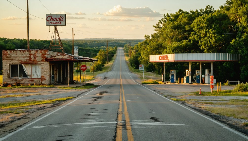
What Remains: Key Landmarks and Structures to See
Silence greets you first—the kind that settles over places where human voices once echoed through doorways and across porches. You’ll find concrete foundations scattered like tombstones across overgrown lots, marking where homes once stood.
The street grid remains visible, though vegetation chokes former pathways and gates block most access points. A few wooden structures still defy gravity, rotting slowly back into earth. Without interpretive signage locations, you’re left reading the landscape itself—chat piles dominating the horizon, their toxic mounds memorial to industry’s appetite.
Ghost town restoration efforts haven’t reached Picher; preservation here means keeping explorers out. The neighboring Cardin water tower pierces the skyline, a lonely sentinel watching over 14,000 abandoned mine shafts and unstable ground beneath your feet.
The Tar Creek Superfund Site: What You Need to Know
Before you venture into what remains of Picher, understand this: you’re standing at the threshold of America’s most toxic ghost town. Designated a Superfund site in 1983, Tar Creek sprawls across 40 square miles of abandoned mines and 30 towering chat piles—some reaching 200 feet high. These mountains of lead-contaminated tailings poison everything they touch.
You’ll notice the creek runs orange, carrying a million gallons of acidic discharge daily. The Native American impact remains profound—the Quapaw Nation derived minimal benefit from decades of mining on their land, excluded from remediation efforts until recently. Ongoing cleanup challenges persist despite $300 million spent: children still test positive for lead poisoning, and toxic dust swirls with every wind. Freedom here comes with serious health risks.
Best Times to Visit and Weather Considerations
You’ll find Cheek’s abandoned structures most rewarding during fall and winter, when temperatures between 50-70°F allow comfortable exploration and golden prairie grasses frame weathered buildings under crystalline skies.
Spring brings flooding risks to low-lying areas and unpredictable storms that can strand you on muddy rural roads, while summer’s 90°F-plus heat makes midday visits punishing across exposed, shadeless terrain.
Plan your visit around Oklahoma’s April-June tornado season and chase the long shadows of winter afternoons—when light angles through empty doorways and creates the haunting contrasts that make ghost town photography unforgettable.
As the storms brew in the distance, consider exploring abandoned places in Tulsa where nature reclaims what was once bustling with life. Each decaying structure tells a story, offering a glimpse into the past that photography can immortalize. These forgotten sites become canvases, allowing you to capture the eerie beauty of neglect intertwined with the vibrant spirit of Oklahoma.
Seasonal Weather Patterns
Planning your ghost town adventure to Cheek requires more than just marking dates on a calendar—Oklahoma’s dramatic seasonal shifts will shape every aspect of your experience. Spring (March-May) delivers violent thunderstorms and storm chasing opportunities as temperatures climb from 63°F to 79°F, though you’ll face maximum precipitation and severe weather.
Summer’s oppressive heat—regularly surpassing 100°F—brings shorter-lived storms and seasonal pests and wildlife. Fall (September-October) offers your sweet spot: pleasant 73-84°F temperatures with secondary precipitation peaks and minimal severe weather threats. Winter turns roads treacherous with freezing rain and unpredictable snowfall ranging from ten to thirty inches.
The state’s 3,000 annual sunshine hours guarantee dramatic lighting for photography, while western Oklahoma’s declining precipitation frequency means drier exploration conditions.
Safety During Storm Season
When storm clouds mass on Oklahoma’s horizon during March through June, visiting Cheek transforms from rural adventure into genuine survival exercise. You’re entering Tornado Alley’s heart, where EF4 monsters like the 2008 Picher twister obliterated twenty blocks and claimed six lives just miles away.
Planning for extreme storms means checking Storm Prediction Center alerts and AccuWeather’s hourly updates before departure—those 88-98% rain chances signal flash floods and 175 mph gusts. Target late fall’s 57-71°F comfort or winter’s quiet months when supercells sleep. Monitoring weather forecasts isn’t paranoia here; it’s survival protocol.
Schedule your exploration during zero-precipitation windows like forecasted clear stretches. When thunder rumbles across abandoned streets, seek shelter immediately. This ghost town doesn’t forgive cavalier weather decisions.
Optimal Photography Lighting Conditions
Golden hour transforms Cheek’s weathered structures into photographer’s gold—those thirty minutes after sunrise (around 6:47 AM in summer, 7:32 AM in winter) bathe collapsed barns and rusted equipment in amber light that softens decay into art. Evening golden hour timing delivers equally dramatic results, casting long shadows across empty Main Street between 7:30-8:00 PM summer months, 5:00-5:30 PM winter.
Seasonal lighting variations dramatically shift your creative possibilities. Spring’s green contrast amplifies rust-red structures. Summer’s harsh midday sun bleaches authenticity from your shots—stick to dawn or dusk. Fall’s golden grasses mirror morning light. Winter’s low-angle sun extends shooting windows throughout the day, while overcast conditions eliminate harsh shadows, revealing texture in weathered wood and crumbling foundations you’ll miss in bright sunshine.
Photography Guidelines and Respectful Exploration
Before you even lift your camera to frame Cheek’s weathered storefronts, you’ll need to understand that ghost town photography demands equal parts technical skill and ethical responsibility. Document decay patterns without disturbing them—your wide-angle shots of crumbling jailhouses and sun-bleached saloons tell Oklahoma’s untold stories.
Pack your tripod for low-light interiors, but verify access first; some sites have tightened rules following vandalism incidents elsewhere.
Capture those rusty door handles, windswept curtains, and forgotten bottles exactly where you find them. Shoot both black-and-white and color to preserve different moods. Research Cheek’s history beforehand so you’re chasing meaningful compositions, not trespassing violations.
Your lens becomes a preservation tool when you’re committed to abandoned structure preservation—leaving nothing but footprints while collecting images that spark historical awareness and respect Oklahoma’s fading frontier heritage.
Nearby Accommodations and Amenities in Ottawa County
After exploring Cheek’s abandoned foundations and weathered remnants, you’ll find comfortable lodging options scattered throughout Ottawa County, from the highly-rated Drury Inn & Suites in nearby Joplin to budget-friendly motels starting at $68 in Miami.
The closest accommodations cluster around Miami and Quapaw, placing you within twenty minutes of the ghost town while offering modern amenities like pools, complimentary breakfasts, and evening kickback perks.
Stock up on supplies and grab meals in Miami before heading out, as Cheek’s remote location offers no services—just silence, ruins, and the wind sweeping through collapsed structures.
Lodging Options Near Picher
Since Picher’s evacuation left the toxic ghost town without a single operating business, you’ll need to base yourself in one of the nearby communities that ring this contaminated landscape. Miami, fifteen miles south, offers the strongest lodging availability with chain motels lining US-69—your headquarters for exploring the chat piles and abandoned streets. Lodging pricing runs $60-100 nightly, fluctuating with seasonal ghost town tourism.
Commerce provides closer proximity to Picher’s skeletal remains, while Quapaw’s tribal nation operates basic accommodations near the mining field remnants. Don’t consider staying in Cardin or Treece—these fellow ghost towns share Picher’s uninhabitable fate. Miami’s Dobson Museum houses relocated Picher artifacts, creating a natural base camp where history meets practicality before you venture into the superfund wasteland.
Dining and Supply Stops
Miami’s restaurant row along US-69 becomes your lifeline after photographing Picher’s contaminated ruins—fifteen minutes south, the scent of hand-breaded chicken fried steak at Buttered Bunn’s Cafe replaces the metallic tang of chat piles. You’ll find distinctive dining options spanning Waylan’s Ku-Ku Burger‘s 1960s Route 66 nostalgia to Carlos Montez’s authentic Mexican plates.
Montana Mike’s Steakhouse delivers quality cuts without gouging your road trip budget, while Goodfella’s Pizzeria has perfected custom pies since 2005.
High Winds Casino offers 24/7 sustenance three miles east on Highway 10—all-you-can-eat catfish Fridays fuel late-night exploration. Stock up at convenient supply stops like Braum’s for dairy essentials and frozen desserts, or hit the casino gift shop for forgotten necessities. Ottawa County’s mom-and-pop establishments keep you mobile between ghost town discoveries.
Connecting With Tri-State Mining District History
Standing at the edge of these abandoned chat piles and rust-stained landscapes, you’re witnessing the remnants of America’s most productive lead and zinc mining operation—a century-long industrial saga that stretched from the 1850s to the 1970s across the borders of Oklahoma, Kansas, and Missouri.
The Picher field delivered staggering numbers:
– 60% of total district production—over 15 million tons of lead and zinc
- 55% of America’s zinc supply from 1921 to 1925
- $1 billion in production by 1950
Today, exploring environmental remediation efforts reveals the complex legacy of mining impacts on Quapaw tribe lands, where 248 mills once thundered with activity. You’ll find interpretive sites documenting how this district powered American industry while leaving behind contaminated waters and towering waste piles—a cautionary tale etched into Oklahoma’s soil.
Legal Considerations and Property Boundaries
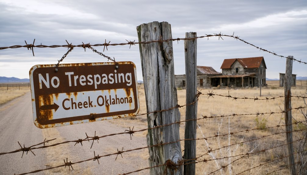
Before you venture toward Picher’s eerie remains, understand that you’re approaching one of America’s most restricted ghost towns—a place where concrete barricades and federal oversight have transformed curiosity into criminal trespass. The EPA’s exclusion zone isn’t merely suggested—it’s enforced.
Picher isn’t an adventure—it’s a federally restricted exclusion zone where curiosity becomes criminal trespass under EPA enforcement.
No trespassing signs mark the perimeter where 14,000 abandoned mine shafts create unpredictable sinkholes beneath your feet.
Property owner responsibilities vanished with the buyouts, replaced by federal jurisdiction over this toxic wasteland. The 100-million-ton chat piles aren’t historical curiosities—they’re active hazmat disposal procedures in progress.
Main strips remain partially visible, but grid streets are barricaded. US Route 69 offers glimpses, yet crossing those concrete boundaries risks prosecution.
Contaminated water, unstable ground, and perpetual remediation mean Picher’s boundaries protect you from invisible dangers lurking beneath seemingly solid earth.
Frequently Asked Questions
Are There Any Guided Tours Available for Visitors to Picher?
No guided tours exist—you’ll navigate Picher’s haunting ruins independently. For organized experiences, explore nearby attractions for guided tours in surrounding areas, or contact local historical society contacts who can share stories while you forge your own path through history.
Can I Bring My Pets When Exploring the Abandoned Town?
You can bring leashed pets while exploring public areas, but avoid trespassing on private property where restrictions may apply. Keep your companion close as you wander through weathered structures and overgrown streets of this hauntingly beautiful ghost town.
Is Cell Phone Service Available in the Picher Area?
You’re in luck—all major carriers deliver excellent coverage quality throughout Picher. Verizon, AT&T, and T-Mobile provide fast LTE with strong data connection strength, ensuring you’ll stay connected while exploring these hauntingly beautiful, abandoned streets freely.
Are There Any Memorials or Museums Dedicated to Former Residents?
No dedicated memorials exist for Cheek’s residents, but you’ll find the Picher historical society preserving mining town memories nearby. Explore abandoned school buildings standing as silent monuments to communities that once thrived along Oklahoma’s forgotten roads.
What Should I Do if I Encounter Other Visitors or Explorers?
Maintain respectful distance from fellow explorers, acknowledging them with a friendly nod. Avoid disrupting their explorations or photography. Share discoveries courteously if approached, but let others experience their own journey through these haunting, abandoned landscapes independently.


