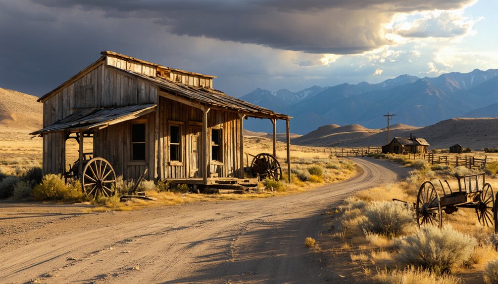
You’ll find Chilly about 20 miles north of Mackay, Idaho, where a gravel road climbs to 6,316 feet through sagebrush-covered Pioneer Mountain foothills. Founded in 1902, this remote settlement once housed Chinese, English, French, and Greek miners who endured -48°F winters before automobiles made the stage stop obsolete in 1925. Today you can explore crumbled foundations, a weathered cemetery, and imagine the log cabins that briefly anchored this high-altitude community before it vanished into Idaho’s backcountry history.
Key Takeaways
- Chilly is located 20 miles north of Mackay, Idaho at 6,316 feet elevation in Custer County’s remote backcountry.
- The ghost town sits at coordinates 44.0776943°N, -113.8789247°W, surrounded by the Pioneer Mountains in Idaho’s high country.
- Founded in 1902, Chilly thrived as a stage route stop until automobiles made it obsolete in 1925.
- All original structures have vanished, leaving only crumbled foundations along the road to mark the former settlement.
- Extreme conditions including -48°F winters and avalanches challenged this diverse mining community throughout its 23-year existence.
Remote High-Elevation Settlement in Central Idaho’s Backcountry
Tucked away in the rugged folds of Custer County’s backcountry, Chilly sits at 6,316 feet above sea level where the Big Lost River Valley meets the Pioneer Mountains. You’ll find this weathered outpost at coordinates 44.0776943°N, -113.8789247°W, roughly 20 miles north of Mackay on terrain that hasn’t changed much since 1902. The geographical remoteness here isn’t just romantic—it’s absolute. No cell service. No grocery stores. Just sagebrush and wind.
The harsh living conditions that gave Chilly its name still grip this elevation, where winter temperatures plunge to -48°F. Early settlers wrapped their cabins in thick adobe-frame walls against the cold, understanding what you’ll quickly learn: at 6,300 feet, survival demanded respect. Those who stayed embraced isolation as freedom’s price. The surrounding terrain spans from a minimum of 6,273 feet to a maximum of 6,401 feet elevation, creating a relatively compact basin that trapped both settlement and cold air. Navigation through this backcountry requires the Chilly Buttes USGS topo map, which charts the intricate folds and draws that define this remote settlement’s geography.
Early Pioneers and the Harsh Realities of 7,000-Foot Living
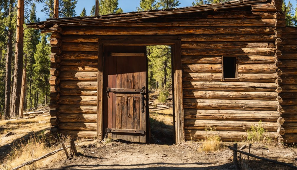
You’ll find the story of Chilly’s founding etched in frost and mud—Hunter and Thalman discovered only the Bradshaws living in a wheel-less covered wagon when they arrived to claim their homesteads. Hunter built a substantial log cabin that became the valley’s anchor, while Robert Thalman’s 1900 return with his bride led to an adobe house that literally couldn’t stand the weather—improperly cured bricks forced him to frame over the crumbling walls, creating two-foot-thick barriers against winters that plunged to 48 below zero.
At 7,000 feet, survival meant adapting fast or freezing, and these early settlers learned to turn failure into insulation. The Chilly Mercantile Company became the community’s lifeline, stocking everything from flour to hardware while serving as the town’s post office under the same roof. Unlike the dispersed rural settlement pattern that defined the Upper Snake River Valley’s homesteads, where families lived miles apart on separate farms, Chilly’s extreme elevation forced pioneers into closer proximity for survival.
Founders Brave Extreme Winters
When Robert Thalman and J.B. Hunter staked their claim in upper Lost River Valley, they faced winters that’d test any pioneer’s resolve. From October through May, frigid conditions dominated this 7,000-foot elevation landscape.
Hunter’s substantial log cabin construction became a survival necessity, not just shelter—thick timber walls offering protection against relentless snowfall and bone-chilling temperatures.
You’d find avalanches weren’t just possible; they were expected. The Custer Cemetery’s grave markers tell the story bluntly: “snowslide” carved into stone alongside names of those who didn’t make it through.
Livestock management challenges compounded these winter dangers, as keeping herds alive through eight-month freezes demanded constant vigilance. The Bradshaws, camping in their wheel-less covered wagon, embodied the raw determination required before proper structures stood ready.
The settlement attracted an ethnically diverse population, drawing people from China, England, France, and Greece, all lured by mining opportunities despite the brutal conditions. Summer brought its own hazards, with grass fires threatening the wooden structures that miners had worked so hard to build.
Adobe Failures and Solutions
Building with adobe at 7,000 feet proved disastrous for Chilly’s early settlers. You’ll find they made bricks from slough clay in the upper valley, but local soil properties sabotaged proper curing techniques. The same treacherous slough that claimed mired cattle couldn’t produce stable building materials.
When temperatures plummeted to 48 below zero, those crumbling adobe walls demanded immediate design modifications. Pioneers ingeniously built wooden frame houses over the failing adobe structures, creating nearly two-foot-thick walls that transformed structural weakness into exceptional insulation. This adaptation meant survival—thick barriers held precious heat against brutal winter nights.
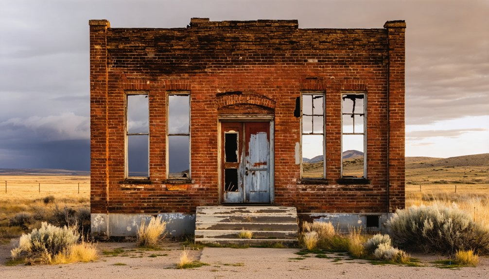
Today, you won’t find evidence of their efforts. Every structure vanished after 1925, including the cement block schoolhouse, leaving only stories of their resourceful battle against elevation and elements. Similar mining communities throughout the Sawtooth Mountains faced equally harsh conditions, though some like nearby Custer managed to thrive for over three decades before fading into history. Custer’s peak population of 600 in 1896 made it one of the region’s most substantial settlements before it too became a ghost town by 1910.
From Thriving Stage Stop to Abandoned Outpost
When J.B. Hunter and the Thalman family rolled into this high valley, they found only the Bradshaws’ wagon-turned-shelter and endless sagebrush stretching toward the Pioneer Mountains. Hunter saw opportunity where others saw isolation—he built a two-story hotel from salvaged lumber hauled up from Whiskey Springs, opened a general store, and suddenly this lonely spot 20 miles north of Mackay had a reason to exist.
The stage route brought enough travelers through that you could’ve grabbed coffee, bought supplies, and rented a bed for the night without riding another dusty mile. Like other Western settlements, Chilly’s fate hung on forces beyond anyone’s control—weather and isolation could make or break a town just as quickly as a played-out mine or a rerouted railroad. The nearby Yankee Fork region experienced its own mining boom during the late 1800s, drawing prospectors through mountain passes and stage stops like Chilly.
Hunter and Thalman Arrive
After pushing through the rugged terrain from Utah in 1898, J.B. Hunter and his partner Robert Thalman discovered a valley ripe for the taking. You’ll find their story mirrors your own hunger for independence—they arrived to find just one couple living in a wagon with its wheels removed. The nearest settlements, Mackay and Challis, sat 20 and 40 miles away.
Hunter’s sheep business expertise and the Homestead Act’s promise of free land drove their venture. They employed adaptive construction methods, with Thalman building his first home from adobe bricks sourced from the valley’s slough. Hunter constructed a substantial log cabin that became the community’s lifeline, eventually establishing the Hunter Store when fellow settlers couldn’t make the grueling supply runs to Blackfoot themselves.
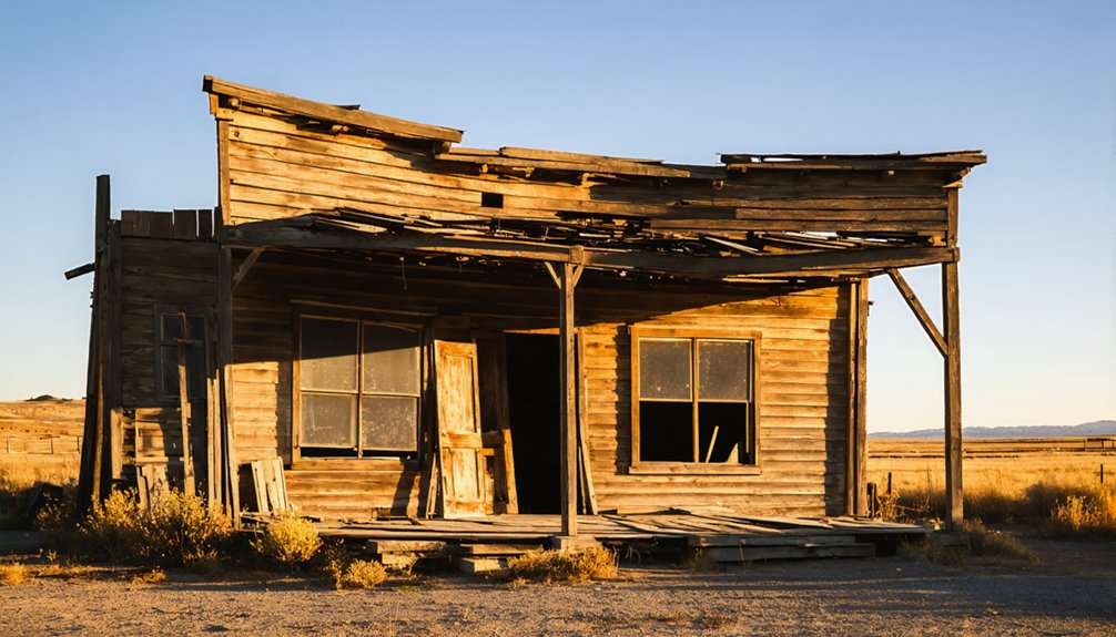
Hotel and Store Operations
As Chilly’s population grew, J.B. Hunter relocated a two-story frame building from Whiskey Springs, transforming it into the settlement’s first hotel. At 7,000 feet elevation, thick walls became essential for survival—temperatures plummeted to 48 degrees below zero. You’ll find it remarkable how travelers found warm refuge in its multiple rooms while the general store thrived alongside, serving cowboys and locals alike.
The operation faced constant challenges:
- Stove design required massive cast iron models to combat brutal winters
- Supply delivery challenges tested patience on treacherous mountain routes
- Adobe-reinforced construction provided paramount insulation against elements
When fire consumed the store in April 1925, shortly after Hunter’s death, Chilly’s fate was sealed. Within months, the town vanished—a testament to frontier life’s fragility.
Swift 1925 Abandonment
The automobile’s thunderous arrival in 1925 transformed Swift from bustling stage stop to silent ruin in mere months. You’ll find where freight handlers once coordinated mining district operations, now just crumbled foundations along the Chilly road. Transportation infrastructure challenges that seemed manageable—rough terrain, seasonal closures—became irrelevant when cars bypassed these remote outposts entirely.
The change wasn’t gradual. Swift’s last stagecoach departed, and nobody returned. Travelers who’d once relied on its corrals and bunks simply drove past, reaching destinations in hours instead of days. By 1930, weather-beaten buildings stood empty, their purpose obsolete.
Today, you’ll spot remnants where miners once rested between claims—a memorial to how quickly progress abandons what it no longer needs.
What Remains at Mountain Springs Ranch Today
Standing at 5563 N Chilly Road today, you’ll find Mountain Springs Ranch operating as a working cattle operation rather than the abandoned relic its ghost town neighbors have become. Mountain Springs Ranch LLC has stewarded this property since 1997, transforming it into a model of sustainable ranching under fifth-generation rancher Shane Rosenkrance.
What you’ll discover here represents ranching’s evolution:
- Active grazing operations with cooperative federal land management replacing century-old adversarial relationships
- Heritage preservation activities maintaining historic structures while supporting modern livestock operations
- Renewable energy infrastructure complementing traditional ranching with forward-thinking resource management
The ranch demonstrates that Idaho’s ranching heritage needn’t become another ghost story. It thrives through biological monitoring, conservation contracts with local bidders, and proving environmental recovery coexists with working landscapes.
Getting to Chilly From Challis and Mackay
Reaching Chilly requires traversing the high desert corridors that freight wagons once rumbled through, hauling supplies from Blackfoot to the mountain mining camps. You’ll find two primary approaches: from Challis to the east or Mackay to the southwest. Both routes echo the old stage stop path where travelers once braced against early transportation challenges, their journeys dictated by snowpack and temperature swings.
The road climbs through Custer County’s sagebrush valleys toward 7,000-foot elevations where remote environmental conditions still demand respect. Pack emergency gear—that -48°F winter reading wasn’t folklore. Your vehicle should handle gravel and washboard sections with confidence. Highway 75 brings you close to Challis, while Mackay anchors the southern access. Between these points, you’ll trace the ghosts of freight teams and stage drivers who knew this landscape’s unforgiving beauty.
Exploring the Cemetery and Historic Structures
After traversing those weathered stage routes, you’ll find yourself standing at the threshold of Chilly’s most enduring landmark—a cemetery that refused to become a ghost alongside the town it outlived. Dating to the 1890s, this sacred ground cradles pioneer families like the Hunters and Thalmans beneath Idaho’s endless sky.
Your uphill walk through ranchland reveals:
- Pioneer gravestone discoveries marking settlers from 1898 onward, including J.B. Hunter (1924)
- Modern burials alongside weathered markers—testament to ongoing cemetery restoration efforts
- Adobe ruins near the slough where locals once made bricks when lumber remained scarce
The ancient butte frames your view across Big Lost River basin. While homes, barns, and the cement block school vanished after 1925’s devastating store fire, these graves persist—silent witnesses to ambitions that couldn’t outlast the harsh valley.
Connecting Your Visit With Nearby Salmon River Ghost Towns
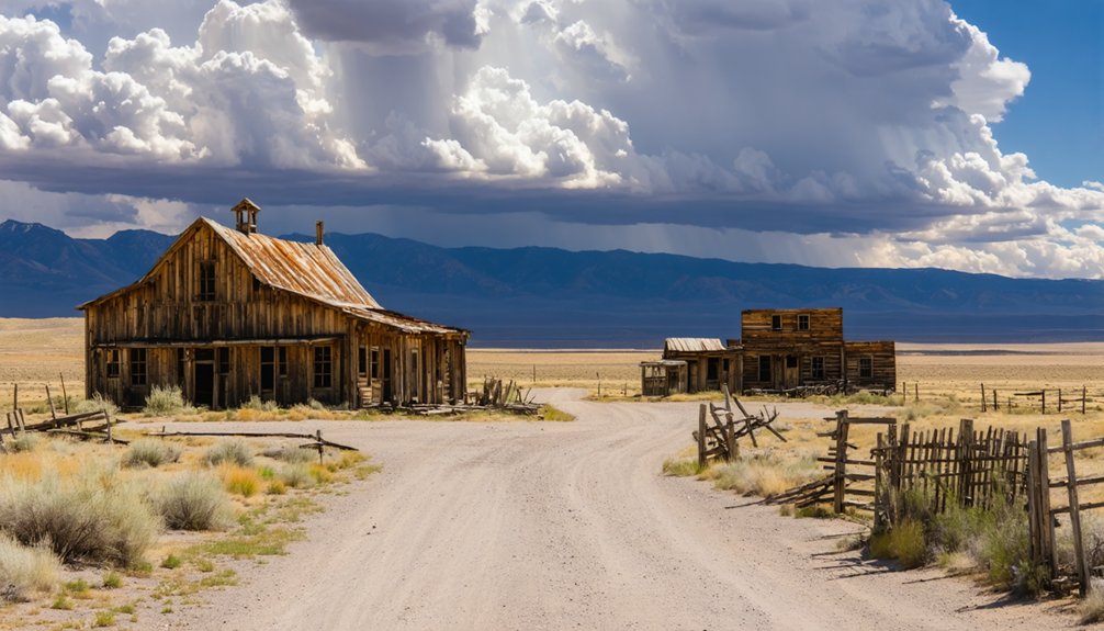
Chilly’s windswept cemetery marks just the beginning of Idaho’s richest ghost town corridor—a 100-mile arc where nineteenth-century mining fever left behind dozens of abandoned settlements clinging to canyon walls and mountain passes.
You’ll find Custer between Challis and Stanley, where restored buildings and a summer museum reveal mining operations from 1879-1911. Head north to Bonanza for an authentic, unrestored experience—just weathered log cabins at 6,375 feet. Shoup offers something different: four residents, gold mine tours, and a historic schoolhouse you can actually sleep in. Gilmore sits closest to Montana’s border with forty structures frozen since 1929’s collapse. Each stop demands different visitor amenities—Custer’s fully developed, while Bonanza requires serious backcountry readiness. Pack accordingly.
Frequently Asked Questions
What Time of Year Is Best to Visit Chilly?
Visit Chilly during spring or fall’s shoulder season advantages when you’ll find ideal weather conditions without winter’s harsh closures. You’re free to explore mountain trails comfortably, photograph restored buildings, and experience central Idaho’s ghost towns at their accessible best.
Are Pets Allowed When Exploring the Ghost Town Site?
Yes, you’ll find pet-friendly policies welcoming leashed dogs at these historic sites. Your furry companion can explore trails alongside you, with nearby lodging options in Stanley offering pet amenities for your adventure-filled stay.
Is Camping Permitted at or Near Mountain Springs Ranch?
You’ll find camping at Mountain Springs Campgrounds nearby, offering campsite facilities with space for your crew. You can explore nearby hiking trails at dawn, then return to your firepit under star-filled skies—pure freedom awaits.
Do I Need Permission to Access Private Property at Chilly?
Crossing invisible boundary lines requires respect—you’ll need permission before entering any private property at Chilly. Private property restrictions protect owners’ rights, while historical preservation concerns safeguard these weathered remnants. Stick to public areas and you’ll roam freely.
Are There Guided Tours Available for the Ghost Town?
Chilly doesn’t offer organized guided tours availability since it’s an unrestored private property. However, you’ll find excellent walking tour options at nearby Custer Ghost Town, where knowledgeable guides share engrossing mining stories throughout summer months.
References
- https://custer.idgenweb.org/history/chillyriseandfall.html
- http://freepages.rootsweb.com/~gtusa/history/usa/id.htm
- https://pinintheatlas.com/travel-blogs/ghost-towns-of-idaho/
- https://www.ghosttowns.com/states/id/chilly.html
- https://www.thegoldminehotel.com/ghost-towns-and-haunted-places-in-idaho
- https://history.idaho.gov/wp-content/uploads/2018/08/0064.pdf
- https://www.youtube.com/watch?v=iS7mvqHQv-8
- https://visitidaho.org/things-to-do/ghost-towns-mining-history/
- https://www.youtube.com/watch?v=8ar0QEhhpP8
- https://en-us.topographic-map.com/map-khnmt6/Chilly/