Navigate to GPS coordinates 39.5352759°N, 96.6308443°W in Riley County to find Cleburne’s ghostly remains scattered across Tuttle Creek Reservoir’s mudflats. You’ll discover concrete foundations, deteriorating sidewalks, and a phantom street grid marking where this 1857 settlement once thrived before the catastrophic 1951 flood sealed its fate. Bring your camera, GPS device, and sturdy boots to explore the limestone schoolhouse foundation and residential plots that survived when 3,000 residents abandoned their homes to rising waters. The complete story of this drowned community and neighboring ghost towns awaits below.
Key Takeaways
- Cleburne’s ghost town site sits at GPS coordinates 39.5352759°N, 96.6308443°W in Riley County near Blue Rapids.
- Visit scattered concrete foundations, deteriorating picnic shelters, and limestone schoolhouse remains marking the vanished community’s street grid.
- Bring camera equipment, flashlights, first aid kit, and GPS for safe exploration of the undocumented urban artifacts.
- Download free USGS topographic maps through the Blue Rapids SW quadrangle to navigate the ghostly landscape effectively.
- Explore nearby drowned towns like Garrison, Irving, and Bigelow around Tuttle Creek Reservoir for a complete ghost town experience.
The Story Behind Cleburne’s Rise and Fall
In 1857, a Scandinavian settler named Peter Carlson arrived along Big Timber Creek and unknowingly set the stage for a town that would rise, thrive, and vanish within a century. The settlement initially bore Big Timber’s name, honoring the town’s Scandinavian heritage through Carlson’s legacy.
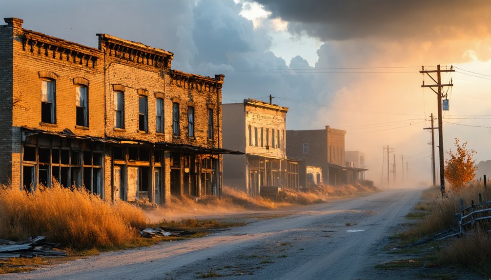
When the Blue Valley Railroad pushed through in 1886, residents renamed it Cleburne after superintendent John C. Cleburne. Cleburne’s early economy thrived on railroad connectivity, transforming a riverside outpost into a functioning community with stores, a high school, and a 1907 stone building housing both gymnasium and theater.
You’d have found prosperity here through the 1950s—until the catastrophic 1951 flood sealed the town’s fate. Federal dam construction displaced 3,000 residents, and by 1960, Cleburne vanished beneath government ambition.
Understanding the Tuttle Creek Dam Displacement
The catastrophic flood of July 1951 transformed the Kansas River basin into a waterlogged graveyard of shattered communities, killing seventeen people and displacing half a million residents in what locals would forever remember as Black Friday. You’ll discover that $1 billion in damage prompted Congress to finally greenlight Tuttle Creek Dam, sealing Cleburne’s fate.
When construction began in 1952, 3,000 people faced impossible choices—abandon family land or watch it sink beneath rising waters. The displacement impact on local economy devastated the Blue River Valley’s agricultural backbone. Challenges faced by displaced residents included relocating entire cemeteries, rebuilding businesses from scratch, and severing generational ties to 50,000 acres of productive farmland.
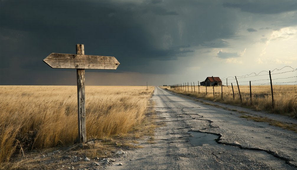
How to Find the Cleburne Townsite
Today’s ghost hunters can pinpoint Cleburne’s watery grave using GPS coordinates 39.5352759°N, 96.6308443°W, which place the vanished townsite in Riley County near Blue Rapids. You’ll find USGS topographic mapping through the Blue Rapids SW quadrangle, available as free printable downloads that’ll guide your exploration at 1,158 feet elevation.
When you arrive, trace the ghostly street grid still etched into the landscape. Scattered foundations mark where Big Timber’s residents once lived, while crumbling sidewalk remnants lead nowhere.
The lake now sits a quarter-mile distant, though a deteriorating park with weathered picnic shelter and playground equipment occupies what was once lakeside territory. Bring your imagination—you’ll need it to resurrect this drowned settlement from its sparse concrete bones and phantom road network.
What Remains at the Ghost Town Today
You’ll find scattered concrete foundations marking where homes and businesses once stood, creating a ghostly street grid you can still trace across the weathered landscape.
A deteriorating picnic shelter and rusted playground equipment sit abandoned near what used to be the reservoir’s edge, though the water has receded at least a quarter mile from its original shoreline.
Chunks of sidewalk and building remnants poke through the grass, offering tangible evidence of the community that vanished when Tuttle Creek Dam claimed this valley.
Visible Foundations and Streets
Scattered across the former townsite, concrete foundations mark where homes, businesses, and community buildings once stood before Cleburne’s 1960 razing. You’ll find these deteriorated but discernible remnants amid overgrown vegetation, their outlines preserved on U.S. Army Corps of Engineers land now converted to parkland. Foundation visibility remains excellent due to the lack of overlying structures, with concrete pieces littering the ground alongside intact sidewalk sections that trace original pedestrian routes.
The old street network preservation reveals Cleburne’s pre-1960 grid layout through concrete edges and landscape alignments. You’ll follow Cleburne Park Road two miles south from U.S. Highway 77 to reach these openly accessible remains. The quarter-mile buffer from Tuttle Creek Reservoir has protected the foundations, streets, and scattered debris that tell this abandoned community’s story.
Abandoned Park Facilities
Beyond the ghost town’s visible foundations lies an equally haunting landscape of abandoned park infrastructure, remnants of a recreational area that failed to thrive on Cleburne’s grave. You’ll discover deteriorated pavilions scattered throughout the grounds, their roofs caving inward and support beams rotting into the earth.
Dilapidated picnic areas sit frozen in time, concrete tables cracked and overturned amid encroaching vegetation. The park’s severe deterioration tells its own story of failure—a space built to celebrate what was lost, now lost itself.
Debris fields mark where facilities once stood, while concrete sidewalks snake through overgrowth like pale scars. Old roads fragment into broken pathways leading nowhere. The Corps-owned land has surrendered to nature’s reclamation, creating a double-layered abandonment that’ll resonate with anyone seeking authentic forgotten places.
Proximity to Lake Shore
Where Cleburne’s foundations once met the water’s edge, a quarter-mile gap now stretches between the ghost town and Tuttle Creek Lake’s current shoreline. You’ll notice this stark separation immediately—roughly 1,320 feet of dry land where waves once lapped at the town’s position on lake shore.
The park that replaced Cleburne was built when water touched the site directly, but shifts in reservoir levels have left it landlocked and deteriorating.
As you explore the crumbling picnic shelter and rusted playground equipment, you’re walking terrain that should be underwater according to the dam’s original promise. The receding shoreline exposes the full scope of what “Big Dam Foolishness” actually delivered: a ghost town neither properly submerged nor preserved, just abandoned to Kansas wind and fading memory.
Exploring the Foundations and Street Network
Today, the bones of Cleburne emerge from the prairie grass in fragments of concrete and stone. You’ll trace the original street grid across the abandoned townsite, where sidewalks and roadways persist as undocumented urban artifacts scattered throughout the landscape. Foundation patterns reveal the settlement’s true scale—residential plots beside commercial structures, all aligned with late 19th-century planning standards.
The limestone schoolhouse foundation stands as one of the most substantial remnants you’ll encounter. Stone foundations outlasted the wooden frames that were dismantled decades ago, offering architectural construction clues about building materials and methods. Debris fields mark where structures once stood. You’re free to wander this ghost grid, piecing together a community that thrived before the dam project erased it from maps in 1960.
Best Times to Visit the Abandoned Site
Spring transforms the Cleburne townsite into its most accessible version, with April through June offering that sweet spot where moderate temperatures meet manageable terrain. You’ll find ideal weather conditions hovering between 60-80°F, perfect for wandering crumbling foundations without battling extreme elements.
The trade-off? Tourist crowds and prices peak during these months as Kansas attractions draw visitors statewide.
Consider these alternatives for maximum freedom:
- September-November: Capture stunning photography during golden hour with temps around 50-75°F and calmer winds for exploring remote corners.
- March: Beat spring crowds while enjoying early warmth near 50°F and greatly reduced accommodation costs.
- January-February: Brave sub-40°F conditions for absolute solitude and rock-bottom prices—just prepare for potential snow blocking access roads.
Other Ghost Towns Near Tuttle Creek Reservoir
Beyond Cleburne’s weathered foundations, Tuttle Creek Reservoir conceals an entire constellation of drowned and displaced communities beneath its waters. Garrison vanished completely by July 1962, its 145 residents scattered when the dam’s construction demanded their surrender. You’ll find only the Carnahan-Garrison Cemetery marking where Main Street once bustled with railroad commerce.
Irving and Bigelow met similar fates around 1960, though they weren’t submerged—authorities simply erased them as potential problems. Stone markers now stand where newspapers printed and children studied in abandoned school buildings. Barrett, once called Barretts Mill, survived better than most. You can still explore its cemetery where remaining gravestones line a gravel road, alongside an 1870s schoolhouse that defied the government’s flood control ambitions.
Essential Tips for Your Ghost Town Adventure

- Camera equipment for capturing paranormal photobombs and documenting crumbling structures
- Flashlights and headlamps for maneuvering dark buildings and after-sunset explorations
- First aid kit and GPS to handle emergencies on isolated roads
Book ghost tours early—after-dark experiences sell out fast. Respect property boundaries and avoid entering unstable buildings. Pack water, snacks, and weather-appropriate clothing for Kansas’s unpredictable conditions.
Frequently Asked Questions
Are There Any Safety Concerns When Exploring the Deteriorated Park Structures?
Yes, you’ll face serious safety concerns. The park’s structural integrity has completely failed—crumbling foundations, exposed debris, and unstable concrete create potential hazards everywhere. Watch for cracks, holes, and deteriorating equipment that could collapse unexpectedly beneath you.
Can I Camp Overnight Near the Cleburne Townsite?
You can’t pitch a tent at Cleburne itself, but nearby lodging options abound at Tuttle Creek State Park—just minutes away. Check camping guidelines for primitive sites, RV hookups, or cozy cabins that’ll serve as your basecamp.
What Photography Equipment Works Best for Capturing Ghost Town Remnants?
You’ll want wide-angle lenses (16-35mm) to capture expansive ruins and a camera with high dynamic range capability to balance harsh prairie light with shadowy interiors. A sturdy tripod lets you shoot during golden hour when abandonment glows.
Are Pets Allowed at the Abandoned Cleburne Park Site?
You’ll find no official pet policies at abandoned Cleburne Park, giving you freedom to explore with your furry companion. However, there aren’t on-site amenities, so you’ll need to pack water, waste bags, and supplies for your pet’s comfort.
How Long Should I Plan to Spend Exploring Cleburne?
Plan 45-60 minutes to explore Cleburne’s crumbling foundations and overgrown streets. You’ll discover the town’s historical significance quickly—geological features are minimal, but the haunting remnants tell powerful stories of communities sacrificed for progress. Perfect for freedom-seeking wanderers.


