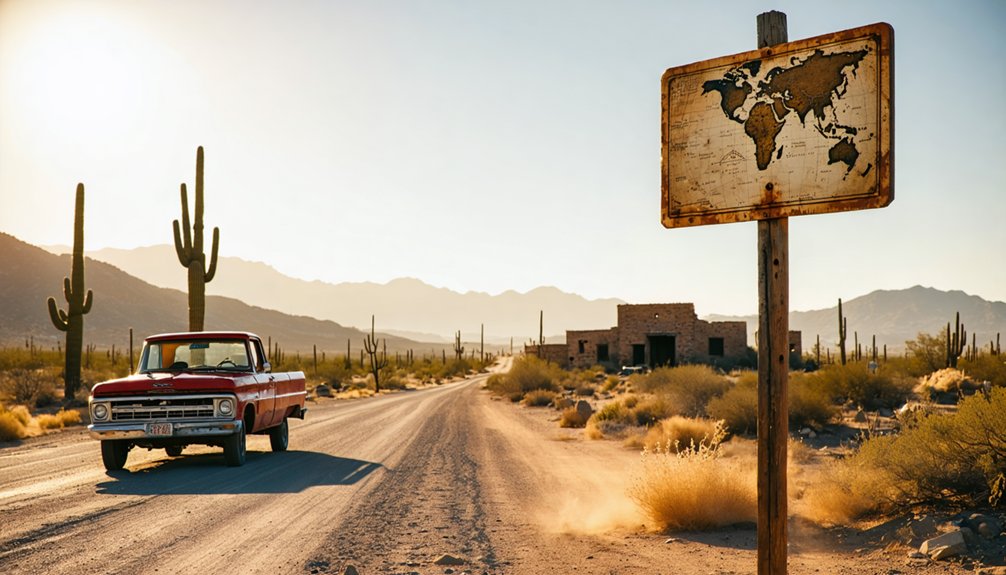
You’ll find Cordes ghost town in Yavapai County at Exit 259 off Interstate 17, about 70 miles north of Phoenix. This 1883 settlement features weathered structures including a historic barn from 1912 and an abandoned gas station that closed in 1973. Visit during early morning for the best photography light, and remember that most buildings sit on private property requiring respectful viewing from roads. The site works perfectly when combined with nearby Cordes Lakes and Cleator, revealing how the 1950s freeway bypass transformed this once-thriving supply depot into haunting desert ruins with fascinating stories.
Key Takeaways
- Access Cordes via Interstate 17 Exit 259 onto Bloody Basin Road in central Arizona’s Yavapai County at 3,802 feet elevation.
- Visit early morning for optimal photography of the 1912 barn, abandoned gas station, and weathered ruins from the 1880s settlement.
- Respect private property boundaries as the original Cordes family home remains occupied and historic structures sit on private land.
- Combine your trip with nearby attractions like Cordes Lakes and Cleator’s Murphy’s Impossible Railroad for a fuller ghost town experience.
- Explore the former stagecoach stop turned supply depot, abandoned after the 1950s freeway bypass ended its role on the Phoenix-Flagstaff route.
From Stagecoach Stop to Supply Depot: The Rise of Cordes
Long before Cordes became a whistle-stop on the Bradshaw Mountain Railway, it served as an essential link in Arizona’s territorial lifeline. You’ll discover a settlement born in 1875 when Powell erected the first adobe building at Antelope Station. The California and Arizona Stage Company transformed this creek-side location into a crucial horse change point connecting Prescott, Wickenburg, and Phoenix.
When German immigrant John H. Cordes purchased the station in 1883 for $769.43, he transformed it beyond simple lodging. You’ll find this stocky, sharp-eyed entrepreneur offered financial stability to local miners as their unofficial banker and supply depot. The outpost thrived serving cattlemen, miners, and the Auza and Manterola sheep herding families during agricultural changes, while supporting the extensive sheep droveways network linking mountain summer ranges to valley winter pastures. Cordes attempted to establish a post office as Antelope Station but was denied, leading him to use his family name for the designation. Like nearby Cleator, which grew along Murphy’s Impossible Railroad route in the early 1900s, Cordes benefited from the expanding transportation infrastructure that connected Arizona’s mining districts.
How Highway Progress Transformed a Town Into Ruins
While Cordes thrived as a stagecoach junction, the very roads that once brought prosperity would ultimately seal its fate. You’ll discover how economic shifts post freeway bypass devastated this mining community.
The town’s post office shuttered in 1944, but Cordes persisted until the 1950s when the Black Canyon Freeway carved through Black Mesa’s cliffs, ruthlessly bypassing the settlement. What you’ll witness today reflects corridor expansion opportunities that sacrificed small towns for progress.
The Cordes family recognized the inevitable, establishing a gas station and restaurant at the new Cordes Junction instead. John Henry Cordes had originally established the store and town at the top of Antelope Hill in 1883. Stand where the old Black Canyon Road meets modern I-17, and you’ll see the stark contrast—a commercial lifeline transformed into abandonment, leaving weathered ruins as silent testimony to highway development’s relentless march. The Black Canyon route’s designation as a state highway in 1936 had initially promised connectivity, yet decades later, the interstate system’s efficiency demands would render the original settlement obsolete.
Where to Find Cordes in the Arizona Desert
Nestled in Yavapai County‘s rugged central Arizona terrain at coordinates 34° 18′ 11” North, 112° 10′ 0” West, Cordes sits where the Verde and East Verde Rivers converge in a landscape of dramatic elevation changes and weathered plateaus. You’ll find this forgotten settlement roughly 26 miles from Camp Verde, accessible via Interstate 17’s Exit 259 onto Bloody Basin Road—a challenging 40-mile stretch demanding high-clearance vehicles.
The surrounding geologic formations tell stories older than any highway, carved by ancient waters that sustained indigenous populations for millennia before settlers arrived. Today’s Turkey Creek drainage follows paths these first inhabitants knew intimately. From Sedona, you’ll wind through Oak Creek Canyon’s mountain passes, while northbound travelers from Black Canyon City face rough dirt roads that filter out casual tourists. The area sits at an elevation of 1,128 meters, where the high desert climate shapes both landscape and accessibility throughout the seasons. Three miles north of modern Cordes Lakes, the ghost town awaits those willing to venture beyond pavement. Explorers can find GPS locations for Cordes and other Arizona ghost towns on detailed maps that document personally visited sites throughout the state.
What Remains Standing at the Original Town Site
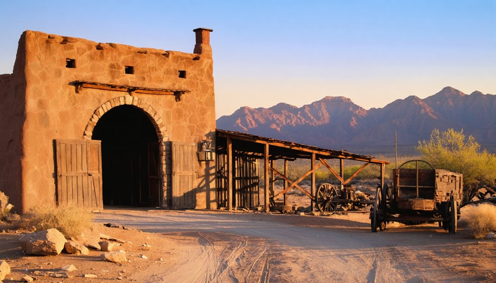
Three weathered structures anchor Cordes to its frontier past, each telling a distinct chapter of the settlement’s 140-year story. You’ll find the original Cordes family home—constructed after 1883—still occupied by descendants who’ve maintained continuous presence on these rolling hills.
The 1912 barn stands nearby, its timbers preserving ranch operations that once supported miners and herders traversing the Agua Fria watershed. Most striking is the derelict gas station, shuttered in 1973 with pumps frozen in place among creosote and prickly pear.
These untouched historic structures and modest farming relics rest on private property marked by “No Trespassing” signs, accessible only via dirt roads southeast of Mayer. The surrounding landscape offers sweeping views of the Bradshaw foothills, with abundant wildlife roaming the high desert terrain. The settlement sits at an elevation of 3,802 ft, where high desert conditions shaped the daily lives of residents from frontier days through the mid-twentieth century. You’re witnessing authenticated remnants, not reconstructed tourist attractions—freedom-seekers’ reward for respecting boundaries while glimpsing Arizona’s genuine past.
Making the Most of Your Visit to This Historic Ghost Town
Timing your arrival makes all the difference when exploring Cordes’ scattered remnants across this high-desert landscape. Early morning light enhances the visual aesthetics of weathered adobe walls and rusted metal against the Bradshaw Mountains’ eastern face.
You’ll navigate freely along roads that once connected Phoenix to Flagstaff before the 1950s freeway bypass. This living ghost town maintains a small resident population, so respect private property while photographing abandoned structures. The town was founded in 1883 by John Henry Cordes, who lent his name to the settlement after the postal service denied his original choice of Antelope Junction.
Combine your exploration with nearby sites—the 1891 Schoolhouse ruins at Cordes Lakes offer easy hiking from primitive parking, while Cleator’s Murphy’s Impossible Railroad route beckons further adventure. Pack water for the 3,763-foot elevation, and remember you’re traversing unregulated territory where Arizona’s mining and ranching history unfolds at your own pace.
Frequently Asked Questions
What Type of Wildlife Might Visitors Encounter in the Cordes Area Today?
You’ll discover an absolutely incredible array of desert dwellers! Expect sightings of rattlesnakes coiled in rocky shadows, occasional mountain lion spotting near remote trails, plus javelina, coyotes, roadrunners, and soaring ravens throughout this untamed wilderness.
Are There Any Guided Tours Available for Exploring the Ghost Town?
You won’t find formal guided tours at Cordes, but you’re free to explore independently. The remote ghost town offers self-guided walking tours through weathered ruins, letting you discover its stories at your own pace without scheduled historical reenactments.
What Is the Best Time of Year to Visit Cordes?
With 272 sunny days annually, you’ll find spring offers ideal weather conditions for your adventure. Comfortable 65-82°F temperatures and minimal crowds make March through May the peak visitation season, giving you unfettered freedom to explore Cordes’ abandoned streets.
Is Camping Permitted Near the Original Town Site?
You’ll find dispersed camping permitted nearby, though no designated campsites exist at Cordes itself. The nearest campground options lie along Bloody Basin Road and Badger Springs, offering first-come availability within Agua Fria National Monument’s boundaries.
What Safety Precautions Should Visitors Take When Exploring Abandoned Structures?
Wear proper footwear with ankle support and bring portable lighting to navigate crumbling floors. You’ll want sturdy gloves, a buddy system, and awareness of your surroundings—collapsed ceilings and hidden hazards lurk everywhere in decaying buildings.
References
- https://www.youtube.com/watch?v=3BjQgKiQPMA
- http://www.ghosttownaz.info/cordes-ranch.php
- https://www.arizonahighways.com/article/arizona-ghost-towns
- https://kids.kiddle.co/Cordes
- https://www.apcrp.org/Cordes/CORDES – MASTER DOCUMENT 082907.htm
- https://magazine.frva.com/2003/01/01/old-mines-and-ghost-towns-in-central-arizona/
- https://janmackellcollins.wordpress.com/category/cordes-lake-arizona/
- http://www.ghosttowngallery.com/htme/cordes.htm
- https://azdot.gov/about/historic-and-scenic-roads/list-historic-roads
- https://www.cornerstone-environmental.com/publications/item/the-verde-river-sheep-bridge


