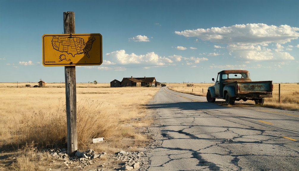
You’ll find Cross ghost town in Kay County at GPS coordinates 36.7083698, -97.089206, where nature reclaims a street grid that witnessed Oklahoma’s swiftest town collapse. Visit during spring or fall’s comfortable 60°F-80°F weather, bringing sturdy boots, water, and offline maps to explore overgrown foundations and remnants of the community that lost everything when the railroad chose Ponca City in 1894. Your adventure deepens when you discover why this pioneer dream vanished in just twelve months and what hidden dangers still lurk beneath the prairie grass.
Key Takeaways
- Use GPS coordinates 36.7083698, -97.089206 to locate the Kay County Cross site in northern Oklahoma’s Cross Township.
- Visit during April-June or September-October for ideal 60°F-80°F temperatures and comfortable exploration conditions.
- Bring sturdy hiking boots, layered clothing, water, snacks, offline maps, and a backup compass for safe exploration.
- Explore remnants including overgrown street grids, building foundations, a vacant church, and abandoned school structures.
- Avoid confusion with other Oklahoma “Cross” locations like Doan’s Crossing or Dead Woman’s Crossing when planning routes.
The Rise and Fall of Cross Ghost Town: A One-Year Wonder
In 1893, when land-hungry settlers flooded into Kay County, Oklahoma, ambitious town promoters staked their claim on what they hoped would become the region’s next booming metropolis—Cross. You’d have witnessed early settlement patterns typical of Oklahoma’s territorial boom: hastily constructed storefronts, dusty streets, and opportunistic entrepreneurs racing to establish dominance.
But Cross faced immediate town funding challenges that would prove fatal. Without railroad access, the settlement couldn’t attract the sustained population or commerce needed for survival. By 1894, Ponca City had secured both the coveted county seat designation and critical rail connections. Cross’s defeat was swift and absolute. Within just one year, you’d have watched hopeful settlers abandon their stakes, leaving behind another footnote in Oklahoma’s landscape of forgotten dreams.
Why Cross Lost the Battle to Ponca City
The showdown between Cross and Ponca City wasn’t decided by geography or population—it hinged on a bold midnight heist that would reshape Kay County’s future. You’ll discover that strategic railroad dealings sealed Cross’s fate when Ponca City promoters offered Santa Fe agent H.W. Liddle two prime lots and a relocated house. He accepted, and supporters dragged Cross’s boxcar depot to Ponca City under cover of darkness to dodge legal injunctions.
The undesirable proximity concerns that initially prevented Santa Fe from serving both towns became Ponca’s advantage. When the first train arrived September 22, 1894, Cross’s residents watched their future roll away. Without railway access, Cross couldn’t survive. Buildings migrated south, families followed, and within months, your destination became a ghost.
What Remains at the Cross Town Site Today
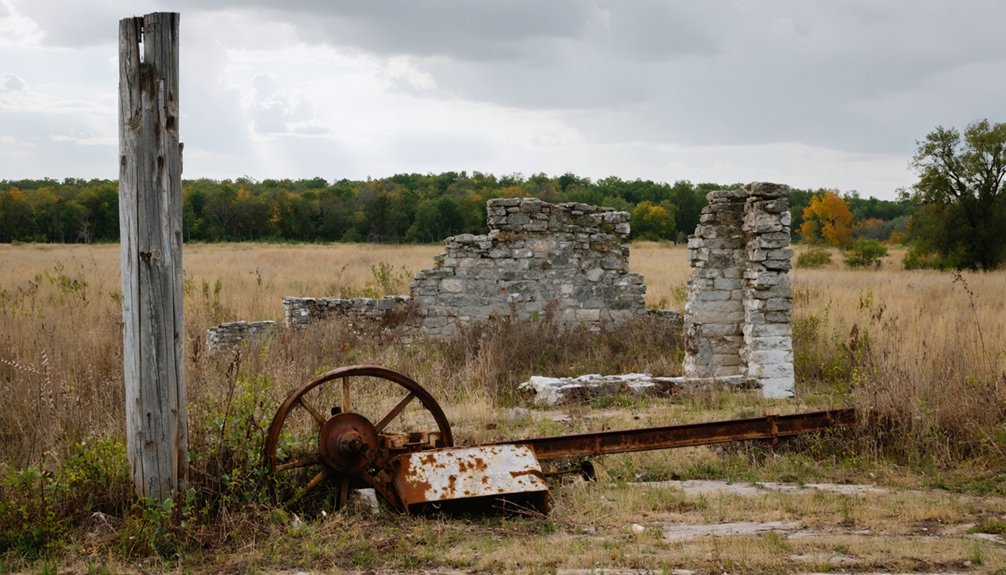
Approaching Cross today, you’ll find nature reclaiming what railroads once abandoned—an overgrown street grid stretching across former town blocks where building foundations emerge like archaeological ruins through tangled weeds and prairie grass.
Your exploration reveals scattered remnants of a mining-era settlement:
- Abandoned buildings still standing include the vacant Christian church and Picher-Cardin High School, their weathered facades marking a once-thriving community
- Dilapidated mining waste piles heap around town perimeters, containing over 100 million tons of chat tailings laced with lead, zinc, and heavy metals
- 14,000 mine shafts honeycomb the unstable ground beneath your feet, creating sinkholes that swallow streets without warning
- Zero residents have called Cross home since 2015, though annual Christmas parades still gather those who remember
The dissolved municipality stands frozen in abandonment.
Getting to Cross: Directions and Access Points
Traversing to Cross requires pinpointing which abandoned settlement you’re actually seeking, since Oklahoma harbors multiple sites bearing this name across its ghost town landscape.
Oklahoma’s landscape conceals several abandoned settlements called Cross, making precise identification crucial before embarking on your ghost town expedition.
For the Kay County location, start with GPS coordinates assessment at latitude 36.7083698, longitude -97.089206 in northern Oklahoma’s Cross Township. You’ll find the 1894-mapped townsite featuring remnants of railways and Main Street.
Don’t confuse this with Doan’s Crossing near southwestern cattle trails at coordinates 34.3333, -99.75, or Dead Woman’s Crossing accessible via I-40 exit 84. Alternate route planning becomes essential when historical township/range notations from period maps need conversion to modern waypoints.
Google Earth helps refine these coordinates, while the Ghost Towns of Oklahoma reference provides verified locations for your independent exploration of these vanished communities.
Best Times to Visit and What to Bring
Timing your Cross ghost town expedition around Oklahoma’s shoulder seasons—April through June and September through October—transforms uncomfortable trudging through abandoned foundations into pleasant archaeological detective work. You’ll enjoy 60°F-80°F temperatures perfect for photographing crumbling structures without summer’s oppressive heat or winter’s biting chill. Check seasonal weather forecasts before departing, as spring storms occasionally sweep through Kay County.
Essential outdoor gear recommendations for Cross exploration:
- Sturdy hiking boots for traversing overgrown lots and unstable terrain
- Layered clothing adaptable to Oklahoma’s unpredictable temperature swings
- Water bottles and high-energy snacks—no convenience stores remain
- Navigation tools including offline maps and backup compass
Winter visits offer solitude but demand warm jackets for 29°F-49°F conditions. Avoid July-August entirely unless you’re masochistic about heat exhaustion.
Combining Cross With Other Kay County Ghost Towns
You’ll maximize your ghost town adventure by crafting a route that weaves through Kay County’s vanished settlements, starting with Cross’s brief 1893-1894 existence before moving to nearby clusters. Plan a northern loop connecting Washunga near Kaw—where you’ll discover how the reservoir swallowed history—then venture to the Blackwell area to explore Eddy’s tornado-scarred remains, Sumpter, and Richland within a ten-mile radius.
Your southern circuit can anchor at Tonkawa, positioning you perfectly to reach Alcorn and Autwine, while Newkirk serves as your western gateway to both Dilworth and Middleton’s forgotten foundations.
Gray Horse Historical Sites
The haunting remnants of Gray Horse anchor a compelling ghost town circuit through northwest Oklahoma, though geography presents an interesting quirk—this Osage County settlement pairs naturally with Kay County‘s abandoned communities despite crossing county lines. You’ll discover abandoned Osage mansions standing as monuments to oil wealth that attracted murderers during the 1920s Reign of Terror.
The centerpiece remains the active round dance hall where tribal ceremonies continue, while the 1939 WPA-constructed school building crumbles nearby.
Essential stops include:
- Gray Horse Cemetery – Reign of terror graves including Lizzie, Minnie Smith, Anna, and Mollie rest here
- Abandoned school building – AJ Love’s 1939 WPA design, closed 1963
- Round dance hall – Still functioning tribal gathering space
- Oil-era mansions – Deteriorating legacies to Osage wealth
Ingalls Outlaw Town Ruins
Shifting southeast from Gray Horse into Payne County, Ingalls stands frozen in its outlaw infamy—a settlement born during the chaotic 1889 Land Run that never escaped its violent reputation. You’ll find crumbling stone monuments marking where deputy marshals fell during the infamous September 1893 shootout with the Doolin-Dalton Gang.
The replica Old Ingalls Hotel recalls Arkansas Tom Jones firing from its second story, while Wilson General Store ruins whisper of a community that prioritized lawlessness and local economy over justice—merchants welcomed outlaws’ generous spending despite their crimes.
Notoriety and town’s image sealed Ingalls’ fate when travelers avoided the blood-stained streets. Walk past rusted signs and weathered buildings along Ash Street, where a historical marker commemorates the battle that transformed this brief frontier hub into eternal ghost town.
Multi-Town Route Planning
After exploring Cross’s abandoned streets where Ponca City’s founding families first settled in 1893, you can weave a northward loop through Kay County’s vanished communities—each town telling Oklahoma’s volatile settlement story through weathered markers and overgrown foundations.
Your route connects settlements shaped by failed regional transportation networks and boom-bust economic development models:
- Marena-Perth: Follow rural roads south to find James Lvll’s town site, marked by a solitary water tower at the old intersection, then visit Oak View Cemetery where the founder rests
- Pleasant Valley: Navigate mapped country paths to remnants of the blacksmith shop, Methodist church foundations, and schoolhouse traces
- Lawrie: Complete your loop at this nearby exploration point clustering efficient Kay County ghost town discoveries
- Efficient Timing: Plan 1-2 hour drives between landmarks using foundation ruins and historical plaques as waypoints
Ponca City Museums and Pioneer History Connections
After exploring Cross’s weathered foundations, you’ll find the full story of Kay County’s pioneer era preserved just fifteen miles south in Ponca City’s museum district. The Pioneer Woman Museum houses authentic settler artifacts and detailed exhibits documenting the fierce county seat rivalries that shaped communities like Cross, while the Marland Grand Home maintains extensive genealogy resources connecting today’s families to their Oklahoma Territory ancestors.
These collections transform faded ghost town memories into tangible history—weathered tools, handwritten land claims, and photographs of the determined settlers who built and abandoned frontier outposts across the prairie.
Cross Settler Artifact Collections
Museums scattered across north-central Oklahoma preserve the material culture of Cross’s pioneer era, offering tangible connections to the settlers who transformed the prairie into farmland.
The Plains Indian and Pioneer Museum displays ancient plains artifacts alongside implements that conquered the unforgiving land—hand-cranked butter churns, cast-iron stoves, and sod-breaking plows. You’ll discover how frontier settlement challenges shaped daily existence through bone needles, hide scrapers, and reconstructed pioneer kitchens.
Essential Artifact Collections:
- Woolaroc Museum – Beaded buckskins and feather bonnets from 40 Plains tribes, plus cowboy saddles and 101 Ranch memorabilia
- Sam Noble Museum – Cooper Skull, North America’s oldest painted object at 10,000 years
- Museum of the Western Prairie – Criswell half-dugout and 1891 Eddleman limestone ranch house
- NMLHS Museum – Chipped stone tools and pottery documenting ancient Native lifeways
County Seat Rivalry Exhibits
The fierce competition between Cross and Ponca City for regional dominance plays out in vivid detail across Ponca City’s museum collections, where you’ll find the promotional cards boasting “The trains stop here just the same as at Chicago” and land run certificates documenting Burton Barnes’s audacious townsite lottery.
These county seat relics reveal how New Ponca’s citizens literally pulled a boxcar station from their rival’s territory, transforming railroad settlement dynamics overnight when that first train arrived September 22, 1894. You’ll discover surveying documents from the Cherokee Outlet opening, photographs of hotels relocating from Cross, and artifacts chronicling how aggressive infrastructure tactics erased one community while establishing another.
The exhibits preserve this cutthroat frontier capitalism that shaped Kay County’s development, offering unfiltered glimpses into 1890s territorial ambition.
Pioneer Family Genealogy Resources
Since 1958, Ponca City’s Pioneer Woman Museum has served as your gateway to tracing territorial Oklahoma’s founding families, housing genealogical touchstones like land run certificates, settlement documents, and artifacts bearing the names of the Cherokee Outlet’s earliest arrivals. The museum genealogy exhibits connect you directly to frontier bloodlines through preserved personal belongings, while pioneer family research tools include detailed timelines tracking westward migration patterns.
Essential genealogical resources at your fingertips:
- Contact staff at 580-765-6108 or piown@history.ok.gov for ancestral research inquiries
- Examine the 1865 bedstead where nine generations began their Oklahoma legacy
- Study family artifacts revealing how your ancestors conquered the unforgiving plains
- Access interactive timelines mapping pioneer families’ contributions to territorial development
Volunteers share stories linking present-day descendants to their territorial roots, transforming impersonal records into living family narratives.
Frequently Asked Questions
Are There Any Safety Concerns When Visiting Remote Ghost Town Sites?
Yes, you’ll face serious risks as unregistered trespassers traversing limited accessibility terrain. Expect toxic lead dust, unstable structures ready to collapse, contaminated groundwater, and higher crime rates. Stay alert, avoid breathing dust, and don’t touch crumbling buildings or tailings.
Can I Camp Overnight Near the Cross Ghost Town Location?
You’ll find overnight camping amenities at Double D RV Park in nearby Texola, your closest option to Cross. Dispersed camping isn’t available due to surrounding private ranchland, so plan for nearby accommodations offering modern conveniences instead.
Do I Need Special Permits to Explore Ghost Town Sites?
Traversing ghost town exploration isn’t always a free-for-all adventure. You’ll need to verify property ownership first, then check local regulations—private land requires written landowner consent, while public sites may need permits depending on your county’s specific requirements.
What Photography Equipment Works Best for Ghost Town Documentation?
You’ll want mirrorless or DSLR cameras with wide-angle lenses for capturing expansive decay. Vintage film cameras add authentic character, while drone photography reveals breathtaking aerial perspectives. Pack sturdy tripods, powerful flashlights, and backup batteries—you’re documenting untamed history.
Are There Guided Tours Available for Kay County Ghost Towns?
You’ll hit a dead end searching for guided Kay County ghost town tours—none currently exist. However, you can explore independently, discovering town preservation efforts and the historical significance of sites through local historical societies and self-guided adventures.


