Planning a ghost town road trip to Defiance, Kansas means venturing deep into Woodson County’s open prairie, where a lone surviving hotel is all that remains of a once-thriving mid-1800s settlement. You’ll want to fuel up in Yates Center, pack water and food, and bring both GPS and printed maps since gravel roads out here are largely unmarked. Spring and fall offer the best conditions for exploring. Everything you need to plan your trip is ahead.
Key Takeaways
- Defiance, Kansas, is a ghost town featuring one surviving structure—an old hotel now used as a private residence—surrounded by open prairie.
- From Wichita, drive 120 miles east on US-54 to Yates Center, then head north on unmarked gravel county roads toward Defiance.
- No services exist at the site, so fuel up in Yates Center and pack water, food, and emergency supplies before departing.
- Spring and fall offer the best visiting conditions, as summer flooding and winter snow can make rural roads dangerous or impassable.
- Nearby ghost towns like Bazaar and Diamond Springs can be combined into a single day trip for a fuller exploration experience.
What Made Defiance, Kansas a Ghost Town?
Once a modest but functional stop on the Kansas prairie, Defiance thrived briefly during the state’s mid-1800s town boom before fading into obscurity by 1886, when its post office closed for good.
Understanding the town history helps you appreciate why so many Kansas settlements shared this fate.
Defiance didn’t fail because of one dramatic event. Instead, economic decline crept in gradually. The local economy depended on agriculture and small commerce, both vulnerable to market shifts and competition from neighboring towns fighting for county seat status.
When those bids failed, jobs disappeared, and residents followed opportunity elsewhere. The Dust Bowl later sealed the region’s trajectory.
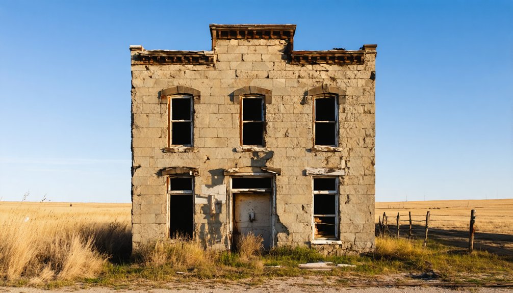
Today, you’ll find almost nothing left standing — just open prairie reclaiming land that once held a community’s worth of ambition and daily life.
What’s Left to See at the Defiance Townsite Today
Knowing what happened to Defiance makes the visit hit differently — but what exactly will you find when you get there? Honestly, not much — and that’s part of the appeal. The Defiance history is written in absence rather than monuments.
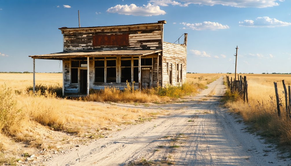
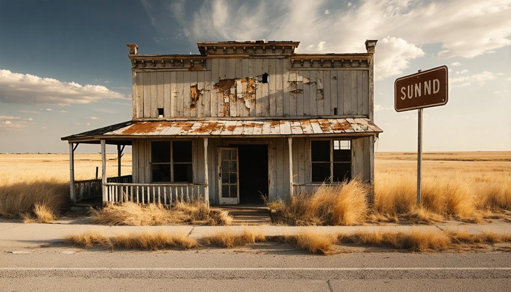
The ghost town features one surviving structure: the original hotel, now privately owned and used as a residence. Respect that boundary.
Beyond it, you’re walking through open prairie reclaiming what settlers once built. No businesses, no post office, no public buildings remain standing.
Unlike Nicodemus, there are no markers guiding your experience. You’ll navigate unmarked county roads to reach a site swallowed by grassland.
That raw, unpolished silence is exactly what draws independent travelers here — freedom to explore history on its own unfiltered terms.
Can You Actually Visit the Old Hotel Still Standing at Defiance?
It’s a private residence, which means you can’t walk through the doors or explore the interior. You’ll need to respect that boundary absolutely.
From the road, though, you can still take in its weathered exterior and imagine the travelers and locals who once passed through.
Local legends swirl around structures like this — stories of boom-era ambitions and quiet disappearances.
Bring your camera, keep your distance, and let the building speak for itself from where you stand.
How to Get to Defiance From Wichita, Topeka, or Kansas City
Getting to Defiance takes some deliberate navigation, but the journey itself sets the mood for a ghost town visit. From Wichita, head 120 miles east on US-54 to Yates Center, then take county roads north toward the site.
From Topeka, drive southwest on I-35 to Emporia, then follow US-50 into Woodson County. Kansas City travelers face a 180-mile, three-to-four-hour drive through open prairie that whispers of ghost town legends long before you arrive.
US-54 intersects Woodson County routes about 8 miles south of Defiance. Expect unmarked gravel roads at the end, so bring GPS or printed maps.
The historical significance of this forgotten crossroads rewards those willing to navigate rural Kansas on their own terms.
How Do You Find Defiance When There Are No Road Signs?
Once you’ve parked your route plan and pointed the car toward Woodson County, the real challenge begins: finding a town that doesn’t announce itself.
Steering through ghost towns like Defiance means relying on GPS coordinates rather than road signs, because there aren’t any. Download offline maps before leaving Yates Center — cell service gets unreliable fast on rural gravel roads.
Hidden landmarks become your orientation tools here. The lone surviving hotel, now a private residence, serves as your primary visual marker.
Cross-reference your coordinates against county road intersections, and watch for the subtle prairie overgrowth patterns that typically signal abandoned settlement sites.
Dry weather matters too — those unmarked gravel roads turn treacherous after rain. Freedom comes with preparation, so bring printed backup maps and trust your instincts when the GPS hesitates.
When to Visit Defiance: Seasons, Road Conditions, and What to Expect
You’ll want to plan your trip to Defiance between spring and fall, when mild temperatures and drier conditions make the rural gravel roads passable.
Winter snow can make those unmarked county roads treacherous, while summer brings the risk of flooding that’ll cut off access entirely.
Pack a GPS or printed maps, fuel up in Yates Center before heading out, and expect nothing in the way of services once you leave the main highway.
Best Seasons To Visit
When should you plan your visit to Defiance? Spring and fall offer the best conditions for exploring this forgotten Kansas landscape. Mild temperatures let you move freely across open prairie terrain, and dry ground keeps gravel roads manageable for standard vehicles.
Summer visits are possible but carry risks — seasonal flooding can make rural county roads impassable, cutting off access entirely. Winter snow creates similar obstacles, leaving you stranded far from services.
Spring and fall also deliver better visibility of Defiance’s ghost town architecture, letting you fully appreciate the site’s historical significance without dense summer vegetation obscuring remaining structural details.
Whatever season you choose, check road conditions before leaving Yates Center — your last reliable fuel and information stop before heading into the unmarked rural roads leading to Defiance.
Road Conditions And Access
Road conditions at Defiance aren’t just a travel detail — they’re the deciding factor between reaching the site and turning back frustrated miles short.
Gravel and dirt county roads lead to the site, and wet weather transforms them into impassable muddy tracks that’ll strand even capable vehicles. Rural navigation here demands more than a phone signal — download offline maps or carry paper backups before leaving Yates Center, your last reliable services stop.
Dry conditions are your green light. Spring and fall offer the most forgiving road safety windows, with firm ground and moderate temperatures.
Summer flash floods can wash out low-lying county routes without warning. Approach with a full tank, sturdy tires, and the confidence that comes from planning ahead — Defiance rewards the prepared traveler.
Where to Fuel Up Before Reaching Defiance, Kansas

Before you head out to Defiance, fuel up in Yates Center — it’s your last reliable stop for gas, food, and supplies before the rural county roads take over.
Once you leave town, you won’t find a single service station, convenience store, or emergency resource anywhere near the ghost town site.
Pack water, snacks, a paper map or downloaded GPS route, and a full tank to keep your trip smooth and stress-free.
Yates Center Fuel Stops
Yates Center offers a handful of fuel stops, and you’ll want to top off your tank here since Defiance has absolutely nothing in the way of services.
Your fuel options are limited once you head into rural Woodson County, so don’t skip this step.
Keep these essentials in mind before leaving Yates Center:
- Fill your tank completely — gravel roads burn more fuel than highways
- Grab water and snacks since no convenience stores exist nearby
- Check tire pressure for rough county road conditions
- Download offline maps before losing cell service
- Note your mileage to track distance on unmarked roads
Yates Center sits roughly 8 miles from the nearest highway access point, making it your last reliable stop before venturing deep into Kansas prairie territory.
No Services At Defiance
Once you leave Yates Center, you’re on your own — Defiance offers absolutely no services, fuel, food, or water. This abandoned ghost town has zero ghost town services remaining, so rural travel demands serious preparation before you hit those gravel roads.
Fill your tank completely in Yates Center, and pack enough water, snacks, and emergency supplies for the entire journey.
Cell service gets spotty once you venture deep into Woodson County’s back roads, so don’t count on calling for help if something goes wrong.
Carry a printed map alongside your GPS — technology fails in remote Kansas prairie land.
Your freedom to explore forgotten places like Defiance depends entirely on self-sufficiency. Arrive prepared, and this ghost town rewards you with raw, unfiltered history completely on your own terms.
Pre-Trip Supply Checklist
Stocking up on 5 essentials — fuel, water, food, a printed map, and emergency supplies — makes the difference between a memorable ghost town adventure and a stranded nightmare on Woodson County’s remote gravel roads.
Yates Center’s your last reliable stop before reaching Defiance’s historic significance and local legends.
Before leaving Yates Center, confirm you’ve packed:
- Fuel — no stations exist beyond town limits
- Water — at least one gallon per person
- Food — enough for unexpected delays
- Printed map — GPS signals drop on rural roads
- Emergency kit — jumper cables, flashlight, first aid
You’re choosing freedom over convenience when exploring forgotten Kansas history.
That choice rewards you only when you’ve prepared smart and supplied yourself completely before hitting those gravel roads.
Ghost Towns Near Defiance Worth Adding to Your Route
While Defiance makes for a compelling destination on its own, you’ll find that the surrounding region rewards deeper exploration with several ghost towns worth folding into your route. Each stop adds unique historical significance to your ghost town exploration.
Head 60 miles southwest to Bazaar, where cattle shipping ruins echo peak 1921 ranching culture.
Drive 50 miles west to Diamond Springs for Civil War-era cemetery remains that quietly tell frontier stories.
If you’re extending your trip northwest, Densmore’s deteriorated churches and homes near the Solomon River sit 200 miles out, while Denmark’s preserved stone church stands 150 miles west in Lincoln County.
Plan your sequence around driving distances, fuel stops in Yates Center, and dry weather conditions for traversing rural gravel roads connecting these sites.
How to Build a Full Woodson County Day Trip Around Defiance
Start your Woodson County day trip in Yates Center, where you can fuel up, grab a map, and tour the historic courthouse before heading north on rural gravel roads to Defiance.
Once you’ve explored the ghost town‘s lone surviving hotel and surrounding prairie, you can swing southwest about 60 miles to catch the cattle shipping ruins at Bazaar or head 50 miles west to Diamond Springs’ Civil War-era cemetery.
Chaining these stops together gives you a full day of Kansas ghost town history without backtracking unnecessarily.
Yates Center Starting Point
Yates Center serves as your natural launching pad for a full Woodson County day trip, sitting just a short drive from Defiance‘s rural back roads.
Yates Center history runs deep as the county seat, offering context for understanding how Defiance economy ultimately collapsed when local industries failed to sustain growth.
Before heading out, stock up here — it’s your last chance for fuel and supplies:
- Fill your gas tank at local stations
- Grab food and water for the road
- Download offline maps for unmarked county roads
- Tour the Woodson County courthouse
- Confirm dry weather conditions before tackling gravel roads
Once you’ve handled logistics, you’re free to explore Defiance without interruption, experiencing Kansas’s raw, unfiltered prairie history on your own terms.
Combining Nearby Ghost Towns
Defiance works best as an anchor for a broader ghost town loop, since Woodson County’s rural roads connect naturally to several abandoned sites worth your time.
Swing southwest roughly 60 miles to Bazaar, where cattle-shipping ruins carry ghost town legends from its 1921 peak.
Head northwest toward Densmore’s deteriorating homes and weathered churches near the Solomon River, letting those abandoned structures tell their own quiet stories.
If you’re building a full day, Diamond Springs sits 50 miles west, its Civil War-era cemetery offering stark contrast to Defiance’s prairie silence.
Plan your route before leaving Yates Center, fuel up, and download offline maps.
These sites share no signage, so freedom here means traversing on your own terms across open Kansas landscape.
What to Bring and Know Before Visiting a Kansas Ghost Town
Before you head out to Defiance or any other Kansas ghost town, packing smart and knowing what to expect’ll save you a frustrating trip. Rural sites like Defiance have no services, no markers, and unpredictable terrain.
Bring these essentials:
- GPS and paper maps – unmarked county roads’ll disorient you fast
- Full fuel tank – Yates Center is your last stop
- Camera and extra batteries – ghost town photography demands patience and preparation
- Sturdy boots – prairie overgrowth hides uneven ground
- Respectful mindset – historical preservation means staying off private property like Defiance’s hotel residence
Dry weather makes gravel roads manageable; wet conditions turn them treacherous.
Gravel roads cooperate in dry weather — but one rainstorm turns your rural adventure into a muddy, wheel-spinning ordeal.
Spring and fall offer the best visibility and comfort. Go prepared, stay aware, and you’ll experience Kansas’s forgotten history on your own terms.
Frequently Asked Questions
Was Defiance, Kansas Ever Considered for Official County Seat Status?
Defiance didn’t secure county seat status, and that failure carries real historical significance. You’ll find that losing the county seat competition drained jobs, sparked a resident exodus, and ultimately sealed the town’s abandoned fate.
Are There Any Historical Photographs or Documents Preserved From Defiance?
Ironically, Defiance’s historical significance left little to preserve! You won’t find many photographs or documents, as preservation efforts barely exist for this forgotten town. Explore county archives in Yates Center — they’re your best shot at uncovering its past.
Did Defiance Have a School or Church Before It Was Abandoned?
The records don’t confirm Defiance’s school history or church significance, but you’d expect both in 1870s Kansas settlements. Explore Yates Center’s archives—you’ll likely uncover community institutions that shaped this forgotten town’s spirit.
How Many Residents Lived in Defiance at Its Peak Population?
Like a candle flickering out, Defiance’s peak population numbers aren’t documented in available ghost town history records. You’ll find population decline swallowed its story whole, leaving no confirmed census figures behind for this vanished Kansas community.
Is Defiance, Kansas Listed on Any Official Historical Registers?
Based on available knowledge, Defiance, Kansas doesn’t appear on official historical registers. It lacks preservation efforts and historical significance recognition, unlike Nicodemus. You’ll find no markers there, so embrace your freedom to explore its raw, untamed prairie remnants independently.
References
- https://en.wikipedia.org/wiki/List_of_ghost_towns_in_Kansas
- https://legendsofkansas.com/kansas-ghost-town-list/
- https://esirc.emporia.edu/bitstreams/b4b4cde4-15d4-4284-a3b5-8430fb9e324e/download
- https://thewanderingpigeon.com/2015/10/03/day-of-kansas-ghost-towns/
- https://www.youtube.com/watch?v=8dtIPX7pIqI
- https://www.ebony.com/these-real-ghost-towns-were-once-bustling-black-communities/
- https://www.visitgck.com/eminence-and-ravanna-the-story-of-finney-countys-ghost-towns/
- https://kids.kiddle.co/List_of_ghost_towns_in_Kansas


