You’ll find Devonia’s ghost town remnants scattered across Anderson County’s mountainside, where the West Coal Company’s Baldwin Coal Preparation Plant once powered a bustling mining community called Moore’s Camp. Take Tennessee State Route 116 through winding coal country to discover stone foundations, decaying homesteads, and an old school building reclaimed by nature since the post office closed in 1975. Spring mornings offer the best photography before humidity builds, though you’ll need four-wheel drive for venturing beyond paved roads to explore the complete story of this vanished Appalachian settlement.
Key Takeaways
- Devonia, formerly Moore’s Camp, is a ghost town in Anderson County, Tennessee, featuring remnants of a coal mining community.
- Access via Tennessee State Route 116; route from Knoxville takes I-40 west to SR-62 through Oak Ridge.
- Four-wheel drive required beyond paved roads; summer offers easiest access due to seasonal road conditions.
- Key sites include stone foundations, decaying homesteads, old school building, and Baldwin Coal Preparation Plant ruins.
- Obtain property owner permission before exploring; spring mornings provide optimal lighting and less vegetation obstruction for photography.
The Rise and Fall of Moore’s Camp Mining Community
Deep in the mountains of Anderson County, Tennessee, the mining community of Moore’s Camp sprang to life as the West Coal Company carved opportunity from Appalachian coal seams. You’ll discover where thousands once found independence through honest work, their livelihoods fueled by black gold extracted from Fork Mountain’s depths.
The Baldwin Coal Preparation Plant anchored this remote settlement, connected to civilization by a 42-mile railroad snaking toward Oneida. Children attended the six-classroom school while their fathers descended into darkness daily, creating an impact on local economy that rippled through surrounding camps like Rosedale and Beech Grove.
But changing community dynamics proved inevitable. When the post office shuttered in 1975 and the school closed in 1991, Moore’s Camp joined Tennessee’s ghost town roster—a legacy to boom-and-bust freedom.
What Remains at the Devonia Ghost Town Site
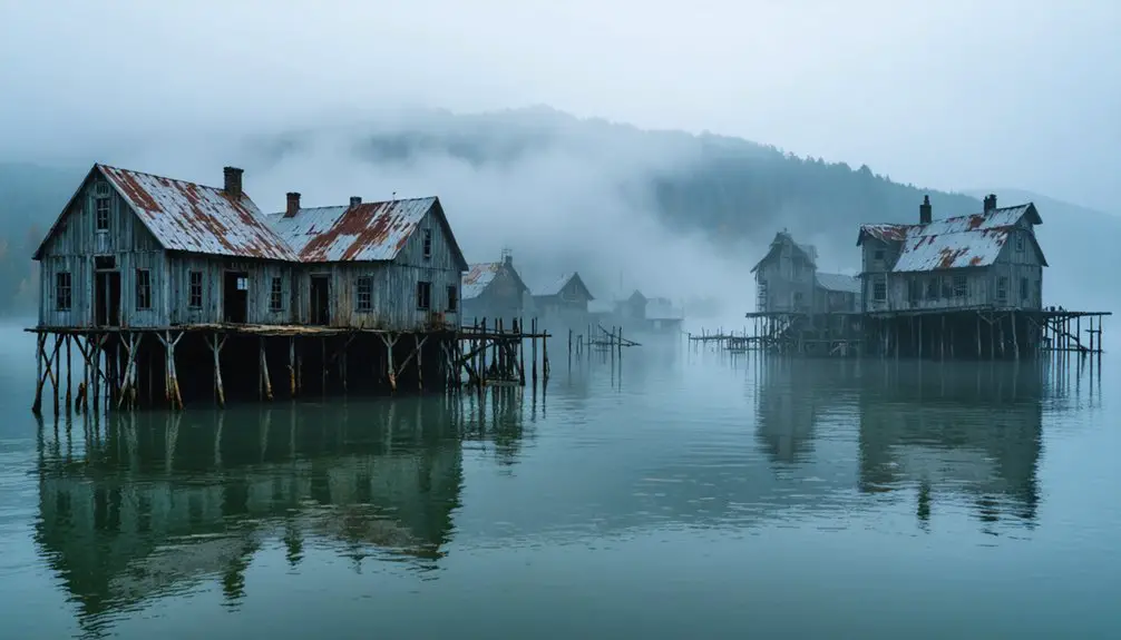
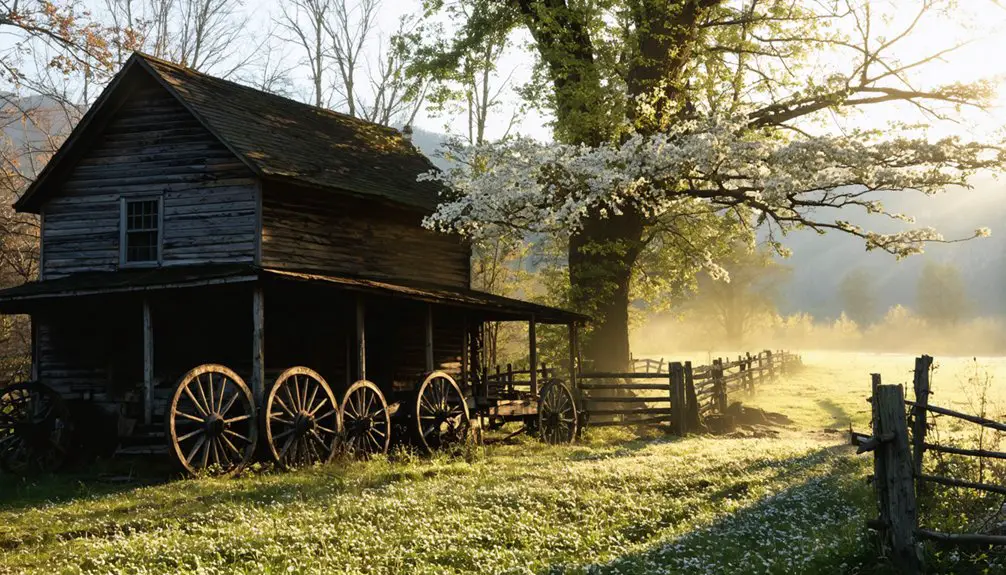
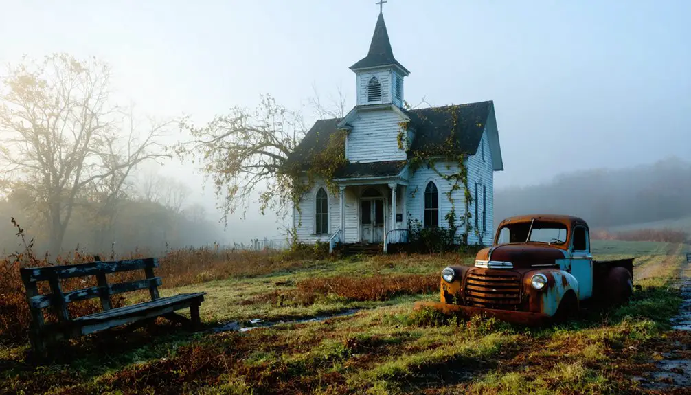
Where civilization once thrived along the mountainside, nature now stages a hostile takeover of Devonia’s remnants. You’ll discover stone foundations jutting through overgrown fields, their outlines marking where families built their lives. Several homesteads scatter across the landscape in various decay stages, while the old school building stands defiant against time’s environmental impact. The Baldwin Coal Preparation Plant looms as memorial to the mining era that defined this community legacy.
Along S.R. 116, you can trace old roadways despite aggressive vegetation reclamation. The general store and post office sites remain identifiable for those willing to explore beyond the pavement. Nearby Beech Grove Cemetery preserves veterans’ graves and historical markers, offering tangible connection to the souls who once called this forgotten hollow home.
Getting There: Routes and Access Points
The journey to Devonia’s scattered remnants begins along Tennessee State Route 116, a winding mountain highway that cuts through Anderson County’s coal country. You’ll navigate curves that follow the historic 42-mile railroad corridor from Oneida, where the impact of railroad on transportation still shapes these narrow passages. From Knoxville, take I-40 west to SR-62, then connect through Oak Ridge’s local highways—roughly 30 miles of freedom-seeking exploration.
Seasonal variations in road conditions matter here. Summer offers easiest access, while winter storms can complicate mountain driving.
The coal preparation plant site marks your central entry point, with gravel roads branching toward Moore’s Camp and Fork Mountain. You’ll want four-wheel drive for venturing beyond pavement, where ghost town fragments hide among reclaimed wilderness.
Combining Devonia With Nearby Abandoned Towns
Beyond Devonia’s coal-scarred hillsides, Tennessee’s abandoned settlements stretch across varied terrain, each offering distinct chapters in the state’s erasure story.
You’ll find Elkmont’s 70 historic buildings thirty miles through mountain roads—preservation efforts saved select structures from total decay after 1992 lease expirations.
Old Butler surfaces from Watauga Lake when water recedes, revealing foundations the TVA couldn’t completely erase.
Tharpe sits 120 miles northwest, where Land Between the Lakes project displaced seventy residents in the 1960s.
Fork Mountain’s overgrown trails connect to Moore’s Camp, weaving community narratives through Anderson County’s coal heritage.
Each site demands different navigation skills—lake schedules, forest service roads, rural routes—but together they map Tennessee’s pattern of deliberate and accidental abandonment.
Photography and Exploration Guidelines
Documenting Devonia requires different tactics than standard landscape photography—coal dust coats your lens within minutes, vegetation obscures structural details by mid-summer, and Tennessee’s humidity creates persistent haze that flattens your shots. You’ll want protective lens filters and cleaning supplies readily accessible.
Spring mornings offer the clearest light before humidity builds, while autumn strips away concealing foliage.
Before exploring, verify legal permissions with current property owners—many former mining operations remain privately held despite appearing abandoned. Trespassing charges eliminate your freedom to return. Pack sturdy boots for unstable terrain, wear long sleeves against overgrowth, and bring a physical map since cell service disappears in these hollows. Test floorboards before entering structures, and always explore with a companion. Your equipment recommendations should prioritize portability over complexity when traversing remote coal country.
Safety Considerations Around Active Coal Operations
While Devonia’s mining camp sits silent, the Baldwin Coal Preparation Plant remains a commanding industrial presence along State Route 116—a mammoth facility that once processed coal from the 42-mile Tennessee Railroad terminus. Though shutdown, this site demands your caution. Vandals nearly destroyed the structure, leaving industrial remnants hazards scattered across unstable ground.
You’ll encounter abandoned railcars, deteriorating equipment, and unsecured coal processing areas where terrain shifts unexpectedly beneath loose materials.
The railroad siding and tracks still snake through the property, creating tripping hazards obscured by overgrowth. Heavy machinery remnants lurk in shadows, their structural integrity compromised by decades of neglect. Keep distance from buildings—what appears solid may collapse without warning. This isn’t trespassing territory worth risking; observe from designated roadways where you’re free to document without endangering yourself.
Frequently Asked Questions
Are There Any Lodging or Camping Options Near Devonia?
You’ll find limited lodging near Devonia’s abandoned buildings, so contact the local historic society for recommendations. Nearby Fredonia offers cabins and vacation rentals, while Clarksville and Nashville provide hotels within 30 minutes of your ghost town adventure.
Exploring the history of Bloodland, Missouri can add a fascinating layer to your journey. The town’s origins are shrouded in mystery, and local historians often share intriguing tales about its past. Be sure to visit the small museum downtown, where you can learn more about the events that shaped this unique community.
What Is the Best Time of Year to Visit?
You’ll find shoulder season visitation ideal—spring and fall offer comfortable seasonal weather patterns for exploring ruins. You’ll avoid summer’s oppressive heat and winter’s treacherous conditions while experiencing Tennessee’s backcountry at its most accessible and beautiful.
Can I Access Historical Records or Old Photographs of Devonia?
You’ll discover Devonia’s past through Anderson County Archives’ extensive archival collections and the Pellissippi Genealogical & Historical Society’s resources. These historical societies preserve photographs, land records, and census data that’ll transport you back to this vanished community’s vibrant days.
Are There Guided Tours Available for Devonia Ghost Town?
No guided tours exist for Devonia—you’ll forge your own path through silent ruins. Like explorers charting unmarked territory, you’ll craft self-guided walking tours using local historian insights from Cumberland Gap, discovering this forgotten settlement entirely on your terms.
Is Cell Phone Service Available in the Area?
Cell phone service exists but you’ll find limited coverage range in Devonia’s remote location. AT&T provides the strongest signal strength, though you shouldn’t expect reliable connectivity in this rural ghost town. Download maps beforehand for your adventure.