Your ghost town road trip to Diamond, Oklahoma requires serious preparation—this isn’t just abandoned buildings, it’s a toxic Superfund site erased from official maps. You’ll need a high-clearance vehicle for unmarked dirt roads southeast of Stigler, plus N95 respirators and chemical-resistant gear to safely explore the contaminated ruins. Towering chat piles and crumbling foundations mark where lead and zinc mining poisoned the landscape so thoroughly that the government bought out every resident. The complete story reveals essential safety protocols and navigation strategies for this disappeared town.
Key Takeaways
- Stigler serves as the last stop for fuel and supplies before heading southeast on rural dirt and gravel roads toward Diamond.
- Use a high-clearance vehicle on unmarked paths, as GPS cannot locate these officially disappeared ghost town sites.
- Expect weathered wooden frames, crumbling foundations, and scattered stone remnants across the barren prairie landscape.
- Wear N95 respirators, chemical-resistant gloves and boots, and eye protection when exploring contaminated areas and abandoned structures.
- Decontaminate equipment and boots after visits, and bring emergency supplies including first-aid kits and eyewash stations.
The Rise and Fall of a Mining Boomtown
When prospectors discovered lead and zinc ore near Picher around 1914, they triggered a transformation that would reshape northeastern Oklahoma’s landscape and economy. You’d have witnessed a mining boomtown explode from wilderness, where company town economies controlled every aspect of daily life.
Operators fenced camps and blocked outside merchants, forcing miners into company stores that deducted wages for credit. Miner working conditions meant payment in scrip rather than cash, keeping workers perpetually indebted to their employers.
The boom surged through the 1920s and 1930s, then peaked again during World War II when Picher’s lead and zinc supplied critical war materials. By the 1960s, production collapsed. Today, those massive chat piles—once sledding hills—stand as toxic monuments to extraction’s price.
Understanding the Environmental Devastation
The prosperity that built Picher came at a staggering cost to the land itself. You’ll witness colossal open pits scarring the landscape, a chronicle to decades of extraction that ignored environmental regulations.
The orange-tinted water pooling in abandoned mines tells a darker story—groundwater contaminated with benzene exceeding safe limits by dangerous margins. These aren’t just eyesores; they’re toxic legacies requiring long term remediation involving tens of thousands of gallons extracted annually.
As you explore, notice the barren earth where nothing grows. The dust you’re breathing carries particulates from disturbed soils, while subsidence risks lurk beneath your feet. This environmental devastation forced property buyouts, expanding buffer zones around pollution hotspots. It’s a sobering reminder that freedom without responsibility leaves permanent scars.
Getting There: Routes and Nearby Landmarks
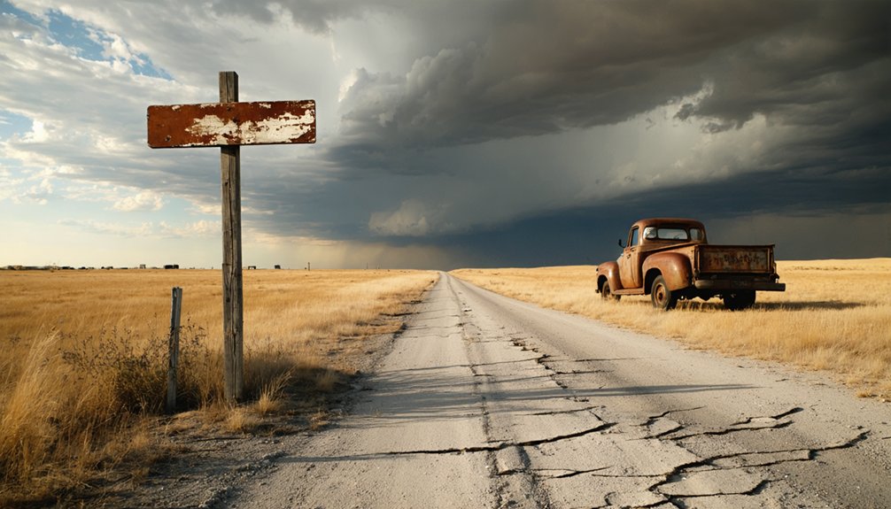
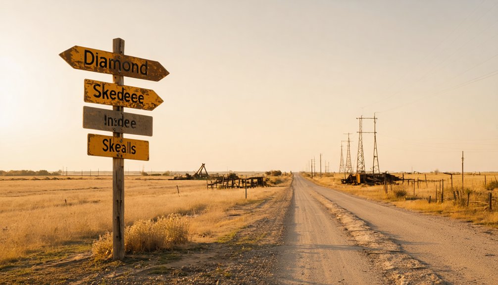
Stigler, the county seat 10-15 miles northwest, offers your last chance for fuel and supplies. From there, rural roads—some dirt, some gravel—lead southeast toward Diamond’s barren site. A high-clearance vehicle proves essential on these unmarked paths where regional history dissolved into Oklahoma earth.
Interactive ghost town maps become invaluable companions, revealing what standard GPS can’t: routes to places that officially don’t exist anymore.
What You’ll See Among the Ruins
You’ll find weathered wooden frames and crumbling foundations scattered across the prairie, their skeletal remains telling stories of families who once called this place home. I recommend bringing a wide-angle lens to capture the eerie contrast between rusted mining equipment and the wildflowers that now reclaim the land.
Watch your step near collapsed structures and old mine shafts—these relics are fragile, and the ground can be unstable where underground tunnels have given way.
Abandoned Buildings and Structures
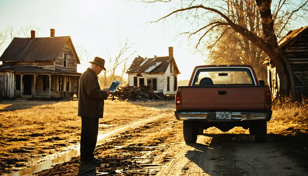
When you first arrive in Diamond, overgrown streets and scattered foundations will be your primary clues that a bustling mining community once thrived here. You’ll spot a few structures still standing—some now serving as abandoned equipment storage, housing tractors amid the ruins. I’ve noticed fewer buildings survive with each visit, their collapse accelerated by over 14,000 unstable mine shafts below.
The repurposed historical buildings tell fascinating stories. You can explore donated structures within the city park, including replicas like the Old Ingalls Hotel from the infamous 1893 shootout. Wander past dust-covered foundations of former saloons and homes, their cracked remnants revealing how shallow mining operations doomed this settlement. Tumbleweeds drift through empty street grids where the Doolin-Dalton Gang once faced federal marshals—freedom’s wild history preserved in decay.
Toxic Chat Pile Landscapes
Dominating the horizon across Diamond’s ruins, massive gray chat piles rise like artificial mountains—some towering 200 feet high—creating an otherworldly landscape that’s simultaneously fascinating and foreboding. You’ll count roughly 30 of these gray behemoths scattered around the area, representing 178 million tons of lead and zinc tailings laden with cadmium, arsenic, and manganese.
While they’re tempting to explore, don’t climb them. The fine toxic powder blows freely in wind, and mitigation strategies remain incomplete despite decades of EPA intervention. These piles aren’t just eyesores—they’re environmental hazards requiring long term monitoring. Stay on designated paths, avoid touching the gray material, and keep windows closed when dust kicks up. The haunting beauty comes with real danger, making respectful distance your wisest approach to experiencing this toxic legacy.
Historical Markers and Remnants
Beyond the toxic gray mountains, Diamond’s scattered remnants tell stories through weathered stone and crumbling brick. You’ll discover roofless buildings with cracked foundations half-buried in dust, their decrepit walls once sheltering saloons and homes.
Stone foundations mark the original town’s footprint—exposed chimney bases and hearths revealing where families gathered before the 1850s fire. Ethnographic studies have documented these pit-features and root cellars, while oral histories preserve memories of bustling streets now silent except for tumbleweeds.
The cemetery holds notable burials, including Choctaw Chief Allen Wright and Reverend Cyrus Kingsbury. Among the ruins, you’ll find cordmarked pottery fragments from 1,500-year-old camps and evidence of four mound-building events spanning 300 years. Each artifact whispers of lives lived freely before abandonment claimed this place.
Safety Precautions for Exploring Toxic Sites
Before stepping foot into Diamond’s crumbling structures, you’ll need to treat this ghost town like the hazardous site it truly is. Your personal protective gear selection starts with N95 respirators for dust and chemical-resistant gloves—I learned this the hard way after my first exploration left me coughing for days.
Pack chemical-resistant boots and eye protection, especially when traversing collapsed buildings where asbestos and lead paint flake freely.
Establish clear boundaries between contaminated zones and your clean staging area. Site decontamination processes aren’t optional—scrub down boots, wipe equipment, and bag contaminated clothing before returning to your vehicle.
Keep emergency supplies accessible: first-aid kits, eyewash stations, and spill containment materials. Freedom to explore doesn’t mean ignoring real dangers lurking in abandoned spaces.
Other Abandoned Towns Worth Visiting in the Area
If you’re already making the trek to Picher, don’t skip Treece and Cardin—two more toxic mining towns that form a haunting triangle of abandonment just minutes apart.
Treece straddles the Kansas-Oklahoma border, its collapsing homes and chat piles spilling across state lines, while Cardin sits wedged between them with rusted equipment scattered like giant tombstones.
You’ll find these stops practically neighbor each other, so gas up in Miami and knock out all three before the afternoon sun turns those metal-contaminated landscapes into shimmering, surreal wastelands.
Treece and Cardin Nearby
The ghost towns of Treece, Kansas, and Cardin, Oklahoma, rise from the poisoned earth like tombstones marking the Tri-State Mining District’s toxic legacy. You’ll find orange-stained waters and chat piles where 20,000 people once extracted $20 billion in ore for wartime ammunition. These aren’t quaint ruins—they’re warnings about environmental justice impacts on working-class communities.
I’ve walked Treece’s torn-up roads where only one holdout remained after the 2009 EPA buyout. The contamination from 70 million tons of tailings caused chemical burns on children playing in Tar Creek. By 2012, both towns were effectively/practically/virtually abandoned.
Don’t trespass on the few remaining structures. The mineshafts have flooded since 1973, and heavy metals still poison the soil. Your hometown connections mean nothing against lead poisoning.
Kansas Ghost Town Stops
While Treece stands as a cautionary tale, Kansas hides gentler ghosts across its prairie. You’ll find Cedar Point in Chase County, where a historic flour mill still stands among crumbling 1870s structures—industrial decline impacts written in weathered wood.
Croweburg’s shotgun houses tell mining stories, while Croft’s twin grain elevators pierce empty skies like monuments to agricultural collapse.
Head to Prairie City’s cemetery where pioneer dreams rest beneath windswept grass. Bridgeport vanished completely after its post office closed in 1976, proving rural depopulation factors spare no settlement.
These abandoned places offer something Diamond can’t—solitude without contamination. You won’t need hazmat suits here, just sturdy boots and respect for forgotten communities. Bring your camera; Kansas ghosts photograph beautifully against endless horizons.
Photography Tips for Capturing Ghost Town Atmosphere
Standing before Diamond’s weathered facades with camera in hand, you’ll quickly discover that ghost town photography demands more than pointing and shooting at decay. Pack your wide-angle lens to capture the entire main street’s abandonment, then switch to your prime for unique architectural details—rusted hinges, peeling paint, hand-carved trim.
Golden hour transforms ordinary structures into dramatic silhouettes, while long exposures during dawn reveal cloud movement above collapsed roofs. Before exploring interiors, conduct an environmental impact assessment: test floorboards, watch for wildlife, respect structural integrity.
Light painting brings mysterious glows to dark doorways during twilight shoots. Frame windows as portals to the past, and always keep horizons level. Your tripod enables those moody, low-light captures that truly convey Diamond’s haunting solitude.
Former Residents Keep Memories Alive
Beyond the camera lens and crumbling structures lie stories that refuse to fade with the paint. You’ll find Picher’s resilient community spirit alive each December when former residents return to their ghost town for cherished seasonal traditions. They gather where the post office once stood, swapping stories and reconnecting despite federal buyouts that scattered them across Commerce, Miami, and beyond.
Don’t be surprised if you spot tearful reunions at nearby Walmart parking lots—that’s where these tight-knit mining families maintain their bonds. They’ll tell you about refusing to abandon their identity, even when lead contamination forced exodus. Their children’s blood carried dangerous levels, yet the community remembers when nearly 15,000 called this place home during the 1920s boom that fueled World War I.
Frequently Asked Questions
Are There Any Hotels or Accommodations Near Picher for Overnight Stays?
You’ll find several hotels in Miami, just 8 miles away, with rates starting at $65 nightly. Nearby Quapaw accommodations offer additional options, while established campgrounds availability lets you sleep under stars near this abandoned town’s eerie landscape.
Can I Legally Enter the Abandoned Buildings or Are They All Off-Limits?
Rusted “Keep Out” signs dangle from barbed wire surrounding Picher’s crumbling structures. Most abandoned buildings are off-limits—they’re privately owned or dangerously toxic. You’ll need to observe safety precautions and respect private property. View safely from public roads instead.
Is Cell Phone Service Available in Picher and Surrounding Ghost Towns?
Yes, you’ll get cell phone coverage in Picher with Verizon, AT&T, and T-Mobile all providing service. However, cell phone coverage reliability can vary near abandoned structures, so download maps beforehand and stay alert to potential hazards of abandoned sites.
What Time of Year Is Best for Visiting Abandoned Mining Towns?
You’ll find spring and fall offer the best conditions for exploring abandoned mining towns. Skip the prime summer months’ oppressive heat and embrace mild autumn weather instead—crisp mornings reveal hidden details while comfortable temperatures let you wander freely through crumbling structures.
Do I Need Special Permission From Authorities to Visit Picher?
You don’t need local government approval to visit Picher—it’s publicly accessible. However, respect fenced areas and private property concerns. I’ve explored freely on Sundays when dump trucks rest, making navigation easier through this hauntingly beautiful wasteland.


