
You’ll find Divide’s ghostly remains along Interstate 5 at coordinates 43°45′04″N 123°07′11″W, where this forgotten railroad town lived from 1900 to 1921. Today, crumbling foundations, railroad grade cuts, and telegraph pole fragments are all that mark where passengers once disembarked. Download paper maps before heading out—cell service vanishes quickly in these mountains straddling the Douglas-Lane county border. Plan for summer visits when clearer conditions reveal the historical fragments, and you’ll discover how to expand your journey to nearby ghost towns like Hardman and Golden.
Key Takeaways
- Divide is located at 43°45′04″N 123°07′11″W in Lane County, accessible primarily via Interstate 5 near the Douglas-Lane border.
- Little remains at the site except railroad tracks, foundation remnants, crumbling concrete, and scattered timber from the abandoned town.
- Visit during summer for clearer conditions; winter brings fog and rain that can complicate exploration efforts.
- Bring paper maps as cell service is unreliable in the mountainous area between Pass Creek and Coast Fork Willamette.
- Combine your trip with nearby ghost towns like Hardman, Ashwood, or Millican for a full historical exploration experience.
The History of Divide: From Rail Stop to Ghost Town
Nestled in the shadow of Oregon’s coastal mountains, Divide sprang to life on May 31, 1900, when postal authorities established an office near a Southern Pacific Railroad station. You’ll find this vanished settlement southwest of Cottage Grove, where Douglas and Lane County borders once blurred—the post office itself shifted from Douglas to Lane County designation by 1909.
Where county lines wavered and postal designations shifted, Divide emerged from wilderness along the Southern Pacific’s steel corridor.
The railroad breathed life into Divide, transforming empty wilderness into a bustling stop for freight and passengers. Early community infrastructure centered entirely on those steel rails cutting through Oregon’s frontier.
But freedom’s restless spirit moved on. When the post office shuttered on January 15, 1921, Divide’s purpose evaporated.
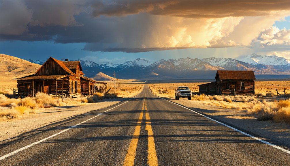
Today, you can trace railroad town relics along this forgotten corridor, where Interstate 5 now speeds past the ghosts.
Getting to Divide: Routes and Driving Directions
To reach Divide’s ghostly remains, you’ll aim for coordinates 43°45′04″N 123°07′11″W in Lane County, where Interstate 5 slices through what was once an essential railroad corridor. Your journey starts from Cottage Grove, the nearest town with fuel and supplies—stock up before venturing into this remote watershed boundary between the Umpqua and Willamette rivers.
I-5 provides your primary access route, though alternative route options exist via old logging roads if you’re feeling adventurous. Pass Creek flows along the west side, the Coast Fork Willamette to the east, marking the drainage divide that gave this ghost town its name.
Seasonal weather conditions matter here—winter brings fog and rain, while summer offers clearer exploration. Pack paper maps; cell service dies quickly in these mountains straddling the Douglas-Lane county border.
What Remains at the Divide Townsite Today
Little survives at Divide today except Interstate 5 itself and the railroad tracks that thunder past where wooden buildings once stood. You’ll find nature reclaiming what civilization abandoned, though traces linger if you know where to look.
What you might discover:
- Foundation remnants: Crumbling concrete and scattered timber mark where homes and businesses operated
- Railroad infrastructure: Original grade cuts and telegraph pole fragments survive along the tracks
- Interpretive markers: Occasional historical signs acknowledge the town’s existence
Unfortunately, preservation initiatives haven’t prioritized Divide like other Oregon ghost towns, and archaeological investigations remain limited. You’re fundamentally exploring on your own, piecing together history from fragments. Bring a camera, respect private property, and let your imagination reconstruct the bustling railroad community that once thrived here.
Nearby Ghost Towns Worth Exploring on Your Loop
While Divide offers sparse remnants requiring considerable imagination, central Oregon rewards ghost town enthusiasts with several better-preserved sites within a comfortable driving loop. You’ll find Ashwood 32 miles northeast of Madras—one of Oregon’s 80 registered ghost towns with actual structures standing.
Hardman sits conveniently on Highway 207, featuring remnants from its 1870s heyday as a farming center. Don’t miss the scenic routes between Shaniko and Antelope, where Cross Hollow stage stop makes an excellent photography detour. For ambitious explorers, Millican lies 26 miles east of Bend—perfect for a quick drive-by.
Plan overnight stays in Madras or Bend to tackle multiple sites comfortably. These backroads deliver the solitude and authentic decay that guidebooks sanitize, letting you experience Oregon’s abandoned corners on your own terms.
Must-See Historical Sites and Landmarks in the Area
You’ll want to budget time for three standout landmarks that anchor this ghost town loop in Oregon’s pioneer past. At Divide, rusted train station remnants still mark where prospectors once disembarked with dreams of striking it rich, while Golden’s weathered mining buildings stand frozen in their 1890s heyday—bring your camera for peeling paint and collapsed roofs that tell their own stories.
About an hour north, Champoeg State Heritage Monument commemorates the 1843 vote that established Oregon’s provisional government, complete with interpretive trails through meadows where French-Canadian settlers once farmed.
Divide Train Station Remnants
Deep in the forested ridges of Oregon’s Nehalem Divide, the crumbling remnants of Divide Train Station emerge from decades of overgrowth like secrets the timber industry tried to forget.
You’ll discover timber trestle relics and rail line remnants dating from 1919 to 1945, when logging trains carved through terrain too steep for roads. I’ve hiked these abandoned paths three times, finding tunnel entrances braced with original timber beams and iron bolts still clutching rotted wood.
What you’ll find:
- Abandoned tunnel portals hidden beneath moss and ferns
- Raised rail beds now serving as narrow hiking trails
- Wooden station footprints marked by rectangular depressions
Access these sites on foot from rediscovered logging roads near Scappoose. Pair your exploration with nearby ghost town remnants for a complete rail heritage experience that highways couldn’t erase.
Golden’s Preserved Mining Buildings
Twenty miles south of those abandoned rail tunnels, Golden’s mining camp tells a different preservation story—one where buildings survived instead of surrendering to the forest. You’ll find Rev. Ruble’s 1892 Campbellite church standing beside his family residence, both National Register landmarks that showcase pioneer architecture preservation at its finest.
The 1904 General Store anchors the commercial district, while scattered outbuildings—including an authentic outhouse and carriage house—paint the complete picture of 1890s mining life.
Oregon Parks owns these structures now, maintaining church museum exhibits that detail Goldville’s brief heyday. Unlike Divide’s crumbling rail infrastructure, Golden offers tangible connection to frontier living. The post office operated until 1920, serving miners who’d eventually abandon their claims.
Walk freely through this outdoor museum where Hollywood occasionally films Westerns against genuinely weathered backdrops.
Champoeg State Heritage Monument
Where Divide’s tunnels crumbled and Golden’s buildings survived, Champoeg State Heritage Monument stands as Oregon’s most consequential ghost town—the birthplace of statehood itself. Here, 102 men voted in 1843 to form Oregon’s first provisional government, defying both British Hudson’s Bay Company control and federal indifference.
The historical significance hits you immediately at the Pioneer Monument, where carved names commemorate those who chose self-governance. You’ll wander streets marked by five-foot wooden posts—all that survived the catastrophic 1861 and 1892 floods that erased this once-thriving community.
Don’t miss these key monuments and buildings:
- Robert Newell House (1852), where desperate townsfolk sought refuge during the Great Flood
- Butteville Academy one-room schoolhouse (1859)
- Over 9,000 unearthed artifacts extending Oregon’s archaeological timeline by two decades
Best Times to Visit and Road Conditions to Consider
Since Oregon’s ghost towns scatter across dramatically different elevations and climates, timing your visit to Divide requires strategic planning around weather patterns that’ll either grant you access or leave you staring at impassable snowdrifts. Fall delivers favorable weather conditions—comfortable temperatures for exploring without summer crowds clogging your solitude. You’ll find photographic opportunities peak during golden hour, when long shadows dramatize weathered structures and decay contrasts beautifully against autumn’s palette.
Winter snow buries high-elevation towns for months, making roads impassable through the Elkhorn area. Summer opens access to otherwise isolated sites, though you’ll sacrifice that haunting emptiness. Spring brings wildflowers threading through ruins, but roads don’t clear until late May. Pack appropriately—cell coverage vanishes in ghost country, and services remain scarce wherever you’re headed.
Safety Precautions for Ghost Town Exploration
Exploring Divide’s decaying structures means you’ll navigate rotted floorboards, rusted metal, and collapsing roofs that can give way without warning. I’ve learned the hard way that stepping near wall supports rather than room centers has saved me from plunging through weakened floors more than once.
Pack a thorough first-aid kit, multiple light sources with backup batteries, and three days’ worth of water in your vehicle—cell service is nonexistent, and the nearest help could be hours away.
Hazardous Terrain and Structures
Watch for these critical dangers:
- Weakened structures with rotting timbers and unstable floors that can give way without warning
- Acid rock drainage creating hazardous water pooling near old mining operations
- Tailings piles masking unstable terrain beneath deceptively solid-looking surfaces
The freedom to explore comes with responsibility. Test every foothold, avoid entering dark openings, and recognize that abandoned doesn’t mean safe—it means unpredictable.
Essential Emergency Supplies
When venturing into Oregon’s abandoned settlements, your survival kit transforms from cautious preparation into lifeline. Pack three days’ worth of water and non-perishable food—you’re miles from civilization when structures collapse or weather turns hostile.
I’ve learned waterproof containers aren’t optional; they’re your shelter resources against sudden downpours.
Your medical contingencies demand serious attention. Stock bandages, antiseptics, and splints for inevitable encounters with rusted metal and unstable floors. Don’t skip the epinephrine auto-injector if allergies run in your history. Pack multiple flashlights with backup batteries—darkness in abandoned buildings isn’t romantic, it’s dangerous.
Satellite phones outperform cell coverage in remote areas. Include personal locator beacons and whistles. Thick-soled boots, gloves, and high-visibility clothing protect against immediate hazards while signaling rescuers if needed.
Frequently Asked Questions
Are There Any Amenities or Services Available Near Divide?
You’ll find basic services like fuel stations and grocery stores in nearby towns, but Divide itself remains beautifully remote. Stock up beforehand—there’s freedom in being self-sufficient when exploring Oregon’s forgotten corners and wide-open spaces.
Can I Camp Overnight at the Divide Ghost Town Site?
Camping overnight depends on local land ownership and camping regulations for that specific area. You’ll need to verify whether it’s private property or public land, then follow the applicable rules for dispersed camping or designated sites nearby.
Do I Need Permits to Visit Divide and Photograph the Area?
Before you chase that wide-open horizon, you’ll need property owner permission to explore Divide legally. Trespassing concerns are real at abandoned sites on private land. Always research ownership and ask permission—true freedom respects boundaries.
What Should I Pack for a Day Trip to Divide?
Pack layers for changing weather conditions, sturdy boots for exploring ruins, plenty of water, snacks, and a first-aid kit. Check road conditions beforehand—you’ll need a reliable vehicle since cell service is spotty in Oregon’s remote backcountry.
Are Guided Tours Available for Divide and Nearby Ghost Towns?
Like a lone tumbleweed rolling freely, you’ll explore Divide independently—no organized historical group tours exist here. Self-guided walking tours let you wander at your own pace, discovering hidden stories without schedules constraining your adventure.


