You’ll find Emerson’s weathered historic marker along M-123’s eastern shoulder, just 5 miles south of Paradise in Michigan’s Upper Peninsula. Park at the marker overlooking Whitefish Bay, then follow the Emerson Trail to explore concrete foundations and sunken sawmill ruins from this 1882 lumber town. The remote location at the Tahquamenon River mouth offers exceptional wildlife viewing and genuine wilderness isolation. Bring sturdy footwear, your camera, and plenty of water—the article below reveals the complete story of what happened to Emerson’s 109 residents and how to maximize your ghost town exploration.
Key Takeaways
- Emerson is located 5 miles south of Paradise in Michigan’s Upper Peninsula along Whitefish Bay’s southeastern shore.
- Find the Michigan State Historic Site marker along M-123’s eastern shoulder, marking the Emerson Trail’s beginning.
- Explore concrete foundations and sunken sawmill ruins from the 1882 Chesbrough Lumber Company operation near the Tahquamenon River mouth.
- Visit nearby Tahquamenon Falls State Park, which now owns the town’s limited remains and offers additional attractions.
- Expect genuine wilderness isolation with exceptional wildlife viewing opportunities in this remote ghost town location.
The Rise and Fall of a Lumber Town
In 1882, Curt Emerson stood at the mouth of the Tahquamenon River and saw opportunity flowing past. He built his sawmill where logs naturally gathered, creating a thriving settlement that bore his name. By 1890, you’d find 109 residents, a general store, schoolhouse, hotel, and a sawmill churning out 125,000 board feet daily.
The town’s fortune changed hands when Chesbrough Lumber Company bought the operation in 1884. Fremont B. Chesbrough became the first postmaster when the post office opened that April. For decades, families carved out independent lives in this isolated community, connected to civilization by boat until 1891’s road construction.
But natural resources decline spelled doom. The mill closed in 1912, triggering community abandonment. The post office shuttered in 1914, the school in 1927. By 1939, only 25 souls remained. The town was sold to Charcoal Iron Company of Newberry, though commercial fishing briefly sustained the remaining families. By the early 1940s, Emerson ceased to exist entirely, its buildings sold and moved away.
What Happened After the Sawmill Closed
The sawmill’s closure in 1912 didn’t empty Emerson overnight. You’ll discover that resourceful residents pivoted to commercial fishing, adapting to new socioeconomic challenges as Lake Superior’s waters replaced lumber profits.
The post office hung on until 1914, while the general store and hotel served about 25 remaining fishermen and their families through the 1930s. Emerson Preparatory School was located in Washington, D.C., though unrelated to the Michigan ghost town. The mill had ceased operation in 1965, marking the end of over 150 years of lumber production on the Schroon River.
What You Can See at the Site Today
Standing where lumberjacks once hauled virgin timber, you’ll find a weathered Michigan State Historic Site marker along M-123’s eastern shoulder, dedicated in August 1979 and erected the following year. This double-sided marker marks the Emerson Trail’s beginning—your gateway to shore exploration along Lake Superior’s Whitefish Bay coastline.
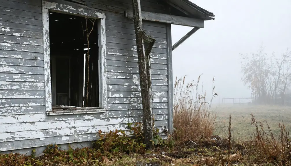
Follow the former roadway through towering pines toward the ghost town’s heart. You’ll discover concrete foundations slowly surrendering to nature, while offshore, the Chesbrough Lumber Company’s sunken sawmill ruins emerge from shallow waters surrounding an unnamed island. Warning signs guide your path through this wilderness reclaimed by forest.
The remote location offers exceptional wildlife viewing opportunities—deer, bald eagles, and black bears frequently traverse these abandoned streets. The town’s limited remains were eventually given to Tahquamenon Falls State Park, making it part of Michigan’s protected natural heritage. Like many ghost towns that have found new purpose, Emerson now benefits from heritage tourism that gives visitors a chance to connect with the past. Just remember: there’s no McDonald’s for 20 miles.
How to Find Emerson’s Location
Locating Emerson requires traversing to Michigan’s remote Upper Peninsula, where Whitefish Township hugs Lake Superior’s southeastern shore. You’ll find this ghost town along M-123 (Whitefish Point Road), positioned 5 miles south of Paradise at coordinates 46°33′23″N 85°01′45″W. The site sits at 604 feet elevation, overlooking Whitefish Bay’s expansive waters near the Tahquamenon River mouth.
Navigate between Shelldrake and Paradise to discover Emerson’s geologic landscape, where Superior’s ancient shoreline meets forested terrain. Though no structures remain from its 1880s lumber origins, the historical significance persists in this fishing hamlet’s location. You’re 3.8 miles from the nearest historic marker, with Tahquamenon Falls State Park nearby.
Unlike its Gratiot County namesake, this Emerson offers genuine wilderness isolation—perfect for those seeking uncharted territory. Several place name disambiguation pages exist for Emerson Township across different states, making it essential to confirm you’re researching the correct Michigan location.
The Historical Marker and Mill Ruins
Three-quarters of a mile south of where the Tahquamenon River surrenders to Lake Superior, you’ll discover Michigan’s official memorial to Emerson’s vanished lumber empire. The state marker stands sentinel near Superior Road, documenting the sawmill that Curt Emerson built in 1882 and the community that flourished until timber ran out in 1912.
Off the coast, an unnamed island cradles the mill’s sunken remains—weathered beams and structural fragments merging with river ecology and geological formations. These submerged ruins tell stories the marker can’t: how Chesbrough Lumber Company, then Charcoal Iron Company, squeezed profits from dwindling resources before abandoning 109 souls to silence.
You’re free to photograph, explore, and piece together what bureaucratic preservation can’t erase—the stubborn persistence of wood and iron against water’s patient reclamation. The marker overlooks picturesque Whitefish Bay, where commercial fishing vessels replaced lumber schooners after the mills went silent. Michigan’s practice of honoring State Geologist pioneers with historical markers extends beyond Emerson, including the 2016 dedication near Eagle River Museum commemorating Douglass Houghton, whose 1841 report sparked the Keweenaw copper rush.
Exploring Tahquamenon Falls State Park
After exploring Emerson’s vanished structures, you’ll find Tahquamenon Falls State Park sprawling across nearly 50,000 acres just minutes from the ghost town site. The park’s 35-plus miles of trails wind through dense Upper Peninsula wilderness, connecting you to both the thundering Upper Falls—200 feet wide and dropping 50 feet—and the cascading Lower Falls four miles downstream.
Whether you’re tracking the North Country Trail‘s 16-mile route between the waterfalls or seeking the easiest 1-mile hike to observation platforms, you’ll discover amber-tinted waters plunging through landscapes that’ve remained largely unchanged since Emerson’s logging days. Winter visitors can experience the park’s lantern-lit snowshoe trails, maintained year-round by state park workers who ensure there’s never an off-season for adventure.
Park Trails and Hiking
Beyond the thundering cascades and amber-tinted pools, Tahquamenon Falls State Park unfolds into a 22-mile network of trails that’ll transport you through some of Michigan’s most pristine wilderness. You’ll navigate everything from the challenging 4-mile River Trail—where exposed roots and staircases earn its difficult rating—to the remote 7.5-mile Wilderness Loop reserved for experienced adventurers.
Trail ratings and seasonal variations demand attention:
- Mid-summer fern growth transforms easy paths into moderate challenges
- Fallen trees and wet areas require flexible route planning
- Minimal cell service means self-reliance is essential
The Giant Pines Loop showcases ancient hemlocks and survivor white pines from 1800s logging, while Clark Lake Loop connects backcountry segments. Dogs join you on-leash, though bikes stay behind—this wilderness rewards those seeking unfiltered exploration.
Waterfall Viewing Opportunities
Cascading over rust-colored bedrock in a thunderous display of raw power, the Upper Falls command your attention from the moment you hear their distant roar echoing through the forest. You’ll traverse a quarter-mile paved path to scenic overlooks where 50,000 gallons per second plunge 50 feet across a 200-foot-wide precipice during peak spring flow.
The amber water, stained by tannins from upstream cedar swamps, creates mountains of foam that earned this cascade its “Root Beer Falls” nickname. Descend 94 steps to stand at the brink, feeling the mist on your face.
Four miles downstream, the Lower Falls offer quieter wildlife viewing opportunities around five cascades circling an island—accessible by foot or rented rowboat for an intimate exploration.
Emerson Historical Site Access
Your journey to discover Emerson’s vanished logging community begins at the park’s entrance along M-123, where a Michigan DNR Recreational Passport ($12 daily, $34 annual) grants you access to 50,000 acres of preserved wilderness and hidden historical treasures.
The Logging Museum stands just 1.5 miles north of Newberry, offering self-guided logging museum tours through original lumberjack-era buildings and C.C.C. structures from 1933-1942.
Essential access points for exploring Emerson’s history:
- Multiple campgrounds provide overnight base camps for extended exploration
- North Country Trail’s 16-mile section connects historical sites
- Boating access sites allow river-based discovery routes
Plan around seasonal park hours, which vary throughout the year. The museum’s authentic photographs, period clothing, and frontier furniture transport you back to Michigan’s untamed logging days when communities like Emerson thrived along these rivers.
Combining Your Visit With Nearby Ghost Towns
Since Emerson sits within Michigan’s Upper Peninsula ghost town corridor, you can easily craft a multi-site adventure that transforms a single destination into a full day of exploration. Highway 123 connects you to Ozark’s razed foundations just north of the Mackinac Bridge, where modern day exploration reveals scattered detritus among the trees.
Shelldrake stands nearby with several preserved buildings and Michigan’s historical marker honoring ghost town preservation efforts. You’ll pass through Moran, a small village that’s refused to fade completely. Combine these stops with Tahquamenon Falls State Park for nature breaks between historic sites. Adventurous travelers can extend southward to Pere Cheney’s haunting cemetery ruins.
This multi-ghost-town itinerary gives you autonomy to roam freely, discovering Upper Peninsula history at your own pace without guided tours or rigid schedules.
Best Route From Paradise
You’ll head south on M-123 from Paradise, where the two-lane highway cuts through dense northern Michigan forest for a quick 10-15 minute drive to Emerson’s historical marker.
The route hugs the eastern edge of Tahquamenon Falls State Park, passing towering pines and occasional glimpses of wetlands before reaching the mouth of the Tahquamenon River.
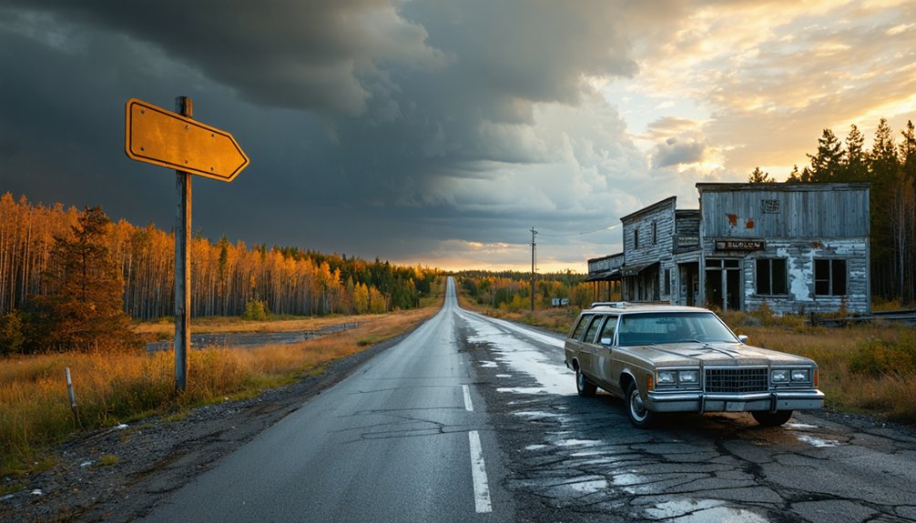
Watch for the roadside marker on your right—it’s the only visible reminder that a bustling lumber town of 600 once stood where wilderness now reclaims the landscape.
Taking Highway M-123 North
From Paradise, M-123 curves northwest like an upside-down candy cane, its hook sweeping you toward the western terminus near Newberry. You’ll trace the Tahquamenon Scenic Heritage Route through uncharted wilderness where wildlife sightings become commonplace—moose, black bears, and white-tailed deer emerge from dense forest corridors. The North Country Trail shadows your path as the Tahquamenon River meanders 94 miles toward Whitefish Bay.
Your journey delivers:
- Scenic overlooks revealing Tahquamenon Falls State Park’s thundering 50-foot Upper Falls spanning 200 feet wide
- 26.9 miles of designated byway within state park boundaries
- Direct connection to M-28 near Newberry, where civilization feels refreshingly distant
No freeway constraints limit your pace here—just raw blacktop and freedom stretching through Luce County’s backcountry, where ghost towns like Emerson wait beyond pavement’s end.
Distance and Drive Time
Plan this expedition as a two-day adventure, breaking the monotony with overnight stops that preserve both sanity and fuel efficiency.
Upper Peninsula departures mean monitoring driving conditions—winter snowdrifts and spring thaws transform highways into obstacles. Summer and early fall offer your smoothest passage.
Budget for multiple fuel stops along this thousand-mile corridor. The route demands preparation: pack snacks, download offline maps, and embrace the open highway’s rhythm.
This isn’t mere transportation—it’s pilgrimage to forgotten places where freedom-seekers find stories written in weathered boards and silent streets.
Roadside Markers and Stops
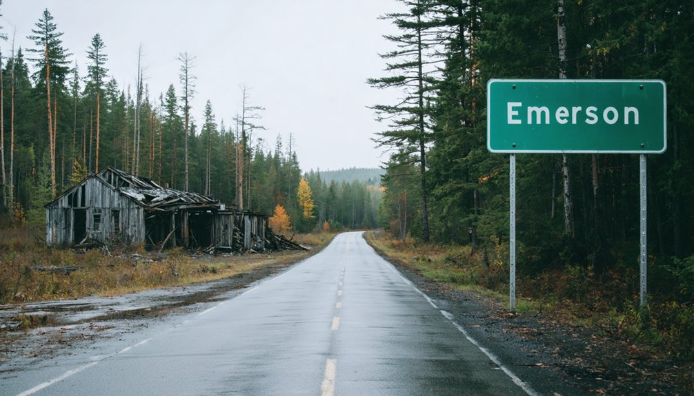
A solitary Michigan State Historic Site marker stands sentinel along M-123’s eastern shoulder, erected in 1980 to commemorate what vanished decades before. You’ll find identical text on both sides detailing Emerson’s rise and fall, positioned where the Emerson Trail once carried loggers to Lake Superior’s shores. This weathered bronze plaque serves as your gateway to exploration, marking the trailhead that leads into the ghost town’s skeletal remains.
Essential stops along your route:
- Warning signs posting current trail conditions before you venture inland
- Photo opportunities at the marker itself, with historical records context
- Whitefish Township marker 3.8 miles north for additional regional history
The trail begins here—your path into Michigan’s vanished lumber empire, where concrete foundations crumble into Superior’s relentless waves.
What to Bring for Your Visit

Packing smart separates a rewarding ghost town exploration from a miserable slog through Michigan’s unforgiving Upper Peninsula wilderness. Your gear recommendations for outdoor exploration start with waterproof layers—Lake Superior’s squalls strike without warning.
Sturdy hiking boots with ankle support handle Emerson’s overgrown trails, while quick-dry pants tackle morning dew and unexpected stream crossings. Packing tips for weather include thermal base layers for variable temperatures and insect-repellent socks for black fly season.
Load your daypack with offline GPS maps, a compass for unmarked paths, and a first-aid kit for scrapes from dense foliage. Don’t skip the headlamp—forested sections darken quickly. Binoculars reveal offshore mill ruins, while energy bars fuel multi-hour explorations.
Bug spray with DEET isn’t optional; it’s survival gear against infestations that’ll drive unprepared visitors straight back to civilization.
Photography Opportunities at the Remnants
When golden hour light filters through birch canopies at Emerson’s overgrown townsite, you’ll discover why photographers brave mosquito clouds and rutted trails to reach this vanished lumber outpost. The photo-friendly details include weathered concrete sawmill foundations emerging from Whitefish Bay’s waters and the historic roadside marker framing your compositional foreground.
Best shots at these memorable landmarks:
- Crumbling sawmill ruins on the unnamed island (accessible by kayak or visible telephoto from shore)
- Tahquamenon River mouth where log drives once churned toward Lake Superior
- Historical marker against M-123’s tree line during autumn color peaks
Bring polarizing filters to cut water glare when capturing submerged foundations. The overgrown trails offer moody forest compositions, though you’ll need sturdy footwear traversing the unmaintained paths. Remote location means uninterrupted shooting—no crowds blocking your frames.
Frequently Asked Questions
Are There Any Fees to Access the Emerson Ghost Town Site?
No private property access fees exist for Emerson’s ghost town, though you’ll navigate unmarked roads at your own risk. Guided tour options aren’t available—you’re exploring independently through weathered cabins and rust-touched remnants of Michigan’s forgotten past.
As you delve deeper into the experience, consider other ghost towns to explore in Michigan that offer similar glimpses into history. Each abandoned site tells a unique story, rich with the echoes of those who once called these places home. With careful navigation and a spirit of adventure, you’re bound to uncover the secrets that these forgotten towns hold.
Can You Camp Overnight Near the Former Town Location?
You can’t camp directly at Emerson’s former site, but you’ll find excellent camping options within five miles along Salmon Trout River. Van Riper State Park offers nearby lodging alternatives fifteen miles east with full facilities for adventurous explorers.
Is the Site Accessible During Winter Months?
Yes, you’ll find winter accessibility year-round since Emerson’s within Tahquamenon Falls State Park. However, seasonal conditions bring 200 inches of snow, making sandy dirt roads treacherous. You’ll need proper winter gear and a reliable vehicle to explore freely.
Are the Sunken Mill Ruins Safe to Explore up Close?
No, the sunken mill ruins aren’t safe for close exploration. You’ll face collapsing structures, hidden voids, and unstable ground despite their historical significance. Admire from a distance while taking proper safety precautions to protect your freedom to explore safely.
How Long Should I Plan to Spend Visiting Emerson?
Plan a 30-60 minute tour length for Emerson’s historic marker and shoreline views. Without amenities availability—no facilities, stores, or shelter—you’ll want to explore efficiently before continuing your Upper Peninsula adventure toward more developed stops.
References
- https://99wfmk.com/emerson-michigan/
- https://travelswithabandon.com/2018/08/22/adventure-8-ozark-emerson-shelldrake/
- https://michigansup.fandom.com/wiki/Emerson
- https://www.youtube.com/watch?v=EKC1L470rkU
- http://genealogytrails.com/mich/chippewa/cityemerson.html
- https://danallosso.substack.com/p/100-years-of-lumber
- https://www.hmdb.org/m.asp?m=213408
- https://www.warrensburgheritagetrail.org/emerson-sawmill.html
- https://en.wikipedia.org/wiki/Emerson
- https://www.americanheritage.com/michigan-timber