You’ll find Erin Springs along State Highway 76, where just 63 souls inhabit what was once Frank Murray’s sprawling 20,000-acre cattle empire. The crown jewel is the three-story Murray-Lindsay Mansion, perched on a windswept hill where native stone walls have weathered since 1879. Natural springs still bubble from the earth, and arrowheads surface near crumbling structures that whisper tales of Chickasaw traders, Irish immigrants, and frontier ambition. Your journey through this haunting landscape reveals layers of history most visitors never discover.
Key Takeaways
- Visit the Murray-Lindsay Mansion, a three-story stone testament to frontier ambition, now preserved by the Oklahoma Historical Society since 1970.
- Explore the natural springs that attracted settlers in 1871, still bubbling from the earth across former Chickasaw territory.
- Access Erin Springs via State Highway 76, located on flat prairie terrain where old stage paths cross north-south through the landscape.
- Witness one of Oklahoma’s smallest incorporated towns, spanning just 0.175 square miles with 63 residents and crumbling historic structures.
- Search for arrowheads surfacing from earth where indigenous history and pioneer settlement intersect across the windswept prairie.
The Rise and Fall of a Chickasaw Nation Settlement
Long before Oklahoma statehood, the land around Erin Springs witnessed layers of human civilization stretching back millennia. You’ll find evidence of Wichita villages from A.D. 1250-1450, alongside countless archaeological sites documenting 8,000 years of indigenous presence.
By 1856, the thriving Chickasaw culture had established sophisticated towns, trade networks, and agrarian communities across this territory. Erin Springs emerged in 1871 along the crucial Fort Sill road, where natural springs attracted merchants, ranchers, and travelers seeking respite. The town flourished with stores, blacksmith shops, and cold drink stands surrounding those legendary springs. Frank Murray owned 8,000 acres of farmland near the settlement, representing the scale of agricultural enterprise that defined the region. Originally called Elm Springs for its large elm tree and natural spring, the stage stopping point was later renamed to honor Erin Westland, Frank Murray’s sister.
But the 1889 land run shattered this prosperity, fragmenting vast ranches into scattered homesteads. Today you’ll discover decaying businesses and infrastructure—silent monuments to a settlement that once bridged indigenous sovereignty and frontier commerce.
Frank Murray’s Cattle Empire and Grand Stone Mansion
When Frank Murray stepped off the wagon in 1871, the Irish immigrant from Londonderry couldn’t have imagined the empire he’d carve from Chickasaw Nation territory. With his part-Choctaw wife Alzira, he transformed raw prairie into 20,000 acres supporting 26,000 head of cattle.
From Irish immigrant to cattle baron: Frank Murray transformed 20,000 acres of Chickasaw prairie into a frontier empire alongside his part-Choctaw wife.
Frank Murray’s cattle operations stretched nearly ten miles along the Washita River’s north bank, where Indian corn yielded 50-60 bushels per acre. His vast herds required registered cattle brands to maintain legal proof of ownership across his sprawling rangelands.
His success demanded a headquarters worthy of the empire. Between 1879-1880, workers hauled native stone from quarries six miles south, constructing a mansion that still stands today. You’ll find this two-story fortress—expanded to three stories in 1902—preserved as the Murray-Lindsay Mansion. The property stands on ground where eight Indians were buried following a skirmish between General Cabell’s soldiers and a small band of Indians on nearby Cabell Creek.
Fort Sill officers once rode this road, stopping to experience the Irish immigrant experience transformed into frontier prosperity.
What Remains of Erin Springs Today
You’ll find precious little when you reach Erin Springs—just 63 souls scattered across windswept prairie where Frank Murray’s cattle empire once thrived. The crumbling stone mansion still watches over empty roads that bear witness to a 54% population collapse, its weathered walls the most substantial reminder of grander days.
What survives here isn’t a town in any traditional sense, but rather a collection of traces: aging structures, drought-parched grasslands, and the stubborn geography that first drew settlers to this remote corner of Garvin County. The settlement spans a mere 0.175 square miles, making it one of Oklahoma’s smallest incorporated places. The median home value of $71,700 reflects a rural reality far removed from the national average, a testament to how thoroughly time and economics have bypassed this isolated community.
The Murray Mansion Legacy
Standing on a windswept hill where eight Native Americans once fell in frontier conflict, the Murray Mansion commands the landscape of Erin Springs nearly 150 years after its first stones were laid. You’ll discover how Irish immigrant Frank Murray‘s ambitious vision—20,000 acres and 26,000 cattle—created this frontier monument before his 1892 financial collapse.
His widow Alzira transformed tragedy into triumph, abandoning traditional ranching for banking operations across Oklahoma towns. She rebuilt the grandeur of stone mansion with a third story in 1902, cementing her independence through shrewd financial investments.
Today, the Oklahoma Historical Society preserves this legacy to resilience. The mansion earned its place on the National Register of Historic Places in 1970, recognizing its significance to Oklahoma’s social history. Walk these grounds where arrowheads still surface from the earth, reminding you that freedom’s story here intertwines pioneer ambition with indigenous memory.
Landscape and Natural Features
A mere two-tenths of a square mile remains of what was once Frank Murray’s 20,000-acre empire, compressed now into a town where 63 souls occupy land that once supported 26,000 head of cattle. The flat terrain stretches across former Chickasaw territory, where preserved natural springs still bubble from the earth that gave this settlement its name.
The land remembers its ranching past, even as vacancy claims 15% of existing structures. The community’s population density of 435 inhabitants per square mile speaks to how concentrated settlement has become in this diminished footprint. The Murray-Lindsay Mansion, constructed over twenty-two years from 1880 to 1902, stands as the most significant architectural remnant of the town’s prosperous era.
- Springs and Water: Original water sources near the settlement still flow
- Flood Zones: Localized flood risk affects three properties over flat drainage patterns
- Open Spaces: Ranch and farmland surrounds the compact town center
- Highway Access: State Highway 76 cuts through accessible terrain
- Historical Routes: Old stage paths cross north-south through the landscape
Community Markers and Roads
Where water once shaped the land, pavement now traces the skeleton of community life. You’ll find Erin Springs marked by weathered community signage at 34°48′40″N 97°36′20″W, a defiant announcement that something still exists here.
The road conditions tell their own story—cracked asphalt veining through 0.2 square miles where 89 souls once gathered, now home to just 22. State highways connect this dot to civilization, but local roads bear the weight of abandonment differently. Some stretch smooth and forgotten, others crumble at their edges like the population itself. The largest group you might encounter here is White at 74.2%, followed by American Indian residents who comprise nearly a fifth of those who remain.
No streetlights illuminate your passage. The county maintains these arteries more from habit than necessity, preserving routes to nowhere particular, leading you past 41 housing units scattered across terrain that drought has claimed.
Nearby Ghost Towns Worth Exploring
While Erin Springs offers its own haunting appeal, the surrounding countryside harbors several forgotten settlements that’ll deepen your ghost town adventure.
- Tussy – Straddling Carter and Garvin Counties, this semi-abandoned site reveals abandoned agricultural structures and foundations from its post-oil boom decline.
- Woodford (Bywater) – Carter County’s 1870 settlement stood until 1974, leaving barren sites accessible via state highways.
- White Bead – Garvin County’s early settlement turned ghost after the 1900s, preserving a cemetery and remnants of its farming past.
- Arbuckle – Nine miles west of Davis, this 1850s military and trading post site offers foundational remains near Fort Arbuckle ruins.
These neglected settlement histories create a compelling circuit through Oklahoma’s vanished communities, each revealing different chapters of frontier life.
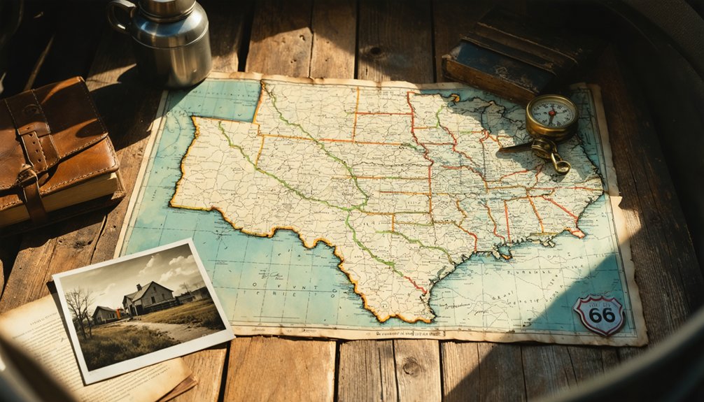
Getting There: Directions and Access Points
You’ll find Erin Springs just two miles south of Lindsay on State Highway 76, the main artery connecting this forgotten settlement to the modern world. The coordinates N34°48’40″ W97°36’20″ mark your destination in far northwestern Garvin County, where the ghost town sits south of the Washita River along what was once a critical north-south stage route.
From Maysville, it’s an eleven-mile journey west, while Interstate 35 travelers can exit and head five miles east via Highway 7 to reach this historic crossroads.
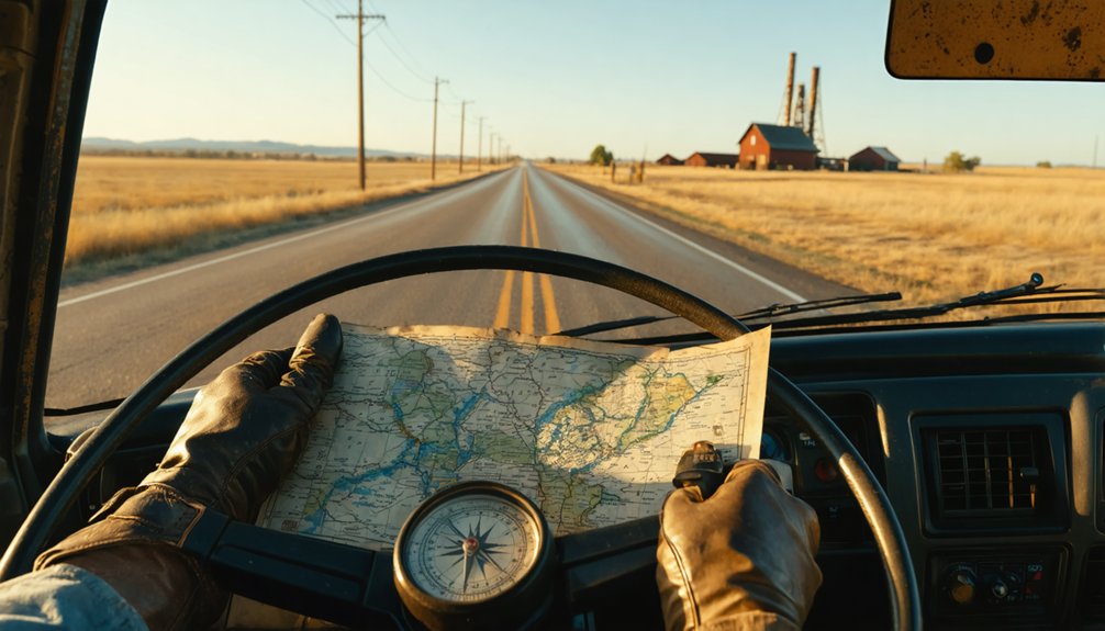
Highway 76 Primary Route
Since Oklahoma’s State Highway 76 cuts directly through Erin Springs, you’ll find this two-lane ribbon of asphalt serves as your primary lifeline to the ghost town. This north-south corridor connects you to freedom-seeking territory where roadway maintenance updates remain minimal and local business offerings have dwindled to essential stops.
Your navigation essentials include:
- Exit 72 from I-35 leads to OK-19, your western transfer point toward the SH-76 junction
- Waze and MapQuest provide real-time routing to landmarks like Erin Springs Superette (13195 SH-76)
- Grid J-6 marks your destination on Oklahoma’s state highway map
- OK-19 intersection serves as your key eastern access checkpoint
- Central time zone governs this southern Oklahoma stretch
The route demands self-reliance—gas up before departure and embrace the sparse landscape ahead.
Distance From Major Towns
Planning your ghost town expedition means understanding Erin Springs’ isolation from Oklahoma’s populated corridors. You’ll find Lindsay closest—just 5-7 miles northeast via SH-76’s branching county roads, a quick 10-minute drive. Pauls Valley sits 22 miles north, offering Interstate 35 access through alternative transportation routes along US-77.
As you explore the unique ghost town attractions in Oklahoma, keep an eye out for the remnants of old storefronts and abandoned homes that tell stories of the past. Each site offers a glimpse into the state’s rich history, with some towns dating back to the late 1800s. Don’t forget your camera to capture the eerie beauty that these forgotten places provide.
From Purcell, you’re facing a 35-40 mile journey southward, while Chickasha requires traversing 45-50 miles across county lines via US-62. Ardmore’s I-35 corridor lies 55 miles southeast, perfect for Texas-bound travelers.
County road conditions vary considerably throughout Garvin County’s rolling terrain. These rural connectors reward adventurous spirits seeking forgotten places, though you’ll want reliable transportation.
The sparse population means fewer services between towns—fuel up before venturing into Oklahoma’s backcountry, where ghost towns hide among the prairie’s quiet remnants.
Historical Stage Road Path
Long before State Highway 76 guided modern travelers to Erin Springs, a dusty government freight road carved its path through the Chickasaw Nation, connecting Fort Sill to Fort Caddo along the Washita River valley. This crucial artery served wagon freight routes twice weekly, carrying mail, supplies, and adventurous passengers through untamed territory.
You can still trace remnants of this historic passage near early stage stands:
- Erin Springs (originally Elm Springs) marked a major stopping point where natural springs refreshed weary travelers
- Cherokee Town operated at the Washita River ford, two miles east of present-day Pauls Valley
- Whitebead functioned as a prominent supply station along the freight road
- Rush Springs provided essential rest for stage drivers and their teams
- Pauls Valley served as another regular relay point
Today’s highways parallel this legendary path to freedom.
Best Time to Visit and What to Bring
Your packing tips start with layers—Oklahoma swings wildly from freezing mornings to scorching afternoons. Rain gear handles the 37.6 inches of annual precipitation, and wind protection combats those relentless 22 mph gusts.
Don’t forget sun protection for exposed wandering. Summer’s brutal 90°F+ stretches and winter’s ice make those seasons less appealing for roaming crumbling structures.
Pack a severe weather kit regardless—Oklahoma’s skies don’t negotiate.
Historic Landmarks and Photo Opportunities
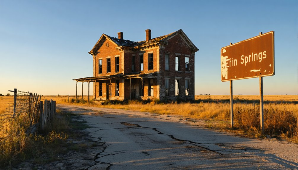
Once you’ve packed your gear and braced for Oklahoma’s moody weather, the real prize awaits in Erin Springs’ surviving landmarks. The Murray-Lindsay Mansion dominates your viewfinder—a rock fortress completed in 1883 that once hosted territorial governors and Fort Sill officers. You’ll find architectural preservation details in every remodeled corner, while the Washita River backdrop adds dramatic depth.
Prime shooting locations include:
- Mansion’s ornate exterior showcasing Chickasaw Nation-era craftsmanship
- Stage stop remnants along the old Fort Sill road
- River overlooks framing isolated prairie vistas
- Ghostly footprints of twelve vanished 1890s structures
- Rural approach roads emphasizing abandoned atmosphere
The photogenic landscape qualities emerge strongest in golden hour, when limestone walls glow and shadows stretch across former streets where blacksmiths and merchants once thrived.
Local Lore and Stories From the Old West
The ground beneath the Murray-Lindsay Mansion holds darker secrets than its limestone walls suggest. When workers excavated the cellar in 1879, they unearthed four skeletons—grim evidence of a bloody battle where eight Indians lost their lives. This hilltop became both burial ground and homesite, embodying the violent clash between settlers and native peoples during old west lawlessness.
You’ll sense these Indian Territory conflicts throughout the region. Arrowheads still surface in Lindsay fields near the creek where indigenous camps once stood. The ranch witnessed frontier brutality firsthand, though no soldiers fell in that fateful encounter. These aren’t sanitized tales from history books—they’re raw reminders of the blood-soaked earth beneath your feet, where expansion and survival demanded brutal choices.
Frequently Asked Questions
Are There Any Restaurants or Gas Stations Near Erin Springs?
You’ll find nearby dining options like Gonzalez Mexican Restaurant and McDonald’s within a short drive. However, availability of fuel stations is limited in this rural area, so you’d better gas up beforehand to maintain your freedom.
Is the Murray Mansion Open for Public Tours Year-Round?
The Murray Mansion welcomes you Monday, Wednesday, and Friday mornings, plus by appointment. Historical preservation efforts by dedicated volunteers maintain this treasure accessible, though January-February focus on planning. Private ownership details safeguard its authenticity remains protected for your exploration.
Do I Need Permission to Explore the Erin Springs Site?
Yes, you’ll need permission since Erin Springs sits on private property. Seek landowner’s approval before exploring—it’s essential. Respect private property rights, and you’ll preserve your freedom to discover Oklahoma’s haunting historical treasures responsibly and legally.
Are There Camping Facilities or Lodging Options Nearby?
You’ll find several camping options nearby, from primitive campsites at Hickory Creek Wildlife Management Area to full-service RV parks. Rural bed and breakfasts dot surrounding communities like Marietta and Ardmore, offering comfortable alternatives to outdoor accommodations.
What Safety Precautions Should I Take When Visiting Abandoned Areas?
Bring proper protective gear—sturdy boots, gloves, respirator masks—because freedom means exploring responsibly. Obtain landowner permission first; trespassing destroys access for everyone. Never venture alone, test floors carefully, and trust your instincts when structures whisper warnings of danger.
References
- https://en.wikipedia.org/wiki/Erin_Springs
- http://genealogytrails.com/oka/garvin/towns.html
- https://kids.kiddle.co/List_of_ghost_towns_in_Oklahoma
- https://freepages.rootsweb.com/~gtusa/history/usa/ok.htm
- https://www.okhistory.org/publications/enc/entry?entry=ER003
- https://okgenweb.net/~okgarvin/towns/erinspringstown.html
- https://www.okhistory.org/publications/enc/entry?entry=GA017
- http://sites.rootsweb.com/~okmurray/history.htm
- https://npshistory.com/publications/chic/co-v4n1-1926.pdf
- https://www.chickasaw.net/our-nation/history.aspx


