You’ll find Fort Denaud 27 miles east of Fort Myers along State Road 78A, where a 1963 swing bridge crosses the Caloosahatchee River at mile marker 108.2. Weathered farmhouse ruins stand defiant among citrus groves, while a historic marker on the south bank designates Pierre Denaud’s original 1838 blockhouse site. The cemetery on the north bank shelters 2,900 graves beneath Spanish moss, and the surrounding landscape reveals how agricultural empire replaced military outposts in Southwest Florida’s transformation from frontier battleground to modern farming corridor.
Key Takeaways
- Fort Denaud sits 27 miles east of Fort Myers along State Road 80 to 78A at a 1963 swing bridge.
- Visit weathered farmhouse ruins, a historic marker at the 1838 blockhouse site, and Fort Denaud Cemetery with 2,900 graves.
- The fort operated intermittently from 1838-1858 during Seminole conflicts before settlers established agricultural communities.
- Nearby attractions include Ah-Tah-Thi-Ki Museum, Captain Hendry’s 1914 house in LaBelle, and the original Fort Myers-Fort Meade military road.
- Modern citrus groves surround the ghost town, showcasing Southwest Florida’s agricultural evolution from frontier settlement to corporate operations.
The Military History Behind Fort Denaud’s Rise and Abandonment
The dense palmetto scrub and towering pine forests of Southwest Florida witnessed Captain B.L.E. Bonneville’s soldiers erect Fort Denaud in 1838 on Pierre Denaud’s land along the Caloosahatchee River. You’ll discover this strategic post served as an essential supply depot during the Second Seminole War, when America’s expansionist vision clashed with indigenous sovereignty.
The fort operated intermittently until 1842, then reopened in 1855 when Seminole resistance during war reignited. Fire consumed the original structure in 1856, prompting relocation across the river. Between military campaigns, settlers recognized the area’s agricultural significance, cultivating citrus and sugar cane. By 1858, federal troops withdrew, leaving fewer than one hundred Seminoles defiant in the Everglades. The fort’s abandonment marked freedom’s complex price in Florida’s frontier.
Finding Fort Denaud: Directions and Key Landmarks Along the Caloosahatchee River
Although ghost towns rarely announce themselves with highway signs, Fort Denaud reveals its presence through a modest swing bridge that pivots across the Caloosahatchee River twenty-seven miles east of Fort Myers. You’ll navigate State Road 80 west to 78A, where the 1963 bridge marks mile 108.2 along Fort Denaud Road in Hendry County.
The river’s tidal estuary influence transforms these lower twenty-five miles into brackish waters past LaBelle. On the south bank, a historic marker designates Pierre Denaud’s original 1838 blockhouse site—your gateway into the Denaud community’s local history.
Cross north to discover the cemetery where settlers rest beneath Spanish moss. The sixty-seven-mile river once connected Fort Myers to Fort Meade via military road, guarding against Seminole resistance through unforgiving wilderness.
What Remains Today: Exploring the Farmhouse Ruins and Historical Markers
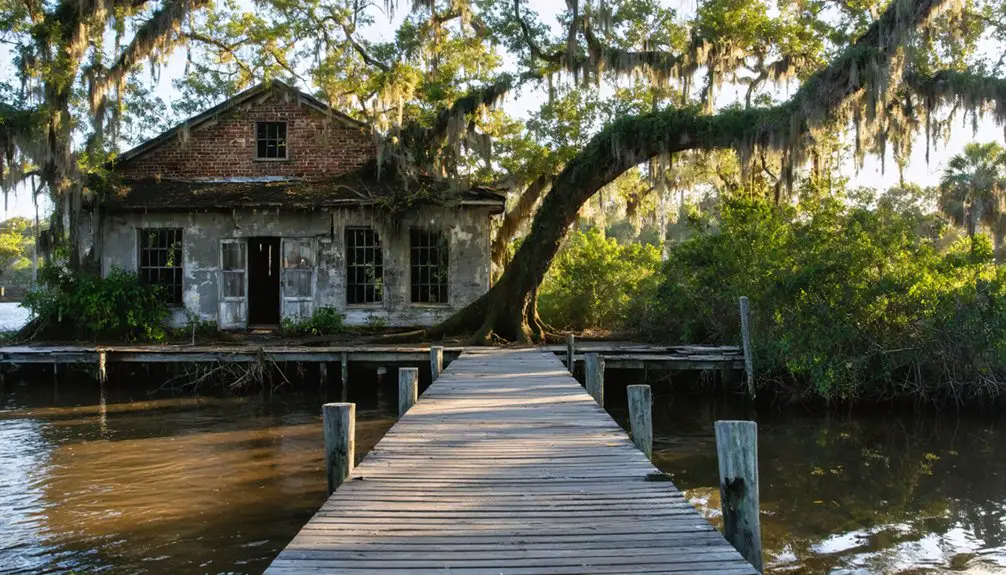
Very little survives Fort Denaud’s transformation from military outpost to farming community, yet what persists tells a story of stubborn endurance against Florida’s reclaiming wilderness. You’ll spot the farmhouse ruins roadside, their weathered walls standing defiant among citrus groves. A prominent chimney anchors the corner—its architecture evidence/proof/indicator of late 1800s construction methods when settlers cultivated sugarcane and citrus after the fort’s 1858 abandonment. These surviving town structures represent the few tangible connections to a community that once thrived here.
Across the Caloosahatchee River, the historic marker erected in 1977 designates where the blockhouse stood. No military buildings remain—fire claimed the original 1838 site. You’ll find Fort Denaud Cemetery nearby, the ghost town’s most enduring landmark, where pioneers rest beneath sprawling oaks.
The Surrounding Citrus Country: Modern Life in This Agricultural Ghost Town
Beyond these crumbling remnants of Fort Denaud’s past, citrus groves stretch toward the horizon—row upon orderly row of dark-leafed trees that define southwest Florida’s modern identity.
Citrus groves extend in geometric precision across the landscape, their evergreen canopy marking Florida’s agricultural present against historical ruins.
You’re witnessing an industry that’s migrated southward over centuries, fleeing freezes that devastated northern groves. What began with Spanish explorers planting trees in the 1500s has transformed into corporate agribusiness, where groves exceeding 5,000 acres replaced family operations after 1945.
The impacts of disease and climate on citrus industry continue reshaping this landscape—micro-sprinkler systems now guard against temperature drops like the 1895 freeze that destroyed 99% of Lake County’s trees.
The evolution of agricultural labor practices here mirrors Florida’s broader transformation, from pioneering settlers to mechanized operations processing millions of boxes annually.
Nearby Historical Attractions to Add to Your Southwest Florida Route
When you’ve absorbed Fort Denaud’s quiet desolation, the surrounding region offers a constellation of historic sites that’ll deepen your understanding of Old Florida’s frontier past.
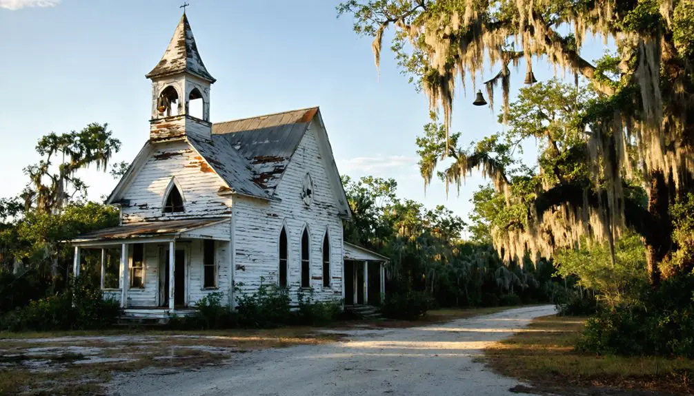
The Ah-Tah-Thi-Ki Museum on Big Cypress Reservation presents Native American perspectives often absent from military narratives—its boardwalk winds through Everglades cypress strands where Seminole resistance once flourished. Ten miles east, Captain Francis A. Hendry’s 1914 frame house in LaBelle connects Confederate cavalry to cattle-driving legends that birthed local folklore traditions.
The Fort Denaud Cemetery itself holds 2,900 graves spanning two centuries, with over 350 veterans resting beneath Spanish moss. Cross the historic swing bridge—one of three surviving in Southwest Florida—and you’ll trace the original military road between Fort Myers and Fort Meade, where frontier commerce replaced warfare.
Frequently Asked Questions
What Is the Best Time of Year to Visit Fort Denaud?
Winter transforms Fort Denaud into absolute paradise! You’ll discover ideal weather conditions with perfect 70-80°F temperatures, explore without suffocating crowds, and experience authentic local events and festivals. December through April offers unmatched freedom for your ghost town adventure.
Are There Any Guided Tours Available at the Fort Denaud Site?
No guided tour experiences exist at Fort Denaud’s actual site, though you’ll discover its historical significance of site independently. You’re free to explore the swing bridge and surroundings at your own pace, crafting your own adventure.
Can Visitors Access the Swing Bridge Built in 1963?
You’ll cross this engineering marvel freely—vehicles roll over daily while boats signal passage beneath. The swing bridge’s structural integrity endures through diligent swing bridge maintenance, letting you experience this 1963 rarity firsthand, no restrictions binding your journey.
Is There an Admission Fee to View the Historical Marker?
You’ll find free admission to this historical marker—no gates or fees restrict your exploration. Nearby historical sites and nearby outdoor activities await your discovery along the Caloosahatchee River, where Fort Denaud’s stories unfold naturally beneath Florida’s open skies.
What Amenities or Facilities Are Available for Visitors in the Area?
You’ll discover Caloosahatchee Regional Park boasts ADA-compliant picnic areas open until sunset, while Harold P. Curtis Honey Company’s gift shops earned 4.8 stars from travelers. Kayak rentals and wildlife viewing areas await your spontaneous exploration throughout this hidden frontier.