Your ghost town road trip to Geels starts along Old Michigan Highway 76, where modest markers point toward vanished lumber camps. You’ll find crumbling concrete foundations hidden among deliberately planted pine rows—silent reminders of families who packed up when the white pine disappeared. The lone foundation sits just 15 feet from Geels Road, easy to explore without lengthy hikes. Bring a vehicle with decent ground clearance if you’re venturing beyond the pavement, and don’t miss the geocache marking this forsaken townsite’s exact coordinates for a complete exploration experience.
Key Takeaways
- Geels lies along Old Michigan Highway 76, marked by modest town signs where a vanished lumber settlement once thrived during WWI.
- Explore crumbling foundations 15 feet from Geels Road and near the five-way intersection, plus find geocache GC1D3NP marking the exact spot.
- The 10.8-mile Geels Loop Trail offers ATV access with sandy whoops, hill climbs, and motorcycle trails through the former town’s footprint.
- Primary trailhead parking is at N44.42291 W84.48078 on Moore Road; vehicles need Michigan DNR ORV licenses for trail access.
- Higher ground clearance vehicles recommended for exploring beyond roadside foundations, especially during wetter months in forested terrain.
The Rise and Fall of a Lumber Town
Deep in Michigan’s northern forests, Geels sprang to life as a flagstop on the M.C. Railroad, connecting isolated lumber camps to sawmills in Midland and Saginaw. You’ll find its story mirrors countless frontier towns built on the logging economy’s promise of prosperity.
During WWI, the settlement thrived with a post office and steady timber shipments, cutting thousands of trees daily. But freedom came with a price—when the white pine disappeared, so did Geels. The social impacts were swift and merciless. Families packed up, the post office closed, and mail rerouted to Roscommon. Logging created tens of thousands of jobs, supporting entire communities that vanished when the timber ran out.
Today, you’re chasing remnants of a place that existed solely for extraction, a cautionary tale of boom-and-bust written across Michigan’s cutover landscape. The town once served as a vital link bringing lumber from the north to processing facilities downstate.
What Remains at the Geels Townsite Today
When you arrive at the intersection of Moore Road and Old M-76, you’ll find yourself standing where Geels’ downtown once bustled with lumbermen and locals—though now only forest surrounds you. The most tangible evidence of the settlement comes from crumbling stone and concrete foundations hidden among the trees, which you’ll need to walk into the woods to discover.
I’ve found that exploring off the main roads reveals the most remnants, though the planted rows of pine trees make it clear that someone deliberately tried to erase this town from the landscape decades ago. As you walk through the site, you might notice gravel crunching out of sync with your footsteps or catch the damp, metallic tang that often lingers in these abandoned places. If you venture a bit north along Moore Road, you’ll reach the ghost town of Moore, which has even less remaining except for a handful of residents who still call the area home.
Visible Physical Structures
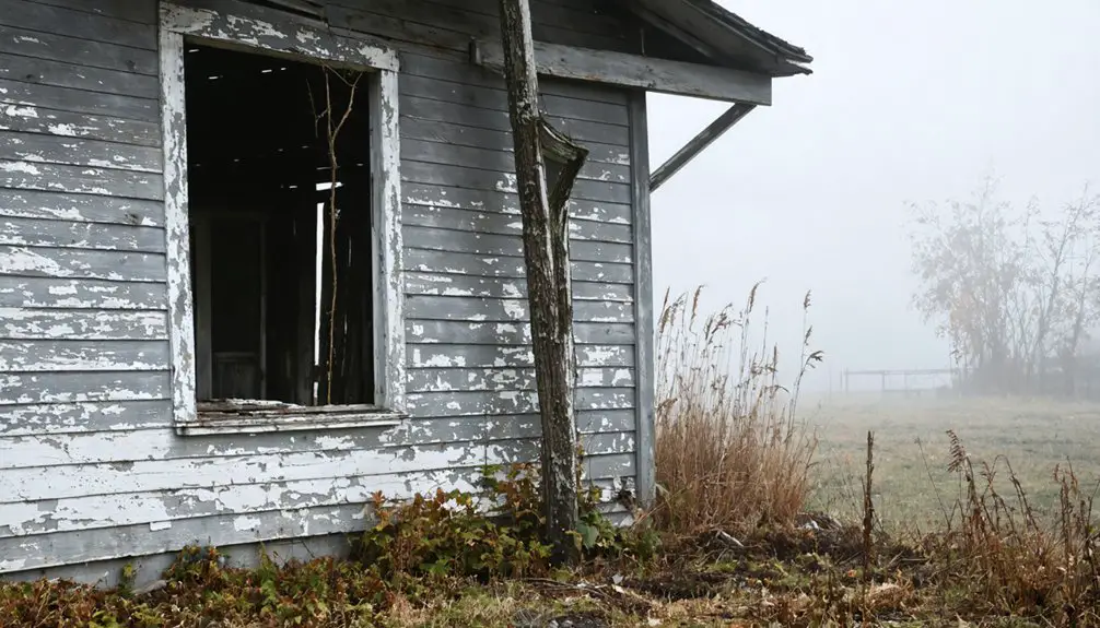
A cement rectangular foundation sits just 15 feet from Geels Road, one of the few tangible traces you’ll find of this vanished lumber town. Faint stone lines peek through thick grass, marking where buildings once stood. You’ll spot these foundation outlines best from aerial views along the access road, though they’re mostly hidden beneath ranks of CCC-planted red pines from the late 1930s.
Near the five-way intersection that marks the former town center, another blank foundation lies closer to the road. The Michigan Central Railroad tracks—critical railroad features that once carried finished lumber to Saginaw Bay ports—still parallel Old 76. Explorers have discovered a cement post marked “R/W”, likely used to demarcate survey lines for new highways during the area’s development. Like the eerie ghost town of Kitsault in British Columbia, Geels maintains its infrastructure remnants despite complete abandonment. Don’t expect signage pointing you toward these remnants or the mysterious “The Pit” nearby. You’re genuinely exploring off-grid here.
Trails and Access Points
Today’s Geels Loop Trail forms a 10.8-mile circuit through the ghost town’s former footprint, giving you two distinct riding experiences depending which direction you choose. Head north and you’ll encounter large whoops and power line trails with one decent-sized hill climb that’ll test your skills. The south section mellows considerably, shifting to a smooth two-vehicle-wide dirt road where you can open up the throttle.
You’ll access the loop off Old Michigan Highway 76, where conditions along trails shift from sandy whoops to harder-packed surfaces. The terrain traversed by vehicles includes oak and pine forests, clear-cut sections, and seasonally wet 50-inch trail segments. Bring your ATV, dirt bike, or side-by-side—just maintain high clearance for the natural surfaces ahead. The southern loop sections feature outwashed hills that add elevation changes to your ride. Motorcyclists will find numerous dedicated trails winding through the area, plus access to Donnies Play Area for open riding.
How to Find and Access the Ghost Town
Finding Geels requires little more than a sharp eye and a willingness to pull off along M-76, where modest town markers announce the location of this vanished lumber settlement. Once you’ve spotted the signs, turn onto Geels Road—it’ll lead you directly to the lone foundation sitting roadside. There’s no need for specialized off road accessibility equipment; your standard vehicle handles this easily. The foundation’s positioned right beside the pavement, making it perfect for quick exploration without lengthy hikes.
Seasonal weather conditions barely impact your visit since you’re fundamentally pulling over rather than trekking through wilderness. Winter snow might obscure the foundation slightly, but it’s still visible. If you’re planning to venture beyond the roadside foundation to explore surrounding areas, a vehicle with higher ground clearance becomes more practical, especially during wetter months when sandy two-tracks can become challenging. For a more substantial ghost town experience with over 20 original buildings, consider visiting Fayette Historic State Park, located about 30 miles south of Escanaba in Michigan’s Upper Peninsula. Look for geocache GC1D3NP if you’re into treasure hunting—it marks the exact spot and adds another layer to your ghost town adventure.
Exploring the Geels ATV Trail and Surrounding Area
Once you’ve located the ghost town remnants, you’ll want to explore the extensive Geels Trail system that sprawls across 46 to 55 miles of sandy, forested terrain.
Park at the main trailhead off Old Michigan Highway 76, where you’ll find adequate space for trailers and staging your ATV or dirt bike—just make sure your vehicle meets the 50-inch width requirement for these trails.
Before heading out, check your tire pressure for sand riding and pack extra water, since the hard-packed whoops and rolling hills will test both your endurance and your machine’s capabilities.
Trail Access and Parking
When you’re ready to explore the Geels trail system, you’ll find the primary trailhead parking lot at coordinates N44.42291 W84.48078 in Roscommon County, where Moore Road provides direct access to the North Loop. A secondary lot sits at N44.35936 W84.37088 for alternative entry points.
Before you head out, check vehicle access requirements—you’ll need a Michigan DNR ORV license, and off-road motorcycles require Secretary of State licensing for certain sections. The 50″ width restriction applies to specific trail segments, while full-width roads accommodate larger vehicles and 60″ SxS rigs.
Thanks to solid trail maintenance protocols, you’ll find clearly marked intersections throughout the system. If you’re approaching from Roscommon, the 10-mile connector route links you directly to the main trail network, giving you maximum freedom to explore.
Notable Landmarks Along Route
The Geels trail system rewards riders with distinctive natural features that break up the forested corridors. You’ll navigate through dramatic pine tunnels where overhead branches create natural archways, then burst into expansive forestry clear-cuts offering unobstructed horizon views. These contrasting landscapes hold both ecological importance as wildlife habitat zones and historical significance as evidence of Michigan’s logging heritage.
Three standout landmarks you won’t miss:
- Robinson Lake Flooding – A sprawling wetland alongside the 10-mile connector route
- Clear-cut observation areas – Open sections revealing the forest regeneration cycle
- Outwashed hills – Rolling southern terrain formed by ancient glacial movement
The northern sections feature oak stands shifting to dense pine forests, while sleeper hills test your throttle control. Each intersection is clearly marked, letting you explore freely without second-guessing your navigation.
Safety and Equipment Tips
Before you twist the throttle and head into Michigan’s backcountry, you’ll need to gear up properly—and we’re not just talking about looking the part. A DOT-approved helmet isn’t optional, and neither are goggles—sunglasses won’t cut it when branches whip past your face. Keep your headlights on and respect the 25 mph limit on ORV roads.
Trail conditions at Geels run sandy with hidden sleeper hills and rocks that’ll test your skills. The north loop gets wet, so bring appropriate equipment and water. Stay on designated trails under 50 inches wide, yield to hikers and equestrians, and keep your GPS handy—this backcountry swallows wanderers whole. Wildlife sightings remind you you’re in their territory. Ride sober, ride smart, and pack out everything you brought.
Geocaching at Michigan’s Lost Towns Cache
Hunting down Michigan’s forgotten communities takes on new excitement when you combine history with the treasure-hunting thrill of geocaching. The Michigan’s Lost Towns Cache Series places you at authentic ghost town locations, each marked with the “MLT” prefix—from Nelsville to Aral’s multi-stage adventure. You’ll need a free Geocaching.com account and GPS-enabled device to navigate these geocache sites where communities once thrived.
Among the intriguing options are ghost towns near Frederick, Michigan, which offer a glimpse into the past with their abandoned structures and rich histories. Exploring these sites not only reveals the stories of those who once lived there but also adds an element of adventure as you search for hidden caches. Each location presents an opportunity to uncover artifacts and learn about the lives of the early settlers in this captivating region.
Essential steps for your ghost town cache hunt:
- Download coordinates and search for caches near Geels using the Northern Lower Peninsula Geotour (GT4F7)
- Bring a pen to sign physical logbooks and record code words
- Log your finds online to collect digital treasures
Note that DNR-managed properties require special permits, and archiving requirements mean some historical caches can’t be revived without dedicated maintainers coordinating through MiGO.
Nearby Ghost Towns and Additional Stops
Don’t miss Freda’s concrete foundations and towering smokestack near Champion Mill, where stamp sand cascades down a manmade waterfall.
The amphitheater-like landscape offers unmatched views of industrial decay meeting nature’s reclamation—pure freedom for wanderers seeking authentic abandoned places.
Frequently Asked Questions
Are There Any Camping Facilities Near Geels for Overnight Visitors?
You’ll find primitive campsites available throughout the nearby Roscommon State Forest, perfect for dispersed camping without permits. If you prefer hookups, there’s RV park accommodations nearby at St. Helen Campground, connecting directly to excellent ORV trails.
What Is the Best Season to Visit Geels Ghost Town?
Like autumn leaves revealing hidden trails, fall discloses Geels’ secrets best. You’ll find ideal weather conditions from September through October—those peak visitation months offer comfortable 50-60°F temperatures, vibrant foliage, and fewer crowds restricting your ghost town exploration.
Do I Need Permits to Explore the Foundation and Townsite?
You won’t need permits for public roads, but watch for private land ownership around foundations. Trespassing carries potential legal issues, so stick to visible public areas. When in doubt, ask locals or township officials before wandering into wooded sections.
Are Guided Tours Available for Geels and Nearby Ghost Towns?
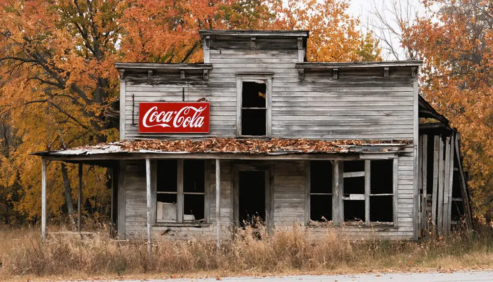
You’ll find absolutely zero guided tours at Geels—it’s pure freedom to explore independently. Nearby Fayette offers self-guided tours through preserved buildings and local history exhibits, while Central provides marked trails. Embrace the unstructured adventure you’re craving.
What Safety Precautions Should Visitors Take When Exploring the Area?
Wear protective gear like sturdy boots and layered clothing for changing conditions. Avoid venturing alone—bring companions for mutual assistance if your vehicle gets stuck. Share your itinerary with someone, pack recovery equipment, and stay alert for unstable structures and wildlife.
References
- https://www.geocaching.com/geocache/GC1D3NP
- https://everafterinthewoods.com/this-eerie-town-in-michigan-is-rumored-to-be-haunted-by-spirits-from-the-19th-century/
- https://www.theinnatstonecliffe.com/blog/fayette-historic-townsite-a-ghost-town-frozen-in-1891
- https://www.youtube.com/watch?v=yyYu9j1naDA
- https://livinginmichigan.com/the-strangest-things-about-michigan/
- https://www.youtube.com/watch?v=d_vMU5E1JpI
- https://coopershortcut.blog/2026/02/20/michigan-historical-lumber-industry/
- https://99wfmk.com/geels-michigan-ghost-town-2020/
- https://www.youtube.com/watch?v=6_tf2Mh9CS8
- https://www.youtube.com/watch?v=7-vjuqiGWJU