You’ll find Geneva City approximately 60 miles from Denver via Highway 285, nestled at 12,000 feet in Pike National Forest. You’ll need a high-clearance 4WD vehicle to navigate the final rocky mile after the initial 4.6-mile stretch. Plan your visit between summer and fall when roads are passable, avoiding afternoon thunderstorms that develop 60-80% of the time. The journey takes under two hours to reach this 1879 mining settlement where crumbling cabins await your exploration of Colorado’s rich mining heritage.
Key Takeaways
- Geneva City is located 60 miles from Denver via Highway 285, accessible through Guanella Pass Scenic Byway in Pike National Forest.
- A high-clearance 4WD vehicle is essential for the final mile of rugged, rocky terrain and creek crossings.
- Summer and fall offer optimal visiting conditions; winter roads become impassable and require backcountry ski or foot travel only.
- Afternoon thunderstorms develop 60-80% of summer days due to high elevation and iron deposits; plan morning visits to avoid danger.
- Geneva Park Campground provides a rustic basecamp for exploring the historic 1879 mining town at 9,800 feet elevation.
The Rich Mining Heritage of Geneva City
Geneva City emerged during Colorado’s explosive mining boom of the late 1800s, when prospectors flooded the Rocky Mountains searching for fortune in the wake of the 1858 gold discoveries. Located in Teller County’s Geneva Gulch, this settlement thrived alongside its primary commodity processing operations—gold and silver extraction that defined the region’s economy.
The Geneva Mining and Smelting Company spearheaded regional mining operations starting in 1879, when Staatsburg Silver Mining claimed 300 units in the district. By 1880, the Rocky Mountain News reported Geneva Gulch’s prosperity, noting the smelter’s first run produced flattering results. This success sparked development of nearby Asterville, creating a bustling mining community. The settlement flourished during an era when Gregory Gulch proclaimed itself “the richest square mile on Earth,” reflecting the widespread optimism surrounding Colorado’s mining districts. The 1859 Pikes Peak Gold Rush had transformed the region, with Central City’s population exploding from 10 to 10,000 in just a month.
You’ll find Geneva City documented in Colorado Mine Directories from 1879 through 1910, marking three decades of mineral wealth extraction before inevitable depletion ended this chapter.
Getting to Geneva City: Location and Route Details
Nestled in northern Park County at the confluence of Geneva Creek and the North Fork South Platte River, this ghost town sits along one of Colorado’s most scenic mountain corridors. You’ll find Geneva City approximately 60 miles from Denver via Highway 285, making it an accessible day trip with a drive time under two hours.
From Denver, head south through Bailey to Grant, then turn right onto Park County Road 62 for five miles. The Guanella Pass Scenic Byway provides your primary route through this high-elevation terrain at 9,800 feet. Planning your route becomes easier when you identify the major roads and highways that connect to the scenic byway and surrounding mountain passes.
Local transportation options remain limited to personal vehicles, as no public transit serves this remote area. For accommodation choices, you’ll find Geneva Park Campground nearby at 9,813 feet elevation, offering a rustic basecamp for exploring this historic mining site. The area lies within the Pike National Forest, adding to the natural beauty surrounding the ghost town.
Road Conditions and Vehicle Requirements
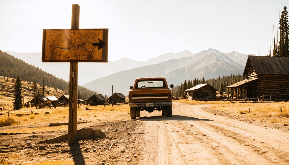
You’ll need a high-clearance 4WD vehicle to reach Geneva City, as the rugged mountain roads demand serious capability beyond what standard vehicles can handle. The route climbs steep, rocky terrain with sections that become impassable during winter months and after heavy rain. Before heading out, check real-time road conditions through Colorado’s traveler information resources to stay updated on closures and weather advisories.
While some visitors attempt alternative access routes through nearby mining roads, these paths present similar challenges and often require even more technical driving skills. If you’re traveling from Denver Airport, consider arranging transportation with a shuttle service that understands mountain driving conditions and can help coordinate your journey to nearby Summit County towns like Frisco or Dillon, where you can then prepare for your off-road adventure.
4WD Vehicle Essential
Before commencing on your journey to Geneva City, understanding Colorado’s demanding road conditions will keep you safe and legal. You’ll need a 4WD vehicle to navigate the unpaved mountain roads leading to this remote ghost town. Colorado’s traction laws require passenger vehicles to have winter tires or chains when conditions deteriorate on designated mountain routes.
Heavy snow, strong winds, and icy spots frequently impact mountain passes in this region.
Check COtrip.org’s interactive map before departure to assess current conditions. Call 511 for real-time road and weather updates. Subscribe to CDOT alerts so you’ll know when traction requirements are enforced. Your 4WD vehicle recommendations should include adequate ground clearance for rough terrain. Meeting snow tire requirements isn’t just smart—it’s mandatory during winter conditions, ensuring you maintain control on treacherous backcountry roads. Maintain proper tire tread depth to ensure optimal traction on these challenging mountain surfaces. Monitor local road reports for Colorado to stay informed about changing conditions that could affect your ghost town adventure.
The journey to Geneva City divides into two distinct phases based on road difficulty. You’ll handle the first 4.6 miles comfortably in most vehicles, traversing gradually roughening surfaces with embedded rocks and minor ruts.
After Waypoint 02, you’ll encounter significantly rockier, narrower passages requiring heightened attention. The final mile demands 4-wheel drive engagement as you tackle intensified embedded rocks and challenging ruts. You’ll face steep uphill sections across tundra, scree, and chiprock near the trailheads. You’ll need to navigate creek crossings that become particularly challenging during spring conditions. You’ll manage steep switchbacks in these upper reaches where off-road trail maintenance varies seasonally.
Beyond the iron fens, you’ll navigate through large avalanche debris areas. Spring runoff deepens creek crossings, while muddy spots proliferate during wet conditions. Summer and fall provide the best access windows for this technical, moderate-rated approach. The trailhead sits at 11,040 feet elevation, marking the starting point for routes to Geneva Peak and neighboring summits.
Alternative Access Routes
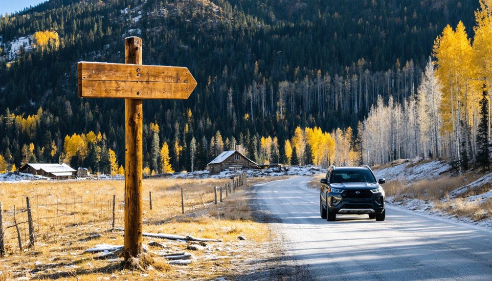
Multiple pathways lead to Geneva City, though Geneva Creek Trail from Highway 285 stands out as the most traveled corridor. You’ll find Guanella Pass Road offering an alternative route from the north, connecting Georgetown and Grant through high-elevation terrain. This unpaved section reaches 11,750 feet near old ski area remnants but closes completely during winter months.
When snow blankets the region, you’ll discover different opportunities:
- Backcountry ski access remains available from the closure gate, requiring foot travel into the wilderness
- Cross country skiing routes emerge across the terrain once vehicles can’t pass
- Summer access resumes after clearing hundreds of downed trees from seasonal storms
Your vehicle choice matters greatly—stock 4x4s handle summer conditions without modifications, while winter transforms these roads into foot-only passages for adventurous skiers seeking solitude.
When to Visit This High-Altitude Ghost Town
You’ll find the best window for visiting Geneva City opens after June, though heavy snowfall years may push accessibility into July.
Summer weekdays offer the ideal combination of passable roads and lighter crowds, while weekends see the dispersed camping areas along FR119 packed with visitors.
Your timing must account for afternoon thunderstorms, sudden temperature drops of 15 degrees or more, and the reality that snow can fall any month of the year above timberline.
Summer and Fall Access
Since Geneva City sits at 11,600 feet elevation, timing your visit correctly makes the difference between an accessible adventure and an impassable snow-blocked trail. Access opens after June, sometimes July depending on snowmelt. You’ll find the road becomes passable once spring runoff subsides and stream crossings drop to about one foot deep.
Optimal visiting windows include:
- Mid-summer through early fall for reliable road conditions and flowing water
- Weekdays for off season solitude at the 30-45 dispersed campsites
- September for fall colors along Geneva Creek while temperatures hover in the 60s
High clearance benefits become apparent beyond the first 4.6 miles, where the road narrows and steepens with loose rock. The trail remains open until winter closure, offering freedom-seekers unrestricted exploration of this high-altitude mining camp.
Weather and Safety Considerations
At 12,000 feet above sea level, Geneva City’s extreme elevation creates weather conditions that shift from pleasant to dangerous within hours. You’ll face electrical storm risks from the area’s dense iron deposits, with thunderstorms developing after noon 60-80% of the time during summer. Temperature swings are dramatic—expect afternoon highs near 66°F dropping rapidly as storms roll in.
Your body contends with reduced oxygen levels and increased altitude sickness at this elevation. Winter proves unforgiving: wind chills plunge to -34°F, while sustained winds of 22-26 mph create widespread blowing snow. You’re looking at snowshoe-only access from the trailhead.
Plan your visit between July and September when conditions moderate. Always check weather forecasts before departure—afternoon thunderstorms can trap unprepared adventurers in life-threatening situations.
Avoiding Weekend Crowds
When Geneva City’s access roads clear each July, weekend warriors flood the trailhead, transforming this remote ghost town into a surprisingly crowded destination. You’ll discover ideal solitude through midweek visitation, particularly Tuesday through Thursday when foot traffic drops considerably.
Avoiding crowds during holidays requires strategic planning—extended weekends pull regional visitors who pack the limited parking at Duck Creek Picnic Area.
Time your arrival strategically:
- Depart before 10 a.m. to beat afternoon excursion groups
- Visit late May through June during shoulder season for balanced accessibility
- Target overcast days when casual tourists stay home
The 12,000-foot elevation and technical 4WD requirements naturally filter visitors, but peak summer weekends still generate congestion. Early September offers freshly opened roads without July’s buildup, giving you the freedom to explore Geneva City’s remnants practically alone.
What You’ll Discover Among the Ruins
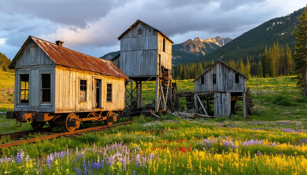
As you explore Geneva City’s remains, you’ll find remarkably well-preserved log cabins that have withstood over a century of harsh mountain weather at 11,585 feet elevation. These structures still feature handmade bunk beds and shelves that once held canned goods.
The historic building foundations reveal the town’s layout, including an original boarding house and saloon that served miners during peak operations until the 1960s.
Scattered throughout the site, you’ll discover remnants of daily life: old oil lamps on tables, pack saddles, and mining equipment. Additional buildings hide among the shrubs, rewarding those who venture off the main path.
The settlement, drawn by gold, silver, and iron deposits after the Civil War, sits at the headwaters of Geneva Creek in Pike National Forest.
Wildlife and Natural Beauty Along the Way
The journey to Geneva City rewards visitors with encounters spanning Colorado’s most iconic wildlife species. You’ll spot mule deer grazing along Threemile Trail #635 and Geneva Creek Trail #697, while elk roam the dense forest areas near the creek. Black bears occasionally emerge from wildlife-rich habitats, and moose appear sporadically during your trek.
Colorado’s iconic wildlife awaits along your Geneva City journey—from grazing mule deer to roaming elk and elusive black bears.
The route showcases exceptional natural features:
- Iron fens create colorful limonite terraces from mineral-rich groundwater, forming acidic wetlands with rare plant communities
- Alpine flower blooms paint the ascent to Geneva City with seasonal wildflowers
- Avian birdwatching opportunities attract enthusiasts seeking diverse species inhabiting pine and aspen forests
Geneva Creek glistens alongside your path, while fall transforms the landscape into breathtaking displays of neon yellows and burnt oranges near treeline.
Safety Considerations for Your Journey
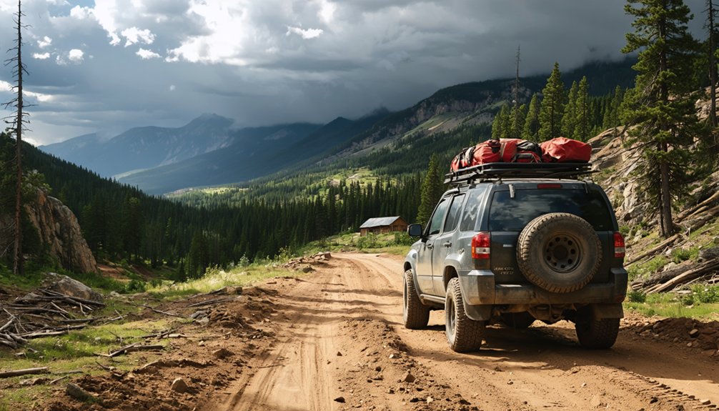
While Geneva City’s natural splendor captivates visitors, reaching this remote ghost town demands serious preparation and respect for the challenging conditions. At 11,750 feet elevation in Pike National Forest’s backcountry, you’ll face water crossings, avalanche damage, blind lips, and loose rock requiring a 4-wheel drive vehicle. The 7.2-mile trail takes approximately two hours each way, with confusing sections testing your navigation skills.
Self sufficiency requirements are non-negotiable here. You’re miles from any sizable town, meaning emergency services can’t quickly reach you. Pack emergency preparedness supplies including navigation tools, extra food, water, and communication devices. Monitor weather closely—gusting winds and rapidly changing conditions create serious hazards at this elevation. Watch for moose and mountain lion tracks, and always inform someone of your plans before departing.
Exploring the Surrounding Guanella Pass Area
Beyond Geneva City’s abandoned cabins and mines, Guanella Pass Scenic Byway unfolds as a 22-mile corridor connecting the Victorian mining towns of Georgetown and Grant. You’ll climb to 11,669 feet, progressing through spruce and aspen forests before reaching alpine tundra at the summit.
The byway delivers exceptional scenic photography opportunities, particularly during September and early October when golden aspens peak against mountain backdrops. Mount Bierstadt (14,065 feet) and Mount Evans flank your route, creating dramatic vistas.
Recreational trail access includes:
- Eight named trails on the south side, including Mount Bierstadt’s relatively easy fourteener climb
- Geneva Creek Trail (#697) and Abyss Lake Trail (#602) for extended wilderness exploration
- Fishing and designated camping sites along cascading creeks throughout the corridor
The paved route typically opens Memorial Day through Thanksgiving.
Tips for Making the Most of Your Visit
Planning your Geneva City adventure requires strategic timing and preparation to navigate the challenging terrain safely. Follow these visitor tips for a successful journey:
Schedule your trip between July and September when road conditions allow safe 4WD access via FSR 119. Check weather forecasts before departure—the area’s dense iron content attracts severe electrical storms at this 11,585-foot elevation.
When planning your itinerary, allocate time for the rugged drive through tight turns and steep sections from Duck Creek Picnic Area. Pack high-altitude essentials and respect the strict off-limits policy for the abandoned Geneva Basin ski area. Consider alternative access by mountain bike or horseback if vehicle travel concerns you.
Start early to maximize daylight for exploring century-old cabins and mining remnants while avoiding afternoon storms.
Frequently Asked Questions
Can I Camp Overnight at Geneva City or Nearby?
You can’t camp directly at Geneva City ruins, but you’ll find excellent nearby lodging options at Geneva Park Campground just down the road. Watch for local wildlife observations including mountain goats and bighorn sheep while exploring this historic area.
Are There Entrance Fees or Permits Required to Visit?
You’ll find no entrance fees for the trail itself, but the museum charges $8.50 for adults. Nearby attractions offer seasonal operating hours, so you’re free to explore the outdoor ghost town area without permits year-round.
What Should I Bring for a Day Trip?
Your adventure toolkit should include water, first aid supplies, flashlight for exploring ruins, navigation tools, and maps. Pack nutritious snacks for energy. Wear comfortable shoes for hiking. Bring protective clothing, communication devices, and camera to document your backcountry freedom.
Is It Legal to Take Artifacts From the Site?
No, you can’t legally take artifacts from Geneva City. The site’s protected by historic preservation laws on federal land. You’d need archaeological excavation permits, which aren’t issued for personal collecting. Violations result in serious fines and penalties.
Are There Restroom Facilities Available at Geneva City?
No restrooms exist at Geneva City—you’ll need cat holes or WAG bags. Wheelchair accessibility is nonexistent on rough trails, and nearby dining options are hours away, so you’re truly on your own in this remote wilderness ghost town.
References
- https://www.uncovercolorado.com/activities/geneva-city-ghost-town/
- https://95rockfm.com/abandoned-ski-resort-geneva-basin/
- https://coloradosghosttowns.com/page249.html
- https://www.uncovercolorado.com/ghost-towns/
- https://sepia-round-9mr2.squarespace.com/journal/abandonded-geneva-basin-ski-resort
- https://www.youtube.com/watch?v=158PUMzpsI8
- https://moredirtmoredistance.com/blogs/more-dirt-more-distance/exploring-geneva-creek-colorado
- https://en.wikipedia.org/wiki/Geneva_Basin_Ski_Area
- https://www.denvergazette.com/2022/06/19/starting-in-1858-heres-a-look-at-the-timeline-of-colorados-mining-past-20bc26e4-e4d3-5eae-8520-8fa197554111/
- https://www.uncovercolorado.com/colorado-mining-history-timeline/


