You’ll reach Gibbonsville via Highway 93 through dramatic canyon country or the scenic gravel route from Wisdom, Montana. This 1877 gold rush town once bustled with over 100 buildings and 600 miners working the legendary A.D.& M. Mine. Today, you can explore the Relic Museum‘s mining artifacts in a restored schoolhouse, wander through the weathered pioneer cemetery, and discover remnants of British-financed operations that extracted nearly $2 million in gold. The following guide reveals hidden details for maximizing your ghost town adventure.
Key Takeaways
- Access Gibbonsville via Highway 43 from Wisdom, Montana or U.S. 93 through Bitterroot Valley; check Idaho 511 for conditions.
- Visit the Gibbonsville Relic Museum in a restored schoolhouse featuring mining equipment, domestic artifacts, and historical photographs.
- Explore the pioneer cemetery with weathered 1800s headstones offering insights into harsh mining-era frontier life.
- Plan for remote conditions on well-maintained gravel routes through high-elevation alpine terrain and canyon country.
- Discover remnants of 100 original buildings from Gibbonsville’s 1877 gold rush boom period.
The Rich Mining History That Shaped Gibbonsville
Long before Gibbonsville earned its name, this remote Idaho valley caught the attention of explorers and fortune seekers. Lewis and Clark traversed this rugged terrain in 1805, documenting its rocky hills and dense vegetation.
Lewis and Clark’s 1805 expedition marked the first recorded encounter with this untamed Idaho valley’s forbidding landscape and natural wealth.
The real transformation began in 1877 when prospectors struck gold in Anderson and Dahlonega Creeks, triggering a rush that’d reshape the settlement forever.
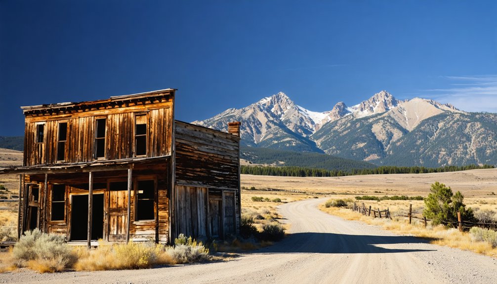
Colonel John Gibbon’s namesake town exploded into peak economic activity with over 100 buildings reflecting colonial architectural styles. You’ll discover this wasn’t your typical boom-and-bust camp—original discoverers developed their claims, establishing the A.D.& M. Mine as the region’s powerhouse operation.
British investors poured capital into operations after 1880, while 600 miners extracted nearly $2 million in gold from these mountain depths.
How to Get There and What to Expect on the Drive
You’ll reach Gibbonsville via U.S. 93, a ribbon of highway that winds through the Bitterroot Valley and traces the Salmon River‘s northern reaches.
From Wisdom, Montana, the most direct route takes you west on Highway 43 past Big Hole National Battlefield, over Chief Joseph Pass and the Continental Divide, then north on U.S. 93 at Lost Trail Pass.
The 30-mile Gibbonsville Road offers an alternative—a well-maintained gravel route that cuts directly south from near Wisdom, climbing through the Bitterroot Mountains before descending into this remote Idaho ghost town.
Driving Route via U.S. 93
Stretching 870 miles through Idaho from the Nevada border to the Canadian crossing at Eastport, U.S. 93 delivers an unforgettable journey to Gibbonsville. Your adventure begins where desert meets mountains, ascending through diverse terrain that’ll captivate any freedom-seeking traveler.
Key Route Highlights:
- Twin Falls to Salmon – Navigate through canyon country, crossing the Snake River and climbing past Borah Peak’s 12,662-foot summit
- Salmon River Scenic Byway – Follow the river’s descent through untamed wilderness at 4,004 feet elevation
- North Fork Ascent – Climb into the Bitterroot Range through Salmon-Challis National Forest
- Modern Navigation – Route signage improvements and modern transportation considerations make apps like MapQuest essential for finding 2046 Highway 93 N near Gibbonsville
The highway transforms from sagebrush flats to alpine magnificence.
Scenic Mountain Road Conditions
Before you venture into Gibbonsville’s mountain terrain, understand that seasonal conditions dramatically reshape your journey. High-elevation routes like Lick Creek Road and Profile Creek Road face mountain pass closures when deep snow blankets summits above 6,500 feet. You’ll encounter variable avalanche risks throughout winter months, particularly on slopes near these elevated passages.
Check Idaho 511 before departure—this real-time resource reveals slick surfaces, reduced visibility from blanket clouds, and current restrictions. Download the 511 app for live traffic updates and weather alerts along your route. While no traffic cameras monitor Gibbonsville directly, WeatherBug provides on-demand road conditions. Cross-border travelers should monitor Gibbons Pass alongside other Montana mountain passes. Winter driving requires vigilance, proper equipment, and willingness to postpone travel when conditions deteriorate beyond safe navigation thresholds.
Must-See Historic Sites and Restored Buildings
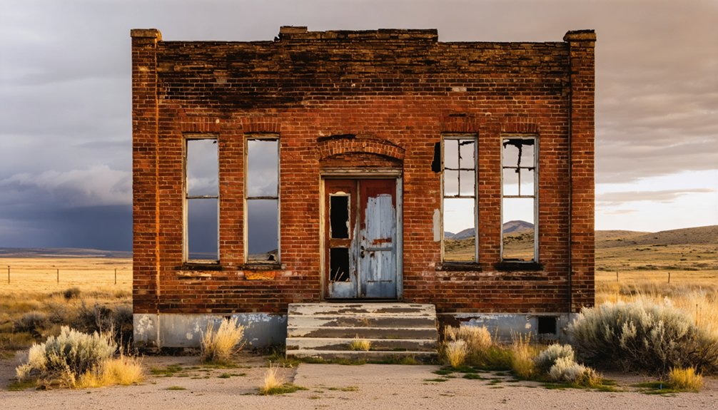
Your exploration of Gibbonsville’s past begins at the Relic Museum, housed in a beautifully restored old school building where mining camp artifacts and early settlement relics bring the town’s boisterous gold rush era to life.
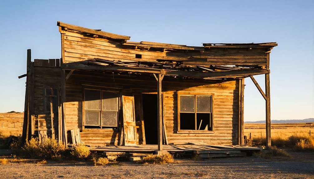
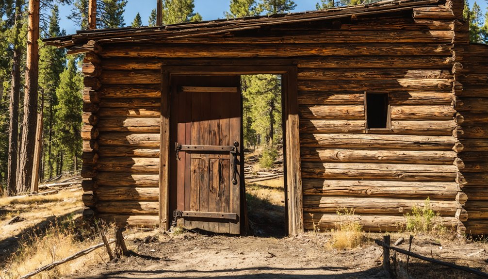
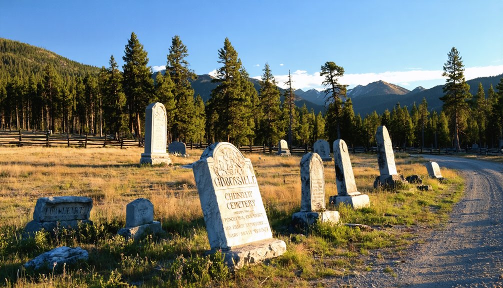
Just beyond the museum, you’ll discover several restored structures that stand among the remnants of what were once over 100 buildings supporting 600 miners and their families. The pioneer cemetery, with its weathered 1800s headstones and protective fencing, offers a poignant glimpse into the lives of those who sought fortune in these remote Idaho mountains.
Gibbonsville Relic Museum Highlights
Nestled within a weathered schoolhouse that once rang with children’s voices, the Gibbonsville Relic Museum preserves the tangible remnants of a mining era that shaped this remote Idaho settlement. The museum’s curatorial focus centers on artifacts that tell authentic stories of frontier resilience and extractive industry hardship.
You’ll discover collections spanning:
- Mining Equipment – Original tools and machinery from the A.D. and M. Mine operations
- Domestic Artifacts – Household items revealing daily life in an isolated mining camp
- Photographic Documentation – Historical images capturing the town’s transformation from boom to quiet settlement
- Personal Effects – Belongings of miners and families who carved existence from unforgiving terrain
While educational programs offered remain minimal due to the town’s small population, the self-guided experience allows you to explore at your own pace, connecting directly with history.
Mining-Era Cemetery Exploration
Perched on a hillside where wind whispers through weathered wooden markers, Gibbonsville Cemetery stands as the town’s most haunting memorial to mining-era mortality. You’ll discover over a century’s worth of burials, from replaced wooden markers documenting the 1877 gold rush days to modern-day interments.
The crumbling headstones tell stories of rough-living miners, families who followed fortune to this remote Idaho outpost, and those who didn’t survive the harsh conditions. While fairly unkempt, that authenticity makes it compelling—no manicured restoration masks the raw history here.
Watch for wildlife sightings as deer and elk often wander through, reclaiming territory once dominated by 600 miners. Located at coordinates 45.5350000, -113.9350000, the cemetery offers an evocative glimpse into the mortality that shadowed every gold rush dream.
Exploring the Gibbonsville Relic Museum
Stepping into the Gibbonsville Relic Museum feels like walking straight into Idaho’s gold rush past. This former school building now preserves the raw history of a mining camp that once housed 600 workers and over 100 structures.
The exhibits and artifacts tell stories of fortune-seekers who carved civilization from wilderness between 1877 and 1959.
Your exploration reveals:
- Mining equipment relics from the A.D.& M. mine, which produced half of the camp’s $2 million gold yield
- Pioneer settlement artifacts spanning Gibbonsville’s transformation from Dahlonega Creek discovery to ghost town
- Daily life items from eight saloons, stamp mills, and businesses that served this remote community
- Historical significance markers connecting Colonel John Gibbon’s Nez Perce campaign to the town’s naming
You’ll discover authentic remnants of hardship and determination that defined Idaho’s mining frontier.
Walking Through the Pioneer Cemetery
A short drive from Gibbonsville brings you to Idaho City’s Pioneer Cemetery, where 40 forested acres hold over 3,000 souls who chased gold dreams into this wilderness. You’ll navigate uneven, pine-covered terrain where weathered gravestones tilt and fade—only 300 markers remain from the estimated 2,000 graves.
The first 200 identified burials tell brutal truths: just 28 died naturally, while mining accidents, murders, and gun violence claimed the rest.
You’ll discover sectioned grounds revealing 1860s social divisions—Masons and Odd Fellows claimed central plots, Catholics rested on higher northern ground, and Chinese miners occupied the southeastern area. Frontier hardships echo through marble markers like Grover Jones’s 1865 stone and James Pinney’s elegant family plot, where countless pioneers lie beneath unmarked earth, their wooden markers long surrendered to time.
Remnants of the A.D. and M. Mine
Just beyond Gibbonsville’s weathered storefronts, the skeletal remains of the A.D. & M. Mine tell stories of boom-era ambition. Named after the American Development and Reduction Mining Company, this operation dominated the district as its largest producer, employing 600 workers who extracted substantial gold from lode deposits.
Evidence of massive mine operations includes:
- Scattered foundations where 100+ buildings once supported workforce dynamics
- Hillside cabin remnants housing miners and their families
- Two sawmill sites that fed construction demands
- Tailings and shaft remnants marking extraction points
Though sporadic mining continued until 1959, the 1907 fire marked the beginning of decline. Today, you’ll find freedom to explore these industrial ghosts, where rusted equipment and crumbling structures stand as monuments to northern Lemhi County’s golden age.
Best Times to Visit and Where to Stay Nearby
While snow blankets Gibbonsville’s ruins throughout deep winter, you’ll find the most rewarding exploration during fall and spring when mild temperatures meet passable road conditions. Weather patterns in these Bitterroot Mountains shift dramatically—summer brings cool, comfortable days perfect for hiking rocky trails, while winter’s accumulation closes mountain roads entirely.
You’ll want high-clearance vehicles year-round, though graded 2WD roads accommodate most travelers in warmer months.
Base yourself in Salmon, 33 miles south on U.S. 93, where lodging and amenities support your adventure. The Broken Arrow Restaurant marks your turnoff point. From this population hub, you’re positioned for seasonal recreation throughout Lemhi Valley—fishing the Salmon River, camping remote spots via gravel roads, or tracking wildlife through dense vegetation where prospectors once wandered.
Other Ghost Towns to Explore in the Region
Lemhi County’s rugged landscape harbors a constellation of ghost towns beyond Gibbonsville, each weathered memorial to Idaho’s silver and gold fever. You’ll find freedom exploring these nearby ghost towns connected through regional mining activities:
Exploring ghost towns in Pennsylvania history reveals a rich tapestry of stories from the past, where communities thrived before being abandoned. Each site has unique remnants that tell of the hustle and bustle during the era of industrial growth. Visitors can immerse themselves in the haunting beauty of these locations, offering a glimpse into a time long gone.
- Gilmore – Sixty miles south of Salmon, this 1879 silver hub preserves 40 structures from its boom years, serviced by the legendarily unreliable “Get Off and Push” railroad.
- Shoup – Nestled in the Salmon River mountains, this settlement echoes the area’s mining past through accessible mountain routes.
- Ulysses – Another Lemhi County remnant offering authentic 19th-century mining relics near the Montana border.
- Bonanza & Bayhorse – Venture into Custer County for these silver-mining legends, featuring preserved mills, stone buildings, and explorable trail systems through Salmon-Challis National Forest.
Frequently Asked Questions
Are There Restaurants or Gas Stations Available in Gibbonsville?
You’ll find Broken Arrow Restaurant serving authentic Mexican cuisine Thursday–Sunday, May through November. However, there aren’t any gas stations here. Gibbonsville’s sparse infrastructure and limited amenities mean you’ll need to fuel up before arriving in this remote freedom-seeker’s paradise.
Is the Gibbonsville Relic Museum Open Year-Round or Seasonally?
The Gibbonsville Relic Museum’s operating hours remain unconfirmed—seasonal operation seems likely given the remote location. You’ll want to contact Lemhi County tourism beforehand to verify when you can explore the museum exhibits and collections showcasing local mining history.
Can Visitors Explore Inside the Abandoned Mine Structures Safely?
No, you can’t safely explore abandoned mine structures. While freedom calls, structural integrity concerns make entering deadly—decayed supports collapse without warning, and liability risks mean you’re responsible. Admire these evocative relics from outside only.
Are There Entrance Fees for the Museum or Cemetery?
I can’t provide specific entrance fee information for Gibbonsville’s attractions from the available data. You’ll need to verify museum hours and cemetery accessibility directly, as these historic sites often offer free access to independent explorers seeking authentic Western adventures.
Is Cell Phone Service Available in Gibbonsville and Surrounding Areas?
Yes, you’ll find cell phone service available in Gibbonsville, though cell tower coverage strength varies by carrier. AT&T offers the best signal at 29.1%, while available data speeds depend on your provider’s network reach.