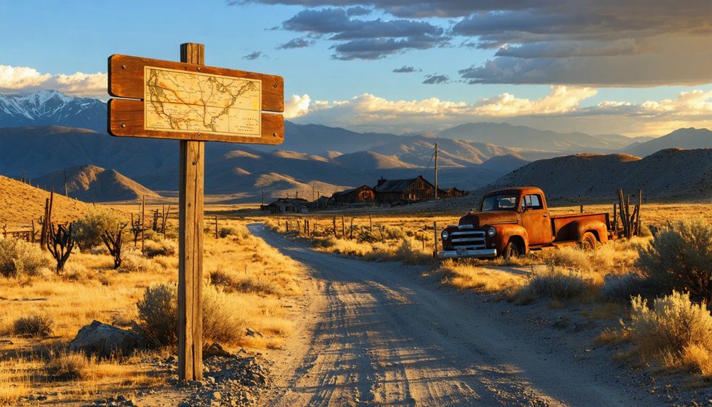
You’ll find Gilt Edge’s weathered stone walls rising from grassland approximately 20 miles northeast of Highway 191, where America’s first large-scale cyanide operations once extracted gold from the Judith Mountains. Plan your visit between late spring and early fall when wildflowers carpet the hillsides and roads remain passable. Pack sturdy boots, topographic maps, and layers for unpredictable high-plains weather, and you can combine this site with nearby Maiden’s preserved Main Street structures for an in-depth exploration of Montana’s concentrated mining heritage.
Key Takeaways
- Giltedge sits 20 miles northeast of Highway 191, requiring backcountry navigation and commitment to reach the remote former cyanide mining town.
- Visit late spring through early fall for optimal conditions, with wildflowers April-June and golden light September-early October.
- Respect private property boundaries and stay alert for crumbling structures, open mine shafts, and toxic groundwater hazards throughout the site.
- Combine your trip with nearby Maiden, exploring both ghost towns in one afternoon along the historic Judith Mountains mining district.
- Pack thermal layers, sturdy boots, topographic maps, and photography equipment for Montana’s unpredictable high-plains weather and unmarked roads.
The Golden Discovery That Started It All
In 1883, when most prospectors were still chasing easy surface gold, W.E. “Limerock” Wilson spotted something different on the east slopes of the Judith Mountains. He’d spent years working Maiden’s mines and recognized the unusual ore rimming the rock—a golden edge that gave the prospect its name.
But Wilson’s discovery came with a catch: the gold existed as finely disseminated telluride, invisible to the naked eye and stubborn as hell. The ore processing methods of the 1880s couldn’t crack it. Traditional mining techniques fell short against this peculiar deposit at 5,000 feet elevation. What looked like fortune turned into frustration, leaving Wilson with a claim that’d take decades of technological advancement before anyone could extract its wealth. It wasn’t until 1892 that the new cyanide process finally proved successful, unlocking the treasure that had taunted miners for nearly a decade. A large mill built in 1897 near the mine operated successfully until 1912, transforming Gilt Edge into a productive mining operation.
Rise and Fall of a Cyanide Mining Town
The cyanide process changed everything for Wilson’s stubborn ore deposit. Where earlier methods failed, this revolutionary technique unbolted the gold in 1892, transforming Gilt Edge into one of America’s first cyanide operations. You’ll find the story of mill siting challenges written in the landscape—the original mill sat two miles from the mine, a logistical nightmare that hobbled early operations.
New owners built a massive mill directly at the mine site in 1897, and prosperity followed. By 1908-1909, peak production made Fergus County the “cyanide capital of the west.” The town’s population peaked around 1908 at 1,500 residents. The mines yielded 500,000 ounces over two decades before exhaustion set in. Even a 1917 tailings reprocessing plant couldn’t revive the glory days. E. B. Coolidge’s crew set up leach tanks to retreat old mill tailings, but the effort fell short. By 1920, freedom-seeking miners moved on, leaving Gilt Edge to the wind.
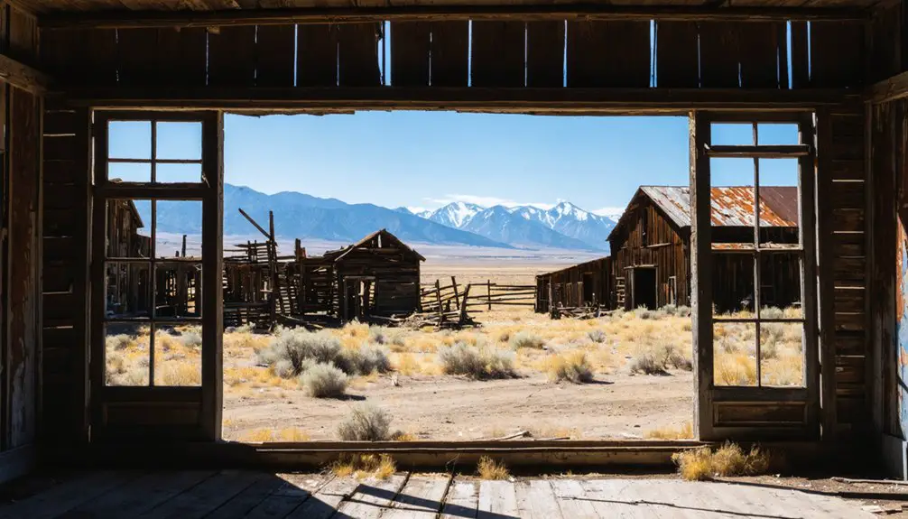
What Remains at the Gilt Edge Townsite Today
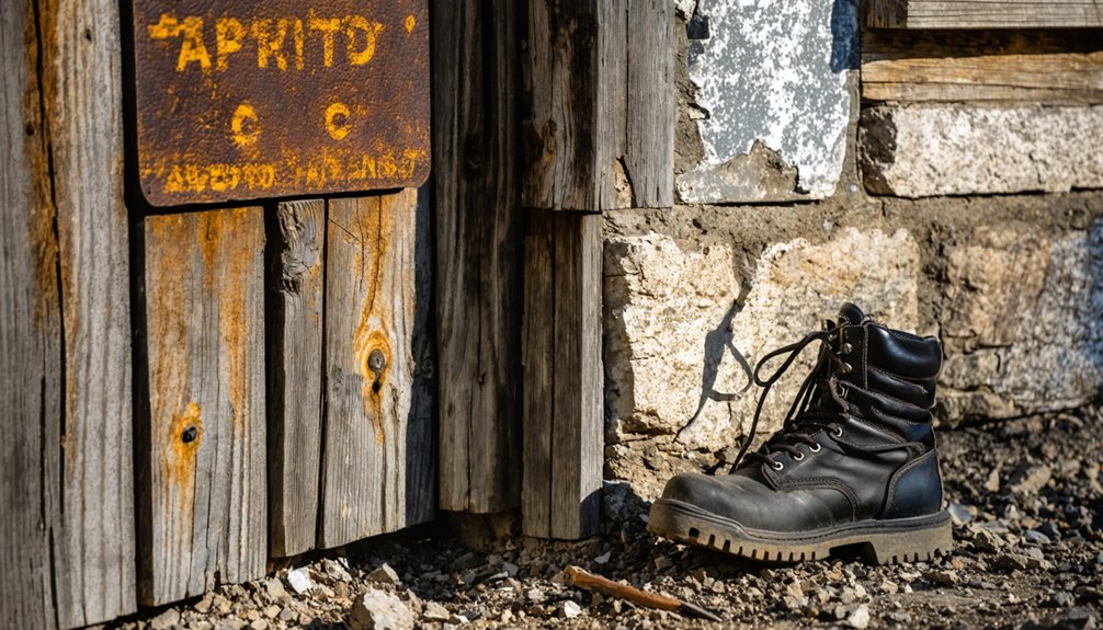
Scattered across a windswept plateau at 4,518 feet, Gilt Edge’s remnants tell their story in stone, wood, and silence. You’ll spot diverse architectural remains: a stone storefront facing the intersection of Maiden and Gilt Edge Roads, a weathered wooden jail, and a brick building standing defiant against Montana’s elements. The former house of prostitution still stands—tangible evidence of tales of lawlessness and vice that once defined this frontier settlement.
Modern homes now punctuate the landscape, their outbuildings scattered among century-old ruins. Most ground here is private property, so you’ll experience Gilt Edge from the roads that slice through the townsite.
Northwest, open cuts scar the mountainside where miners extracted 100,000 ounces of gold before operations ceased in 1991. The town’s mining legacy began when gold was discovered in 1883 on the east slopes of the Judith Mountains, though the settlement itself wouldn’t emerge for another decade. At its peak, this remote outpost rivaled Fort Benton in size, with thousands of prospectors and merchants calling it home.
Getting There: Directions and Route Planning
Reaching Giltedge requires commitment to backcountry exploration, as this remote plateau sits approximately 20 miles northeast of Highway 191 in Fergus County’s rugged heartland. You’ll need to stop in Lewistown—the county seat—for current directions to reach the townsite, since marked routes don’t exist.
The ghost town lies 4.5 miles east of Maiden along Chippewa Creek, roughly 10 miles south of Fergus. Historical route considerations matter here; miners once carved paths through this terrain that modern vehicles can’t always follow. While exploring the area, consider that Rocky Point also sits within Fergus County, offering another glimpse into the region’s mining past.
Highway 191 from Judith Park Recreation Area provides your primary access point, though Highways 87, 80, 81, and Montana 3 offer alternative approaches. The most reliable route involves driving east from Lewistown ten or eleven miles to Cheadles schoolhouse, then heading northwest to the townsite. Local knowledge proves essential—these coordinates (47°9’23″N, 109°14’34″W) won’t guarantee passage without understanding current trail conditions.
As you explore the area, keep an eye out for ghost town attractions in Montana that showcase the rich history of the region. These remnants of the past provide a fascinating glimpse into the lives of early settlers and the challenges they faced. With a little creativity and imagination, you can almost hear the echoes of bustling activity that once filled these now-desolate places.
Best Time of Year to Visit This Montana Ghost Town
While Giltedge’s windswept plateau technically remains accessible year-round, you’ll find late spring through early fall offers the most rewarding conditions for exploring these crumbling stone foundations and overgrown mine shafts. April through June brings shoulder season crowds—meaning practically none—while wildflowers carpet the hillsides and morning mist adds mystique to your solitary wanderings among the ruins.
September through early October delivers crisp air and golden light without peak summer heat, plus you’ll score lower accommodation rates in nearby towns. This off-peak season also means discounted rates on tours and flights if you’re traveling from out of state. Before heading out during these shoulder seasons, double-check that any nearby services you’re counting on haven’t closed up shop temporarily.
Winter’s harsh reality means snow-obscured trails and bone-chilling winds that’ll cut short your exploration. Seasonal road accessibility becomes sketchy when storms roll through Central Montana’s mountains. Summer works fine, though July and August bring warmer temperatures that expose you completely on this treeless terrain where miners once chased silver dreams.
Exploring the Mining Cuts and Dumps
From the crumbling townsite foundations, you’ll spot the massive open cuts and waste dumps scarring the mountain slopes about one and a half miles northwest—raw gashes in the earth where 1980s operators chased the last viable gold before abandoning Giltedge for good in 1991. You can approach via Maiden Road or Gilt Edge Road, both converging at Chickadee Avenue near the old workings.
The dumps stretch across the slopes—stratified piles of sample cuttings from various mining eras, punctuated by adits, shafts, and exploration trenches. Montana DEQ designated these tailings a priority site, conducting geochemical sampling and environmental assessments throughout the oxidized waste rock. While fascinating to explore, remember these features contain heterogeneous metal concentrations from decades of cyanide processing that revolutionized operations here in 1892.
Important Property and Safety Considerations
You’ll notice Gilt Edge exists almost entirely on private property—beyond the public roads intersecting at former Chickadee Avenue, the stone storefront, wooden jail, and scattered ruins all belong to current landowners living among the remnants.
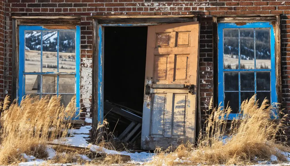
The open mine cuts and dumps on the northwest slopes aren’t just fenced-off relics; they’re genuine hazards with unstable ground and hidden shafts that’ve claimed careless explorers. Your visit depends on respecting “No Trespassing” signs and staying alert to crumbling structures that survived a 1949 hotel fire but won’t necessarily survive your weight against rotted beams.
Respect Private Property Boundaries
Most of Gilt Edge’s crumbling structures and weathered ruins stand on private property, making this ghost town more of a drive-through experience than an exploratory adventure. Understanding property rights protects both you and the landowners who’ve maintained these historic sites for decades.
You’ll find the small jail building and scattered stone foundations visible from public roads—stick to these designated routes for avoiding trespassing issues. While you won’t see posted signs everywhere, assume everything beyond the road belongs to someone.
Maiden’s nearly twenty structures require the same respect: admire from Montana Street and Main Street without stepping onto private land. Your freedom to explore Montana’s backcountry depends on honoring these boundaries. Take your photos from the roadside and leave the sites undisturbed.
Historic Mine Safety Hazards
Beyond the visible property lines lie dangers that have claimed lives since Gilt Edge’s mining heyday began in the 1880s. Open shafts collect groundwater that leaches arsenic, cadmium, lead, and mercury into surrounding ecosystems—residual contaminant risks that’ll persist for generations.
You’ll encounter unstable rock formations ready to collapse without warning, just as they did during historic salvage operations. Inadequate ventilation in abandoned tunnels creates asphyxiation zones where toxic gases accumulate silently. The Bureau of Land Management continues long term hazard mitigation across Montana’s abandoned mine lands, but enforcement can’t cover every forgotten shaft.
Fire spread hazards remain where old timbers rot beneath your feet. These aren’t theoretical dangers—they’re documented killers that don’t distinguish between trespassers and the curious.
Combining Your Visit With Maiden and Other Nearby Sites
Since Maiden Road and Gilt Edge Road converge at Chickadee Avenue, you’ll find these two historic mining camps practically neighbors in the Judith Mountains. Maiden’s Main Street, once bustling with gold rush prosperity before 1912, sits just a short drive from Giltedge’s scattered ruins and stone storefronts.
You can easily explore both sites in a single afternoon, tracing the arc of fortune as business and population shifted between these two camps in the late 1890s.
Maiden’s Historic Mining District
The windswept peaks of the Judith Mountains cradle a remarkable concentration of Montana mining history, where Maiden and Gilt Edge form the twin anchors of a designated Historic Mining District. You’ll find nearly twenty surviving structures scattered along drivable Montana and Main Streets, though respect the private property boundaries.
The preserved 1884 Maginnis ten-stamp mill stands as evidence to an operation that extracted 400,000 ounces of gold from these hills. Historic preservation efforts have protected this authentic snapshot of frontier life, where eight saloons once fueled a town economy serving 1,200 residents.
Unlike sanitized tourist traps, Maiden remains delightfully unmanicured—crumbling stone walls, weathered timber frames, and rusting mining equipment tell their stories without interpretation signs dictating your experience.
Planning Your Route
While Giltedge rewards solitary exploration, you’ll maximize your ghost town experience by threading together the Judith Mountains‘ scattered mining remnants into a single day’s adventure.
Consider this strategic loop:
- Start east from Lewistown on MT Highway 200 to Giltedge’s weathered streets
- Continue north via Gilt Edge Road toward Fort Maginnis ruins and Teddy Blue Abbott’s grave
- Return west through the Judiths on Maiden Road, examining hillside dumps and open cuts
- Add Kendall’s superior interpretive signs via Highway 87 routes if time permits
- Check Lewistown for current access conditions before departing
Most nearby historical sites sit on private land, so respect boundaries while driving Maiden Road and Gilt Edge Road’s public corridors. Summer offers ideal conditions—winter snow closes routes. This stark country demands self-reliance; inquire locally about ford crossings at Ford’s Creek.
Essential Gear and Supplies for Your Trip

Before you venture into the windswept grasslands surrounding Giltedge, pack strategically for Montana’s unpredictable high-plains weather. Layer thermal base gear beneath durable outerwear—temperatures swing forty degrees between dawn and afternoon. Sturdy hiking boots grip crumbling foundations you’ll explore among weathered structures.
Your camping essentials should include emergency shelter, water purification tablets, and three days’ backup provisions. Cell service vanishes miles before arrival, making personal safety gear non-negotiable: first-aid kit, GPS device, flashlight with spare batteries. Bring leather gloves for traversing rusted metal and splintered wood at abandoned mine sites.
Pack photography equipment for capturing golden-hour light across empty valleys. A detailed topographic map guides you through unmarked roads branching toward forgotten claims. Tools stay in your vehicle—disturbing artifacts destroys irreplaceable history.
Frequently Asked Questions
Are There Any Documented Ghost Sightings or Paranormal Activity at Gilt Edge?
No documented ghost sightings exist at Gilt Edge, despite its haunted buildings like the stone jail and brothel ruins. You’ll find an eerie atmosphere among the abandoned structures, though paranormal investigators haven’t officially recorded any supernatural activity here.
Can I Metal Detect or Collect Artifacts From the Townsite?
You’ll need landowner permission before metal detecting at Gilt Edge, since it’s private property. Metal detecting regulations and historical preservation policies restrict artifact collection without consent. Beyond the public roads, you’re trespassing—respect ownership boundaries while exploring.
What Wildlife Might I Encounter While Exploring the Area?
You’ll find abundant wildlife sightings throughout Montana’s prairie, where over 200 bird species thrive. Expect diverse bird populations including eagles and sandhill cranes, plus pronghorn antelope, deer, coyotes, and prairie dog towns dotting your exploration route.
Are There Any Camping Facilities Near Gilt Edge?
Campground availability near Gilt Edge is limited, but you’ll find local lodging options at Bannack State Park’s 24 sites or Bear Creek’s mountain retreat. For true freedom, BLM’s Log Gulch offers 70 dispersed-style sites for adventurous explorers.
How Long Should I Plan to Spend Exploring the Townsite?
You’ll need about 1-2 hours for a thorough tour length of Giltedge’s scattered ruins. The townsite’s historical significance warrants careful exploration, but remember most areas are private property, so you’re limited to old streets and designated viewpoints.
References
- https://www.montanaliving.com/blogs/destinations/explore-montana-ghost-towns
- https://westernmininghistory.com/towns/montana/gilt-edge/
- https://www.ghosttowns.com/states/mt/giltedge.html
- https://static1.squarespace.com/static/5e7d4bd4b56fd5047d73a90b/t/63e0508a33e30815a0006c9c/1675645072475/Central+Montana+Ghost+Towns-Kendall_Giltedge+Maiden+Fort+Maginnis.pdf
- https://www.mtmemory.org/nodes/view/3799
- http://sites.rootsweb.com/~mtfergus/homestead/fm-ge01.htm
- https://hiddenmt.com/ghost-towns-and-gold-mines-central-montana
- https://westernmininghistory.com/mine-detail/10071313/
- https://thediggings.com/mines/usgs10071313
- https://www.mtmemory.org/nodes/view/4008