You’ll find Grafton 40 miles from Zion National Park, accessible via SR9 and a final 1.5-mile unpaved stretch that becomes impassable after rain. Spring and fall offer ideal visiting conditions to explore the 1886 schoolhouse, pioneer homes, and cemetery with 100 carved tombstones. Bring your high-clearance vehicle, wide-brimmed hat, and plenty of water for this authentic frontier settlement where Hollywood filmed countless Westerns. The weathered buildings and dramatic red-rock landscape hold stories that reveal why this Mormon community thrived, struggled, and ultimately vanished into Utah’s desert silence.
Key Takeaways
- From Rockville, head east on SR9, turn right onto Bridge Road, and follow 3.3 miles to the dead-end.
- Use a high-clearance vehicle; the final 1.5 miles are unpaved clay impassable after heavy rain.
- Visit the 1886 schoolhouse, Alonzo Russell’s 1888 home, John Wood residence, and cemetery with 100 carved tombstones.
- Spring and fall offer ideal temperatures; avoid scorching summers and bring water, sunscreen, and sun protection.
- Check weather forecasts before departure and visit during daylight hours for safety and visibility.
Getting to Grafton: Directions and Road Conditions
Finding Grafton requires a bit of adventure, but that’s half the charm of visiting this weathered ghost town tucked along the Virgin River. From Rockville’s town center, head east on SR9, then turn right onto Bridge Road. You’ll cross the historic 1926 iron lattice-truss bridge before bearing right at each intersection for 3.3 miles to the dead-end.
The final 1.5-mile stretch is unpaved clay that becomes impassable after heavy rain. Weather considerations matter—check conditions before committing to this route. High-clearance vehicles handle rough patches better. The trailhead information shows coordinates 37.161151 N, -113.037713 W, accessible dawn to dusk. No services exist here, so come prepared. Park in Rockville if conditions look sketchy and bike or hike instead.
The Rise and Fall of a Mormon Settlement
You’ll find Grafton’s story begins in 1859 when Mormon families arrived to grow cotton for Brigham Young’s Cotton Mission, carving irrigation ditches into the red earth and raising adobe homes along the Virgin River.
The settlement barely took root before the devastating 1862 flood swept away entire houses—one family floated their newborn son to safety in a wagon box—forcing everyone to relocate upriver.
Cotton Mission Beginnings 1859
When Brigham Young envisioned a self-sufficient Mormon empire in 1859, he dispatched Nathan Tenney and five determined families into southern Utah’s unforgiving desert to cultivate an unlikely crop: cotton. These Tenney family pioneers—the Barneys, Davies, McFates, Platts, and Shirts—established Wheeler, a precarious settlement one mile downstream from present-day Grafton.
You’d find these settlers wrestling irrigation ditches through silt-laden soil, their hands raw from channeling the temperamental Virgin River toward thirsty cotton fields. The Cotton Mission vision wasn’t about profit; it was about breaking free from outside dependencies.
After Santa Clara’s successful 1854 cotton experiment, Young saw opportunity in Dixie’s red earth. By the Civil War’s outbreak in 1861, their isolation transformed into strategic advantage—homegrown cotton meant independence.
Floods and Conflicts
Just forty days of relentless rain in January 1862 turned the Virgin River into a churning monster that devoured Wheeler whole. Adobe homes collapsed into muddy torrents while Nathan Tenney’s family floated their wagon-box home to safety—naming their newborn Marvelous Flood Tenney. Settlers watched helplessly as furniture, clothing, and three barrels of molasses drifted downstream.
The 1-1.5 mile relocation to Grafton’s new site didn’t solve anything. You’ll understand why they abandoned it when you learn the irrigation ditches needed weekly unclogging, dams washed out three times yearly, and crop destruction became an annual tradition. Then came 1866’s Paiute cattle raids and the Berry family murders. The church ordered everyone to Rockville for safety. Only forty settlers returned in 1868, stubbornly clinging to their flooded, isolated farmland.
Final Abandonment 1940s
The forty determined settlers who returned in 1868 couldn’t have imagined their descendants would abandon Grafton entirely within seventy-six years. By 1890, only four families clung to their hardscrabble existence.
The 1906 Hurricane Canal proved the final blow—you’d have left too when men helped build their own town’s demise, watching precious Virgin River water flow twenty miles downstream to Hurricane’s promising flatlands. Families literally relocated their houses, escaping flood-prone subsistence for better yields.
When the Mormon church discontinued its branch in 1921, communal ties severed. Contributing factors—poor irrigation, scant rainfall, economic isolation—compounded relentlessly. The last residents departed in 1944, closing a chapter forever. Grafton’s post 1944 status transformed it into Utah’s most photogenic ghost town, preserving frontier dreams in weathered wood and silence.
Historic Buildings You Can Still Explore
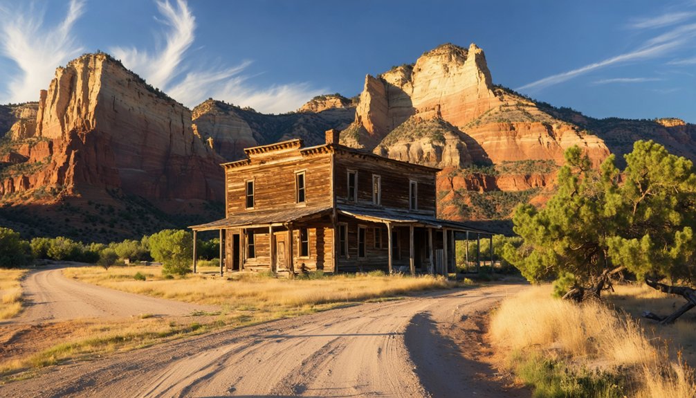
Five weathered structures rise from Grafton’s dusty landscape, their adobe walls holding stories of pioneers who carved lives from this unforgiving terrain. You’ll find the 1886 schoolhouse standing against massive red rock formations—the most photographed building in the Western U.S.
Wander through Alonzo Russell’s restored 1888 home, where families once gathered on the front porch for music under desert stars. The John Wood residence from 1877 showcases traditional construction methods that withstood floods and harsh seasons. Inside the combination church-schoolhouse, carefully preserved artifacts reveal how one building served multiple community needs.
Don’t miss the cemetery’s 100 intricately-carved tombstones, where you’ll read heart-wrenching inscriptions about the Ballard family losing five children. Each structure offers unguided exploration—no ropes, no restrictions.
Grafton’s Hollywood Fame and Cultural Impact
Local anecdotes add depth to your visit—neighbors skipped school to watch production, and children chatted with Redford without recognizing him.
The ghost town’s dramatic landscape provided authenticity filmmakers craved, preserving this abandoned frontier settlement in popular culture.
You’ll find Grafton remains Hollywood’s secret weapon, a picturesque location that’s helped define southern Utah’s enduring appeal beyond Zion’s boundaries.
What to See: Cemetery, Schoolhouse, and Pioneer Homes
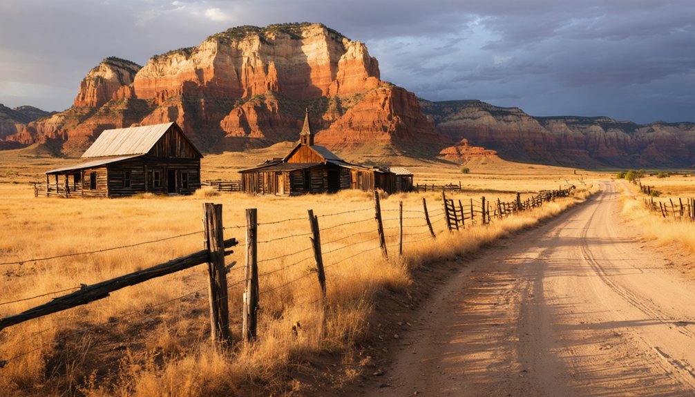
Walking through Grafton’s weathered gate, you’ll immediately encounter the settlement’s most poignant landmark—a windswept cemetery where roughly 84 graves tell stories of relentless hardship on the Mormon frontier. About 50 are children’s graves, documenting epidemic diseases like diphtheria and scarlet fever that devastated families. The Ballards lost all five children before age ten. You’ll find Southern Paiute burials alongside settler plots, reflecting the community’s inclusive practices.
Beyond the cemetery, the 1886 schoolhouse stands remarkably intact with characteristically low ceilings. You’ll discover weathered pioneer homes scattered across the valley, their wooden frames bearing witness to stubborn determination. These structures offer genuine ancestral connections—descendants still gather here annually. The pioneer lifestyle demanded everything, and these crumbling homesteads prove some paid the ultimate price for freedom.
Best Times to Visit and What to Bring
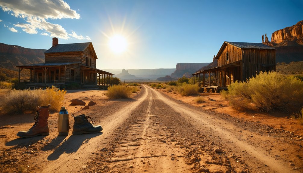
After experiencing the emotional weight of Grafton’s cemetery and weathered homesteads, timing your visit properly means the difference between memorable exploration and genuine misery. Spring and fall deliver ideal temperatures, while summer afternoons transform this shadeless ghost town into a relentless oven. You’ll want gear recommendations that prioritize survival: wide-brimmed hat, sunscreen, lightweight long sleeves, and ample water bottles—there’s zero on-site amenities.
Safety precautions start before departure. Drive an SUV or high-clearance vehicle on those fifteen minutes of gravel roads from Springdale, traversing steep inclines slowly. Check forecasts religiously; wet conditions render routes impassable. Visit during daylight hours when visibility aids wayfinding and the desert reveals its stark beauty without threatening your well-being. Bring sufficient hydration for everyone—dehydration strikes fast in this unforgiving landscape.
Nearby Attractions to Complete Your Southwest Adventure
After exploring Grafton’s sun-bleached structures and windswept streets, you’ll find yourself perfectly positioned to discover Southern Utah’s greatest treasures.
Just 30 minutes east, Zion National Park beckons with crimson cliffs and canyon trails, while historic Rockville—possibly Utah’s cutest town—offers a charming base camp mere minutes from the ghost town.
The surrounding landscape holds more abandoned settlements waiting to tell their pioneer stories, each connected by scenic backroads that wind through red rock country and agricultural valleys planted by those early Mormon settlers.
Zion National Park Trails
Just thirty minutes from Grafton’s weathered buildings, Zion National Park transforms your ghost town excursion into a full-blown Southwest adventure. You’ll find everything from family-friendly strolls through Southwest Desert’s golden grasslands to challenging wilderness routes requiring trail permits for groups over twelve.
The iconic Zion Canyon trails—Angels Landing, The Narrows, Emerald Pools—connect via shuttle stops, though you’ll want to check seasonal trail closures before heading out. Weeping Rock remains closed following rockfall, as does the Observation Point route.
For solitude-seekers, Kolob Canyons offers longer out-and-back hikes at higher elevations, while Kolob Terrace Road accesses rugged backcountry stretches. Waterproof topographic maps color-code steepness and detail twenty-nine ranked day hikes with marked water sources for planning your escape.
Historic Rockville Town
While Grafton’s crumbling schoolhouse captures the romance of abandonment, its sister settlement Rockville thrives just across the Virgin River as a living embodiment of why location matters. You’ll discover how Mormon colonization efforts pivoted here in 1866 when Brigham Young ordered consolidation during the Black Hawk War. Grafton’s farmers trudged daily to this safer haven, eventually abandoning their flood-prone fields entirely.
Today’s Rockville still celebrates those self sufficient farming practices through heritage orchards and irrigation canals that defied the desert. You can walk Bridge Road where 150 pioneers built what Grafton couldn’t sustain—permanence. The contrast teaches more than any museum: they chose resilience over stubbornness, transforming Virgin River water into lasting prosperity while Grafton became beautiful ruins. That’s the freedom of adaptation.
Southern Utah Ghost Towns
Why settle for Grafton alone when a constellation of abandoned mining camps awaits within two hours’ drive? Silver Reef near Leeds broke geological rules as sandstone’s first silver strike, transforming sleepy southern Utah into 1870s boom-town chaos. You’ll find fading structures where thousands once chased fortune.
West of Cedar City, Old Irontown‘s beehive oven stands sentinel among desert landscapes where iron production defied harsh conditions. Frisco‘s charcoal kilns and crumbling buildings tell Wild West tales through Beaver County’s regional geology. Each site reveals how miners wrestled precious metals from unforgiving terrain.
Start at Silver Reef—locals recommend it for first-timers—then chart your own course through Stateline and beyond. Sego Canyon near Moab adds petroglyphs and vintage cars to your collection of mining relics, making this circuit unforgettable.
Frequently Asked Questions
Are There Any Guided Tours Available at Grafton Ghost Town?
You’ll find privately led tours departing from nearby Springdale, where enchanted buses transport ghost-hunters through Grafton’s haunted remains. Alternatively, embrace self-guided exploration—wandering freely among weathered cabins and pioneer graves without fees or schedules restricting your adventure.
Is Camping Allowed Near Grafton or Along the Virgin River?
Yes, you’ll find primitive campsites on nearby BLM lands with scenic river views. Follow the 14-day limit, camp 300 feet from water, and use existing sites. Check local restrictions before settling in for your adventure.
Can You Enter the Historic Buildings or Only View From Outside?
“Look but don’t touch” applies here—you can enter some restored homes and the church, respecting private property access and historical artifact preservation. The schoolhouse remains exterior-only viewing. You’ll find informative plaques guiding your self-directed exploration throughout.
Are There Restroom Facilities Available at the Grafton Ghost Town Site?
No, there’s zero public restroom availability or drinking water access at Grafton. You’ll find complete freedom but absolutely no facilities—it’s raw, untamed desert. Stop in Rockville beforehand to handle necessities before exploring this wild ghost town.
Is the Ghost Town Accessible for Visitors With Mobility Challenges?
The ghost town isn’t mobility-friendly. You’ll encounter rough terrain, stairs in buildings, and no accessible path options. There’s zero mobility assistance availability—just rugged gravel trails and steep areas requiring independent navigation through this remote, unmodified historic landscape.


