You’ll find Granada’s weathered ruins seventeen miles southeast of Seneca in Nemaha County, accessible via rural farm roads from US 59 near Wetmore. Navigate to GPS coordinates 39.7199979°N, -95.7935986°W, where crumbling business buildings and a deteriorating brick high school mark what remains of this 1855 settlement. The site offers pure exploration without tourist amenities—just windswept prairie and scattered structures from Granada’s peak around 1906. Plan connections to nearby ghost towns like Guittard Station, and discover what essential supplies and photography techniques will enhance your backcountry adventure.
Key Takeaways
- Granada is located 17 miles southeast of Seneca in Nemaha County at GPS coordinates 39.7199979°N, -95.7935986°W.
- Access the site via rural farm roads from US 59 near Wetmore, with connections to US 36, US 75, KS 63, and KS 9.
- Expect weathered business buildings, homes along Main Street, and a deteriorating brick high school without preservation or tourist facilities.
- Respect artifacts, photograph structures carefully, and watch for unstable buildings when exploring the authentic frontier ruins.
- Combine your visit with nearby ghost towns like Guittard Station, Log Chain Station, or Hollenberg Pony Express Station.
The Historical Journey From Pleasant Spring to Granada
In 1855, when most of Kansas remained untamed prairie, D. M. Locknane staked his claim at what would become Pleasant Spring in Granada Township. You’ll discover how early settlers like Chappel, Pilant, and Haigh transformed this remote spot into an essential waypoint, digging one of Kansas’s first wells to sustain travelers crossing the plains.
By 1856, Manaoh Terrill’s store stood ready for business, and that August, Locknane became postmaster of this frontier outpost.
The settlement thrived along the overland express route to Denver, where William Letson carried messages through dust and danger from 1859 to 1863. Locknane’s Granada Hotel welcomed weary stage passengers by 1859. When the post office rechristened itself Granada in 1864, this thrifty town symbolized frontier independence—a community built by determined souls seeking opportunity beyond civilization’s reach. Just down the Spring River, Baxter Springs drew people from all regions seeking fortune in what became a principal trade mart of the Southwest.
By the time of the Civil War, Granada had grown into a thrifty little town with essential services that drew travelers and settlers alike.
What Remains of Granada Today
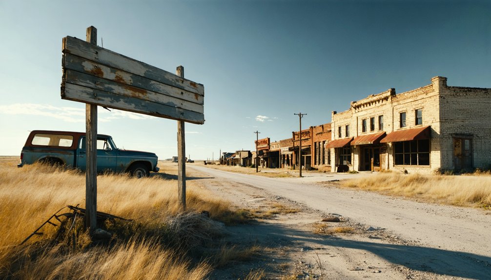
The ghost town of Granada slumbers seventeen miles southeast of Seneca in Nemaha County’s northeastern quarter, where gravel roads wind through prairie grass toward forgotten dreams. You’ll discover weathered business buildings and homes along what was once Main Street, their wooden frames legacy to 1850s ambitions.
The brick high school stands in serious disrepair, yet no building preservation efforts have rescued its crumbling walls. Unlike modern small community redevelopment projects, Granada remains untouched—no structures hauled away for salvage, no revival plans disrupting its authentic decay.
Scattered ruins punctuate the landscape where ten houses once thrived during Civil War prosperity. Eight miles north of Wetmore, this forgotten settlement offers pure exploration without gift shops or guided tours. Granada had some ruins and abandoned buildings remaining as testament to its vanished community. You’re free to wander among genuine abandonment. Kansas has many ghost towns compared to other states, making it a prime destination for exploring forgotten communities.
Getting There: Directions and Routes to the Ghost Town
You’ll find Granada nestled in the farmlands of Nemaha County, accessible via US 59, which cuts through northeast Kansas near the town of Wetmore. From this main artery, you’ll navigate a network of rural farm roads that wind through rolling prairie—expect the journey to take about 90 minutes from Topeka or two hours from Kansas City.
The coordinates 39.7199979°N, -95.7935986°W will guide modern GPS users to within sight of what remains, though locals near Wetmore can point you toward the old Granada Township area if your navigation falters. The site sits at an elevation of 1,214 feet above sea level, where the prairie landscape transitions into gently undulating terrain. Like many of Colorado’s 194 ghost towns, Granada reflects the region’s settlement patterns and economic shifts that led to abandonment.
Major Highway Access Points
Reaching Granada requires traversing a network of rural Kansas byways that spiral out from US Highway 36, the primary east-west corridor slicing through Nemaha County approximately 17 miles northwest of the ghost town. You’ll navigate minimal modern infrastructure as pavement surrenders to gravel, where freedom-seekers discover authentic backcountry exploration.
Key Highway Connections:
- US Highway 36 – Main arterial running near Seneca, your launch point for southeastward county road exploration
- US Highway 75 – North-south corridor threading through Nemaha County’s eastern reaches
- Kansas Highway 63 – Regional connector intersecting county backroads toward Granada’s coordinates
- Kansas Highway 9 – Eastern route linking toward Topeka direction
Alternative access points exist through unmarked rural paths branching from Wetmore, though GPS coordinates (NE1/4 S12 T4S R14E) prove essential where signage vanishes into prairie winds. Granada ranks as number 601 among Kansas’s 1,613 municipalities, reflecting its remote positioning within the state’s transportation grid.
Estimated Travel Times
Planning your journey to Granada demands realistic time expectations, as this remote Nemaha County destination sits beyond the reach of interstate efficiency. From regional transportation hubs, you’ll navigate rural highways where projected transit times stretch beyond simple distance calculations.
Topeka delivers the quickest access at 45-60 minutes via US-75 and US-36, while Manhattan requires 55-70 minutes through northeastern routes. Kansas City sits 75 miles distant—budget 90 minutes for the journey.
The historical overland stage route that once carried Denver-bound travelers now translates to winding county roads adding 10-20% beyond highway estimates. From Seneca, seventeen miles of rural pavement separate you from Granada’s scattered remnants. Factor extra time for exploration, unmarked turns, and the unhurried pace these backcountry adventures demand.
Exploring the Ruins and Abandoned Main Street
When you arrive at Granada’s former Main Street, time seems to have frozen somewhere around 1906. You’ll find weathered structures that once housed the drugstore, hardware store, and other establishments from Granada’s peak years. The remnants tell stories of pioneers like David Locknane and William Letson who built this community from scratch in 1855.
Granada’s weathered Main Street structures stand as silent monuments to the pioneers who carved this community from the Kansas frontier in 1855.
As you explore, keep these guidelines in mind:
- Respect artifact preservation—leave everything as you found it
- Document the local history significance through photography only
- Watch for unstable structures among the ruins
- Consider the original settlers’ determination and independence
These crumbling buildings mark where the Granada Hotel stood and where overland routes to Denver once passed through, making this an authentic window into Kansas frontier life. Just a mile from town, the Amache incarceration site stands as a National Historic Landmark where over 7,000 Japanese-Americans were forcibly relocated during World War II. The Department of the Interior supports locally led conservation efforts to preserve historic sites and increase access to outdoor spaces across the country.
Other Ghost Towns to Visit in the Region

You’ll find Guittard Station waiting in nearby Marshall County, where crumbling stone walls mark what was once a crucial Pony Express stop from 1861 to 1900.
Head northeast into Douglas County and you can walk among the weathered headstones at Prairie City’s cemetery, then explore the ruins of its old church and a solitary abandoned stone house that’s stood since the 1850s.
These settlements along historic mail routes tell the story of Kansas before the railroad changed everything, their empty buildings and overgrown main streets preserving a vanished era of frontier communication. When the railroad lines shifted development elsewhere, these once-thriving communities lost their customers and local businesses, leaving behind only silent reminders of their former prosperity.
Pony Express Route Stops
The Pony Express route through northeastern Kansas offers a concentrated collection of historic stations within easy driving distance of Granada, making this region ideal for exploring multiple ghost towns and relay points in a single trip. These Pony Express waystation history sites reveal nineteenth century commerce and transportation networks that connected frontier settlements.
Essential Stations Within Your Route:
- Hollenberg Station – Kansas’s only unaltered station in its original location, two miles east of Hanover on SR243, now a state historic site where riders once changed horses along the busy Oregon-California Trail.
- Seneca Station – Smith Hotel served riders with hot meals and soft beds 70 miles west of St. Joseph.
- Troy Station – Early Division 1 home station near Marysville providing extended rest stops.
- Log Chain Station – Just one mile north of Granada on the old Military Road.
Northeast Kansas Abandoned Settlements
Beyond the Pony Express stations, northeastern Kansas conceals dozens of abandoned settlements where stone foundations peek through prairie grass and solitary church steeples mark communities that once thrived.
You’ll discover Prairie City near Lawrence, where a cemetery and crumbling church ruins tell stories from 1857 to 1883.
Drive to Bala in Riley County, where deteriorating Presbyterian Church walls stand witness to the evolution of frontier farming before Fort Riley’s expansion claimed the land.
Neuchatel offers restored treasures—a schoolhouse, town hall, and church preserved by locals who refused to let history vanish.
Each site holds remnants of civil war history, particularly Douglas County’s Free-State settlements. These ghost towns sit within 25 miles of modern cities, offering afternoon explorations where you’ll walk paths pioneers once traveled.
Best Times and Conditions for Your Visit
While Granada’s remote prairie landscape welcomes visitors year-round, spring and fall deliver the most rewarding conditions for your road trip adventure. You’ll find moderate temperatures and calm winds from April through June, perfect for exploring crumbling structures and photographing weathered storefronts.
September through November offers equally pleasant weather patterns, though you’ll encounter more fellow explorers during this peak season.
Seasonal pricing considerations for budget-conscious travelers:
- Winter months (January-February) bring bitterly cold conditions but rock-bottom accommodation rates
- Summer’s July-August heat creates ideal low-season savings with fewer crowds
- Spring and fall command premium prices due to cultural events and ideal exploration weather
- Shoulder months (March, December) balance comfortable conditions with moderate costs
Pack layers regardless—Kansas weather shifts dramatically across its four distinct seasons.
Essential Supplies and Safety Considerations
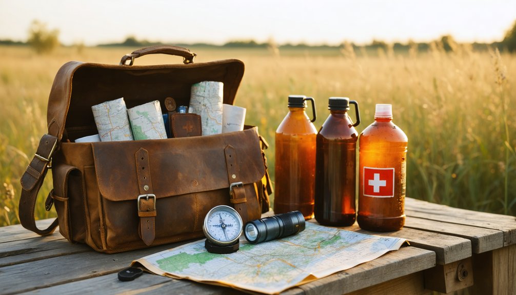
Before you set out across the windswept prairies toward Granada’s haunting remnants, you’ll need to transform your vehicle into a self-sufficient basecamp. Emergency preparedness begins with water—pack one gallon per person daily, plus electrolyte packets for Kansas’s dehydrating heat. Inspect your tires for gravel-road capability and load spare equipment, jumper cables, and a portable compressor. The nearest services hide miles away in towns like Lakin, so fuel up completely.
Resource conservation matters here. Pack a thorough first aid kit with snake bite treatments, carry offline maps for the unmarked ghost town roads, and equip a satellite communicator where cell towers abandon you. Layer weather-appropriate clothing, sun protection, and insect repellent. This remote corner of Prowers County rewards the prepared traveler who respects isolation’s demands.
Photography and Documentation Opportunities
Your camera will capture stories written in weathered wood and crumbling foundations scattered across Granada’s forsaken landscape. Photographic documentation approaches reveal a boomtown that once housed 1,500 souls among four saloons and three dance halls before the railroad’s 1875 betrayal sent it spiraling toward oblivion.
Fifteen hundred dreams abandoned when iron rails chose another path, leaving only weathered wood to whisper Granada’s boomtown betrayal.
Focus your lens on these compelling remnants:
- Main Street ruins where buildings stood until 1886’s mass relocation three miles west
- Granada Creek’s origin point marking the 1873 platting that sparked settlement dreams
- Neglected cemetery traces holding silent testimonies to frontier ambitions
- New Goodnight Trail routes starting at Fort Sumner in 1876
Historical artifact preservation methods shine at the Amache Museum on East Goff Street, where summer exhibits contextualize Granada’s dramatic rise and fall.
Respecting Private Property and Access Guidelines
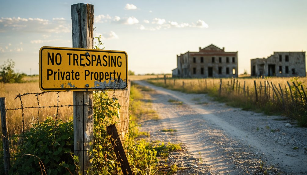
Though Granada’s weathered structures beckon photographers and history enthusiasts, traversing this ghost town demands careful attention to property boundaries that have evolved considerably since the settlement’s 1855 founding. You’ll find utility company fencing clearly marking restricted zones, while former Main Street buildings now sit on privately-held parcels requiring explicit permission for entry. County records in Seneca, seventeen miles northwest, document current ownership that differs dramatically from Granada’s commercial heyday.
Liability concerns have prompted landowners to establish firm visitor restrictions, particularly around structurally compromised buildings. You can photograph from public roads and rights-of-way without trespassing, but accessing fenced areas or entering abandoned structures risks legal complications. Contact Nemaha County’s historical society before your visit to identify accessible sites—the cemetery typically welcomes respectful visitors, while private residences and business foundations remain off-limits without coordination.
Frequently Asked Questions
Are There Any Local Legends or Ghost Stories Associated With Granada?
You won’t find documented ghost stories specific to Granada, unlike other Kansas ghost towns. However, abandoned structures dot the landscape where you might hear eerie sounds, and unexplained sightings near the old town remain possible for adventurous explorers.
What Caused Granada to Become Abandoned in the Early 1900S?
Granada’s abandonment stemmed from economic decline when the railroad relocated to La Junta in 1875, triggering a population exodus. You’ll find residents fled to thriving Coolidge and Lamar, leaving Granada’s dreams scattered across the windswept prairie by 1886.
Can You Camp Overnight Near the Granada Ghost Town Site?
No overnight camping exists directly at Granada’s ghost town site, but you’ll find freedom at nearby Hiawatha’s Hipcamp locations. Camping amenities available include campfires and flexible stays, though seasonal accessibility considerations mean checking winter conditions before heading out.
Are There Any Guided Tours Available for Granada and Nearby Ghost Towns?
No guided tours by local historical society exist for Granada’s ghost town ruins. You’re free to explore through self-guided walking tours around town, discovering abandoned Main Street buildings and Pleasant Spring’s weathered remnants at your own adventurous pace.
What Wildlife or Natural Hazards Should Visitors Be Aware Of?
Watch for venomous snakes like rattlers hiding among prairie grasses and crumbling foundations. Flash flooding can strike suddenly in low-lying areas during storms, transforming dry creek beds into torrents. Stay alert and you’ll explore safely.
References
- https://www.legendsofamerica.com/granada-colorado/
- https://legendsofkansas.com/kansas-ghost-town-list/
- https://history.nebraska.gov/wp-content/uploads/2017/12/doc_publications_NH1937GhostTowns.pdf
- https://en.wikipedia.org/wiki/Francisco_Vázquez_de_Coronado
- https://krex.k-state.edu/server/api/core/bitstreams/9c40dc16-3f86-4121-926c-5c1ce8215be4/content
- https://roordawrite.wordpress.com/2015/01/16/old-granada-colorado/
- https://fhsuguides.fhsu.edu/kansasheritage/hamiltoncounty
- https://lewisartwilliams.com/blog/168227/tree-spirits
- https://legendsofkansas.com/granada-kansas/
- http://www.kansashistory.us/cherokee-ch13.html


