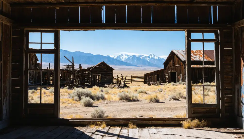
Your ghost town road trip to Hassel, Montana leads to Broadwater County’s northeastern slopes, where a weathered two-story brothel stands as the most striking survivor among scattered cabin foundations and mine scars. You’ll find this 1866 placer camp along Indian Creek, where $5,000,000 in gold once flowed through a 120-stamp mill before 1946 dredging operations buried the main street. The site’s fragmented remnants—tunnel traces, foundation stones, and topographic scarring—whisper tales of engineering marvels and catastrophic transformation awaiting your discovery.
Key Takeaways
- Hassel is located in Montana where prospectors established the mining camp of Saint Louis in 1869 near Indian Creek.
- The two-story brothel building remains the most prominent structure, with scattered cabin foundations and tunnel traces still visible.
- The site produced $5,000,000 in gold and once supported 200 residents during its peak mining operations.
- 1946 dredging operations severely damaged the townsite, burying buildings and altering the landscape and Indian Creek channel.
- Engineering remnants include the Crow Creek Ditch and Hassel Canyon Flume, which once supplied water for mining operations.
The Rich History of Hassel’s Gold Mining Era
The glint of placer gold in Indian Creek’s gravels sparked Montana’s next chapter in 1866, drawing prospectors into what would become Broadwater County‘s rugged terrain. By 1869, you’d have found forty determined miners establishing what they called Saint Louis, working shallow tunnels and open pits with simple quartz extraction methods.
The ore extraction techniques evolved dramatically through the 1880s, when stamp mills and hydraulic sluicing replaced hand tools at operations like Diamond Hill’s Mother Lode, Bunker Hill, and Ajax Mine. Over two decades, these claims produced $5 million in gold before declining yields forced abandonment by 1910.
The environmental impact of mining became starkly visible in 1946, when dredging operations buried the entire camp beneath tailings, erasing most physical traces of this once-thriving frontier settlement.
Major Mining Operations and the Diamond Hill Stamp Mill
Among Hassel’s scattered claims, Diamond Hill Mining Company‘s operations stood apart in scale and ambition. You’ll find the legacy of their stamp mill construction half-mile northwest of town, where they erected a 40-stamp mill in the early 1890s to handle ore processing operations from glory holes.
Scottish investors saw potential, expanding it to an impressive 120-stamp facility in 1897 for $400,000. They powered it with electricity generated at Crow Creek—a revolutionary approach for its time.
From 1898 to 1900, this massive mill ran at full capacity, producing $500,000 worth of gold. Yet freedom-seekers often face harsh realities: insufficient water supply forced closure shortly after its peak, leaving behind silent testimony to ambitious dreams that outpaced available resources.
What Remains of Hassel’s Town Buildings and Streets
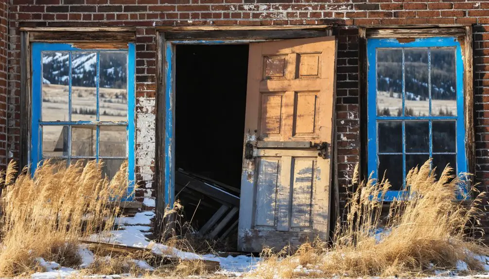
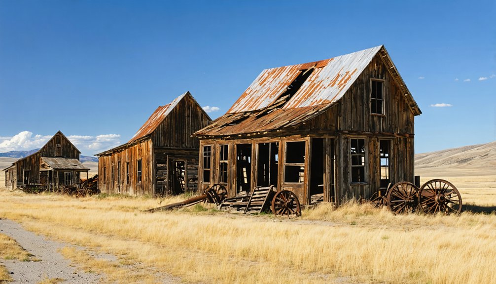
When you arrive at Hassel today, you’ll find only scattered fragments of what was once a bustling camp of 200 residents in 1895. The most striking survivor is a two-story brothel structure, standing among a handful of weathered frame homes and log miners’ cabins that hint at the town’s former street layout.
The 1946 dredging operation proved catastrophic for preservation—Indian Creek’s channeling buried much of the original townsite beneath massive waste tailings that now obscure where buildings once lined the camp’s streets.
Visible Building Remnants Today
Despite decades of aggressive mining operations that have reshaped the landscape, scattered remnants of Hassel’s bustling past still emerge from the scarred earth. You’ll discover accessible architectural remnants that escaped the 1946 dredging devastation, though much of the original camp lies buried beneath mining waste tailings.
The most striking example of old building preservation stands as the two-story brothel, possibly featuring a basement—a symbol of the camp’s rough-and-tumble character. You’re free to explore:
- The iconic brothel structure rising defiantly above the tailings
- Weathered frame home foundations scattered across the active mining site
- Decaying log cabin remnants from miners’ dwellings
- Quartz mining tunnel traces and open pit scars marking early operations
These fragments whisper stories of 200 residents who once extracted $5,000,000 in gold from these Montana mountains.
Main Street Layout Traces
The brothel and cabin foundations you’ll encounter mark distinct points along what was once Hassel’s functioning main street, though pinpointing the exact roadway beneath decades of mining disruption requires imagination and careful observation. You’ll need to trace the logical connections between scattered stone remnants, visualizing how commercial enterprises lined this central artery serving the transient population.
The post office location anchored one end, while residential cabins branched outward from the commercial core. Today’s hillside reveals subtle depressions and leveled platforms where buildings once stood, their spacing suggesting the street’s original path. Walk the terrain slowly, noting how foundations align with natural contours—Montana’s mining-era planners followed practical patterns you can still read in the landscape’s bones.
1946 Dredging Destruction Impact
Standing at what remains of Hassel’s town center, you’re witnessing a landscape twice destroyed—first by the gradual decline that emptied the camp after 1910, then by the catastrophic 1946 dredging operations that literally consumed what still stood. The dredging systematically obliterated mine shafts and tunnels, causing complete disruption of underground structures that once honeycombedthe hillsides. High waste tailings buried miners’ cabins and the foundations of frame homes where 200 people once lived.
What the dredges left behind:
- Scattered mining equipment emerging from tailings piles
- Altered Indian Creek channel reflecting permanent hydrological changes
- Topographic scarring revealing the violence of mechanical excavation
- Fragmented building remnants standing against impossible odds
The alteration of local hydrology destroyed the eleven-mile Crow Creek Ditch system, erasing the engineering achievements that sustained this remote community.
Engineering Marvels: The Crow Creek Ditch and Hassel Canyon Flume
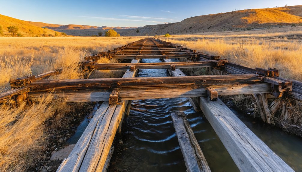
Between 1866 and 1875, a consortium of miners and businessmen south of Helena engineered an audacious solution to southwestern Montana’s water scarcity problem. They constructed the Crow Creek Ditch, sourcing water from Eureka Creek’s headwaters—nearly twice as long as contemporary ditch systems in Montana. These ditch engineering innovations transformed the dry northeastern flanks of the Elkhorn Mountains into viable mining territory.
The crown jewel was the Hassel Canyon Flume, erected in 1876 by John Murray and Joe McElroy. This wooden marvel snaked along steep canyon walls, defying gravity as it carried water through Indian Creek’s treacherous terrain. You’ll appreciate how these water supply challenges sparked ingenious solutions—combining ditches and wooden flumes to divert precious water for hydraulic mining operations that would’ve been impossible otherwise in this parched landscape.
Why This Thriving Camp Became a Ghost Town
As you walk among Hassel’s scattered ruins, you’ll notice the telltale signs of a community that didn’t fade gradually—it collapsed.
The depleted gold veins that once promised fortune became barren by the late 1800s, forcing mining operations to pack up their mills and relocate to more productive sites near Pony. Even more devastating, industrial dredging operations physically tore through the landscape, destroying what remained of the camp and erasing entire streets from existence.
Depleted Gold Ore Supply
When prospectors struck gold in Indian Creek’s gulches around 1866, they couldn’t have imagined the camp’s eventual fate was already written in the bedrock. The easily accessible riches that built Hassel would become its undoing.
The timeline of Hassel’s decline unfolded swiftly:
- Shallow placer exhaustion devastated Johnny Gulch and White Creek operations by the late 1870s, eliminating $1.5 million in accessible deposits
- Depleted lode deposits on Diamond Hill and Giant Hill forced mine closures as surface oxidized ores vanished
- Deeper sulfide ores required expensive smelting operations that most operators couldn’t afford
- The district sat idle from the 1870s until railroad access revived limited mining in 1883
Mill Relocation to Pony
The death blow to Hassel came not from depleted veins but from the machinery meant to process them. When John Cowan’s Butte investors erected a 10-stamp mill near the Strawberry mine in 1900, they relocated equipment from Columbia mine rather than building at Hassel. You’ll find the tailings dam placement followed North Willow Creek’s natural drainage, bypassing Hassel entirely.
The stamp mill construction details reveal economic calculation—processing ore closer to Pony’s railroad spur made financial sense, but it strangled Hassel’s lifeline. By 1903, when the operation reverted to W.W. Morris, Hassel’s fate was sealed. The mills that promised prosperity clustered around Pony instead, leaving Hassel’s miners to watch their town’s purpose—and population—vanish downstream.
Dredging Destroyed the Camp
By 1910, Hassel’s veins had surrendered their richest ore, and the miners who’d carved fortunes from these hills began their exodus. Brief revival attempts flickered through the 1930s before World War II extinguished them permanently.
Then came 1946’s final assault: modified mining equipment churned through Indian Creek, dredging for remaining placer gold. This mechanical beast devoured everything—the landscape you’d recognize, the structures that housed 200 souls, even the tunnels beneath.
Dredging environmental impact transformed Hassel into oblivion:
- Massive tailings buried log cabins and frame homes under waste piles
- Creek bed scooping collapsed mine tunnels and shafts
- Original post office and Masonic Lodge sites vanished completely
- Once-thriving camp became unrecognizable under debris fields
Today’s terrain tells this violent story—altered, scarred, barely whispering its prosperous past.
Getting to Hassel in Broadwater County
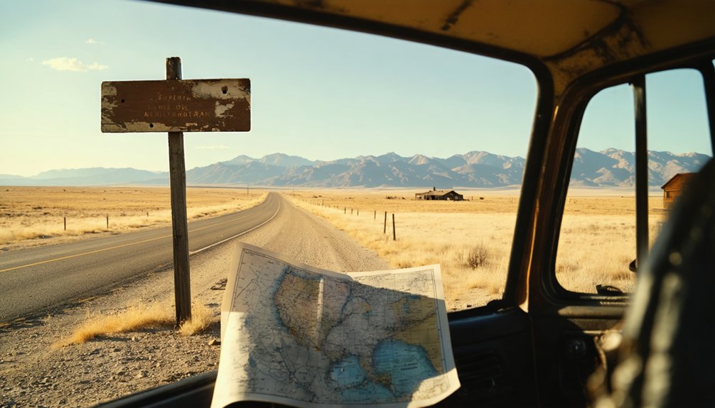
Nestled five miles west of Townsend along Indian Creek, Hassel sits at 5,200 feet elevation in Broadwater County’s historic Park Mining District. You’ll find the coordinates at 46.3078°N, 111.66560°W, where mining roads branch westward from Townsend through the Helena National Forest vicinity. While driving route options exist through the Indian Creek Mining District, you’re venturing into territory with uncertain ownership status—Apollo Mining Company currently operates here, and private land access restrictions likely apply throughout the area.
Before heading out, check current conditions and respect all posted boundaries. The Elkhorn Mountains backdrop and Confederate Gulch’s neighboring history make this worth the effort, but tread carefully. MapQuest and Google Maps can guide your approach, though ground-truthing remains essential in these remote mining districts.
What to See and Photograph at the Site Today
What remains of Hassel today tells a stark story of boom-and-bust mining life through weathered wood and crumbling stone. You’ll discover photogenic ruins scattered across this mountainous terrain west of Townsend, where nature reclaims what miners left behind.
Weathered remnants whisper tales of fortune-seekers as wilderness slowly swallows what ambitious miners carved from these unforgiving Montana mountains.
Top sites to explore and capture:
- The Brothel Ruins – This two-story structure with exposed smokestacks offers compelling photography angles through rotted floors and decayed staircases
- Scattered Mine Shafts – Multiple accessible shafts within a ten-minute walk showcase post-1875 gold operations
- Original Log Cabins – Weathered miners’ dwellings and the Masonic Lodge building dot the landscape
- Main Street Remnants – Trace the 1895 post office location and abandoned rail lines
The dramatic mountain scenery frames these relics perfectly, creating powerful compositions where wilderness meets forgotten history.
Frequently Asked Questions
What Amenities Are Available Near Hassel for Visitors Today?
Hassel harbors history but lacks modern amenities. You’ll find no lodging accommodations or picnic areas at this abandoned ghost town. Instead, you’ll discover raw, untamed Montana wilderness—perfect for adventurers seeking authentic frontier solitude beyond civilization’s constraints.
Exploring abandoned sites like this offers a rare glimpse into the past. Many travelers seek out ghost towns to explore in Colorado, as these places tell stories of lost lives and faded dreams. Each journey into these remnants of history can spark a deeper appreciation for the resilience of those who once called these towns home.
Is Special Permission Required to Visit the Apollo Mining Company Area?
You’ll need private property access permission before exploring the Apollo Mining Company area. Despite its historical significance as a mining site, the land remains privately owned. Always respect boundaries and contact landowners directly to arrange your visit beforehand.
What Is the Best Season to Visit Hassel Ghost Town?
You’ll find Hassel’s rugged beauty peaks during early spring visitation, when wildflowers emerge, or amid late fall scenery’s golden aspens. Both seasons offer solitude and accessible roads, letting you explore freely without summer crowds constraining your adventure.
Are There Guided Tours Available for Hassel and Nearby Ghost Towns?
Hassel doesn’t offer guided tours—you’ll explore independently through self-guided tours of mine shafts and abandoned buildings. Nearby Garnet provides vehicle-based excursions, while Bannack features audio walking tours with narrated stations throughout its preserved structures.
How Long Should I Plan to Spend Exploring the Hassel Site?
You’ll find Hassel’s compact nature works perfectly for freedom-seekers—the ideal visit duration spans just a few hours. The approximate site size allows you to explore brothels, mine shafts, and scattered cabins thoroughly while maintaining your adventurous pace.