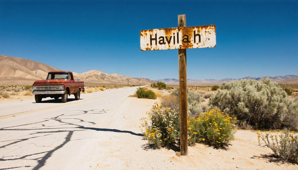
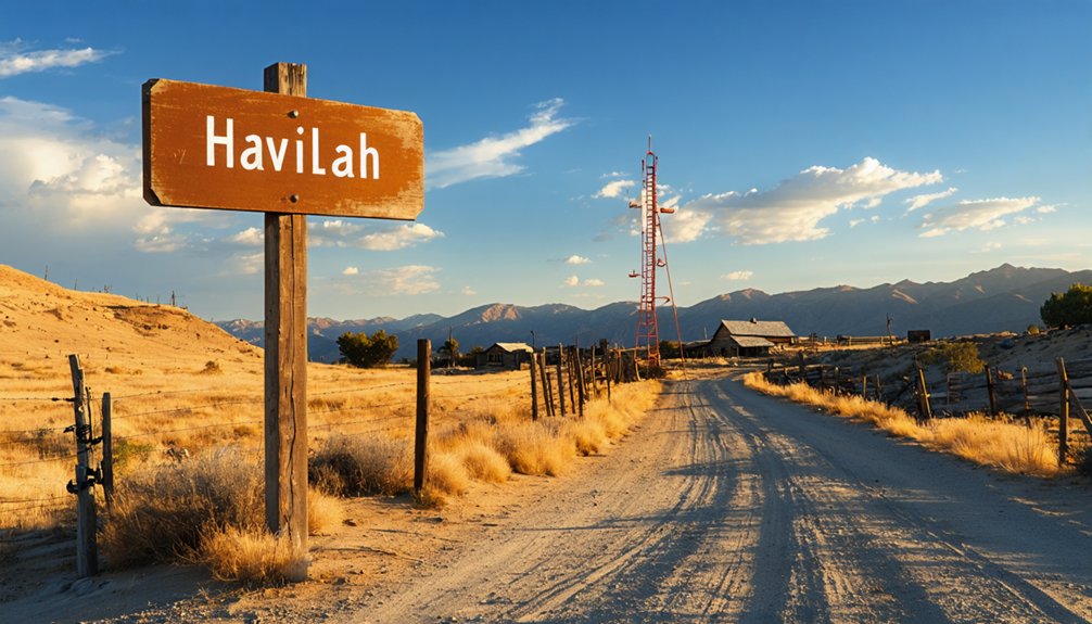
You’ll reach Havilah by driving the winding Caliente-Bodfish Road through Sequoia National Forest, five miles south-southwest of Bodfish at 3,136 feet elevation. This authentic Gold Rush ghost town reveals its best secrets during spring or fall when temperatures hover in the 50s-70s—perfect for exploring the surviving schoolhouse-turned-community center and historic cemetery that outlasted the 2024 Borel Fire. Roadside markers trace where 147 buildings and 13 saloons once thrived before gold ran dry in 1874, and there’s so much more waiting in these sun-scorched canyons.
Key Takeaways
- Havilah is located 5 miles south-southwest of Bodfish, accessed via Caliente-Bodfish Road through Sequoia National Forest at 3,136 feet elevation.
- Visit in spring or fall for ideal temperatures in the 50s-70s range; avoid summer heat and potential winter snow.
- Explore the surviving schoolhouse community center, historic cemetery, and California Historical Landmark #100 marking the 1864 gold discovery.
- Follow roadside markers creating a self-guided heritage trail where 147 buildings once stood, including 13 saloons.
- Drive from Bakersfield airport offers scenic canyon vistas en route to this former Kern County seat abandoned in 1874.
Getting to Havilah: Directions and Access Routes
Tucked into the rugged mountains where Havilah Canyon meets Haight Canyon, this weathered ghost town sits at 3,136 feet elevation, approximately five miles south-southwest of Bodfish in Kern County. You’ll navigate the Caliente-Bodfish Road to reach this remote settlement, following narrow winding roads that snake through terrain flanked by Sequoia National Forest.
The journey rewards you with scenic canyon vistas as elevations shift between 3,050 and 3,400 feet above sea level. Your adventure begins from Bakersfield’s airport (BFL), heading northeast into the San Joaquin Valley’s mountainous edge. Watch for milepost 279 where Havilah Canyon’s roadway drops into the valley floor.
Winter travelers should prepare for possible snow conditions, while summer brings clear passage through these isolated peaks rising over 1,000 feet above the canyon route.
What Remains After the 2024 Borel Fire
When you arrive in Havilah today, the scars of destruction stretch across the landscape where homes once stood, yet three landmarks pierce through the devastation like sentinels of survival. The old schoolhouse-turned-community center rises from the ash-blackened hillside, its walls somehow spared while neighboring structures collapsed around it.
Beyond the ruins, weathered headstones in the historic cemetery still mark graves dating back to the 1860s gold rush, standing witness to both the town’s original demise and its latest brush with obliteration.
Saved Schoolhouse Community Center
Among the charred ruins and ash-covered hillsides surrounding Havilah, the replica schoolhouse stands as a monument to both luck and quick thinking during the devastating 2024 Borel Fire. When flames ignited beneath the deck, a neighbor wielded a recently completed water system to stop the blaze’s advance.
You’ll discover this 1911-designed building now hosts community center operations managed by the Havilah Historical Society’s dedicated volunteers.
The structure’s survival showcases three critical elements:
- Strategic firefighting prioritization over adjacent museum buildings
- Immediate deck reconstruction by society members after fire suppression
- Ongoing historical society fundraising to support professional contractor restoration
This gathering space continues welcoming visitors seeking authentic pioneer heritage amid the mining-era plaques marking where California’s first Kern County school district began operation in 1866.
Old Cemetery Still Stands
While flames consumed foundations and reduced pioneer homes to ash pits across nearly 60,000 acres, Havilah’s old cemetery emerged from the Borel Fire’s fury remarkably intact. You’ll find weathered headstones standing sentinel where fire tornadoes raged through the valley, their inscriptions still readable while nearby structures melted into unrecognizable ruins. This preservation feels almost defiant—a sign, witness, or proof to something beyond mere luck.
The cemetery’s survival anchors future preservation efforts for this ghost town, offering tangible connection to Kern County’s mining heritage when so much else vanished. As you walk among the graves, you’re experiencing what firefighters deliberately protected: community memorials that outlasted the inferno.
Historical plaques along Caliente-Bodfish Road complement these markers, creating a heritage trail through a landscape where even the replica courthouse burned.
Historic Sites and Landmarks to Explore
Standing at the dusty crossroads where Caliente-Bodfish Road cuts through what remains of Havilah, you’ll find yourself surrounded by echoes of California’s gold rush glory days. The roadside markers create a self-guided journey through preserved artifacts of a vanished era, offering unique tourism opportunities for adventurers seeking authentic Western history.
You’ll discover three remarkable landmarks:
- California Historical Landmark #100 – marked by plaques near the Bodfish post office and original courthouse site, commemorating the 1864 gold discovery
- One-Room Schoolhouse Replica – Kern County’s first public school, miraculously saved from 2024’s devastating Borel Fire
- Old Havilah Cemetery – where weathered headstones reveal stories of boom-era settlers
Signs mark where 147 buildings once thrived, including thirteen saloons that fueled wild frontier nights.
The Story Behind California’s Gold Rush Ghost Town
Gold fever transformed a quiet valley in the southern Sierra Nevada foothills into Kern County’s first seat of power. You’ll find Havilah’s story echoes the classic boom-and-bust cycle that defined California’s gold rush era. When prospectors discovered rich deposits in 1864, mining operations quickly sprang up throughout the surrounding hills. The town became the county seat in 1866, drawing fortune-seekers who believed they’d strike it rich.
At its peak, the population history tells of a thriving community with saloons, stores, and government buildings. But like countless mining camps before it, Havilah couldn’t escape its fate. When the gold played out and the county seat moved to Bakersfield in 1874, residents abandoned their dreams and drifted away, leaving behind weathered buildings standing as monuments to ambition.
Best Times to Visit and Weather Considerations
Planning ahead pays off when you’re mapping out your journey to Havilah’s weathered remnants. Ideal exploration windows open during spring and fall when seasonal humidity levels drop and temperatures hover in the comfortable 50s-70s range. You’ll want to avoid summer’s punishing heat that’ll drain your wanderlust fast.
Spring and fall offer Havilah’s sweet spot—mild temps, low humidity, and none of summer’s relentless heat to sap your exploring energy.
Target these prime months for unrestricted exploration:
- March – 70°F highs, 10-mile visibility, and just 1.04 inches of rain create perfect ghost-hunting conditions
- November – Minimal precipitation (0.52 inches) keeps dirt roads accessible while 67°F days invite extended rambles
- February – Mild 64°F temperatures and stable atmospheric pressure support comfortable outdoor discovery
Winter months deliver pleasant daytime exploration, though you’ll face shorter daylight hours. Spring’s decreasing humidity and exceptional visibility make it your ultimate freedom pass.
Nearby Attractions in Kern River Valley
Your adventure doesn’t end when you leave Havilah’s dusty streets behind—the Kern River Valley spreads before you like a treasure map of California’s wildest offerings. Plunge into Tubatulabal tribal history at Kern Valley Museum, where Native American artifacts tell stories spanning centuries.
Silver City Ghost Town resurrects 1850s buildings—complete with Hollywood filming locations that’ve hosted countless Western productions. You’ll find haunted legends and authentic relics at every turn.
One of the most intriguing aspects of ghost town attractions in New Chicago is the eerie atmosphere that envelopes visitors. As you wander through the abandoned streets, you might stumble upon remnants of the past that tell stories of those who once lived there. Guided tours often include chilling accounts of ghostly encounters, adding an extra layer of excitement to your exploration.
Chase bigger thrills on the Kern River’s Class IV-V rapids or stand humbled beneath 275-foot sequoias on the Trail of 100 Giants. For quieter moments, cast your line where mountain-fed waters teem with trout, or explore cascading pools at 7 Teacups. Each mile reveals another reason why prospectors, outlaws, and dreamers chose this untamed corner of California.
Frequently Asked Questions
Are There Any Dining or Lodging Facilities Available in Havilah?
No, you won’t find any food availability or lodging options in Havilah’s dusty streets. This authentic ghost town offers pure exploration freedom, but you’ll need to venture 45 miles to Bakersfield for meals and accommodations.
Is the Old Havilah Cemetery Accessible to Visitors?
You’ll find this resting place of pioneers accessible for exploration. While historic preservation status remains documented through California’s landmark system, current maintenance conditions reflect nature’s quiet reclamation—weathered headstones standing sentinel where gold seekers once dreamed of fortune.
Do I Need a Permit to Visit Havilah?
You don’t need visitor permits required for Havilah’s public areas. However, respect private property restrictions—some historic buildings remain privately owned. You’re free to explore the cemetery and roadside remnants, but always honor posted boundaries and local rights.
Are There Guided Tours Available for Havilah’s Historic Sites?
No formal guided tours exist at Havilah—you’ll explore independently through self-guided walking tours among weathered remnants. Historical reenactments occasionally bring the past alive during special events, but mostly you’ll wander freely, discovering stories at your own pace.
What Safety Precautions Should Visitors Take When Exploring the Ruins?
Picture a crumbling wall suddenly giving way beneath your hand. You’ll need to bring sturdy shoes and avoid entering unstable structures—these century-old ruins weren’t built for tourists. Stay outside, photograph from safe distances, and preserve your independence by staying alert.


