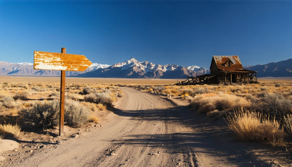
Your ghost town road trip to Heiner starts from Helper, Utah, just eight miles southeast along mixed pavement and dirt roads that wind through Carbon County’s mining country. You’ll navigate roughly 180 miles of route weaving past abandoned camps like Sunnyside and Standardville, so check Waze for real-time conditions before departure. Once there, you’ll explore foundation outlines, railroad remnants, and a deliberate grid layout that once supported 700 tons of daily coal production. The surrounding canyon holds stories of engineering ambition and frontier enterprise waiting beyond these weathered storefronts.
Key Takeaways
- Start from Helper, Utah and navigate roughly 180 miles through abandoned mining camps including Sunnyside, Standardville, and Latuda on mixed pavement and dirt roads.
- Check road conditions before departure using Waze for real-time traffic updates, as routes include unpaved sections through remote canyon terrain.
- Explore Heiner’s 11-acre core featuring stone foundations, adobe walls, Wells Fargo building, and remnants from the 1882 fire and 1923 mining peak.
- Note access restrictions with no trespassing signs and rock barriers limiting vehicle entry to certain areas of the ghost town site.
- Visit the visible east-west grid pattern with foundation sites, old railroad corridor, and 660×660-foot blocks marking the former company town layout.
The Story Behind Heiner’s Name Changes
The Utah ghost town of Heiner didn’t always bear that name—it started as Panther, a rough tent city that sprang up around the local mining operations. By 1914, you’d have found a one-room school, company store, and post office serving the community.
The transformation to “Heiner” came as recognition of Daniel Heiner’s influence—a man who’d walked 1,000 miles to Utah at age eight and overcame hardships faced by early Mormon colonists. His prominence grew through business ventures and the role of religion, eventually becoming President of Morgan Stake.
The 1923 construction of a four-room brick schoolhouse marked the town’s peak. Today, you’ll discover remnants of that pioneer enterprise: stone foundations and weathered storefronts standing as evidence to the Heiner family’s enduring legacy.
Getting to Heiner: Detailed Driving Directions
You can maximize your ghost town adventure by starting from Helper, Utah, and weaving through several abandoned mining camps before reaching Heiner’s remote basin.
I’ve mapped this route to include Sunnyside, Standardville, and Latuda—each offering crumbling structures and mining relics that tell southern Utah’s boom-and-bust story.
The full loop covers roughly 180 miles of mixed pavement and dirt roads, so pack extra water, fuel, and a detailed topo map since cell service vanishes once you leave Highway 10.
Route From Helper
Since Heiner sits practically within Helper’s backyard, getting there requires just a short local drive from the town’s central landmark at 1 Depot St. You’ll appreciate the convenient route planning—fire up MapQuest or Google Maps for turn-by-turn guidance along U.S. Route 6/191.
The minimal driving time means you’re looking at distances comparable to other close Utah pairs: think Erda to Stansbury Park’s 1.78 miles or Centerville to Farmington’s 4.39 miles.
I’ve made this drive myself, and you’ll find the route straightforward with Mountain time zone consistency throughout. Waze offers real-time traffic updates, though congestion’s rarely an issue on these backroads. Check current road conditions before departure, especially during winter months.
You’ll pass local gas stations and restaurants if you need provisions before venturing into ghost town territory.
Combining Multiple Ghost Towns
Planning a multi-ghost-town itinerary around Heiner transforms a quick stop into a full-day Carbon County mining heritage adventure. You’ll discover 16+ documented ghost towns clustered within this region, abandoned after changing economic circumstances ended Utah’s coal boom era.
Start at Coal City just 2 miles south on Highway 6/50, then navigate to Heiner’s Panther Canyon location before continuing to Castle Gate (4.2 miles), Royal/Rolapp Mine (5.2 miles), and New Peerless Mine (6.0 miles).
The Castle-Coal Country Driving Tour Guide maps these sites along evolving transportation networks that once connected thriving mining camps. You’ll need a vehicle capable of handling gravel and dirt roads—some locations sit beyond maintained routes. Plan six to eight hours for thorough exploration of mining equipment, structural remains, and canyon landscapes defining Carbon County’s industrial past.
What Made Heiner a Coal Mining Hub
The story of Heiner as a coal mining hub traces back to 1859, when Daniel Heiner walked 1,000 miles to Utah as part of his family’s migration west. He secured coal claims for his twelve children, establishing the Black Hawk mine as one of Utah’s finest operations.
His son Moroni revolutionized the region’s potential in 1907 by presenting President Theodore Roosevelt with a plan to open Carbon and Emery Counties‘ coal beds. Roosevelt’s approval transformed coal extraction techniques across 2,400 acres, with the mine reaching 500 tons daily by 1918 and 700 tons by 1923.
Coal transportation logistics improved dramatically when railroad tracks connected Price to Mohrland, enabling efficient shipment. By 1916, United States Fuel Company consolidated these operations into a $10 million enterprise.
The Transformation Into a Planned Company Town
As you stand among Heiner’s foundations today, picture the deliberate transformation from makeshift miners’ quarters to a genuine community.
Between 1911 and 1914, while Fullmer Brothers’ forty teams graded the railroad approach and Heyl & Patterson erected the massive tipple from Pittsburgh, workers and their families needed more than temporary shelter—they needed a town.
The Heiner family’s ranching experience taught them that stable operations required permanent infrastructure, so they built homes, stores, and gathering spaces that would anchor families to this remote canyon for decades.
From Boarding Houses to Homes
When miners first arrived at Heiner in the early 1900s, they pitched canvas tents across the windswept Utah landscape, creating a temporary settlement that would house them while they extracted coal from the Blackhawk Formation.
You’ll notice housing metamorphoses took shape by 1914, when the Liberty Fuel Company replaced those canvas shelters with permanent wooden and brick structures. The company built a one-room school and store, establishing work based residency that tied your livelihood directly to your address.
Community Infrastructure and Amenities
Railroad tracks began slicing through Carbon County’s rugged terrain in July 1911, when the Fullmer Brothers of Price and Orangeville commanded forty horse teams to grade the roadbed that would transform Heiner from an isolated coal prospect into an industrial nerve center.
You’ll discover that social institutions followed swiftly—the Pittsburgh-built Heyl & Patterson tipple anchored operations by October 1914, processing tons of coal daily.
The 1916 consolidation under United States Fuel Company‘s $10 million umbrella brought systematic civic infrastructure: company stores, schools, and recreation halls that defined planned mining communities.
Moroni Heiner’s leadership as vice president guaranteed the town bearing his name received modern amenities that attracted workers seeking autonomy alongside steady wages in Utah’s coalfields.
Life in Heiner: Stores, Schools, and Services
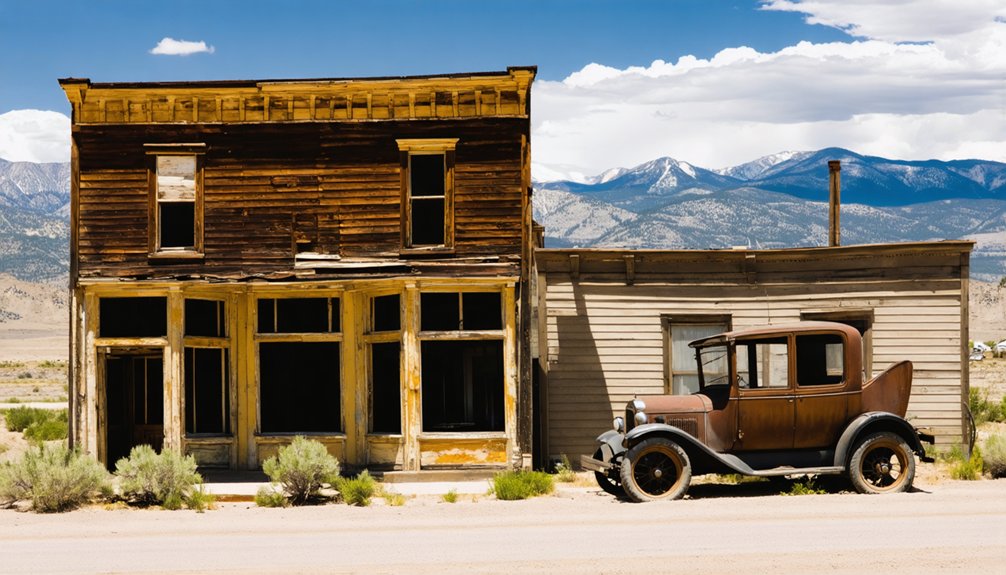
Though Heiner never achieved the bustling commercial districts of Silver Reef or Helper, this small mining settlement carved out its own modest infrastructure during its brief existence.
Unlike larger camps that sustained diverse services and functioning schools for decades, Heiner’s amenities reflected its transitory nature:
- Basic provisions – A small company store supplied miners with essentials, lacking the mile-long commercial strips of established towns
- Limited education – Any schooling likely occurred in makeshift spaces, unlike Ophir’s dedicated facilities
- Minimal services – No stagecoach stops or justice courts existed here, unlike Cove Fort’s elaborate operations
- Self-reliance required – You’d have traveled to nearby communities for specialized goods
This stripped-down existence characterized frontier mining life before settlements either boomed or disappeared—Heiner chose the latter path.
What You’ll Find at the Ghost Town Today
Today, Heiner exists as a shadow of its mining-camp origins—literally and figuratively. You’ll encounter stone foundations and adobe walls surviving from an 1882 fire, plus the Wells Fargo building and “hot box” jail. However, no trespassing signs and rock barriers restrict vehicle access, especially near recent uranium removal zones requiring environmental impact assessment.
Modern homes now surround the 11-acre core, with only select structures protected on the National Register. The eerie atmosphere intensifies when you consider burial sites discovery remains common throughout Utah’s ghost towns—many graves unmarked and forgotten.
While 1991 restoration efforts rebuilt certain buildings, you’ll mainly find skeletal remains: crumbling streets, partial church walls, and remnants stripped for materials decades ago. Desert isolation preserves what’s left of this violent boomtown past.
Exploring the Grid Layout and Railroad Remnants
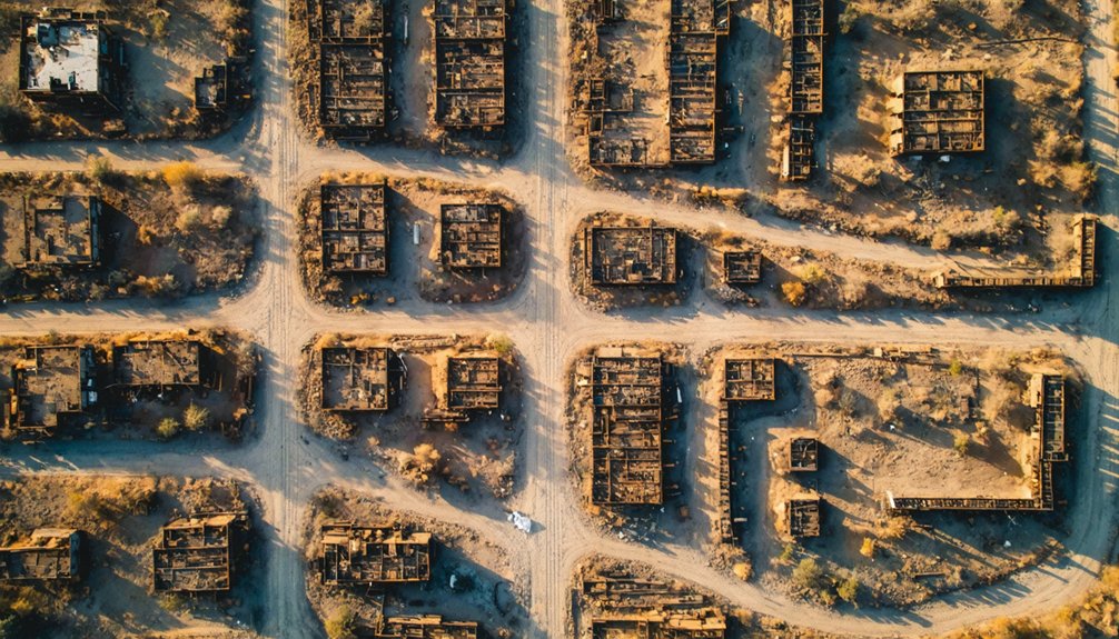
As you walk through Heiner’s remains, you’ll notice the deliberate east-west grid pattern that Frank Cameron laid out in 1913, with street alignments still visible where shade trees once lined the routes.
The old railroad corridor runs roughly parallel to the townsite, about a mile from where Helper sits today—look for the graded embankments and cuts that connected the mine to the Rio Grande main line.
Foundation sites dot the canyon floor near the small stream, marking where over 200 houses, the company store, and the school (whose bricks later ended up in Helper’s LDS church) once stood.
East-West Grid Pattern
Nine days after Brigham Young and his fellow pioneers first glimpsed the Salt Lake Valley in 1847, they’d already staked out a revolutionary street grid—one that would spread across Utah like a mathematical blueprint stamped onto the high desert.
Understanding these routing methodologies helps you navigate Heiner’s ghost town ruins:
- Block dimensions: Utah’s 660×660-foot squares create the largest blocks in the western U.S.
- Street widths: 132-foot intersections allowed ox teams full turning radius
- Numbering system: Addresses jump by hundreds from Temple Square outward
- Terrain adaptation: The grid persists from Wasatch peaks to western flats
You’ll find this pattern near Heiner, where section-line roads follow one-mile intervals. The system gives you freedom to explore without complex navigation—just follow the numbers.
Railroad Corridor Features
While Mormon settlers imposed order through their geometric street system, the Utah Railway carved an entirely different logic through these mountains—one dictated by gradient percentages, water-level routes, and the relentless physics of moving coal trains over 7,440-foot Soldier Summit. The railroad grade construction began in September 1912, with crews blasting through Price River Canyon on punishing 90-day deadlines. You’ll still find evidence of their tunnel engineering prowess—particularly that 500-foot bore near Thistle, the line’s longest penetration through solid rock.
The 1917 Mammoth Dam disaster proved nature’s indifference to human ambition, washing away 1,500 feet of track and halting operations for six months. Today, remnants of this coal-hauling corridor tell stories of engineering audacity: ghost grades clinging to canyon walls, abandoned tunnel portals, and rusting infrastructure reclaimed by sagebrush.
Foundation Sites Discovery
Walking Heiner’s townsite today, you’ll discover how that Mormon geometric precision translated into industrial reality—ten-acre blocks still legible beneath decades of sagebrush encroachment, their 132-foot corridors now ghost streets guiding you between crumbling foundations. The consolidated building layout reveals distinct residential and commercial zones through these foundations indicators:
- Concrete home bases cluster in organized rows, marking family dwellings
- Larger stone foundations designate former commercial structures and company buildings
- Rail-adjacent loading dock remnants showing coal transport integration into town design
- Scattered ties and ballast connecting foundations to spur lines
Navigate on foot using the grid pattern—it’s your blueprint to understanding how Utah Valley Saints’ city planning merged with Carbon County’s industrial demands, creating a surprisingly orderly mining camp.
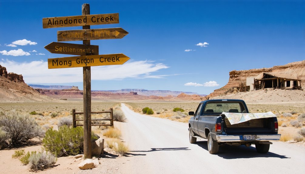
Nearby Ghost Towns Along Gordon Creek
The Gordon Creek Mining District harbors a trio of interconnected ghost towns that once formed the backbone of Carbon County’s coal operations. National, Consumers, and Sweet worked as a unified system, with shared company facilities including a post office, schoolhouse, hospital, and amusement hall. Each camp maintained its own store and well, giving miners essential independence while benefiting from collective resources.
You’ll find these sites nine miles west of Helper along Consumers Road, near Coal City. National’s red brick officials’ houses and 1930s blockhouses with indoor plumbing showcased the company’s investment. Mining equipment remnants and scattered foundations mark where thousands once worked. Active mining continues nearby, so exploration’s limited, but you can spot structural traces along upper Gordon Creek’s rugged terrain—testaments to boom-and-bust cycles that defined western coal country.
Combining Your Visit With Other Area Attractions
Beyond the coal camps of Gordon Creek, Utah’s ghost towns cluster near some of the state’s most spectacular natural landmarks, letting you pack multiple adventures into a single trip.
Utah’s ghost towns double as base camps for natural wonders, turning history hunts into multi-adventure expeditions.
Strategic Multi-Stop Routes:
- Grafton Near Zion – Combine Butch Cassidy filming locations with walking trails through the refurbished schoolhouse, then hit Zion’s scenic overlooks the same afternoon.
- Silver Reef to St. George – Explore sandstone silver mines north of Leeds, then spend evening hours in St. George’s historic district.
- Sego Canyon Double Feature – Score petroglyphs and ghost town ruins in one stop near Moab, with ancient rock art lining the access road.
- Nine Mile Canyon Art Gallery – Stretch your legs on walking trails past 40 miles of petroglyphs, some dating back 6,000 years near Thompson.
Each pairing maximizes your freedom to roam without backtracking.
Best Practices for Visiting Historic Mining Sites
While abandoned mining sites whisper stories of boom-and-bust fortunes, they also hide genuine dangers that demand your respect and preparation. Ghost town safety starts with avoiding unstable mine shafts—their collapsed timber supports won’t forgive curiosity. I’ve watched rattlesnakes sunbathe near crumbling foundations, reminding me why sturdy boots and watchful eyes matter.
Historic preservation ethics means leaving everything untouched. That rusted ore cart? Photograph it, don’t move it. Those weathered footprints in mine dust? They’re part of Heiner’s living timeline. Pack water, inform someone of your plans, and research site history beforehand—Tintic Mining Museum offers invaluable context.
Your freedom to explore comes with responsibility. Travel in groups, stay on established paths to prevent erosion, and report vandalism. These sites survive because visitors understand preservation protects adventure itself.
Frequently Asked Questions
What Time of Year Is Best for Visiting Heiner Ghost Town?
Visit Heiner during spring or fall when winter weather conditions won’t hinder your exploration. You’ll appreciate preservation efforts better in mild temperatures, giving you freedom to wander weathered structures and capture authentic photos without extreme heat or snow.
Are There Any Entrance Fees or Permits Required to Explore Heiner?
No formal fees or permits exist for Heiner, but you’ll need private property access since it’s on restricted land. Historical preservation concerns mean you should respect remaining structures and seek permission before exploring this remote ghost town.
Is Camping Allowed Near Heiner or Other Gordon Creek Mining Sites?
Yes, you’ll find primitive camping facilities nearby on BLM land. Respect the historical significance of mining sites by camping 300 feet away from structures. Follow 14-day limits and pack out everything—you’re preserving freedom for future explorers.
How Long Should I Plan to Spend Exploring Heiner’s Remnants?
Like a fleeting whisper from the past, you’ll need 1-2 hours to explore Heiner’s scattered stone remnants. Few historical preservation efforts exist here, leaving only local community memories and crumbling walls to tell their stories.
Are the Roads to Heiner Accessible for Standard Vehicles Year-Round?
No, road conditions to Heiner aren’t reliably passable year-round in standard vehicles. Seasonal accessibility depends heavily on weather—winter snow and spring flooding often block access. You’ll need to check UDOT resources before attempting your adventure there.


