You’ll find Hermanas 30-40 miles south of Deming along challenging desert routes demanding high-clearance vehicles and careful preparation. Spring and fall offer the most comfortable exploration windows, with temperatures between 50-70°F, while summer’s punishing heat makes midday visits treacherous. The lone surviving railroad section house stands amid crumbled foundations, its partial walls revealing construction techniques from the El Paso & Southwestern Railroad era. The journey requires self-sufficiency—limited services mean bringing ample water, fuel, and supplies as you discover how mining barons, railway ambitions, and desert farmers created this borderlands community.
Key Takeaways
- Travel 30-40 miles south from Deming (zip 88030) on challenging routes requiring high clearance vehicles and thorough preparation.
- Visit during spring or fall for mild 50-70°F temperatures; avoid June’s extreme heat during afternoon exploration.
- Expect minimal remains: only the railroad section house survives with partial walls and foundation fragments visible.
- Bring all supplies as no public services exist; remote desert location offers unobstructed views of Tres Hermanas Mountains.
- Explore the historic El Paso & Southwestern Railroad site that once connected Arizona mining camps through waterless desert.
Getting to Hermanas: Routes and Road Conditions
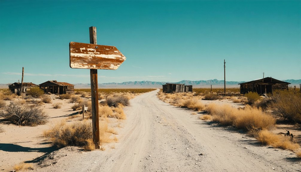
The journey to Hermanas begins in Deming, the county seat of Luna County, where paved highways give way to dusty backroads that slice through New Mexico’s Chihuahuan Desert. You’ll head south from Deming’s zip code 88030, traveling 30-40 miles through flat lowland terrain where civilization fades with each mile.
NM 9 runs along the southern border near the Tres Hermanas Mountains, while NM 11 links toward Columbus and the Mexican frontier. These challenging access routes demand high clearance and preparation—there’s no GPS reliability here. Limited public services mean you’re truly on your own once you leave Deming’s boundaries. Bring extra fuel, water, and supplies. This isn’t a casual Sunday drive; it’s an expedition into Luna County’s forgotten corners where freedom-seekers find authentic solitude.
What Remains: The Railroad Section House and Original Structures
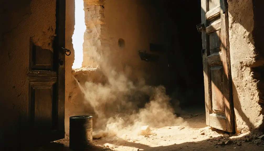
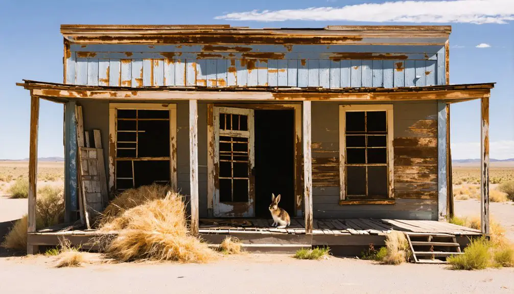
After traversing the rugged backroads, you’ll find precious little waiting at journey’s end. The railroad section house stands as Hermanas’ sole survivor—a weathered chronicle of the El Paso & Southwestern Railroad’s maintenance operations. This crumbling structure represents your entire cultural artifacts discovery in this desolate landscape.
One weathered section house remains—a skeletal testament to railroad maintenance operations where 150 frontier residents once thrived before abandonment claimed everything else.
What defines the section house architecture experience:
- Partial walls and foundation remnants reveal original construction techniques
- Desert elements have reclaimed most structural integrity over decades
- No other original buildings survived the ghost town’s abandonment
- The site offers unobstructed views toward Tres Hermanas Mountains
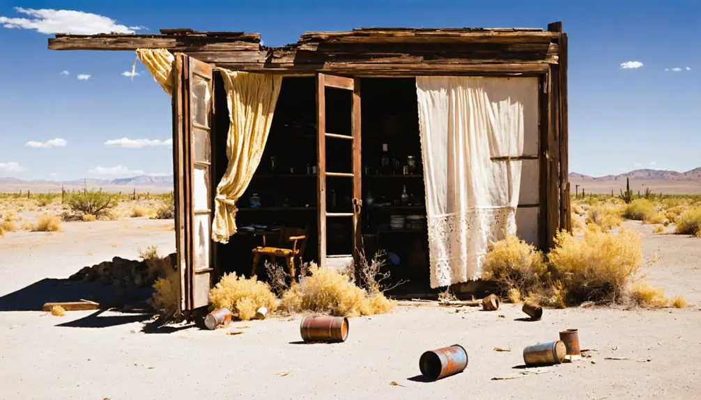
You’re witnessing authentic frontier decay here—no reconstructions or tourist trappings. Just honest ruins amid scrubland, where 150 residents once sustained a farming and stock community. The town’s post office operated from 1903 until 1925, serving the scattered homesteaders and railroad workers who called this remote outpost home. Like other railroad towns, Hermanas emerged when tracks were laid to connect remote settlements across the southwestern territories. The section house’s skeletal frame tells Hermanas’ entire story without embellishment.
Best Time to Visit the Desert Ghost Town
Planning your Hermanas expedition demands attention to the Chihuahuan Desert’s unforgiving temperament. Spring delivers ideal exploration conditions—March through May offers mild 50-70°F temperatures before thunderstorms threaten. You’ll find clear skies perfect for photographing local attractions and appreciating the town’s historical significance without summer’s brutal 96°F assault.
Fall mirrors spring’s hospitality, with September’s 83°F highs cooling to November’s comfortable 65°F range. Only three October rain days interrupt your desert wanderings. The area experiences minimal wind variation, with speeds ranging between 8 mph in summer and 11 mph during winter months, ensuring stable conditions for outdoor exploration.
Winter brings surprising mildness—48°F average lows mean accessible year-round exploration, though minimal snowfall occasionally dusts the abandoned structures. Despite the desert setting, humidity levels remain consistently high, creating atmospheric conditions that can intensify the perceived temperature during warmer months.
Avoid June’s peak heat when daytime temperatures make afternoon investigations punishing. The desert shows mercy in shoulder seasons, granting you comfortable passage through this weathered remnant of frontier ambition.
The Railroad Legacy: El Paso & Southwestern Line
Copper’s insatiable appetite birthed this desert iron giant in 1888, when Arizona’s mining barons chartered the Arizona and South Eastern Railroad to haul ore from Bisbee’s rich veins. By 1901, it transformed into the El Paso & Southwestern Railroad, conquering 1,200 miles of unforgiving terrain.
Railroad construction challenges shaped this legendary route:
- Stopping Southern Pacific trains to lay crossing tracks near Deming
- Building through waterless desert between mining camps
- Establishing Alamogordo as a company town for shops and lumber
- Connecting coal mining operations from Dawson to serve Phelps Dodge interests
You’ll find Hermanas positioned along these historic rails, where steam locomotives once thundered through hauling copper and coal. The EP&SW’s ambitious westward push created towns overnight before Southern Pacific absorbed the entire system in 1924, ending the independent line’s remarkable frontier journey. The Copper Queen Consolidated Mining Company financed the entire western line from cash reserves, demonstrating the mining industry’s profound control over territorial transportation development. By December 1902, the railroad completed building from Douglas to El Paso, establishing the critical eastern terminus.
Hermanas’ Agricultural and Ranching Heritage
Long before railroad tracks scarred this borderland, Pueblo Indians transformed the harsh desert into productive farmland using the ingenious Three Sisters method—corn, beans, and squash planted in symbiotic harmony. You’ll discover how this ancient intercropping system, dating to 1070 AD, let beans climb cornstalks while squash suppressed weeds below.
By the 1930s, traditional crop diversification expanded beyond subsistence—lettuce, onions, alfalfa, and especially chile peppers thrived here. Women’s agricultural leadership proved essential to this frontier’s survival. Emma Jean Cervantes, the legendary “Queen of Cayenne,” pioneered sustainable practices while managing vast operations across New Mexico and Mexico. Her foreman remained loyal for forty years, evidence of her vision. The Cervantes family’s agricultural roots ran deep in nearby La Mesa, where Emma Jean’s grandfather Andres Apodaca bought 500 undeveloped acres for $90 per acre, establishing a farming legacy that would span generations. The Three Sisters technique never required tilling the fields, which enhanced soil fertility and sustainability compared to conventional farming methods that depleted the land.
Today, Tres Hermanas Farm in Albuquerque resurrects these time-tested methods, training refugees in pesticide-free cultivation that honors Hermanas’ enduring agricultural spirit.
Exploring Nearby Ghost Towns: Hachita and Beyond
Just seven miles west of Hermanas, you’ll find the scattered remains of Hachita—actually two ghost towns bearing the same name. The original mining camp of Old Hachita clings to the Little Hatchet Mountains foothills where Apache Indians once extracted turquoise, while New Hachita marks the 1902 railroad stop that briefly revived the district’s fortunes.
Beyond these sister settlements, the surrounding mountains hide even older mining camps from the 1870s, creating a network of abandoned sites that traces southwestern New Mexico’s boom-and-bust mining legacy. Among the weathered remnants, you can still spot trash, tools, and glass bottles left behind by long-gone residents. Visitors should exercise caution around open vertical mine shafts that remain throughout the area, and the strong Border Patrol presence reflects the site’s proximity to Mexico.
Hachita Mining District History
The story of Hachita begins with the rhythmic tap of small stone hatchets against turquoise-rich rock, as Native Americans worked the Little Hatchet Mountains for centuries before Spanish explorers arrived and christened the area “Hachita”—small axe. These native american mining practices laid the foundation for later mineral wealth extraction when American prospectors discovered copper, lead, and silver in 1875.
By the 1880s, the Eureka Mining District thrived with 300 residents who carved out lives in unforgiving terrain:
- Three saloons and two general stores served miners’ needs
- Steam smelting works processed ore from American National, Hornet, and Gold King mines
- Railroad connections enabled ore shipments to distant markets
- Apache raids and desert heat tested every settler’s resolve
The boom ended when silver prices collapsed in 1893.
Multi-Town Route Planning
Beyond Hermanas’ weathered railroad section house, a network of forsaken settlements sprawls across New Mexico’s southwestern corner, each connected by ribbon-thin highways that slice through creosote-studded desert. You’ll navigate NM 9 west 24 miles to Hachita, where crumbling adobe walls mark both mining-era ruins and the railroad town that replaced them.
Extended loops access Hermosa’s flood-scarred valley, Chloride’s 1879 silver veins, and Hillsboro’s gold-rush legacy—each site bearing distinct historical significance through boom-and-bust cycles that defined territorial economies. These vanished communities reveal profound community impact: miners, ranchers, and railroad workers who carved existence from unforgiving terrain.
Spring and fall offer ideal conditions for multi-day circuits combining NM 152 and NM 52, transforming solitary exploration into thorough southwestern mining district immersion.
Photography Tips and What to Bring
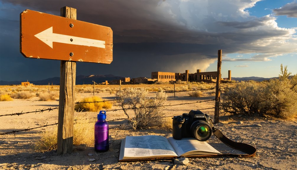
You’ll need a camera body with full manual controls and a sturdy tripod to capture Hermanas’ crumbling adobe walls and weathered structures in the harsh desert light.
Pack wide-angle zoom lenses like a 16-35mm to frame entire building facades, plus a telephoto 70-200mm to isolate distant architectural details against New Mexico’s vast sky.
Time your shoot for the golden hours just after sunrise or before sunset, when warm light rakes across textured surfaces and long shadows reveal the ghost town’s haunting character.
Essential Camera Gear
When photographing Hermanas and other ghost towns across the Southwest, your camera gear becomes as critical as your water supply—both determine whether you’ll capture the haunting beauty of these forsaken places or return with nothing but frustration.
Pack a mirrorless or DSLR body that handles shadow and light subtleties. Wide-angle lenses (16-35mm) frame vast abandonment scenes, while a versatile 24-70mm f/2.8 tackles most situations. Essential accessories include:
- Sturdy tripod for low-light interiors and deliberate compositions
- Flashlights and headlamps to illuminate forgotten corners
- Circular polarizer for deepening desert skies
- Cleaning kit for combating relentless dust
Remote locations mean equipment maintenance matters—spare batteries, memory cards, and lens cloths aren’t luxuries. There’s no spare parts availability when civilization lies fifty miles behind you.
Best Lighting Conditions
The sun’s position transforms Hermanas from mere ruins into a photographer’s cathedral of light and shadow. Golden hour bathes crumbling adobe in warm amber, revealing textures that midday’s harsh glare would obliterate.
You’ll want clear skies for high-contrast drama—shooting at noon carves deep shadows across doorways and collapsed walls. Time of day matters profoundly: blue hour’s fading twilight lets you light-paint structures against emerging stars at ISO 6400, while new moon nights expose the Milky Way’s arc over this high desert graveyard.
Don’t dismiss cloudy conditions, though. Overcast skies diffuse light beautifully, displaying intricate details in weathered wood and stone that harsh sunlight would wash away. Post-storm clarity offers the ultimate conditions for capturing Hermanas’s haunting essence.
Understanding the Rise and Decline of a Railroad Community
Railroad ambitions converged on this dusty New Mexico crossroads in 1902 when the El Paso & Southwestern Railroad drove its steel rails through the desert, connecting Texas copper smelters with Arizona’s Bisbee mines. Understanding the railroad construction timeline reveals how Hermanas transformed from empty rangeland into a critical watering stop along the South Line between Douglas and El Paso.
From empty rangeland to vital railroad watering stop—Hermanas emerged where desert ambitions met steel rails in 1902.
Regional economic shifts sealed the town’s fate:
- Silver demonetization in the 1890s collapsed nearby Lake Valley mines
- Railroad section houses replaced mining camps as economic anchors
- Cattle and wool shipments sustained the 150-person community through the 1920s
- Southern Pacific’s passenger service ended in 1952, abandoning the route
You’ll find only the skeletal section house remains today—a weathered monument to ambitions that once rolled through on iron wheels.
Frequently Asked Questions
Are There Any Facilities or Services Available in Hermanas Today?
No facilities or services exist in Hermanas today. You’ll find only abandoned buildings and infrastructure deterioration across this remote mining ghost town. It’s pure wilderness—no stores, lodging, utilities, or gas stations await your arrival here.
The history of hermanas, new mexico is steeped in tales of miners who once sought fortune in its rugged landscape. As the years passed, the population dwindled, leaving behind a silent testament to the hopes and struggles of those who once called this place home. Now, nature reclaims the land, shrouding the remnants of its past in an ever-thickening veil of foliage.
Exploring the best ghost towns in New Mexico reveals not only the remnants of a bygone era but also the stark beauty of the desert landscape. Each site tells a unique story of resilience and decline, inviting visitors to imagine the lives once lived among its abandoned structures. As you venture through these hauntingly beautiful places, the echoes of the past resonate, leaving a lasting impression on all who visit.
Is It Legal to Enter the Remaining Railroad Section House Structure?
You’ll need to investigate the structure’s legal status before entering, as railroad easements persist on private property. Consider preservation efforts and respect ownership rights—trespassing carries consequences. Check with local authorities or property records first for permission.
What Wildlife or Safety Hazards Should Visitors Be Aware Of?
Keep your eyes peeled for rattlesnake sightings during warmer months and watch for unstable structures and abandoned mine shafts. You’ll also encounter javelina, bears, and coyotes while exploring this wild, remote frontier territory.
Can You Camp Overnight Near the Hermanas Ghost Town Site?
No overnight camping’s available directly at Hermanas ghost town. You’ll find nearby camping opportunities in Animas, just minutes away, offering electric hookups and proximity to overnight accommodations. Rusty’s RV Ranch in Rodeo provides another freedom-seeking basecamp option.
Are There Any Guided Tours Available for Hermanas and Nearby Ghost Towns?
No guided tours exist for Hermanas, but you’ll discover self-guided walking tours at nearby Chloride and Lake Valley ghost towns. Their historic site preservation efforts let you explore independently, wandering sun-bleached streets and abandoned structures at your own adventurous pace.
References
- https://www.ghosttowns.com/states/nm/hermanas.html
- https://albuqhistsoc.org/SecondSite/pkfiles/pk220railroadboom.htm
- https://www.abandonedrails.com/hermanas-to-deming
- https://www.youtube.com/watch?v=Gi9ZDUcFu98
- https://www.american-rails.com/nm-lrrs.html
- https://newmexicoculture.org/exhibit/4338/19/working-on-the-railroad
- https://sfrhms.org/resources/structures/
- https://npshistory.com/publications/usfs/region/3/cibola/cultres6.pdf
- https://myperfectweather.com/api/cityinfo/35023Ani/degF/Average-Weather-in-Animas-New-Mexico-United-States-Year-Round
- https://weatherspark.com/y/8698/Average-Weather-in-Cerro-Gordo-Mexico-Year-Round