Planning a ghost town road trip to Homansville, Utah, starts in Eureka, just two miles southwest of the site. You’ll need a 4WD vehicle for unpaved roads and should visit between spring and fall for the best conditions. Once there, you’ll find crumbling foundations, scattered tailings, and pump house remnants where 300 residents once lived before the town’s abandonment by 1900. Keep exploring to uncover everything this forgotten Tintic Range mining camp has to offer.
Key Takeaways
- Homansville sits two miles northeast of Eureka, Utah, requiring a short detour off SR-6 on unpaved roads needing a 4WD vehicle.
- The abandoned mining town, once home to 300 residents, was fully deserted by 1900 and repurposed as a lime quarry in 1916.
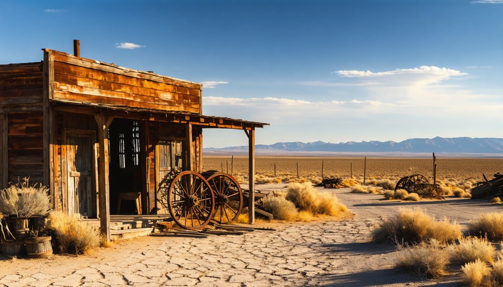
- Expect crumbling foundations, scattered tailings, and remnants of pump houses, but no standing structures or preserved buildings remain on-site.
- Combine Homansville with Knightsville, Mammoth, Ophir, and Mercur for a comprehensive Tintic ghost town loop covering 20–30 miles.
- Visit during spring or fall for ideal photography conditions, manageable temperatures, and the most reliable road accessibility.
What’s the History Behind Homansville, Utah?
Although it’s little more than a memory today, Homansville once hummed with the activity of a thriving mining community nestled two miles northeast of Eureka, Utah. Its Homansville origins trace back to Captain J.W. Gunnison’s survey party, where Sheppard Homans lent his name to this emerging settlement.
The town’s mining significance centered on water supply, as pump houses kept nearby operations running efficiently. At its peak, you’d have found 300 residents carving out a living in this rugged corner of the Tintic Range.
But when railroads arrived, favoring larger smelters over water-dependent operations, Homansville’s fate was sealed. By 1900, the town was abandoned, later repurposed as a lime quarry in 1916 before fading entirely into Utah’s high desert landscape.
How Do You Get to Homansville From Eureka?
Now that you know what drew settlers to Homansville, you’re probably wondering how to find what’s left of it.
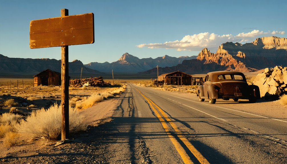
Start in Eureka, Utah, a historic town sitting two miles southwest of the site. Head northeast along local roads, taking a short detour off SR-6, and you’ll reach Homansville in roughly five minutes.
Homansville access requires some preparation. Expect unpaved roads, so a 4WD vehicle gives you flexibility and confidence on rougher stretches.
Pack wisely before heading out — unpaved roads make a 4WD vehicle your most reliable companion on this rugged route.
Spring through fall offers the best conditions for exploring this remote corner of Juab County.
Once you arrive, the terrain itself tells the story. Foundations, tailings, and scattered remnants preserve the area’s mining legacy in raw, unfiltered form.
Bring water, a map, and a camera — there are no facilities waiting for you out there.
What’s Actually Left at the Homansville Site Today?
When you arrive at Homansville, you’ll find the site stripped down to its bones — crumbling foundations, scattered tailings, and faint structural remnants of the pump houses that once kept nearby mines running.
The tailings mounds and rock debris tell the clearest story, marking where extraction operations hummed at their peak before the railroad shifted the economic tide.
Look closely at the pump house remains, because they’re among the most tangible evidence that a community of 300 people once built their lives around this remote patch of Utah hillside.
Ruins and Foundation Remnants
Silence greets you at Homansville — no standing walls, no preserved structures, just the stubborn remnants of a town that vanished before 1900.
What you’ll find are scattered stone foundations, earthen depressions, and pump house remnants half-swallowed by the Tintic Range landscape. These traces reward patient ruins exploration — you’ll need to walk the site carefully, reading the terrain for clues about where buildings once stood.
Bring a camera, because foundation photography here captures something genuinely evocative: geometric stonework overtaken by sagebrush, tailings mounds casting long shadows, and a stark Utah sky framing it all.
Chief Consolidated Mines repurposed this ground as a lime quarry in 1916, so expect quarry scarring alongside the original settlement traces.
Read the ground closely — it tells Homansville’s whole compressed story.
Tailings and Mining Evidence
Three distinct types of mining evidence dominate the Homansville site: tailings piles, quarry scarring, and the compressed earthen signatures of pump house operations.
Your tailings analysis begins the moment you arrive — these gray-white mounds tell Homansville’s mining history better than any written account.
Watch for these four evidence markers:
- Tailings piles: mineral-rich waste heaps revealing ore extraction patterns
- Quarry scarring: limestone cuts from Chief Consolidated’s 1916 lime operations
- Pump house depressions: flattened earth where water infrastructure once stood
- Scattered ironwork: corroded metal fragments from abandoned equipment
You’re reading a layered industrial timeline when you walk this ground.
Each feature represents a different operational era.
Bring your camera and document freely — this open landscape rewards curious, independent explorers who appreciate raw, unfiltered history.
Pump House Structural Remains
Although Homansville’s peak population once hit 300 residents, what you’ll find at the pump house site today is far more modest — compressed earth depressions, scattered concrete footings, and corroded ironwork that mark where the water infrastructure once operated.
The pump house itself has lost all structural integrity, leaving only fragments that hint at its original purpose: supplying water to nearby mining operations.
You’ll want to move carefully through the area, as uneven ground and buried debris create real hazards.
Look closely at surface-level remnants — bolt patterns in cracked concrete reveal equipment placement, while rusted pipe segments suggest the layout of water lines.
These understated details reward patient observers who appreciate reading a landscape stripped down to its industrial bones.
What to Bring and Watch Out for at Homansville
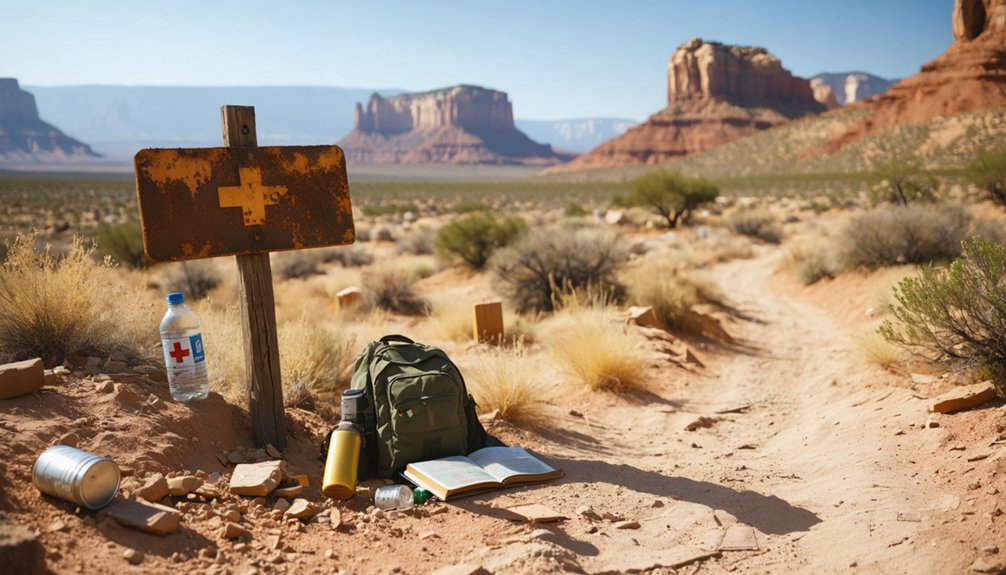
Before you head out to Homansville, pack water, a detailed map, and a 4WD-capable vehicle since you’ll face unpaved roads and zero on-site facilities.
Watch your step around old foundations and mine tailings, as unstable ground and open shafts can pose serious injury risks.
You’ll also want to respect any posted no-trespass signs, since portions of the site may still fall under active private mining claims.
Essential Gear To Pack
Packing the right gear can mean the difference between a rewarding ghost town adventure and a miserable slog through central Utah’s unforgiving terrain. Homansville sits on unpaved mountain roads, so come prepared with camping essentials and reliable navigation tools before you roll out.
Throw these into your rig before leaving Eureka:
- Water – At least two gallons per person; no facilities exist on-site
- Paper maps or GPS – Cell service drops fast in the Tintic Range
- 4WD-ready tires – Rocky, rutted roads punish unprepared vehicles
- First aid kit – You’re miles from the nearest help
Traveling light but smart keeps you free to explore without anxiety. The ghost town rewards prepared visitors with raw, untouched history that most travelers never discover.
Safety Hazards To Avoid
Homansville’s abandoned mining landscape looks peaceful from a distance, but the site hides real dangers that’ll catch you off guard if you’re not paying attention.
Old mine shafts and collapsed pump house foundations can appear suddenly beneath loose soil, so watch every step carefully. Bring proper safety equipment — sturdy boots, gloves, and a flashlight — because unstable ground and sharp debris demand real protection.
Don’t enter any structure or shaft opening, regardless of how solid it looks. Wildlife awareness matters here too; rattlesnakes favor rocky, sun-warmed terrain exactly like this, and you’ll encounter them without warning.
Scan the ground before stepping and check before reaching into crevices or brush. Stay alert, move deliberately, and you’ll keep your ghost town adventure from becoming an emergency.
The Tintic Ghost Town Loop: Homansville, Knightsville, and Mammoth
While Homansville makes for a rewarding standalone stop, you’ll get far more out of your day by stringing it into a full Tintic ghost town loop with Knightsville and Mammoth.
This compact circuit covers roughly 20–30 miles and immerses you in genuine ghost town culture and deep mining heritage.
Here’s how to structure your loop:
- Start in Eureka — explore its preserved downtown before heading northeast to Homansville.
- Swing through Knightsville — Jesse Knight’s famously saloon-free mining camp tells a unique story.
- Push on to Mammoth — scattered remnants reward curious explorers.
- Return via SR-6 — a straightforward route back to civilization.
Plan for spring through fall, pack your own water, and keep a paper map handy.
Other Tintic District Ghost Towns Worth Adding to Your Route
The Tintic District stretches well beyond Homansville, Knightsville, and Mammoth. If you’ve got time to extend your route, two additional ghost towns deserve a serious look.
Ophir sits near Tooele County and offers silver mining ruins with a mercury revival story that sets it apart from standard Knightsville history and Mammoth mining narratives. It’s compact, photogenic, and historically rich.
Mercur, another strong addition, ran on gold and mercury operations before its eventual abandonment. Its dramatic boom-bust arc mirrors the broader Tintic pattern you’ll already recognize from your earlier stops.
Both towns sit within reasonable driving distance, letting you build a fuller picture of Utah’s mining collapse without backtracking unnecessarily.
Pack your maps, fuel up in Eureka, and commit to the longer loop.
When Is the Best Time to Visit Homansville?
Once you’ve mapped out your extended Tintic loop, timing your visit to Homansville becomes the next practical question worth settling.
Spring and fall deliver the best conditions for exploration and photography tips worth following: golden light, manageable temperatures, and stable road surfaces.
- Spring (April–May): Wildflowers add seasonal attractions against crumbling foundations.
- Fall (September–October): Sharp light and cool air create ideal photography tips for ruins.
- Summer: Accessible but hot; start early and carry extra water.
- Winter: Mountain roads become unpredictable; 4WD becomes essential, not optional.
You’ll want dry, clear days regardless of season.
Mountain weather shifts fast, so check forecasts before heading northeast from Eureka.
Flexibility keeps your road trip moving freely.
Frequently Asked Questions
Was Homansville Ever Considered for Official Utah Historical Landmark Designation?
Surprise — bureaucracy hasn’t stamped Homansville with official approval! The available knowledge doesn’t confirm its landmark designation, but you’ll recognize its historical significance meets landmark criteria through Tintic District records and Carr’s ghost town guides.
Are There Guided Ghost Town Tours Available in the Tintic Mining District?
You’ll find guided explorations of the Tintic Mining District’s rich mining history through local operators and Eureka’s historical society. They’ll take you through ghost towns, sharing fascinating stories of boom-and-bust frontier life you won’t forget!
Can You Camp Overnight Near the Homansville Site Legally?
Coincidentally, you’ll find no designated campsites near Homansville! Camping regulations require checking with Juab County and BLM offices for overnight permits. You’re free to explore — just secure proper permissions before pitching your tent nearby.
How Does Homansville Compare in Size to Other Tintic District Towns?
You’ll find Homansville history shows it’s smaller than most Tintic mining peers — peaking at just 300 residents compared to larger hubs like Mammoth and Eureka, which dominated the district’s booming silver and gold operations.
Are Any Homansville Artifacts Preserved in Local Eureka Museums?
Local museum exhibits might hold Homansville artifacts — check the Tintic Mining Museum in Eureka! You’ll likely discover preserved relics, documents, and mining tools that tell this ghost town’s fascinating story firsthand.
References
- http://www.expeditionutah.com/forum/index.php?threads/ghost-town-homansville-utah.5931/
- https://onlineutah.us/homansvillehistory.shtml
- https://capitolreefcountry.com/ghost-towns/
- https://www.youtube.com/watch?v=vWLVdD4W98E
- https://www.familysearch.org/en/wiki/Utah_Ghost_Towns
- https://www.youtube.com/watch?v=brCXNENu9D4


