Planning your Jerryville ghost town road trip requires realistic expectations—you’ll find absolutely nothing but forest at coordinates 38°25′32″N 80°18′40″W. The mining camp vanished completely by the late 1940s, leaving zero trace of its converted rail car homes. You’ll need topographic maps since the railroad corridor offers the only reliable approach, though parking’s challenging. Maximize your journey by combining Jerryville with nearby Thurmond’s wild gambling history and Nuttallburg’s dramatic industrial ruins along the New River Gorge for a complete ghost town adventure.
Key Takeaways
- Use coordinates 38°25′32″N 80°18′40″W to locate Jerryville’s remote site, as no signs, trails, or physical structures remain today.
- Access via the railroad corridor route, but expect parking challenges and seasonal limitations from spring floods and winter snows.
- Bring topographic maps for navigation since vanished railroad tracks and complete forest reclamation leave few reference points.
- Combine Jerryville with nearby Nuttallburg and Thurmond ghost towns to maximize your trip and explore multiple historic mining sites.
- Respect private property boundaries and prepare for wilderness hiking through a completely erased camp with zero tangible history.
The Rise and Fall of Jerryville Mining Camp
When flat rail cars rolled into the West Virginia hills around 1947, they carried more than just supplies—they hauled the very homes that would form Jerryville. You’d find halved box cars planted twenty feet from the tracks, each side sheltering one family behind flimsy curtain dividers.
Living conditions at Jerryville were grim—cramped quarters in a dungeon-like setting where sunlight rarely penetrated. Worker safety concerns plagued every shift as miners descended into the darkness, facing double dangers from both the coal face and unreliable infrastructure.
The camp’s existence proved as temporary as its housing. By the late 1940s, Jerryville vanished, leaving no trace. Today, even the railroad tracks are gone, swallowed by reclaiming forest.
What Remains at the Jerryville Site Today
The forest has reclaimed every trace of Jerryville. You’ll find nothing but overgrowth conditions when you arrive—no buildings, foundations, or streets marking where hundreds once lived.
The railroad tracks that defined this camp’s layout have been stripped away, leaving only bare earth where boxcar-sized houses once stood twenty feet from the rails. Recent visitors managed to salvage a single piece of rail as proof the town existed at all.
No signs guide you here, no trails cut through the wilderness. The elementary school, church, and company housing have vanished completely since the mine closed in the early 1960s. Your search for remnant artifacts will likely prove futile—this ghost town offers freedom from modern intrusion, but zero tangible history to touch.
Getting to Jerryville: Directions and Access Tips
Finding Jerryville requires determination and a willingness to navigate unmarked terrain in one of West Virginia’s most remote corners. You’ll venture into Webster County’s backcountry using coordinates 38°25′32″N 80°18′40″W as your guide, though standard GPS may falter in these hollows.
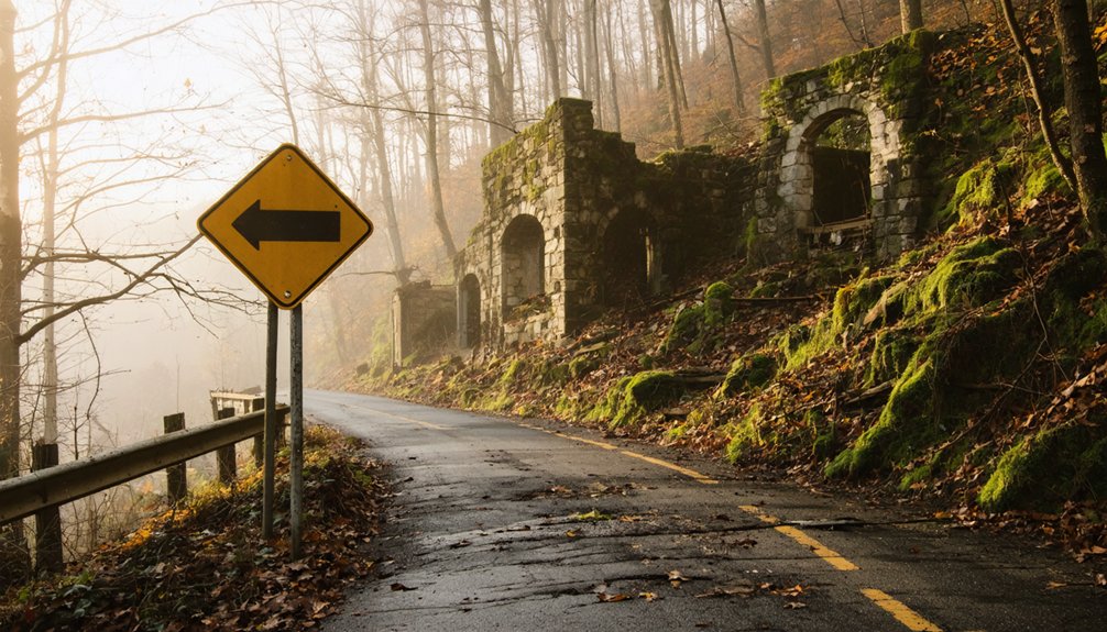
The former railroad corridor offers the most reliable approach, but parking logistics demand creativity—there’s no designated lot, so you’ll need to find safe roadside pulloffs on county routes. Seasonal accessibility varies dramatically; spring floods and winter snows can render dirt roads impassable for weeks.
Come prepared with topographic maps, as the vanished tracks leave few reference points. Property boundaries blur in these forgotten valleys, so respect private land and tread carefully through what remains of this railroad ghost town.
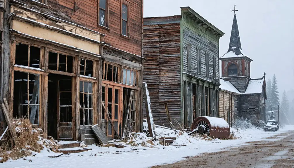
Thurmond: the Ghost Town With the Wildest History
You’ll find Thurmond’s wild past written in gunpowder and greenbacks—this railroad hub once moved more freight than Cincinnati while hosting a 14-year poker game that landed in Ripley’s Believe It or Not.
The Dun Glen Hotel across the river saw so many murders and gambling deaths that management installed a mortuary in the basement. At its 1920s peak, trains roared through every few minutes carrying New River coal while shootouts punctuated card games in smoke-filled back rooms.
Shootouts and Poker Violence
Captain William D. Thurmond’s Baptist prohibitions couldn’t contain the chaos erupting across the New River. At Dun Glen Hotel, you’d find bootleg liquor sales fueling deadly confrontations where high-stakes poker games turned violent.
Ripley’s Believe It or Not documented a 14-year continuous poker game here—the world’s longest—but the real story lies in the bloodshed. Killings became routine as passions flared over cards, whiskey, and the prostitution business thriving in basement rooms.
You’d witness bodies pulled from the river, like the dead man found with $80 still in his pocket—fined posthumously for carrying a pistol, then dumped in potter’s field. One pastor observed the only difference between Hell and Thurmond was the river running through town.
Peak Freight Handling Era
Beyond the violence and vice, Thurmond’s real power came from its position as the freight-handling capital of West Virginia. During boom period freight volumes in the early 1900s, this tiny town processed more cargo than Cincinnati—an almost unbelievable feat.
You’ll find it hard to imagine today, but 18 rail lines converged here, transforming Thurmond into the essential refueling stop along 73 miles of track. Coal from surrounding mines poured through daily, creating a logistics empire in the mountains.
Then the impact of diesel locomotive technology hit like a sledgehammer. Steam engines no longer needed constant refueling stops. Thurmond’s strategic advantage evaporated overnight. The massive C&O engine house and water tanks became monuments to obsolete technology, standing empty while freight trains roared past without stopping.
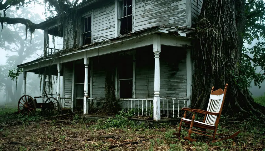
Exploring Nuttallburg and Dun Glen Along Your Route
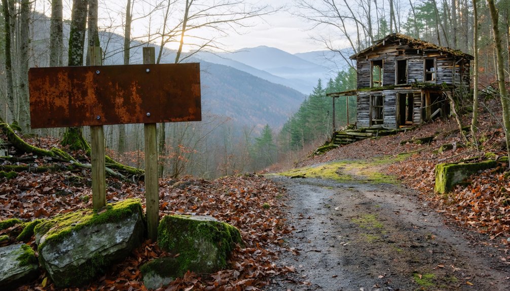
As you wind through the serpentine curves of Route 16 toward Jerryville, the crumbling remnants of Nuttallburg emerge from the dense West Virginia forest like a half-remembered dream. This 1870 coal town—four miles south of Fayetteville near Winona—offers unparalleled hiking opportunities through its industrial skeleton.
You’ll discover architectural relics from Henry Ford’s 1920s modernization: steel tipple ruins, foundations of 110 company houses, and the Roebling suspension bridge spanning the New River. The “smokeless” coal seam that once employed 125 miners lies silent above the old C&O line.
Park at the National Park Service trailhead and descend into the gorge, where coke ovens and mining structures cling to limestone cliffs. Nearby Dun Glen provides additional exploration before continuing your ghost town pilgrimage.
Planning Your Complete West Virginia Ghost Town Adventure
Stringing together multiple ghost towns requires strategic route planning, since these abandoned settlements scatter across southern West Virginia’s rugged terrain like forgotten puzzle pieces. You’ll maximize your adventure by clustering locations geographically—Thurmond, Kaymoor, and Quinnimont all fall within New River Gorge National Park boundaries, while Sewell’s coke ovens connect through Babcock State Park. Stotesbury sits slightly south in Raleigh County, making it an ideal final stop.
Plan your ghost town route by clustering locations—Thurmond, Kaymoor, and Quinnimont create a perfect New River Gorge circuit through abandoned coal country.
Essential planning considerations:
- Download offline maps since cell service drops in hollows
- Pack hiking boots for Kaymoor’s 821-stair descent
- Bring 4×4 vehicle or check road conditions for Sewell access
- Respect historic preservation efforts by leaving artifacts undisturbed
Connect with local community involvement through ranger stations—they’ll share hidden access points and recent discoveries. These conversations often reveal the human stories behind industrial ruins.
Frequently Asked Questions
Are There Any Safety Concerns When Visiting Abandoned Mining Camp Sites?
Yes, you’ll face potential hazards like unstable structures, hidden dangers including open shafts, and toxic residues. You’re exploring at your own risk, so stay alert, watch your footing, and never venture into deteriorating buildings or underground passages.
What Facilities or Amenities Are Available Near These Ghost Town Locations?
You’ll find the Thurmond NPS Visitor Center in a restored depot offering historical exhibits and trail information. However, available food options and nearby lodging accommodations are limited—you’ll need to venture outside these ghost towns for essential amenities.
Is Permission Required to Access Private Property at These Sites?
Yes, you’ll need permission. Respect private ownership, obtain landowner consent before exploring Jerryville’s remnants. West Virginia law demands it—trespassing risks $1,000 fines and jail time. Check Webster County property records, contact owners directly, and you’ll explore freely and legally.
What’s the Best Time of Year to Visit West Virginia Ghost Towns?
You’ll find fall ideal for exploring ghost towns when seasonal weather conditions bring comfortable temperatures and stunning foliage. Local tourism trends show fewer crowds after summer, giving you freedom to wander abandoned sites without battling peak-season visitors.
Are Guided Tours Available for Any of These Abandoned Mining Communities?
You’ll find guided side-by-side vehicle tours exploring Thurmond, Prince, and other abandoned coal towns throughout New River Gorge. While Jerryville lacks official tours, you can take self-guided tours and discover educational exhibits at nearby ghost town sites independently.