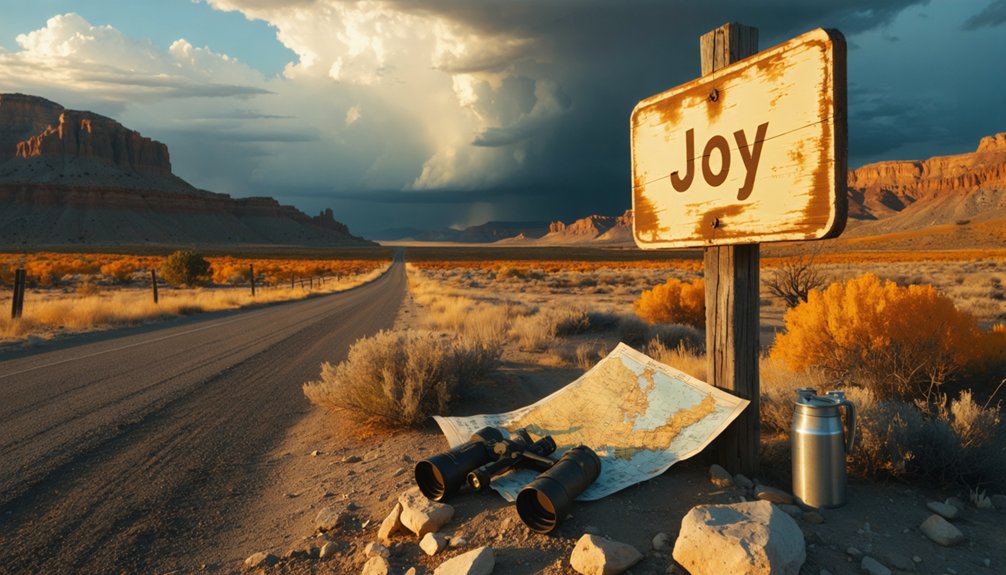
From Delta, Utah, you’ll drive 10 miles north on US-6 before turning west onto Brush Highway‘s 31-mile gravel stretch. At the unmarked four-way intersection, swing southwest for seven miles of dirt road—high-clearance vehicles essential. Joy’s weathered foundations emerge at 39.572097°N, 113.061445°W, nestled against the Drum Mountains at 5,919 feet elevation. You’ll discover crumbling structures, the Black Boy mine complex‘s shafts and adits, and two lonely grave markers beneath star-filled skies. The journey ahead reveals everything you’ll need for this backcountry adventure.
Key Takeaways
- Joy ghost town sits in Utah’s remote Drum Mountains at 39.572097°N, 113.061445°W, elevation 5,919 feet in Juab County.
- Drive north 10 miles on US-6 from Delta, then west 31 miles on Brush Highway gravel road.
- Turn southwest at the unmarked four-way intersection onto dirt road for final 7 miles to townsite.
- High-clearance vehicle and desert driving experience required to navigate unmarked backcountry roads and rugged terrain.
- Explore crumbling foundations, Black Boy mine shafts, and enjoy exceptional stargazing in this 1872 mining district.
The Mining Legacy of Harry Joy and Charles Howard
Deep in Utah’s remote Drum Mountains, two ambitious mining engineers from Detroit staked their claim on what they believed would become a profitable venture. Harry Joy and Charles Howard arrived in 1872, bringing pioneering mining technologies to extract manganese, copper, silver, and gold from the unforgiving terrain near Mount Laird. They established the Detroit Mining District and founded the town bearing Joy’s name, creating a hub for independent prospectors seeking their fortune.
These influential regional figures developed the Black Boy mine complex, featuring elaborate shaft and adit systems that challenged conventional extraction methods. Joy later channeled his mining success into founding the Packard Motor Company, while Howard continued operations in Utah’s backcountry. Their partnership exemplified the risk-taking spirit that defined America’s mining frontier. The settlement’s isolated location, positioned southeast of the Fish Spring Range, made transportation of ores and supplies increasingly expensive and difficult. Today, visitors can still find two modern grave markers at the site, silent witnesses to the human stories that unfolded in this desert mining camp.
Where to Find Joy Ghost Town in Utah’s Remote Desert
You’ll find Joy’s abandoned townsite at coordinates 39.572097, -113.061445, perched at 5,919 feet in Juab County’s desolate western reaches.
From Delta, head 10 miles north on US6, then turn west onto Brush Highway for 31 miles until you reach an unmarked four-way intersection. Turn southwest onto the unnamed dirt road and proceed for 7 miles until reaching Joy.
The gravel roads leading to Joy’s empty site are well-graded and accessible, though exploring the southeast mines scattered across the surrounding hills requires high clearance or 4WD to navigate the unmaintained desert tracks. The foothills contain remnants of mining operations, including the notable Black Boy complex that once anchored this remote district. Among the district’s remains, you’ll discover remnants of buildings and mining equipment from Joy’s history as a mining settlement.
GPS Coordinates and Location
Tucked into the remote Drum Mountains of Juab County, Joy’s crumbling remnants sit at GPS coordinates 39.572097° N, 113.061445° W—a pinpoint in Utah’s vast desert that marks what was once a thriving mining camp. You’ll find the site at approximately 5,919 feet elevation, surrounded by geological features that drew prospectors over a century ago.
The coordinates place you in the heart of the historic Detroit mining district, where graded gravel roads converge at a four-way intersection seven miles from the townsite. Various mapping sources list slightly different coordinates—39.5727254° N, 113.0585782° W appears on some references—but all cluster within a narrow range, directing you to the same stone foundations and scattered relics. Two modern grave markers stand at the site, silent sentinels in an otherwise vanished townscape.
Lady Laird Peak rises to the southeast, marking mining operations that once sustained this forgotten outpost. Nearby historic sites include the Simpson Springs Pony Express Station, Fort Deseret, and the Morrison Charcoal Ovens, which served the region’s mining operations.
Route From Delta
From Delta, Utah, your journey to Joy begins with a straightforward 10-mile northbound stretch on US-6, where the highway cuts through sagebrush flats with the Pahvant Range rising to the east.
Your 48-mile route unfolds as follows:
- Turn west onto Brush Highway – gravel road conditions remain excellent for 31 miles, offering scenic viewpoints along route of the vast Sevier Desert stretching endlessly westward
- Watch for the unmarked four-way intersection – your critical turning point where wilderness truly begins
- Swing left (southwest) onto the unnamed dirt road – civilization fades behind you as basin and range country dominates
- Follow this track seven miles to Joy’s weathered remnants, where 1870s mining dreams still whisper through collapsed timber frames
High-clearance vehicles access southeastern mining areas beyond the main townsite. The foothills surrounding the townsite contain remnants of mining operations, including the notable Black Boy complex with its network of shafts and adits.
Terrain and Access Requirements
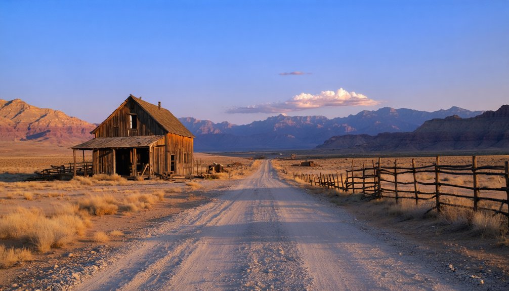
Joy’s weathered foundations emerge from Sevier Desert’s alkaline flats at 5,919 feet elevation, nestled against the eastern slopes of the Drum Mountains where ancient lakebed sediments meet volcanic upthrust rock. You’ll navigate unmarked dirt roads through this rugged backcountry—watch for the unsigned left turn pointing toward Mount Laird, then continue seven miles until Joy materializes on your right. The remote terrain access demands high-clearance vehicles and desert driving experience, as washboarded tracks and scattered mining debris challenge even seasoned explorers.
Historical isolation explains why this manganese operation shuttered quickly—difficult transportation challenges made ore shipment economically impossible. Today, that same seclusion grants you absolute freedom to wander crumbling foundations without crowds. Approach deteriorating structures cautiously; a century of desert winds has weakened what miners left behind. The site appears on the Lady Laird Peak USGS topographic map, helping modern explorers pinpoint this obscure settlement’s exact location in the vast desert expanse. High elevation and low humidity combine with minimal light pollution to create exceptional stargazing conditions after sunset.
Getting There: Routes and Road Conditions
Reaching this remote ghost town requires traversing a series of well-maintained desert roads that’ll test your sense of adventure without punishing your vehicle. Your journey begins on paved US-6, shifting to desert exploration through strategic turns and unmarked intersections where GPS becomes your trusted companion.
As you continue, keep an eye out for signs of the past that peek through the desert foliage. Many adventurers seek to explore ghost towns in Utah, where remnants of a bygone era create an intriguing contrast against the arid landscape. Each stop along the way reveals stories waiting to be uncovered, making every mile a discovery in this forgotten part of the world.
Among these intriguing locations are several ghost towns near Clear Lake, Utah, each possessing unique histories that draw in curious travelers. The remnants of these settlements, often accompanied by rusted mining equipment and abandoned structures, evoke a sense of nostalgia and wonder. As you wander through, the silence is punctuated only by the whispers of the wind, telling tales of the lives that once thrived in these desolate areas.
Adventure meets accessibility on this desert route—challenging enough to feel remote, tame enough for careful navigation with standard vehicles.
The Route Breakdown:
- Highway to Backcountry – Drive 10 miles north of Delta on US-6, then pivot west onto Brush Highway for 31 miles of maintained gravel
- The Unmarked Turn – At the four-way intersection, swing left onto the unnamed dirt road stretching 7 miles to Joy’s remnants
- Standard Vehicle Territory – Graded surfaces accommodate regular clearance cars during dry conditions, though weather forecast considerations matter
- Mining Road Adventures – Southeast exploration demands high-clearance 4WD, especially with seasonal accessibility changes affecting unmaintained tracks
Upon arrival, you’ll find the townsite itself largely vanished from view, though two grave markers stand as quiet reminders of Joy’s earliest residents who settled this desert mining district in 1872.
What Remains at the Abandoned Mining Site
After traversing the desert labyrinth of roads, you’ll discover that Joy guards its secrets through absence rather than spectacle. The 1872 settlement that once anchored the Detroit mining district has vanished, leaving only scattered stone foundations barely visible against the earth. Two modern grave markers stand sentinel by the roadside—stark reminders of humanity’s fleeting claim on this harsh landscape.
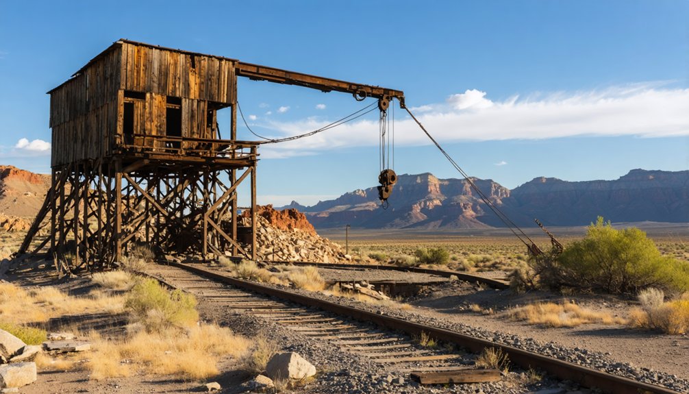
The real treasures lie southeast in the foothills, where the Black Boy Complex clings to existence. Named for dust-blackened miners emerging from underground, these workings showcase deteriorating structural integrity of remnants—wood framing still visible in accessible shafts. Evidence of past prospecting appears throughout: bulldozer scars, reopened adits, and reclamation attempts that ultimately surrendered to time and economics.
Mining Relics and Structures to Explore
The Black Boy Complex sprawls across the southeastern foothills like a monument to industrial ambition, its skeletal remains offering the most substantial exploration opportunities near Joy. You’ll discover notable mining artifacts scattered across deteriorating terrain where historic preservation concerns take a backseat to nature’s relentless reclamation.
Key structures worth investigating:
- Processing facilities with concrete walls, mysterious metal mesh attachments, and cylindrical water storage tanks embedded in dugout buildings
- Intact wood-framed shafts defying reclamation efforts, though unmarked openings demand extreme caution during approach
- Stone utility buildings near ore processing areas, connected by enigmatic roads leading toward upper mining sites
- Telegraph pole remnants crowning hilltops where miners once communicated with distant civilization
Bore holes puncture cliff faces while foundations stubbornly grip mountainsides—tangible evidence of 150-year-old hard rock operations.
The Grave of Matt Evans and Other Historical Markers
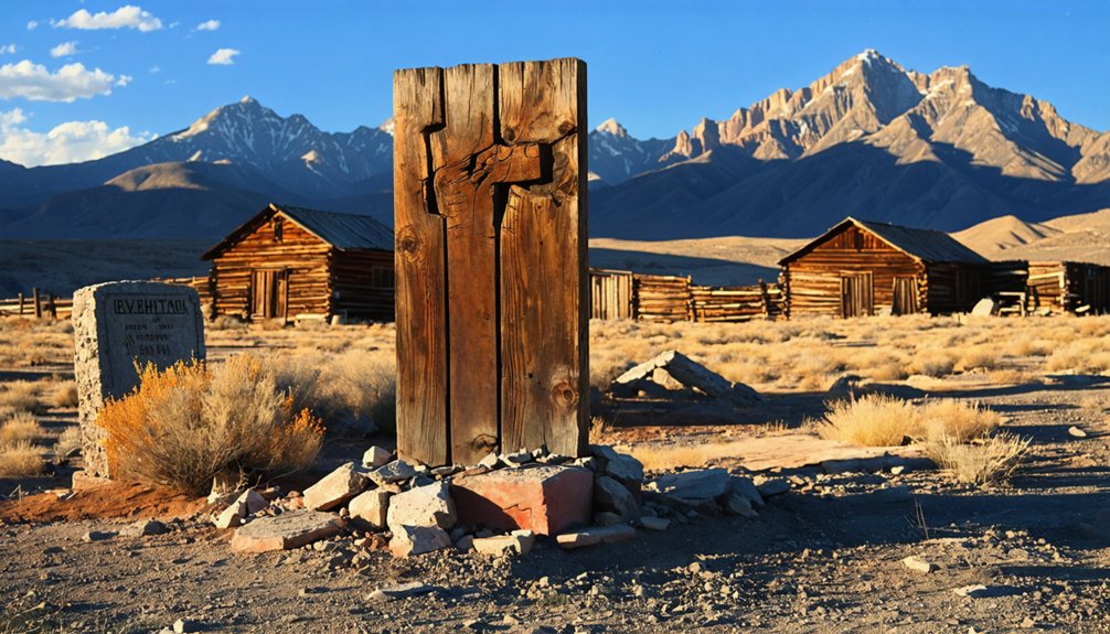
Near Joy’s four-way intersection, a solitary grave marker stands as the ghost town’s most poignant historical artifact—the final resting place of Matt Evans, a 19-year-old who froze to death after being ejected from a local bar.
Restored on August 8, 1999, this grave marker replaced the original weathered headstone. You’ll find it easily accessible for gravesite photography, with the desert landscape providing a stark backdrop that captures Joy’s harsh realities. The Great Basin Museum maintains digitized images as part of their historical preservation efforts.
Many visitors initially confuse this site with “No-Nose Maggie’s” grave, but that’s actually Mary Ann Devitt, Joy’s postmaster from 1899-1919, buried in Eureka. Evans’s grave predates her tenure, making it one of Joy’s oldest documented burials and your chance to connect with authentic frontier history.
Activities and Adventures Around the Ghost Town
Beyond paying respects to Joy’s departed residents, you’ll discover this remote ghost town serves as a launching pad for genuine desert adventures.
Offroad thrills and scenic viewpoints await:
- ATV exploration – Sandy trails lace through lower hills and connect forgotten mining roads leading to Black Boy facility, with minimal traffic (roughly one vehicle per hour) ensuring uninterrupted rides across open desert.
- Mine remnant investigations – Peer inside graffiti-marked shafts, examine multi-level workings, and photograph weathered equipment scattered among stone buildings and concrete-walled dugouts.
- Primitive camping – Set up dispersed camps throughout BLM-managed terrain, surrounded by desert silence and proximity to exploration routes.
- Extended adventures – Spot wild horses roaming Millard County’s west desert or tackle nearby Notch Peak’s 3,000-foot cliff face for extraordinary scenic viewpoints.
Best Times to Visit and Weather Considerations
You’ll find the best conditions for exploring Joy’s weathered structures during late summer through fall, when temperatures settle into comfortable ranges and dirt roads remain reliably passable.
Winter snowfall can render the route treacherous or completely inaccessible, particularly if you’re driving a standard vehicle without four-wheel drive. Always check weather forecasts before departing, as summer monsoons can trigger flash floods that transform dry washes into dangerous torrents within minutes.
Summer-Fall Optimal Seasons
- June solstice period – 15 hours of exploration time with temperatures averaging 86/51°F
- July-August dry spell – Minimal precipitation guarantees reliable dirt road access
- September sweet spot – Reduced crowds, comfortable 79°F highs, enhanced fall lighting
- Early fall changeover – Pleasant conditions before November’s freezing temperatures arrive
Pack for 30-degree temperature swings and inform someone of your route.
Winter Access Challenges
While summer and fall offer ideal conditions for exploring Joy, winter transforms this remote ghost town into a potentially inaccessible and hazardous destination. Snow accumulation impacts unmaintained dirt roads leading to the site, often blocking passage for weeks.
Unpredictable winter weather conceals mining hazards—open shafts and adits become invisible traps beneath snowdrifts, while ice-coated foothill trails turn treacherous.
You’ll face temperatures plunging below freezing nightly, with daytime highs barely reaching 40°F. Wind chill during short daylight hours compounds exposure risks. Gravel roads receive no winter plowing, and UDOT typically closes seasonal routes November through May.
Low visibility during snowstorms obscures unmarked intersections along Brush Highway, leaving you stranded in sandy desert terrain where frozen surfaces increase skid risks and limit your exploration freedom.
Flash Flood Awareness
Flash floods transform Utah’s serene desert landscapes into deadly torrents within minutes, and Joy’s remote location places you squarely in this danger zone. Your flood preparedness determines whether this adventure becomes a memorable journey or a survival situation.
Critical awareness measures for your visit:
- Monitor monsoon patterns – Avoid July through September when isolated severe storms dump quarter to half-inch rainfall, triggering instant flooding in dry washes surrounding ghost towns.
- Check National Weather Service alerts – Daily forecasts reveal marginal risks including 60 mph winds and flash flood probabilities specific to southern Utah’s slot canyons.
- Recognize burn scar dangers – Post-wildfire areas channel muddy torrents with zero warning, mimicking 2005’s devastating southwest Utah floods.
- Build community resilience – Share real-time conditions with fellow explorers, creating networks that enhance everyone’s safety in these unpredictable backcountry environments.
Essential Supplies and Safety Precautions for Your Trip
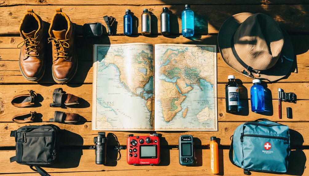
Before you set off into the high desert wilderness surrounding Joy, Utah, gather the gear that’ll keep you safe on these remote gravel roads and abandoned mine sites. Pack your portable first aid kit, sun protection, and plenty of water for this backcountry adventure.
As you venture deeper, consider exploring ghost towns near Fruita, which offer a glimpse into the past and fascinating stories of the settlers who once called them home. The remnants of these abandoned buildings can often be seen dotting the landscape, each site revealing unique histories waiting to be uncovered. Ensure you have a camera ready to capture the haunting beauty of these desolate locations.
The best seasons for Utah ghost towns are typically spring and fall, when temperatures are more moderate and the scenery is breathtakingly vibrant. During these times, the contrasts of the red rocks and the golden hues of the surrounding foliage create a striking backdrop for exploration. Don’t miss the chance to immerse yourself in the local history and capture the essence of the past in your photos.
Mapping mining site locations becomes crucial when maneuvering the unmarked four-way intersection and exploring hidden trails through lower hills. Your park tour app and physical maps will guide you through thirty-one miles of graded gravel along Brush Hwy.
Avoiding unmarked hazards means staying alert around open shafts with dome-shaped roofs just twelve inches thick. Never enter these crumbling structures—view Black Boy’s tailing piles from safe distances instead.
Bring your headlamp, multi-tool, and portable charger for extended exploration through this ghost town’s sandy terrain.
Frequently Asked Questions
Are There Any Camping Fees or Permits Required to Visit Joy Ghost Town?
You won’t pay camping fees or need permits at Joy Ghost Town since it’s on public land. However, you’ll want to take safety precautions for the remote desert terrain and guarantee you’ve got adequate camping availability backup plans.
Can You Collect Artifacts or Mining Relics From the Site?
Hands off—you can’t collect artifacts or mining relics from Joy. Federal law protects these pieces of local mining history, preserving the historical significance of artifacts for everyone. Violating this risks $20,000 fines and imprisonment, so just photograph instead.
Is Cell Phone Service Available Anywhere Near Joy Ghost Town?
You won’t find cell phone service at Joy Ghost Town—signal strength is nonexistent and carrier availability is zero. The remote desert location offers complete disconnection. Delta, 40-50 miles away, provides your nearest coverage for emergencies.
Are There Any Nearby Ghost Towns Worth Visiting in the Same Trip?
You’ll find several ghost towns within driving distance. Silver City and Mammoth offer abandoned mines to explore, while Knightsville provides scenic overlooks of Juab County’s rugged terrain. Each site delivers that untamed desert freedom you’re craving.
What Wildlife Might You Encounter in the Drum Mountains Area?
You’ll spot mule deer grazing among sagebrush at dawn and dusk, while pronghorn antelope roam open valleys. Watch for rattlesnake presence near rocky outcrops—they’re common in warmer months. Hawks and golden eagles soar overhead throughout your adventure.
References
- http://www.expeditionutah.com/forum/index.php?threads/ghost-town-joy-juab-county-ut.5412/
- https://onlineutah.us/joyhistory.shtml
- https://ghost-towns.close-to-me.com/states/utah/joy-ut/
- https://www.mapquest.com/us/utah/joy-ut-ghost-town-784847678
- https://visitmillardcounty.com/attractions/joyghosttown/
- https://www.youtube.com/watch?v=_Q_MurSaRyM
- https://www.blm.gov/visit/joy-townsite
- https://umbrasearch.org/catalog/f32df6ebeb8a8b0d2d4c38ab7d6c23634d7b11a4
- https://utahrails.net/pdf/Driving-Tour-Guide_Castle-Coal-Country.pdf
- https://www.mojaveunderground.com/forum/forum/adventure/trip-reports/492-joy-utah-drum-mountains-juab-county-utah-2008


