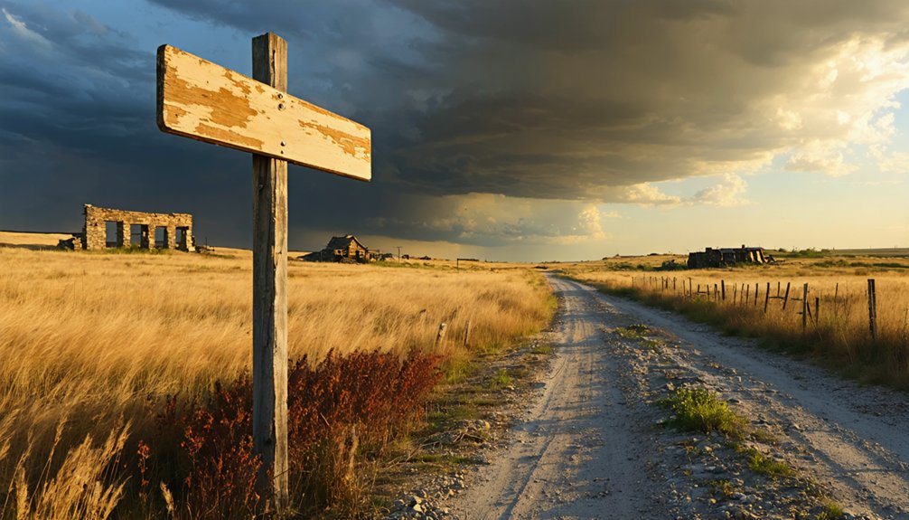
You’ll discover southeastern Kansas’s most atmospheric mining heritage along a 12-mile gravel road loop connecting Rochester’s intact 1880s church and weighing station to Kansapolis’s tornado-damaged foundations. Start at Rochester’s three surviving structures—the standing church building, Professor Barber’s schoolmaster house foundation, and the deteriorating coal weighing station that once documented regional bituminous distribution. The route preserves tangible evidence of coal communities that doubled Cherokee County’s population by 1900, with additional context awaiting those who explore the complete historical corridor.
Key Takeaways
- Kansapolis and Rochester are mining ghost towns in southeastern Kansas established during the coal boom of the 1880s-1900s.
- Rochester features three main structures: a standing church, schoolmaster’s house foundation, and deteriorating coal weighing station.
- The church building remains the most intact architectural survivor from the town’s 1880s origins.
- Professor Barber’s house foundation shows 20×30-foot dimensions with partial walls, marking the dual-purpose schoolhouse and teacher residence.
- Visit the coal weighing station to see the original platform scale documenting Rochester’s 1880-1920 coal distribution operations.
Historical Background of Kansapolis and Rochester Mining Communities
When coal seams first emerged along southeastern Kansas hillsides in the mid-1800s, prospectors recognized the region’s underground wealth would fundamentally transform Cherokee County’s agricultural landscape.
You’ll discover that Missourians began extracting coal near present-day Weir by the late 1860s, establishing “gopher hole” drift mines along outcropping beds. The coal mining industry impact accelerated dramatically when the first underground shaft mine opened near Scammon in 1874, drawing workers who doubled the county’s population by 1900.
Mining-dependent settlements materialized around extraction sites, with Kansapolis and Rochester exemplifying this expansion. Coal companies constructed mining camps to house miners and their families, creating self-contained communities with company stores, schools, and churches. Kansas’s subsurface mineral wealth extended beyond coal, as salt beds discovered in 1887 at shallow depths revealed ancient deposits from the Permian Sea that once covered the region. The rise and fall of mining towns followed production peaks—1917 and 1918 each yielded 7.25 million tons—before mid-1970s mineral depletion ended operations, leaving ghost communities behind.
What Remains at the Rochester Ghost Town Site
When you visit Rochester today, you’ll find three primary structures that anchor this former mining community to its 1880s origins.
The standing church building represents the town’s most intact architectural survivor, while nearby foundation remnants mark where the schoolmaster’s house once stood.
Between these landmarks, the deteriorating coal weighing station offers tangible evidence of the mining operations that defined Rochester’s economic purpose. Like many Kansas communities, Rochester experienced decline of the railroad, which contributed to its transformation into a ghost town.
Rochester stands among the over 3,800 ghost towns that have been researched across the country, reflecting the broader pattern of abandonment that shaped America’s landscape.
Standing Church Structure Today
Across Kansas’s abandoned settlements, religious structures demonstrate remarkable resilience against decades of neglect and environmental degradation. You’ll find St. Mary’s Church still standing in Densmore, while trees have completely overtaken the red-brick Methodist Church nearby. In Centropolis, both Christian and Baptist churches remain open despite minimal population.
Lyona preserves its century-old church, still hosting occasional services alongside the 1870 school building. The architectural features of these structures—stone foundations, solid timber frames, and careful craftsmanship—explain their survival where homes and businesses crumbled. In Bazaar, an active Methodist Church continues to serve the community alongside a historic school and a few scattered homes. Once the largest cattle shipping point in Kansas during the 1920s, Bazaar has transformed into a quiet settlement with mostly newer houses and only a handful of remaining businesses.
Religious heritage preservation efforts vary by location: Lecompton offers student-narrated tours past Constitutional Hall, while Quindaro’s Western University ruins face restricted access. The 115-year-old Harlem Baptist Church, fire-damaged in 2021, represents what’s often lost when protection fails.
Original Schoolmaster’s House Foundation
Though vegetation now obscures much of its perimeter, the foundation of Professor Barber’s residence marks one of Rochester’s most significant educational remnants within the Kansapolis ghost town cluster. You’ll find concrete and limestone blocks outlining a 20×30-foot structure near the original school grounds, with partial walls rising 1-2 feet at the eastern edge.
The interior layout reveals decayed floor joists and exposed metal hardware from 1870s construction. This dual-purpose building served as both schoolhouse and teacher housing until the 1890s, costing approximately $300 through subscription funding. Early settlers often relied on Indians to help peel bark for cabin roofs, and similar construction techniques may have been employed in Rochester’s initial buildings before more permanent structures replaced them. The preservation status remains stable despite freeze-thaw cracking and 50% height reduction since 1920s abandonment.
Access the site via dirt road spring through fall, wearing sturdy footwear to navigate uneven terrain safely. The area’s educational heritage extends beyond Rochester, as nearby Pittsburg’s Department of Drawing and Design was established in 1910 under Lyle I. Bower, reflecting southeastern Kansas’s commitment to academic development during the early twentieth century.
Coal Weighing Station Remains
Behind the Old Schoolhouse’s weathered frame, you’ll discover the coal weighing station—a modest timber structure that documents Rochester’s participation in the regional coal distribution network from 1880-1920. The original platform scale remains intact, preserving the coal weighing process where wagons rolled across empty, drivers selected their fuel from segregated piles, and workers hand-shoveled loads through sizing screens.
This architectural preservation captures the manual labor economy that defined frontier commerce before mechanization transformed such operations. Inside, you’ll find farm implements alongside exhibits detailing regional agriculture—berry cultivation and dairy operations that sustained independent livelihoods. The station sits behind and to the right of the Old Schoolhouse. Kansas coal was a good grade bituminous variety with favorable heating value, prized throughout the regional trade networks. The historical society provides access upon request, allowing you to examine this evidence of self-reliant commerce and the physical demands that characterized economic freedom in territorial Kansas.
Exploring the Kansapolis Ruins and Tornado-Damaged Structures
When you arrive at Kansapolis, you’ll find a landscape where coal mining prosperity has dissolved into scattered remnants. The church, schoolmaster’s house, and coal weighing foundation stand as primary survivors of both economic collapse and natural devastation.
Tornado remnants mark this site’s violent transformation after mining cessation, with destroyed structures creating minimal evidence of the 924 residents who once thrived here. Mining company impacts remain visible through nearby strip mine scars that sustained operations until final abandonment.
The 1964 school closure signified the town’s definitive end. You’re free to explore these unguarded ruins, where nature reclaims industrial footprints. Document the remaining houses before weathering erases them completely—these structures represent Kansas’s authentic mining heritage, preserved only through visitor awareness and photographic records.
Best Route for Your Ghost Town Road Trip

After documenting Kansapolis’s weathered structures, you’ll need a strategic route that maximizes your access to northeastern Kansas’s most historically substantial ghost town sites. Begin at Irving and Bigelow in Marshall County, then proceed to Barrett’s cemetery with its historic headstones.
Continue to Norway and Talmo in Republic County before heading south through Franklin County to Centropolis, located ten miles northwest of Ottawa via county roads. Road conditions vary considerably—gravel segments add 30-60 minutes to your journey.
Property access requires careful navigation; Oil Hill’s townsite near El Dorado remains private, viewable only from the turnpike overpass. End at Richland’s ruins in Shawnee County, accessible through local roads. This 150-mile loop preserves your autonomy while respecting boundaries and maximizing documentation opportunities across unincorporated communities.
Diamond Springs Cemetery and Surrounding Points of Interest
The cemetery at Diamond Springs stands as the sole visible remnant of a community that once served as the “Diamond of the Plains” along the Santa Fe Trail. You’ll find 182 documented memorial records here, with headstone inscriptions dating to the 1860s and 1870s marking early immigrants who arrived before the town’s official 1887 organization. The historical cemetery layout reveals the settlement’s diverse population, including Russian Mennonites who arrived in the late 1870s and African American residents who comprised a significant percentage of the community.
Beyond the burial grounds, you can explore scattered stone ruins from the original mail station complex—remnants of Samuel Kingman’s 1865 observations of three two-story stone buildings. The spring itself now feeds a concrete cistern on private Diamond Spring Ranch property, accessible only with permission.
Dunlap and the Black Settler Colony Heritage
Your journey continues to Dunlap, where Benjamin “Pap” Singleton established one of Kansas’s most significant Black settler colonies in 1878 on 7,500 acres of government land. The Singleton Dunlap Farm Colony attracted 300 Exodusters fleeing post-Reconstruction violence, each purchasing 40-80 acre plots and building a complete community infrastructure including churches, four schools, and the Freedmen’s Academy.
You’ll find the Dunlap Colored Cemetery—listed on the National Register in 2018—preserving the graves of pioneers like Columbus Johnson and Ralph Maddox, marking this critical chapter in Kansas’s abolitionist legacy.
Dunlap’s 1878 Founding Story
Spring 1878 marked a pivotal moment in Kansas settlement history when Benjamin “Pap” Singleton, born enslaved in Nashville, Tennessee in 1809, selected Dunlap as the site for his third and most ambitious freedmen colony. Having escaped bondage in 1846, Singleton orchestrated the purchase of 7,500 acres of government land at $1.25 per acre, establishing what would become his most successful venture.
The colony’s foundation rested on principles of economic self-sufficiency:
- Individual land parcels ranged from 10 to 160 acres, requiring settlers to purchase their own homesteads
- Down payments started at just $1 to $2 per acre for larger plots
- The role of Presbyterian Church became central through the 1880 establishment of the Freedmen’s Academy
Black Pioneer Community Life
Beyond Singleton’s initial land acquisition, Black settlers transformed Dunlap into a thriving self-contained community through their purchases of 40- to 80-acre plots at $1 to $2 per acre. You’ll discover how over 300 residents built complete independence by December 1880, operating their own blacksmith shop, bank, hotel, flour mill, and butter factory after white merchants excluded them.
Religious and social institutions anchored community life—Methodist and Baptist churches rose shortly after arrival, hosting annual Emancipation Day celebrations each September 22nd until 1931. Educational developments included the Presbyterian Church’s Freedmen’s Academy, founded by Andrew Atchison in the 1880s for university preparation, operating alongside three other separate schools mandated by white hostility.
The settlement’s half-mile-distant cemetery, established in 1880 after white objections, preserves this autonomous Black pioneer legacy.
Connecting Abolitionist Historical Sites
While Benjamin “Pap” Singleton’s escape via the Underground Railroad in 1846 shaped his future as an Exoduster leader, his 1878 establishment of Dunlap Colony directly connected Kansas’ abolitionist legacy to post-Reconstruction Black settlement. You’ll discover how Black abolitionist influences transformed 7,500 acres of former Kaw Indian Reservation into self-governing communities.
Visit these heritage sites:
- St. Paul African Methodist Episcopal Church – worship center reflecting spiritual autonomy
- Freedman’s Academy – educational pillar serving both Black and white residents
- Dunlap Colored Cemetery (National Register, 2018) – final resting place of Columbus Johnson and founding pioneers
- Dunlap Colored School – important evidence of community-driven learning
Early Black enterprise efforts created businesses, farms, and social organizations achieving self-sufficiency by 1880. The Atchison, Topeka, and Santa Fe Railway provided essential market access for these determined settlers.
Additional Sumner County Rail Towns Worth Visiting
The railroad’s ambitious expansion across Sumner County created a constellation of small towns that thrived on grain shipments and livestock commerce throughout the late nineteenth century. You’ll discover additional historic railroad communities like Perth, which anticipated the Kansas City, Lawrence and Southern Kansas Railroad in 1879 before the Atchison, Topeka and Santa Fe finally arrived in 1888. The town peaked at 240 residents by 1910 as a livestock shipping point.
Hunnewell served as a railhead for cattle drives after Caldwell, connecting to the Chisholm Trail’s endpoint. Rome, Corbin, and Drury round out your exploration of these remarkable agricultural roots—each featuring grain elevators and stores before declining post-1910. These settlements offer tangible evidence of how rail access shaped independent frontier communities.
Safety Considerations and Access Tips for Remote Sites
Exploring abandoned settlements demands careful preparation since most Kansas ghost towns occupy private property without maintained access roads. Access permissions must be secured before entering any site—trespassing laws apply even to deteriorated structures. Contact county historical societies or local landowners to establish legitimate entry rights.
Legitimate access requires advance permission—historical exploration rights don’t override private property laws protecting even abandoned Kansas settlements.
Essential precautions include:
- Structural assessment – Abandoned buildings pose collapse risks from rotted flooring, unstable walls, and compromised foundations
- Seasonal weather hazards – Spring flooding, summer heat exposure, and winter ice create dangerous conditions on unmarked rural roads
- Emergency communication – Cell service remains unreliable in remote areas; carry GPS devices and inform others of your itinerary
- Documentation equipment – Bring cameras, measurement tools, and notebooks while wearing sturdy footwear and protective clothing
Your autonomy depends on responsible exploration practices that respect property boundaries and preserve remaining historical artifacts.
Combining Your Trip With Other Kansas Historical Destinations
Since Kansapolis sits within a state containing over 6,000 documented ghost towns, strategic route planning transforms a single-site visit into extensive historical documentation. You’ll find concentrated clusters in Rooks County with 20+ sites including Amboy and Cresson, while Neosho County offers extinct towns along the Missouri, Kansas & Texas Railway.
Empire City’s remnants near Galina provide mining-era context, and Pawnee’s restored 1855 territorial capitol connects legislative history. Document community oral histories at sites like Dunlap, where descendants of the 1878 Singleton colony maintain preservation records.
Local preservation efforts have catalogued Diamond Springs’ post-1863 structures and Perth’s schoolhouse foundations. Rice County’s Crawford and Galt, plus Kent in Reno County, create efficient routing patterns for broad archival photography and site assessment across multiple historical periods.
Frequently Asked Questions
Are There Any Restaurants or Gas Stations Near Kansapolis and Rochester?
Like tumbleweeds marking forgotten crossroads, you’ll find limited local dining options near Kansapolis’s ghost town remnants. Gas station availability requires planning ahead—Winchester’s three miles distant. Rochester’s Crossroads District preserves culinary heritage through documented sandwich shops and breweries.
Can I Camp Overnight at the Ghost Town Sites?
Camping availability at these abandoned sites isn’t documented in official records. You’ll need to verify overnight accommodations through local county offices, as preservation regulations vary. Always respect private property boundaries and historical site protection ordinances before planning your stay.
Is Cell Phone Service Available in These Remote Areas?
Coverage availability varies considerably in Rochester’s ghost town area. You’ll find limited signal strength from major carriers due to tower distance. Check address-specific maps from Verizon, T-Mobile, or AT&T before departing to document your independent exploration reliably.
Do I Need Permission to Explore Private Property Ruins?
Yes, you’ll need permission before exploring private property ruins. Obtaining landowner consent protects your freedom to explore legally while respecting private property boundaries. Trespassing charges aren’t worth the risk—contact owners or historical societies first.
What’s the Best Season to Visit These Kansas Ghost Towns?
Spring and fall paint the perfect canvas for your exploration—mild temperatures let you document ruins comfortably. Fall foliage frames photographic records beautifully, while winter solitude offers unmatched quietness, though harsh conditions challenge your freedom to roam safely.
References
- https://www.hhhistory.com/2019/05/ghost-towns-of-kansas.html
- https://www.youtube.com/watch?v=bIyEsOezCTo
- https://thewanderingpigeon.com/2015/10/03/day-of-kansas-ghost-towns/
- https://www.youtube.com/watch?v=KBXINX0xqnU
- https://www.kcur.org/arts-life/2022-04-09/ghost-towns-are-all-around-kansas-city-if-you-know-where-to-look
- https://www.youtube.com/watch?v=dF7vGl5xasI
- https://legendsofkansas.com/neosho-county-extinct-towns/
- https://en.wikipedia.org/wiki/List_of_ghost_towns_in_Kansas
- https://legendsofkansas.com/coal-mining-in-kansas/
- https://www.indsalt.com/history


