
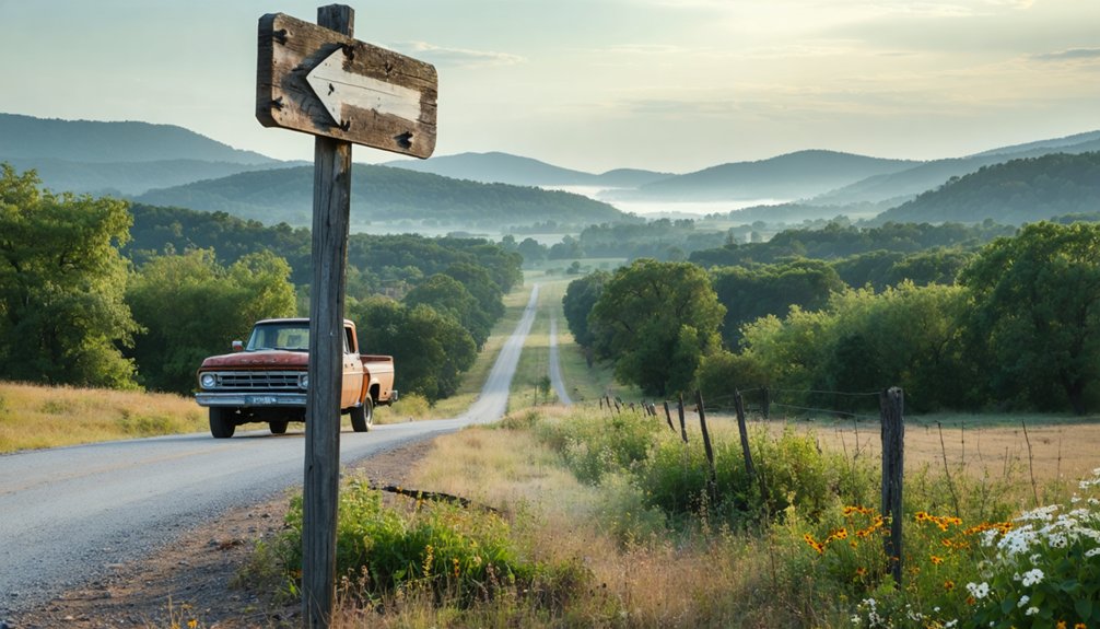
You’ll find Kosoma eight miles north of Antlers in Pushmataha County, accessible via rural roads that wind through dense pine forests. The ghost town sits at 525 feet elevation where the Frisco Railway once thundered through. Two weathered 1880s structures mark where section supervisors maintained the tracks, while a granite memorial on nearby Big Mountain honors four RAF cadets killed in a 1943 training crash. Pack sturdy boots, your GPS coordinates (34.3484335 N, -95.613028 W), and prepare for terrain that reveals both railroad history and wartime sacrifice.
Key Takeaways
- Kosoma is 8 miles north of Antlers in Pushmataha County, with GPS coordinates 34.3484335 N, -95.613028 W for navigation.
- Two weathered structures from the 1880s railroad boom remain, once housing track supervisors for the St. Louis-San Francisco Railway.
- The AT6 Monument marks where three training planes crashed in 1943, killing four RAF cadets in fog-shrouded peaks.
- Obtain the Kosoma USGS topographic map for route planning through remote terrain at 525 feet elevation near Kiamichi River.
- Annual memorial ceremonies honor fallen pilots with 21-gun salutes; Pushmataha County Historical Society documents restoration possibilities for remaining structures.
Getting to Kosoma: Directions and Route Planning

Finding Kosoma requires a spirit of adventure and careful navigation, as this ghost town sits tucked away in the wooded hills of southeastern Oklahoma’s Pushmataha County. You’ll find it at coordinates 34.348°N, -95.613°W, roughly eight miles north of Antlers along winding back roads that once served thriving local industries. From Antlers, head north through terrain that witnessed Kosoma’s rise and fall, reflected in its historical demographics of boom and bust cycles.
The Kosoma USGS topographic map proves essential for route planning through this remote territory at 525 feet elevation. You’re in Central Time Zone country here, where civilization feels distant. The nearest major airport sits in Texarkana, but true explorers embrace the isolation. Pack your GPS waypoint (34.3484335 N, -95.613028 W) and prepare for unpaved roads leading to forgotten history. The Geographic Names Information System maintains detailed records of Kosoma and other geographic features across all U.S. states and territories. Modern navigation systems can also utilize the location’s UTM coordinates in Zone 15S for precise mapping and surveying purposes.
The Railroad and Timber Boom That Built Kosoma
Once you’ve navigated those winding roads to Kosoma’s coordinates, you’ll stand where the whistle of Frisco locomotives once echoed through the Kiamichi River valley. In the 1880s, the St. Louis-San Francisco Railway punched through Choctaw Nation, establishing stations every few miles. Kosoma’s proximity to the Kiamichi River made it perfect for watering steam engines.
When timber barons discovered these virgin forests, Kosoma exploded into a boomtown. Sawmill operations sprang up throughout the surrounding mountains, shipping lumber through Kosoma’s depot. Six daily trains hauled fortunes in timber while merchants, doctors, and saloonkeepers crowded the streets. Dance halls stayed lively until morning. Workers often received payment in scrip to be spent at company-owned commissaries.
But timber industry decline proved inevitable. By the late 1950s, passenger service vanished. The final freight train rolled through in 1981. The Frisco maintained passenger services in Oklahoma until 1967, making Kosoma’s depot part of a statewide network that connected rural communities to major cities.
What Remains: Exploring the Surviving Structures
Two weathered buildings greet visitors along the Kosoma Loop, silent witnesses to a century of abandonment. These railroad-era structures, built during the 1880s settlement boom, once housed section supervisors who maintained tracks for the St. Louis-San Francisco Railway. You’ll find them just off State Highway 2, roughly 10 miles north of Antlers.
Unfortunately, vandalism has scarred these remnants over the decades. Without vandalism prevention measures or active protection, they’ve endured exposure and neglect. Yet they stand—defiant against time and the elements.
The Pushmataha County Historical Society documents what survives here, exploring restoration possibilities that could preserve this fragment of Oklahoma’s frontier past. Similar to other mining communities in the state, towns like Cardon saw their populations relocated by government buyout programs when environmental concerns necessitated evacuation. In Picher, the closure of post offices in 2009 marked a significant loss of community identity for residents who remained. Drive the loop yourself, witness what remains, and you’ll understand why some histories deserve protection, even when abandoned to freedom’s harsh realities.
The AT6 Monument and Big Mountain Crash Site
Just north of Kosoma’s remnants on Big Mountain, you’ll find a granite memorial marking where three AT-6 Texan training aircraft plunged into the fog-shrouded peaks on February 20, 1943, killing four young Royal Air Force cadets far from home.
The monument stands at the “natural tombstone”—a massive boulder thrust upward by one plane’s impact—discovered by local rescuers who’d heard the crashes echo through the misty Kiamichi Mountains.
Rattan Elementary students researched the tragedy for four years before dedicating this memorial on the 57th anniversary, transforming a remote crash site into a commemoration of wartime sacrifice and enduring U.S.-U.K. bonds. Local craftsmen donated their time and labor while students raised funds for materials to create the granite marker. Each year since 2000, small yearly ceremonies have drawn RAF officers, Choctaw Nation Color Guard members, and local residents who gather to honor the fallen pilots with a 21-gun salute and flag presentations.
Historical Aircraft Crash Details
On February 20, 1943, fifteen AT-6 training aircraft departed on what should’ve been a routine low-level cross-country flight across Oklahoma. Twelve planes made it through. Three didn’t.
When fog and rainy mist swallowed the Kiamichi Mountains, fate intervened violently. The first aircraft slammed into White Rock Mountain‘s steep southern slope, killing pilot Vincent Cockman and navigator Frank Frostick. The third plane spiraled into Big Mountain in a head-on collision, claiming pilots Mike Hosier and Maurice Jensen.
Rescuers discovered something haunting—impact forces had ejected a massive rock that stood like a natural tombstone marking their sacrifice. This #OklahomaAirCrashLegacy reminds you that freedom’s always been written in blood and courage, long before #UNESCOWorldHeritageApplications formalized history’s sacred ground. Decades later, another T-6 variant would claim lives during a 2023 crash over Lake Winnebago when diminished airspeed triggered a fatal accelerated stall. Modern T-6 Texan II trainers continue serving as primary trainer aircraft for U.S. Air Force pilots, though the fleet faced a brief grounding in 2018 due to unexplained pilot symptoms.
Monument Dedication Ceremony Events
- Rural students designed and presented Allen Parsons’s granite monument celebrating UK-US cooperation
- British vice consul and embassy officials traveled from Houston and Washington to witness the dedication
- Oklahoma Highway Patrol confirmed attendance exceeding 1,000 souls on that mountaintop
- International press coverage broadcast the event throughout England via Daily Telegraph, Daily Mail, and Associated Press worldwide
British dignitaries marveled at these achievements from students in one of America’s poorest regions, creating something profoundly moving where tragedy once occurred.
Visiting the Memorial Site
When you arrive at Big Mountain north of Moyers, you’ll find yourself standing where tragedy transformed into legacy. The granite memorial rises from the earth beside nature’s own tombstone—a massive boulder thrust upward by the 1943 crash impact. You’ll trace the names of four Royal Air Force cadets who never made it home, their sacrifice preserved through dedicated monument upkeep by the community.
For deeper exploration, local visitor resources await at the Pushmataha County Historical Society in Antlers, eight miles from the site. The Oklahoma Historical Society in Oklahoma City holds additional records.
Students from Rattan Elementary spent years researching this forgotten chapter, ensuring these young aviators wouldn’t fade into obscurity. Their work reminds you that freedom’s price echoes across generations.
Best Times to Visit and What to Bring
Timing your visit to Kosoma can make the difference between a memorable adventure and a sweaty slog through Oklahoma’s unforgiving humidity. Spring and fall deliver the sweet spot—comfortable temperatures without oppressive heat or crowds.
Skip the summer sweat—Kosoma’s spring and fall seasons offer the perfect balance of mild weather and peaceful solitude.
Pack smart for your escape:
- Layered clothing including rain gear for those 50-inch annual downpours and fleece for chilly mornings
- Navigation tools with offline maps since cell service vanishes beyond Highway 2
- Protection essentials like high-SPF sunscreen, bug spray for mosquito-heavy sulfur springs, and snake bite supplies
- Water reserves at one gallon per person daily—no facilities exist in this forgotten settlement
Monitor ideal seasonal events and wildlife preservation activities through fall when Kiamichi’s creatures prepare for winter. Check road conditions before fording Buck Creek during spring rains.
Nearby Attractions in Pushmataha County
After exploring Kosoma’s remnants, you’ll find the Kiamichi River Valley spreads before you like a green corridor carved through ancient mountains, where the river’s clear waters have shaped both landscape and local culture for millennia.
The AT6 Monument stands as a concrete marker to tragedy—a stark memorial where an Air Force transport crashed in 1948 on these rugged slopes. Big Mountain rises 2,369 feet above sea level, offering panoramic vistas that stretch across Pushmataha County’s forested ridges and hidden hollows.
Kiamichi River Valley Exploration
Beyond the forgotten remnants of Kosoma, the Kiamichi River Valley unfolds as a pristine wilderness playground where rugged mountain ridges meet crystalline waters. You’ll discover gentle currents perfect for kayaking alongside scenic bluffs, while native fish species like the rare leopard darter navigate these clear waters.
The surrounding forests showcase remarkable flora and fauna diversity, hosting everything from black bears to red-cockaded woodpeckers.
Your Valley Adventures:
- Paddle pristine waters with numerous entry points offering unique routes outside Sardis Lake’s boundaries
- Cast lines for exceptional fishing amid tranquil pools and rushing streams
- Trek mountain trails winding through pine forests where Indiana bats and rare mussels thrive
- Camp riverside under towering ridges reaching 2,600 feet elevation
This untamed landscape promises complete escape from civilization’s constraints.
AT6 Monument and Big Mountain
Rising from the forested ridges northeast of Kosoma, Big Mountain conceals a sobering piece of World War II history beneath its canopy of pines and oaks. On February 20, 1943, severe fog claimed three AT-6 aircraft from the RAF cadet training program during a low-level flight from Terrell, Texas. The crashes killed four British cadets, including Michael Hosier and Maurice Jensen, whose plane struck Big Mountain with such force it uprooted a boulder—creating a natural tombstone from crash debris that stands today.
The granite AT6 Monument at this exact spot, dedicated in 2000 by Rattan Elementary students who researched the tragedy. The memorial honors UK-US cooperation while serving as a windswept reminder of wartime sacrifice in these remote Kiamichi Mountains.
Frequently Asked Questions
Are There Any Safety Concerns When Exploring the Abandoned Buildings in Kosoma?
Yes, you’ll face serious risks exploring Kosoma’s decaying structures. Structural integrity concerns plague abandoned buildings with rotting floors and collapsing roofs, while wildlife presence—from snakes to raccoons—adds danger. Tread carefully; freedom requires respecting nature’s reclamation.
Can I Camp Overnight Near Kosoma or on the Ghost Town Property?
You can’t camp on Kosoma’s private ghost town property, but you’ll find excellent outdoor recreation options nearby. Ouachita National Forest offers dispersed camping with 14-day limits, giving you freedom to explore while respecting camping policies.
Is Kosoma Privately Owned or Can Visitors Freely Access the Area?
You’ll find Kosoma’s remnants aren’t locked behind gates—public land access via State Highway 2 means you’re free to explore. However, verify private property rights for individual structures before wandering, as ownership boundaries aren’t always clearly marked.
Are There Guided Tours Available for Kosoma and Other Nearby Ghost Towns?
No tour guides available for Kosoma itself—you’ll explore independently through self-guided walking routes. Nearby Guthrie and Oklahoma City offer organized ghost tours, but Kosoma’s crumbling ruins await your personal discovery at your own pace.
As you wander through these hidden remnants, you’ll quickly understand why Kosoma is considered one of the most intriguing ghost towns to explore in Oklahoma. Each crumbling structure tells a part of the story, inviting you to imagine the lives that once filled this now-silent place. Be sure to take your time and appreciate the haunting beauty that these forgotten sites have to offer.
What Happened to the Residents When Kosoma Became a Ghost Town?
When Kosoma’s timber ran out, residents faced economic decline and relocated to find work elsewhere. You’ll discover they simply packed up and moved on, leaving behind empty buildings that stand as weathered monuments to their vanished dreams.
References
- https://kids.kiddle.co/Kosoma
- https://www.okhistory.org/publications/enc/entry?entry=GH002
- https://www.okhistory.org/publications/enc/entry?entry=MI028
- https://latitude.to/articles-by-country/us/united-states/244493/kosoma-oklahoma
- https://edits.nationalmap.gov/apps/gaz-domestic/public/summary/77399
- https://oklahoma.hometownlocator.com/ok/pushmataha/kosoma.cfm
- https://www.topozone.com/oklahoma/pushmataha-ok/city/kosoma/
- https://nona.net/features/map/placedetail.1260927/Kosoma/
- https://edits.nationalmap.gov/apps/gaz-domestic/public/gaz-record/1090233
- https://ug.utc.city/589394


