You’ll find Lake Fern at coordinates 28.14944°N, 82.57972°W in Hillsborough County’s Keystone area, though virtually nothing remains of Gordon J. Barnett’s 1930s fernery empire that once dominated global production. The 1963 fire destroyed the school, leaving scattered suburban homes where citrus groves and pine forests once thrived. Access requires landowner permission since ownership records aren’t publicly documented. The site’s complete transformation from Florida’s fernery capital to abandoned settlement offers little physical evidence, but archival photographs preserve what fire and time erased—and there’s more to this vanished community’s story.
Key Takeaways
- Lake Fern is located in Hillsborough County at coordinates 28.14944°N, 82.57972°W, served by ZIP code 33556.
- Property ownership and access rights are unclear; visitors must obtain permission from current landowners before entering the site.
- Little physical evidence remains from Lake Fern’s fernery era, as the 1963 fire destroyed the school and citrus groves.
- The area is now occupied by scattered suburban residents where the former 1900 citrus settlement once thrived.
- Haunting reports feature Sarah, the final postmaster, whose red-haired spirit allegedly appears in the Brennan home’s second floor.
The Rise and Fall of a Frontier Settlement
The shores of Lake Concord bore witness to centuries of human habitation before Lake Fern emerged as a settlement. You’ll discover the St. Johns people occupied this land from 800 to 1565 CE, followed by Fort Concord’s construction in 1849. Stephen J.L. Hooker established his homestead here during the 1850s, with Lake Fern settlers arriving by 1882.
Turpentine stills and sawmills drove early 20th-century expansion. The Dowling Lumber Company and Lyon Pine Mill acquired vast tracts, transforming Lake Fern into a railroad stop.
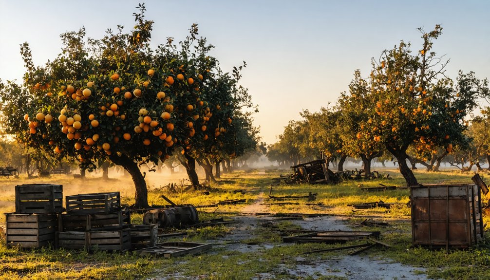
Gordon J. Barnett’s 1925 fernery catalyzed growth, and by the 1930s, area ferneries dominated global production.
However, factors contributing to decline emerged early. Government intervention efforts, including Barnett’s failed 1937 incorporation bill, couldn’t prevent Lake Fern’s eventual abandonment as educational and economic infrastructure collapsed.
What Remains Among the Pine Forests Today
Little physical evidence survives from Lake Fern’s bustling fernery days, though scattered clues mark where the community once thrived. You’ll find the former school site on Lutz-Lake Fern Road’s west side at CR587, nestled within old citrus groves until fire destroyed it in 1963.
The environmental impact of early twentieth-century agriculture shaped this landscape, transforming native pine forests into productive ferneries that sustained families for generations.
Today’s scattered suburban residents occupy land where the 1900 citrus settlement flourished. The lake itself remains, offering tangible connection to the area’s historical significance. Pictorial records confirm what’s vanished, but you’re free to explore public roads surrounding the site—currently for sale and destined for shopping centers or housing developments that’ll erase these final traces of frontier life.
Getting There: Location and Access Requirements
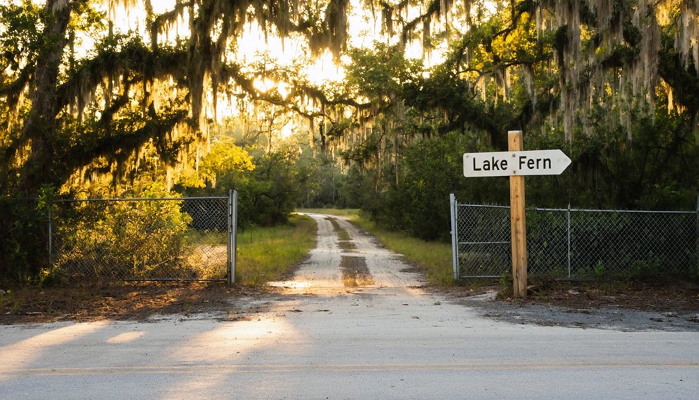
You’ll find Lake Fern in Hillsborough County at coordinates 28.14944°N, 82.57972°W within the Keystone census-designated place, accessible via routes serving the greater Tampa Bay region near Odessa.
The 31.49-acre lake sits at 62 feet elevation in what was historically the Citrus Park-Fern Lake census division, now served by ZIP code 33556.
Before visiting, you must secure permission from property owners, as no public access rights exist without explicit authorization—the GNIS documentation provides no ownership records to guide legal entry.
Exact Coordinates and Directions
Two distinct lakes bearing the Fern name exist in Central Florida, requiring careful coordinate verification before departure. Fern Lake in Seminole County sits at 28.6952921° N, -81.3285888° W near Longwood, while Lake Fern in Hillsborough County occupies 28.14944° N, -82.57972° W near Odessa.
You’ll find the Seminole location accessible within 0.1 miles of Longwood, surrounded by community growth patterns that’ve transformed former wilderness into residential zones. The Hillsborough site maintains its 31.49-acre footprint at 62 feet elevation, documenting local environmental impacts across decades.
Navigate using government maps showing ZIP codes 32750 and 33556 respectively. Both locations remain accessible through public routes, though verifying current access conditions protects against trespassing concerns while preserving these distinct water bodies for future documentation.
Private Property Permission Rules
Before attempting any visit to Lake Fern sites, understand that Florida’s water access laws don’t override private property rights surrounding these water bodies. Current research reveals no publicly documented permission protocols or authorized access routes for this location.
You’ll need to independently identify and contact private property owners whose land borders the area, though specific contact information isn’t readily available through standard channels.
Check with local government regulations in the relevant county office, as ordinances may restrict or prohibit access entirely. No established visitor procedures exist for Lake Fern Inhabited. Without confirmed permission from landowners and verification of current legal status, any attempt to access the site risks trespassing violations. Document all permission requests and responses before proceeding with travel plans to this remote location.
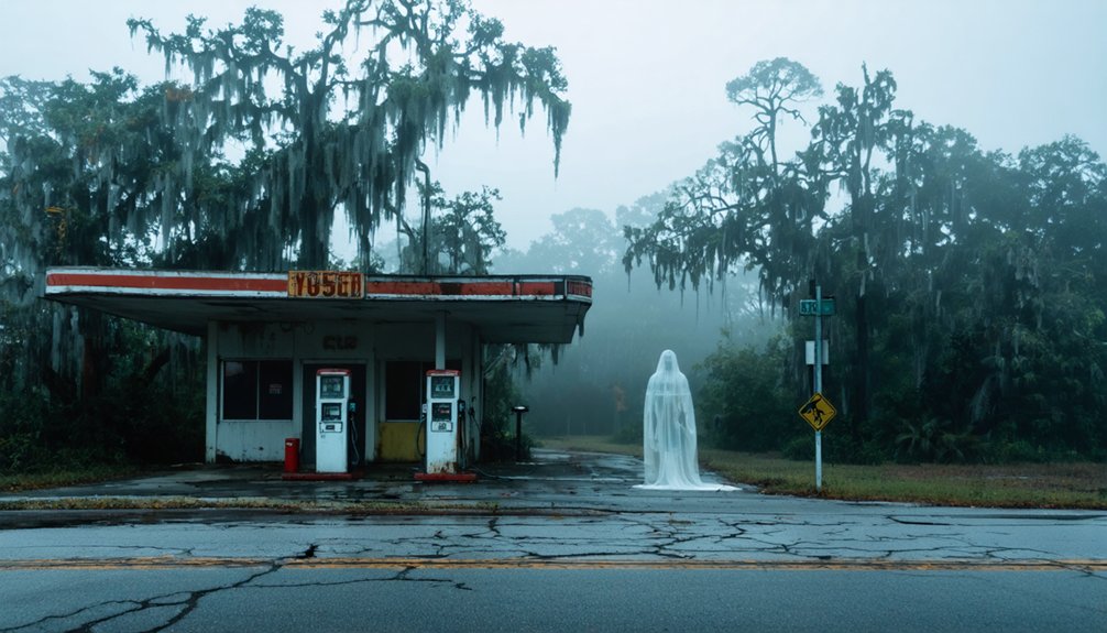
Exploring the Haunted Structures and Ruins
When you venture into Lake Fern‘s historical landscape, you’ll discover that most haunted structures exist only in archival photographs and documented accounts. The 1963 fire eliminated the Lake Fern School completely, leaving only citrus grove remnants now slated for development.
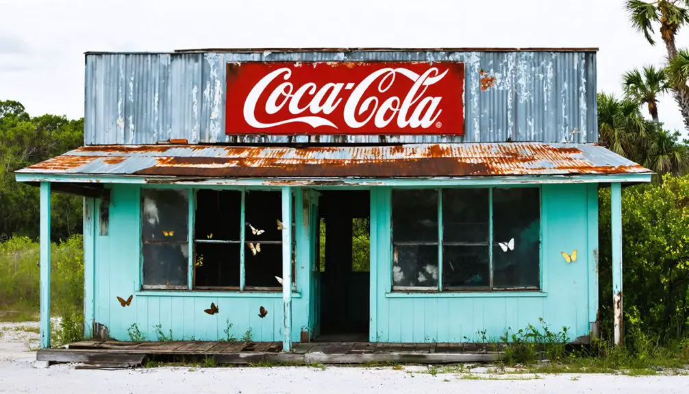
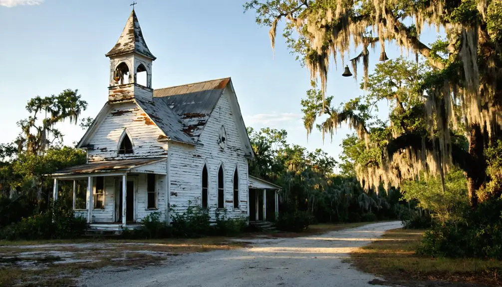
Kerr City’s hotel, burned in 1907 after unresolved mysteries surrounding a preacher’s disappearance, survives only through images showing rusted bed frames. The preserved schoolhouse and church maintain their National Register status within the privately-owned ghost town.
Haunting reports center on Sarah, the final postmaster whose red-haired spirit reportedly appears in the Brennan home’s second floor. You’ll need landowner permission to access these sites, as private ownership protects both the physical ruins and their documented paranormal activity from unauthorized exploration.
The Great Freeze That Changed Everything
You’ll find that Villa City’s transformation from thriving citrus hub to abandoned ghost town traces directly to the catastrophic freeze events of December 1894 and February 1895. The twin Arctic blasts devastated the region’s citrus industry, with temperatures plunging to 12 degrees and obliterating production from 6 million boxes to a mere 100,000 statewide.
Within one year, Villa City’s population collapsed from 150 residents to just a handful as ruined growers abandoned their frozen orchards and fled north, south, or out of state entirely.
Winter of 1894-1895
The citrus groves stretching across northern Florida’s fertile river valleys appeared invincible until December 27, 1894, when blizzard-like winds screaming at 25-30 mph drove temperatures to record lows—11°F in Tallahassee, 14°F in Jacksonville, 19°F in Tampa.
Orlando recorded 18°F the following day. Destroyed foliage triggered vulnerable new growth during January’s warm spell, setting the stage for catastrophe.
Mid-February’s second freeze devastated everything—West Palm Beach dropped to 27°F, ice split tree trunks vertically, orchards decades old died to their roots. These meteorological conditions eliminated northern and central Florida’s citrus industry overnight.
The broader statewide impacts transformed settlement patterns permanently: entire communities vanished, nearly half of North Florida homes stood vacant, and survivors abandoned farms mid-season, launching Florida’s irreversible agricultural migration southward.
Citrus Industry Collapse
By 1894, Florida’s citrus industry had transformed the state into America’s premier orange producer, shipping over 5 million boxes annually through an expanding railroad network that connected newly established cities like Orlando and Lakeland to northern markets. Then temperatures plummeted to 18°F in December 1894 and February 1895, decimating the entire citrus belt.
Production collapsed from 6 million boxes to just 50,000 within months. Grove values crashed from $1,000 per acre to $10. Lake County lost 99% of its trees. The economic impacts proved catastrophic—entire communities vanished as growers abandoned their frozen investments.
This agricultural transformation forced the industry’s permanent relocation southward, where you’ll find today’s groves concentrated in the peninsula’s warmer zones, forever altering Florida’s settlement patterns and leaving ghost towns scattered across the former Orange Belt.
Mass Resident Exodus
When temperatures plummeted below freezing twice within six weeks, Florida’s citrus-dependent population made a swift calculation: staying meant financial ruin. You’d have witnessed entire families abandoning decades-old homesteads, leaving unwashed dishes and unfinished projects behind.
Communities like Earnestville simply vanished as farmers migrated north or west, seeking viable agricultural opportunities. The economic aftermath reshaped settlement patterns permanently—land values collapsed, forcing complete abandonment of once-thriving groves.
Tourist reactions to these ghost settlements would become part of Florida’s frontier mythology. Where 21,737 planted acres once produced millions of orange boxes, scrub and wetlands reclaimed the territory. This exodus wasn’t gradual decline but immediate desertion, preserving snapshot moments of 1895 life that you can still trace through archaeological evidence today.
Supernatural Encounters and Local Legends
Local legends surrounding Lake Fern’s citrus community intertwine with documented tragedies that’ve shaped the area’s supernatural reputation since the early 1900s. You’ll encounter tales of haunting apparitions near Press Landing, where a woman was murdered before her daughter on November 22, 1977. The discovery site at High Banks remains etched in community memory.
Press Ogelsby’s isolated life with an Indian woman on Press Island adds layers to unresolved disappearances throughout the region. The ancient overgrown cemetery harboring Spanish burials sits within dense hammocks along the St. Johns River’s high bluffs. You’re free to explore these documented locations independently, though the 1963 school fire site and surrounding citrus groves now face commercial redevelopment, potentially erasing remaining physical connections to these preserved oral histories.
Nearby Attractions and Places to Stay
Several documented heritage sites within a twenty-mile radius of Lake Fern’s former citrus settlement offer perspectives on Florida’s frontier and agricultural history. You’ll discover scenic nature trails threading through preserved groves where original homesteaders cultivated their claims. Historic marker placements throughout the region identify abandoned packing houses, railway spurs, and settlement boundaries—tangible evidence of communities that flourished then faded.
For overnight stays, you’re not bound to conventional lodging. Primitive camping sites near conservation areas let you experience the landscape as early settlers did. State forest campgrounds provide freedom to explore dawn and dusk, ideal times for documenting architectural remnants. Small-town motels in surrounding communities offer affordable bases while respecting the archaeological sensitivity of abandoned sites. Document responsibly; these locations exist for preservation, not exploitation.
Frequently Asked Questions
What Supplies Should Visitors Bring When Exploring the Kerr City Ghost Town?
You’ll need to bring bottled water for hydration, wear sturdy hiking boots for rough terrain, pack insect repellent, carry flashlights for dark structures, and bring a first aid kit—essential supplies for safely documenting this historically significant, privately-owned site.
Are There Guided Tours Available for the Privately Owned Ghost Town?
No guided tours exist—ironic for a “ghost town” with suburban sprawl. You’ll find only self-guided tours of scattered development at Lake Fern. Kerr City offers limited access opportunities since private owners closed it, respecting their conservation-focused stewardship and property rights.
What Is the Best Time of Year to Visit Lake Kerr Area?
Visit Lake Kerr during January through April when cooler seasonal weather conditions optimize bass fishing in shallow waters. You’ll find uncrowded nearby outdoor activities including kayaking, wildlife observation, and swimming in crystal-clear springs throughout Ocala National Forest’s pristine landscape.
Can Visitors Camp Overnight Near the Kerr City Ghost Town Site?
You can’t camp directly at private Kerr City, but you’ll find overnight parking options at nearby Juniper Springs Recreation Area. Check camping regulations for FERN, SAND, and TROP loops, where preserved forest sites respect the ghost town’s historic buffer zone.
How Long Does a Typical Visit to Kerr City Take?
You can’t legally visit Kerr City due to private ownership and no-trespassing signage availability. Historically, ideal tour duration was under an hour when permitted. Respecting these boundaries preserves the site’s integrity while you explore nearby public forest alternatives instead.