
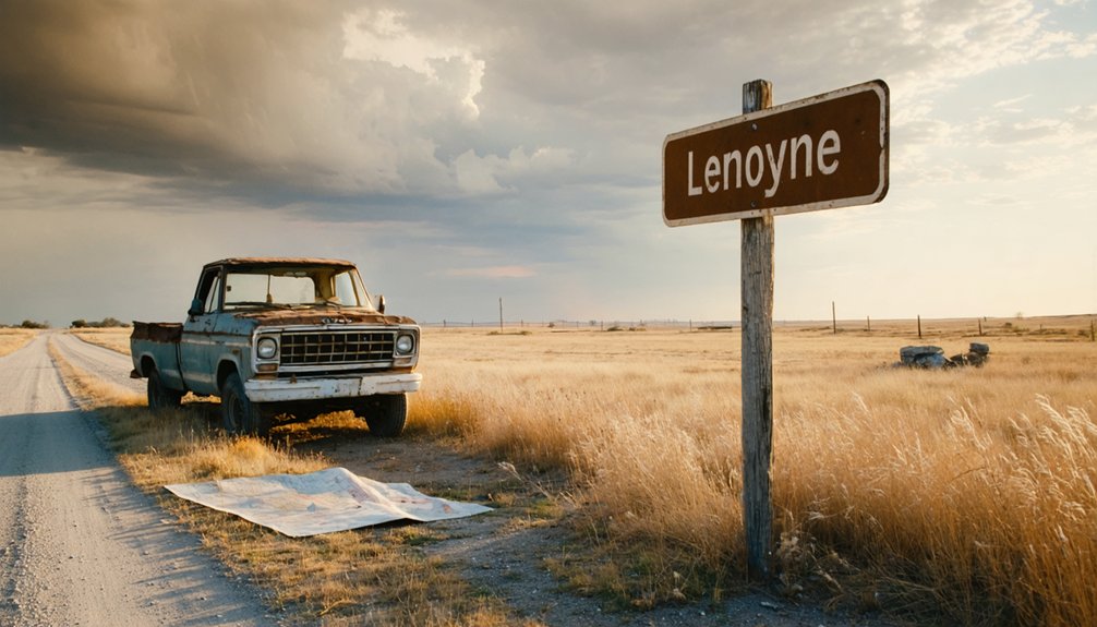
You’ll discover one of America’s most haunting destinations beneath Lake McConaughy’s shimmering surface, where the 1940s prairie town of Lemoyne rests 50 feet underwater. Drive to Nebraska’s largest reservoir and watch for drought years when receding waters expose ghostly foundations, fence posts, and streets from the community sacrificed to Kingsley Dam’s creation. Modern Lemoyne sits two miles north, where 110 residents relocated their homes before floodwaters arrived. The complete story of this drowned settlement reveals why preservation matters.
Key Takeaways
- Lemoyne lies submerged beneath Lake McConaughy’s Admiral’s Bay, two miles south of the current Lemoyne town site.
- Visit during droughts when low water levels expose building foundations, fence posts, and remnants of the original 1911 town.
- The 2004 all-time low water level revealed the most structures, including homes, gas station, hotel, and bank foundations.
- Access the site via Lake McConaughy State Recreation Area, Nebraska’s largest reservoir at 30,500 acres near North Platte Valley.
- Combine your visit with Kingsley Dam tours to learn how the 1941 hydroelectric project created this underwater ghost town.
The Story of Original Lemoyne: A Thriving Plains Settlement
When the Union Pacific Railroad pushed its branch line through the North Platte Valley in 1909, it carved more than tracks through the prairie—it carved opportunity. Lemoyne Jacobs saw it, petitioning the railroad to cross his land. By 1911, surveyors had mapped a town bearing his name along the North Platte River‘s banks.
This riverside location attracted settlers with pioneering spirit who’d followed the Oregon Trail decades earlier. The Haythorn family had already homesteaded here in 1884, proving the land’s promise. By 1924, you’d have found 200 residents building their futures—a school educating 19 students, the Western Bridge Construction Company‘s new river crossing, a $3,500 hotel, and Bethany Presbyterian Church’s steeple rising above the plains. The town served as a gateway for transcontinental migrations and cattle trails, building on Ogallala’s historic role in westward expansion. The town name itself has become part of a broader disambiguation page that lists various places and people sharing the Lemoyne designation.
Why Kingsley Dam Changed Everything
When you stand atop Kingsley Dam today, it’s hard to imagine that 163 feet below the waterline lies the original Lemoyne—homes, businesses, and memories submerged when construction wrapped in 1941.
The $43 million project took five years and 26 million cubic yards of earth to complete, creating a three-mile-long barrier that forced every family in town to pack up and relocate to higher ground. This one of the world’s largest earthen dams rises 10 stories tall, a testament to the massive engineering feat that reshaped the region.
What emerged was Lake McConaughy, a 30,500-acre reservoir that drowned the old settlement beneath 142 feet of water at its deepest point. Today, travelers can explore the enduring legacy of this displacement through Cora Baumann’s research collection, donated to the Nebraska State Historical Society and available for public viewing in their archives.
Dam Construction Timeline
The North Platte River carved its path through Nebraska’s sandhills for millennia before March 13, 1936, when construction crews broke ground on what would become one of the world’s largest earthen dams. You’ll appreciate the ingenuity of 1930s construction techniques—workers pumped loess clay and water through pipes on trestles, creating a watertight core while sand-and-gravel slurry formed the dam’s sides. They moved 26 million cubic yards of earth across 3.5 miles, then covered the face with rock riprap and 180,000 jackstones, each weighing 800 pounds.
The Public Works Administration grant of $19 million, combined with a $24 million loan, funded this $43 million project. By 1941, Kingsley Dam stood 163 feet high, holding back Lake McConaughy‘s waters and delivering irrigation to drought-stricken farmland. Three hydroplants began generating electricity that same year, providing power to the region. The dam’s completion marked the end of C.W. McConaughy’s decades-long vision to harness spring flood waters for supplemental irrigation during Nebraska’s dry summer months.
Forced Town Relocation
As Lake McConaughy‘s waters rose behind Kingsley Dam in 1941, they swallowed an entire village—110 residents watched their hometown of Lemoyne disappear beneath Admiral’s Bay. You’ll find their story carved into Nebraska’s landscape, where homes and businesses were jacked up and rolled two miles north to higher ground. Most landowners negotiated sales with Central District, though some fought through lawsuits while construction thundered on.
The community sentiments ran deep—families saw their roots severed, their dreams submerged for irrigation’s sake. Local historian Cora Baumann spent fifty years documenting this loss, capturing poetry that mourned: “Old LeMoyne is gone, the dwellers moved on.” The dam’s construction followed years of obstacles, from obtaining federal funds to battles over water rights that reached the Supreme Court. The historical significance resurfaces literally during droughts, when foundations emerge from the depths, drawing grandchildren back to walk their ancestors’ drowned streets. Today’s fishermen cast lines over submerged town foundations, targeting walleye and white bass where homes once stood.
Lake McConaughy Creation
Before Kingsley Dam rose from the North Platte River‘s banks, Nebraska’s farmers watched their crops wither under relentless droughts while precious water escaped uselessly toward the Missouri. Then everything changed.
Between 1936 and 1941, workers pumped 162 feet of sand and clay into a massive hydraulic-fill barrier stretching 3.1 miles across Keith County. The $43 million New Deal project drowned 35,000 acres beneath what became Lake McConaughy—Nebraska’s largest reservoir holding 1.74 million acre-feet of liquid independence. The pumping process created a watertight core by mixing loess soil and water into the ground, forming the second largest hydraulic fill dam in the world.
Farmland acquisition displaced entire communities like Lemoyne, but the trade-off transformed central Nebraska into an agricultural powerhouse. Five hundred miles of irrigation canals now feed fields that once thirsted. The Kingsley Hydroelectricity Plant generates 50 MW of power from the dam’s south side, operated by the Central Nebraska Public Power and Irrigation District. The impact on native wildlife created new ecosystems where pioneers once homesteaded, forever altering this windswept prairie landscape.
What Lies Beneath Lake McConaughy
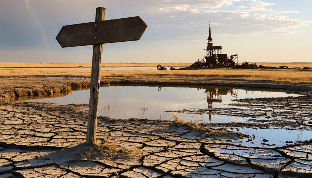
When Lake McConaughy’s waters recede during severe droughts, you’ll witness eerie remnants of Lemoyne emerging from the lakebed—crumbling building foundations, old fence posts, and fragments of a town that vanished beneath 100 feet of water in 1941.
The all-time low water level recorded on September 14, 2004, exposed more of these ghostly structures than locals had seen in decades, offering rare glimpses into the valley’s buried past. You can stand where Lemoyne’s main street once bustled with activity, now marked only by weathered concrete and the silent testimony of a community sacrificed for Nebraska’s water future.
Submerged Town Foundations
The foundations of old Lemoyne rest fifty feet below the surface of Lake McConaughy in Admiral’s Bay, creating an eerie underwater ghost town that’s haunted these waters since 1941. You’ll find remnants of homes, a gas station, hotel, and bank where streets once bustled with 110 residents. During low water periods, early submersion evidence emerges—root cellars and basements break the surface like forgotten memories.
The history of Lemoyne, Nebraska, is a tale of resilience and adaptation, reflecting the challenges faced by the small community over the decades. As water levels change, residents can occasionally revisit this past, exploring the submerged relics that remind them of their town’s vibrant history. Each dive into the depths uncovers artifacts that tell stories of a bygone era, connecting present-day explorers with those who once called Lemoyne home.
The Harris family’s 1940 home foundation still marks their family’s 1894 homestead site. Trophy fish now navigate between walls that once sheltered generations of Nebraska pioneers. Visitor exploration opportunities vary with water levels; sometimes you’ll spot these concrete ghosts from shore, other times they’re hidden thirty-three feet down, waiting for drought to reveal their stories again.
Drought Reveals Hidden History
Low water levels at Lake McConaughy don’t just reveal old foundations—they pull back a seventy-year curtain on Nebraska’s agricultural desperation and engineering ambition. When drought struck in fall 2004 and 2006, you could witness what hadn’t been visible since the 1950s: Lemoyne’s skeletal remains emerging from receding waters. The lake dropped to near-record lows, exposing roads, building foundations, and artifacts from a town sacrificed for survival.
These droughts created ripple effects beyond ghost-hunting opportunities. Local business losses mounted as recreation declined and hydropower diminished. You’ll understand that community impacts stretched across irrigators receiving their first water restrictions since the 1940s.
The exposed remnants tell two stories simultaneously: one town’s death and an entire region’s lifeline, both preserved beneath the same waters.
When Drought Reveals the Sunken Town
During the near-record drought of 2004, Lake McConaughy’s water levels plummeted to just one-fifth of normal capacity, and the reservoir began surrendering secrets it had kept for over six decades. As water receded over 60 feet in Admiral’s Bay, ghostly underwater remnants emerged from the murky depths—foundations of a hotel, bank, gas station, and general store marking where a thriving community once stood.
You’ll find former residents like Loy Baumann returned to walk these exposed ruins, identifying his grandfather’s barbershop and his mother’s childhood home. Local resident recollections grew emotional as Beverly Harris pointed out her grandparents’ root cellar from 1894. Tree stumps and pottery shards scattered across the site tell stories of 110 families displaced when progress demanded their sacrifice.
Getting to Modern Lemoyne and Lake McConaughy
Reaching Lake McConaughy requires just a short northbound journey from Ogallala, where Highway 61 cuts through western Nebraska’s sandhills toward the state’s largest reservoir. You’ll cover roughly 8 miles before Big Mac’s sprawling waters emerge across the horizon—22 miles of shoreline freedom stretching beneath open sky.
Multiple access points welcome exploration along Shoreline Road, connecting Martin Bay’s swimming area to Arthur Bay and Sandy Beach. The west end opens via Highway 92, while Kingsley Dam guards the eastern boundary.
Park facilities include the Water Interpretive Center at 1475 Highway 61 N, campgrounds with all-weather pads, and boat ramps scattered along the shore. Snag your $8 day pass online beforehand. Before departing, call 308-284-8800 to check Keith County’s current fire restrictions.
Best Times to Visit for Underwater Town Viewing
When should you plan your ghost town pilgrimage? Timing depends entirely on water level fluctuations—you’ll need severe drought conditions to glimpse Lemoyne’s foundations. The 2004 drought dropped the reservoir to one-fifth capacity, exposing building remnants when water receded over 60 feet below normal. Similarly, 2022’s dry spell revealed root cellars from the 1940 relocation.
The challenge: visiting during droughts requires monitoring North Platte River conditions, as predictions remain notoriously unreliable. When exposure occurs, you’ve got limited time—levels can rise 10-12 feet within months. Check the visitor center’s exhibits on hydrology patterns before planning your trip. Winter hydroplant work sometimes aids recovery, potentially ending viewing windows quickly.
Your best strategy? Follow regional drought reports and stay flexible with travel dates.
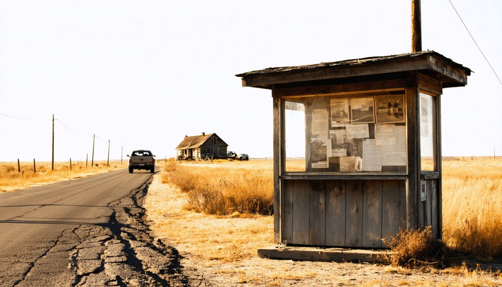
What to See and Do in Today’s Lemoyne
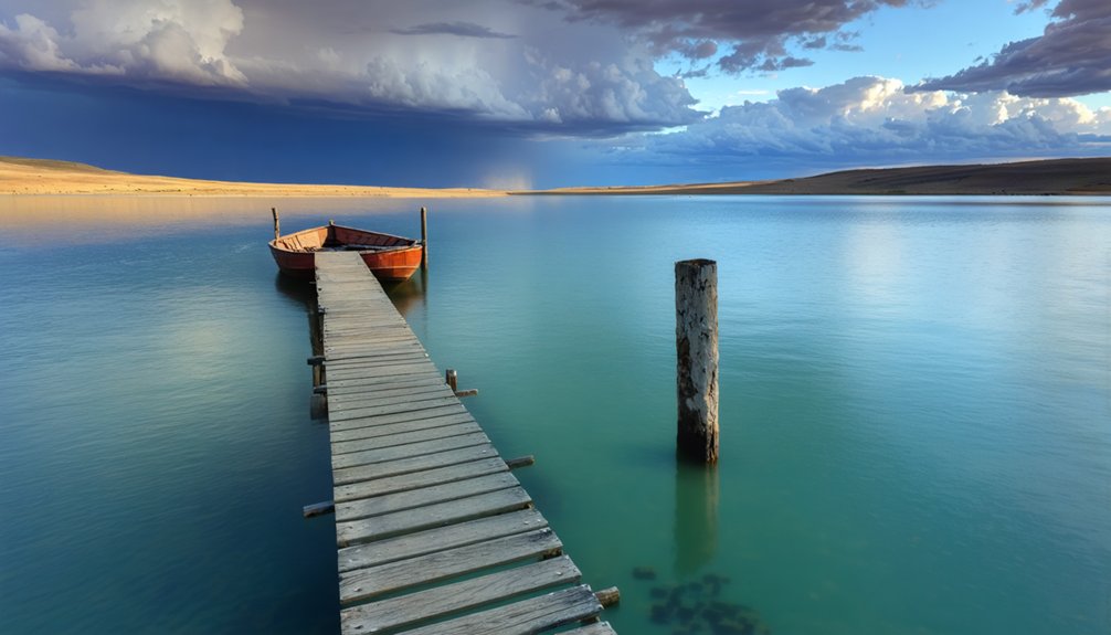
Though the original Lemoyne sleeps beneath Lake McConaughy’s waves, today’s relocated community thrives as a beach town gateway to Nebraska’s largest reservoir. You’ll find modern amenities serving lake visitors alongside reminders of frontier heritage. Launch your parasailing adventure with Big Mac Parasailing’s 4.9-rated experiences, or tee off at Bayside Golf Course overlooking the water. The sandy beaches draw seasonal crowds who’ve discovered this unlikely Nebraska oasis.
Between water sports, explore historic landmarks like Boot Hill Cemetery’s ghost town remnants and the Petrified Wood Gallery’s exceptional exhibits. During drought years, you can spot the original town’s foundations emerging from receding waters—a haunting glimpse of Lemoyne’s submerged past. Local businesses understand the wanderer’s spirit, offering everything from lakeside lodging to provisions for your next adventure.
Preserving the Memory: Where to Learn More About Old Lemoyne
Beyond the shimmering waters and sandy beaches lies a deeper story waiting for those who seek it. You’ll find Lemoyne’s legacy preserved in Cora Baumann’s remarkable collection at the Nebraska State Historical Society Archives in Lincoln. This former resident spent fifty years documenting displaced families and saving artifacts like the town’s 1938 population sign. Her historical documentation offers researchers authentic voices from those who lived through the relocation.
Online resources complement these archival collections—sites like RuralResurrection.com and VisitKeithCounty.com share firsthand accounts and drought-revealed photographs. You can access detailed inventories on the NSHS website before planning your visit. Beverly Harris’s testimony about her grandparents’ root cellar and Julius Hoffman’s haunting poem “Old Lemoyne Is Gone” capture the community’s enduring spirit beyond government records.
Frequently Asked Questions
Are There Any Safety Concerns When Exploring Exposed Foundations During Low Water?
Yes, absolutely. Water levels have dropped over 60 feet historically, exposing treacherous terrain. You’ll face structural integrity concerns and potential unstable soil conditions—cracks, hidden basements, and shifting ground threaten every step you take near these crumbling foundations.
Can I Scuba Dive to See the Underwater Remnants of Old Lemoyne?
No official scuba diving permissions exist for Lemoyne’s underwater remnants. Historical preservation efforts and local tourism initiatives focus on drought-exposed foundations instead. You’ll find silt-obscured debris at 50 feet presents unreliable conditions, making surface exploration your safer, legal option.
Were Any Residents Compensated Fairly During the Eminent Domain Buyouts?
Records don’t reveal compensation details, though land acquisition challenges likely occurred. You’ll find no documented property value disputes, but residents’ tearful goodbyes suggest money couldn’t replace their freedom-loving community’s roots before Lake McConaughy’s waters claimed everything.
Are There Guided Tours Available to the Original Townsite Location?
No guided tours are available to explore the submerged townsite. You’ll need to venture independently when drought exposes remnants, though private property concerns and fluctuating water levels mean you’re traversing this lost settlement on your own terms.
What Happened to the Cemetery When the Town Was Relocated?
The cemetery was carefully relocated to higher ground before flooding began. You’ll find the graves underwent disinterment and headstones removal, then respectful reburial. Today, you can still visit Lemoyne Cemetery in its preserved hilltop location.
References
- https://www.onlyinyourstate.com/experiences/nebraska/underwater-ghost-town-ne
- https://nebraska.tv/archive/what-ever-happened-to-old-lemoyne
- https://history.nebraska.gov/flashback-friday-encore-town-of-lemoyne-sacrificed-for-lake-mcconaughy-1941/
- https://visitkeithcounty.com/explore/surrounding-area/lemoyne/
- https://nebraskapublicmedia.org/news/news-articles/drought-has-dried-up-rivers-and-lakes-revealing-abandoned-towns-and-shipwrecks/
- https://ruralresurrection.com/ghost-towns-lemoyne-nebraska/
- https://en.wikipedia.org/wiki/Lemoyne
- https://farmandranch.com/property/haythorn-s-lake-mcconaughy-vistas
- https://nebraskaland.unl.edu/item/nela.1973_051_04
- https://history.nebraska.gov/tag/lemoyne/


