Your ghost town road trip to Leslie Gulch starts with gravel roads winding through Oregon’s high desert to discover Watson’s submerged history beneath Owyhee Reservoir and its relocated schoolhouse marking the original townsite. You’ll traverse challenging routes from Marsing or Jordan Valley—air down your tires and pack extra water, because there’s zero cell service once you’re ten miles in. Plan multiple days at Slocum Creek Campground to explore petroglyphs, pioneer cemeteries, and those burnt-orange hoodoos carved from 15.5-million-year-old volcanic ash while bighorn sheep outnumber people around every canyon bend.
Key Takeaways
- Choose from three main routes (Northern via US 95, Southern through Jordan Valley, or Western from Highway 201) to reach Leslie Gulch.
- Fill up gas in Marsing or Nampa before departing, as cell service disappears after 10 miles with no services available.
- Drive slowly on washboarded gravel roads, air down tires beforehand, and avoid traveling during rain for safer passage.
- Visit Watson’s relocated schoolhouse and cemetery at Owyhee Reservoir, marking the submerged ghost town’s original location.
- Base camp at Slocum Creek Campground with full supplies including water, shade, and emergency provisions for complete self-reliance.
Spectacular Geology and Unique Rock Formations of Leslie Gulch
When you first glimpse Leslie Gulch’s otherworldly landscape, it’s hard to believe you’re still in Oregon. Towering honey-combed cliffs explode in orange, terra cotta, and beige hues—remnants of a massive volcanic eruption 15.5 million years ago. The Mahogany Mountain caldera ejected 280 cubic kilometers of rhyolite ash, creating deposits up to 1,000 feet thick.
You’ll witness stark landscape contrasts where erosion patterns carved soft tuff into dramatic hoodoos, spires, and vertical pinnacles. Harder basalt dikes slicing through the formations resisted weathering, forming dark columns against burnt-orange walls. Where basalt lava reached the surface and solidified, these hard caps slow erosion of the underlying ash layers. Gray-green sage accents the red-orange rocks in natural amphitheaters. In late spring and early summer, wildflowers provide colorful contrast to the honey-combed rocks and desert vegetation.
Fifteen million years of erosion exposed these layered volcanic deposits, rewarding adventurous travelers with unobstructed views of Earth’s raw geological power.
Rich History From Native Americans to Pioneer Settlements
The same geological forces that sculpted Leslie Gulch’s dramatic spires also created a landscape rich enough to sustain human life for millennia. Shoshone, Northern Paiute, and Bannock tribes thrived here for 10,000 years, their Native land use patterns evident in petroglyphs scattered throughout the arroyos—some dating back 6,000 years.
You’ll find rock art depicting what resembles a wooly mammoth, testifying to ancient hunter-gatherer presence. Indigenous resource management transformed this harsh Great Basin environment into sustainable territory through sophisticated fishing, hunting, and root processing techniques along the Owyhee River. Stone tools with small etched teeth have been discovered at sites throughout the region, likely used for scraping animal hides from the elk, coyote, and rabbits that roamed these canyons.
Everything changed when Scottish-Canadian fur trappers arrived in 1818-1819. Three Hawaiian expedition members vanished exploring these canyons, giving the river its Polynesian name. By the 1860s, white settlers’ cattle ranches and stagecoach stations displaced centuries of indigenous stewardship. The gulch itself was named after Hiram E. Leslie, a rancher who was struck by lightning in the area in 1882.
Exploring the Ghost Towns of Watson, Silver City, and Rockville
Your ghost town exploration around Leslie Gulch reveals three distinct remnants of Owyhee River valley settlement.
the historical significance of leslie gulch is deeply rooted in the mining history of the region, showcasing the challenges and triumphs of early settlers. Each remnant tells a story of the harsh conditions they faced and the community that once thrived amid the stunning landscapes. As you explore, you can almost hear the echoes of the past in the whispering winds that sweep through the ravines.
Watson lies beneath Lake Owyhee’s waters—only its relocated schoolhouse and nearby cemetery mark where families once crossed the river on horseback to attend classes and soak in gender-segregated hot springs. This pioneer community was located approximately 5 miles upstream from Leslie Gulch, where families lived on both sides of the Owyhee River. The Watson Cemetery sits just 0.2 kilometers from the original townsite.
Silver City perches high in the mountains with challenging access roads, while Rockville served travelers along the historic mail route connecting these isolated pioneer communities.
Watson’s Sunken Pioneer Community
Five miles upriver from Leslie Gulch, the ghost town of Watson lies submerged beneath Owyhee Reservoir’s murky waters—a pioneer community swallowed by progress. You’ll find nothing but ripples where families once lived on both sides of the river, their early pioneering experiences lost to dam construction.
This settlement represented the raw determination of thriving pioneer communities in Oregon’s remote Owyhee region, where Ruth Henderson taught school in 1930 with just a two-year teaching degree. The town’s namesake, C.B. Watson—attorney, journalist, and conservation champion—died that same year, having witnessed Ashland’s transformation while his upriver namesake faded. Born in Pike County, Illinois in 1849, Watson arrived in Oregon as a young man seeking opportunity in the West. Like other Southern Oregon settlements, Watson’s pioneers faced the region’s legacy of conflict that dated back to attacks on trappers in the 1830s.
Today, you’ll need imagination and perhaps diving gear to explore what remains of this river-centric community, now resting silent beneath the reservoir’s surface.
Silver City Access Challenges
While Watson surrendered to Owyhee Reservoir‘s depths, Silver City clings to Idaho’s mountainsides twenty miles east of the Oregon border—defiant but nearly as unreachable. You’ll need high clearance vehicles to tackle the brutal mountain roads winding through the Owyhee Range at 8,000 feet. Railroad dreams died here in 1912, leaving only rough tracks that’ll test your axles and resolve.
Here’s the catch: those 70-odd weathered structures standing since the 1860s? All privately owned. Private property restrictions mean you can’t just wander freely through this perfectly preserved ghost town. Year-round residents guard their mountain sanctuary fiercely. The Idaho Hotel opens summers only, offering your sole legitimate entry point. Come prepared for isolation—electricity vanished in the 1930s and never returned. Winter access becomes nearly impossible when four to six feet of snow blankets the town annually. During Silver City’s peak, around 2,500 residents called this remote mountain settlement home. This freedom costs planning.
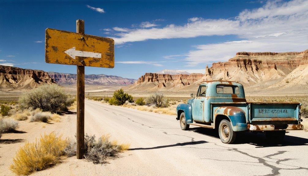
Rockville’s Historic Mail Route
How did mail carriers brave the Owyhee backcountry when dirt tracks connected isolated settlements like scattered breadcrumbs across the high desert? You’ll discover that mail service logistics demanded raw courage between Rockville, Watson, and Silver City. Carriers navigated wagon routes from Jordan Valley through punishing terrain, where mail delivery challenges included river crossings, rattlesnake-infested canyons, and week-long isolation.
The route’s abandonment after Highway 97’s 1917 bypass preserved this corridor’s untamed character. Rockville’s post office limped along until 1952, serving stubborn holdouts who refused to surrender their desert outposts.
Today, you’ll trace these forgotten tracks through private ranchlands and BLM wilderness, where modern adventurers face similar navigation puzzles. Those old mail carriers would recognize your independent spirit, choosing backroads over interstates, seeking stories etched in weathered headstones and collapsed stage stations.
Wildlife Viewing and Rare Plant Species
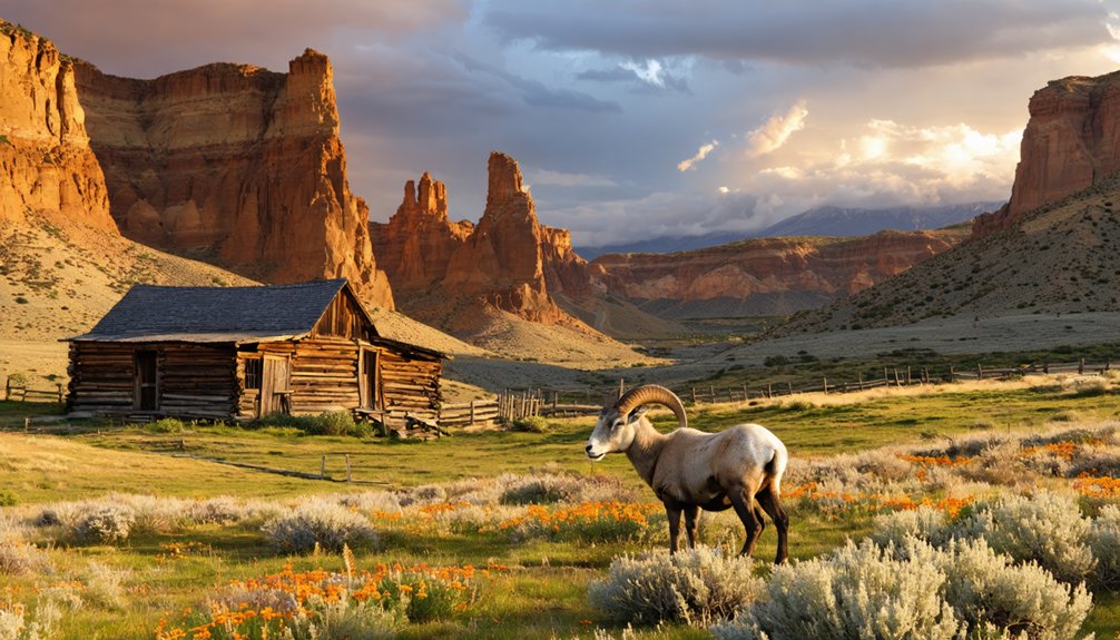
After exploring weathered ghost towns, you’ll discover Leslie Gulch harbors living treasures just as rare as its abandoned settlements. The steep rhyolite cliffs shelter over 200 California bighorn sheep—the country’s largest herd—while the ash-derived soils beneath your boots nurture plants found nowhere else on Earth.
Grab your binoculars for the Juniper Gulch trail, where you’re likely to spot rams traversing impossible cliff faces and, if you’re observant, glimpse the delicate blooms of Packard’s blazing star growing exclusively in this remote drainage.
California Bighorn Sheep Herds
The steep volcanic cliffs of Leslie Gulch harbor one of conservation’s greatest success stories—a thriving population of over 200 California bighorn sheep that once vanished from these canyons entirely. After disease and unregulated hunting wiped them out in the early 1900s, biologists reintroduced 17 sheep in 1965 from Hart Mountain. Today, that bold gamble’s paid off spectacularly—you’re looking at the nation’s largest California bighorn herd.
Hike the 1.6-mile Juniper Gulch trail for your best viewing odds. Scan the talus slopes and cliff faces where these magnificent animals navigate terrain that’d give mountain goats pause.
Conservation challenges persist, though. Oregon Department of Fish and Wildlife uses helicopters for population monitoring and disease testing, ensuring these wild herds stay healthy and free-ranging across the rugged Owyhee drainage.
Endemic Plant Species
Looking closer at those same volcanic slopes where bighorn sheep clamber, you’ll discover something even rarer—plants that exist nowhere else on Earth. Leslie Gulch’s rhyolitic ash-tuff soils nurture botanical treasures like Packard’s blazingstar and Ertter’s groundsel, both endemic annuals clinging to greenish-yellow talus. You’re witnessing endemic flora conservation in action—this Area of Critical Environmental Concern protects over 26 unique species.
The newest discovery? Bentonite biscuitroot, identified in 2024 after hiding in plain sight for decades. These aren’t garden-variety wildflowers; they’re survivors adapted to volcanic substrates that would kill most plants. Protection of rare species here means preserving the very ground beneath your boots. Tread thoughtfully—you’re walking through evolution’s laboratory, where new endemics still emerge from centuries-old ash.
Desert Wildlife Encounters
Few wildlife spectacles rival watching a California bighorn ram navigate sheer volcanic cliffs with balletic precision—and Leslie Gulch delivers this drama regularly. Over 200 sheep comprise the country’s largest California bighorn herd, descendants from just 17 animals reintroduced in 1965. You’ll maximize encounters on Juniper Gulch’s trails, where these agile ungulates share terrain with mule deer and Rocky Mountain elk.
Beyond the marquee species, you’ll spot remarkable diversity:
- Predators: Coyotes, bobcats, and occasional cougars patrol the canyons
- Small mammal sightings: White-tailed antelope squirrels dart across talus slopes while Townsend’s big-eared bats roost overhead
- Seasonal bird migrations: Spring brings abundant non-game birds joining resident chukar partridge, California quail, and raptors
Dawn and dusk offer premium viewing when wildlife ventures into sandy washes for water.
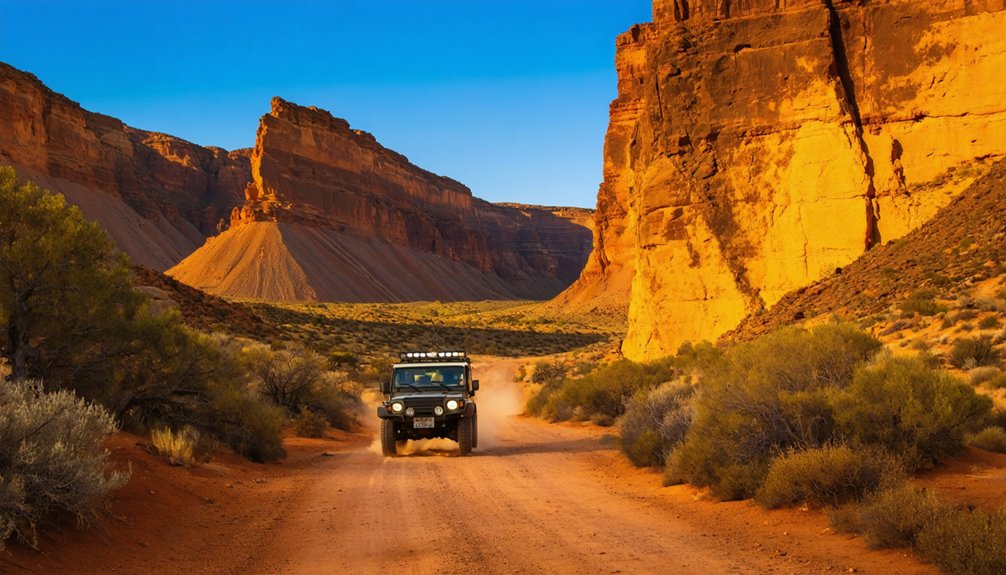
Getting to Leslie Gulch: Routes and Road Conditions
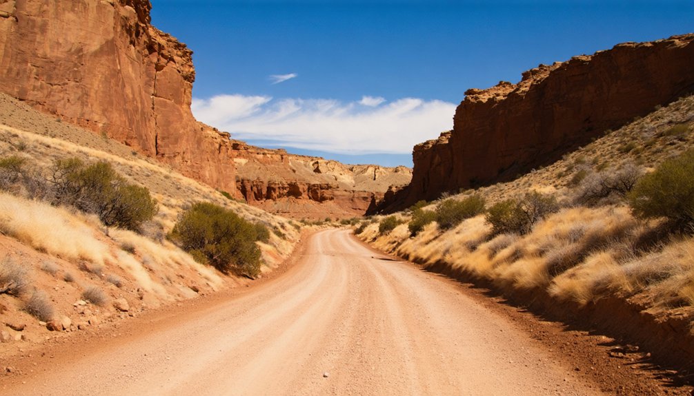
Getting to Leslie Gulch requires traversing a maze of gravel roads that wind through Oregon’s high desert, but don’t let that intimidate you—the journey itself becomes part of the adventure.
The winding gravel maze to Leslie Gulch isn’t an obstacle—it’s where your desert adventure truly begins.
Three main routes converge on this wonderland: the Northern Route via US 95 from Marsing (80 miles from Boise), the Southern Route through Jordan Valley, and the Western approach from Highway 201.
Expect challenging road accessibility with washboarded surfaces demanding slow speeds—figure 1+ hour one-way once you leave pavement.
These isolated location considerations mean filling up in Marsing or Nampa and accepting you’ll lose cell service after 10 miles.
Air down your tires before hitting gravel, and never attempt the drive during rain. Any vehicle can make it in dry conditions, making this remote paradise achievable for freedom-seekers willing to embrace the dust.
Essential Tips for Your Multi-Day Adventure
Once you’ve navigated those dusty roads and rolled into Slocum Creek Campground, you’ll want to maximize your time in this otherworldly landscape. Self reliance requirements are real here—zero cell service means you’re truly off-grid.
Pack your camping essentials strategically:
- Water and fire precautions: Critical during dry seasons when yellowed grasses become tinderboxes
- Shade structures: Minimal natural cover means brutal summer exposure
- Complete supplies: No quick runs to town when you’re this remote
Evening rewards include chukars calling across canyons while sage and juniper scents drift through camp. You’ll hear coyotes echoing off those honeycomb rock formations as temperatures drop. With 200 bighorn sheep roaming nearby and wildlife outnumbering people, you’re experiencing true wilderness freedom—just come prepared for it.
Frequently Asked Questions
Are There Campground Facilities With Water and Restrooms in Leslie Gulch?
You’ll find primitive camping facilities with pit toilets but no water at Leslie Gulch—bring your own supply. Expect limited cell phone coverage, so plan ahead. The remote setting offers true freedom from modern conveniences and crowds.
What Is the Best Season to Visit for Wildflowers and Wildlife?
You’ll find the best wildflower displays from early spring through late spring (April-May), with peak blooms painting the canyons vibrant colors. Visit at dawn or dusk for ideal wildlife spotting, when animals are most active and temperatures stay comfortable.
Do I Need a High-Clearance or Four-Wheel-Drive Vehicle?
Under dry conditions, you won’t need special clearance—most vehicles handle the main road fine. However, road conditions assessment reveals high clearance vehicle advisability after rain, when muddy ruts transform accessible routes into challenging 4WD-only adventures requiring proper preparation.
Are There Entrance Fees or Permits Required to Visit the Area?
No entrance fees or permits required—you’re free to roam this BLM wonderland without bureaucratic barriers. Accessibility considerations include rough roads, but Leslie Gulch welcomes all adventurers. Simply arrive and explore; your wanderlust is your only ticket needed.
Can I Swim or Boat in Lake Owyhee Near Leslie Gulch?
Yes, you can swim and boat in Lake Owyhee near Leslie Gulch. However, check current water levels first—they’ve dropped considerably, affecting boat accessibility. Most boat ramps remain open, though you’ll need proper equipment for safe recreation.
References
- https://www.wanderinraw.com/post/leslie-gulch
- https://flyfisherscluboregon.com/literary-angler-leslie-gulch-orvs-and-a-grand-slam/
- https://pnwphotoblog.com/ghost-town-of-watson-oregon/
- https://npshistory.com/brochures/blm/or/leslie-gulch-succor-ck-nbcb-1990-2.pdf
- https://recklessroaming.com/leslie-gulch-oregon/
- https://www.youtube.com/watch?v=6gHFUM4MNck
- https://traveloregon.com/things-to-do/destinations/parks-forests-wildlife-areas/leslie-gulch/
- https://www.blm.gov/blog/2022-05-16/drawing-lightning-and-inspiration-southeastern-oregon
- https://www.blm.gov/visit/leslie-gulch-area-critical-environmental-concern
- https://wickershamsconscience.wordpress.com/2017/06/20/geology-101-leslie-gulch/


