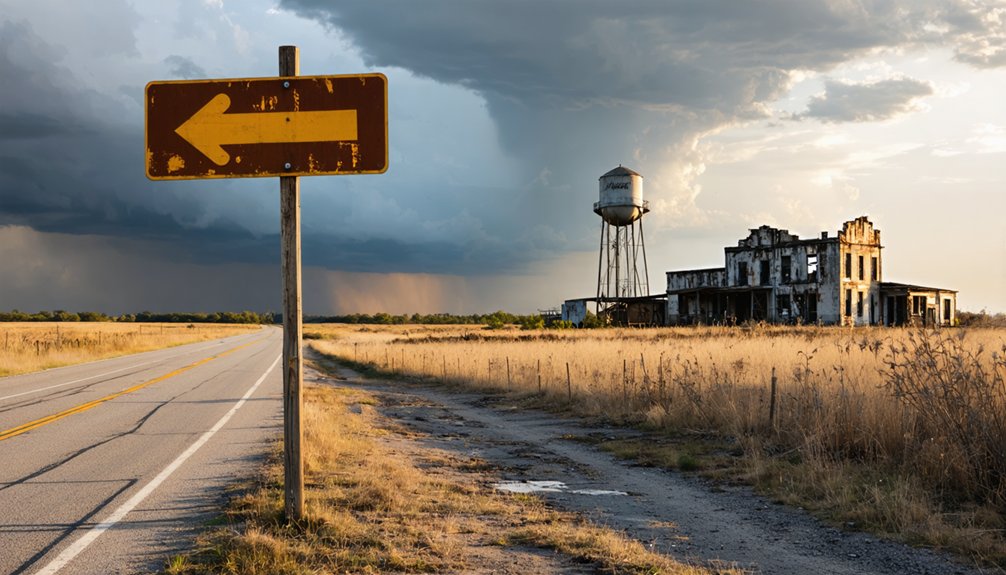
You’ll find Lewisburg’s historical marker along East Burrow Road in Morrilton, where residential streets now cover what was once Arkansas’s bustling river port. The Arkansas River still flows past empty banks where 80 businesses thrived in 1850, before the town refused railroad passage and faded into memory. Visit during fall months when temperatures hover between 50-70°F and you can walk the quiet roads where Confederate troops once drilled. The complete story of this vanished county seat reveals why armies abandoned it twice.
Key Takeaways
- Navigate to Morrilton, AR 72110, then follow State Route 9 toward the Arkansas River and take East Burrow Road west.
- Visit the historical marker, the most tangible remnant of the once-thriving 1850s steamboat port with 80 businesses.
- Explore residential streets where Confederate forces camped and Conway Mounted Rifles organized in May 1861.
- Plan your trip for fall (September-November) with 50-70°F temperatures or late winter for optimal conditions and visibility.
- Avoid May-July for heavy rainfall and October-February when surrounding woods become restricted during hunting season.
Getting to the Historic Site Near Morrilton
Where exactly does a town vanish when progress leaves it behind? You’ll find Lewisburg’s remnants absorbed into Morrilton’s southeastern neighborhoods, roughly 50 miles west of Little Rock. Navigate to Morrilton AR 72110, then follow State Route 9 (South Bridge Street) toward the Arkansas River. East Burrow Road leads you west to the historical marker documenting this Civil War-era settlement.
The ghost town dissolved when the Little Rock and Fort Smith Railroad bypassed it by two miles in 1871. Today’s road conditions favor modern vehicles—paved streets replace muddy trading routes. Parking availability near the marker accommodates curious travelers seeking freedom from interstate monotony.
What remains isn’t abandoned ruins but residential streets where steamboat commerce once thrived, where Confederate forces once camped, where Arkansas River ferries once determined a town’s fate. The Conway Mounted Rifles organized here in May 1861 before Lewisburg became a Union stronghold. Multiple geographical locations across the United States share the Lewisburg name, making this Arkansas settlement distinct among its namesakes.
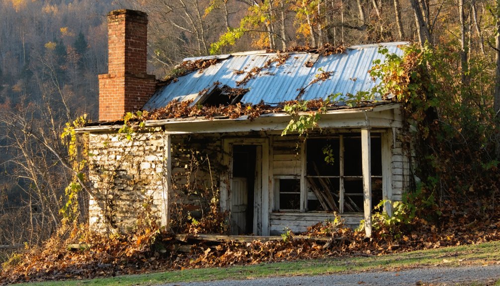
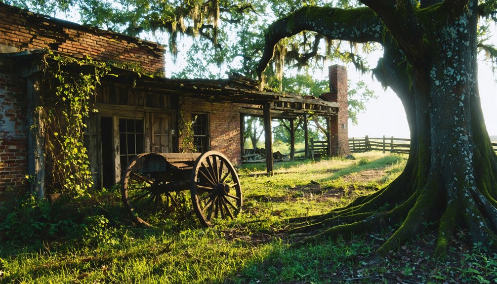
Many of these abandoned buildings in Lewisburg hold stories of a vibrant past, their decaying facades echoing the bustle of earlier years. Each structure offers a glimpse into the lives of those who once inhabited this area, contributing to its rich historical tapestry. As time continues to unfold, there remains hope for revitalization and new beginnings in this unique corner of Arkansas.
What Remains of Arkansas’s Former River Port
Standing where Lewisburg’s steamboat docks once bustled, you’ll spot a historical marker—the most tangible acknowledgment that 2,000 people built lives here. The Arkansas River still flows past empty banks where merchants once tracked seasonal flood patterns and captains consulted river navigation equipment before docking.
Two thousand souls once thrived where now only a marker and the river remember their bustling steamboat town.
What’s vanished tells the story:
- Opera house foundations where settlers gathered for entertainment
- Ferry landing remnants from Charles Isley Sr.’s operation until 1919
- Trading post grounds where Nimrod Menifee established Conway County’s first commercial hub
- Courthouse site that anchored this former county seat’s authority
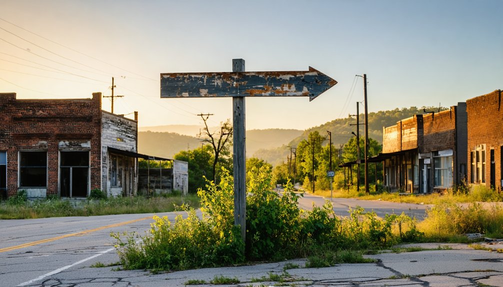
No businesses remain from the 80 that thrived in 1850. No steamboats echo their whistles. Just river currents and silence where refusal of railroad passage sealed this town’s fate, preserving its ghost for those seeking vanished American independence.
Civil War History Along Your Visit
The riverbank silence breaks when you consider what unfolded here between 1863 and 1865—Federal troops raising their flag over contested Arkansas territory, guerrilla fighters emerging from wooded ridges, and a town caught between armies that would abandon it twice before the war ended. You’ll walk ground where the Third Arkansas Cavalry hunted partisan ranger activities through July 1864, tracking irregular forces through Searcy County’s backcountry.
Best Time to Explore the Abandoned County Seat
When September’s humidity finally breaks across the Arkansas River valley, you’ll find Lewisburg’s ruins at their most accessible—dry trails threading through waist-high grasses that haven’t yet browned, foundations emerging from soil that won’t cling to your boots with spring’s mud.
Optimal seasonal site accessibility windows:
- Fall (September-November): Post-rainy season delivers firm ground, 50-70°F temperatures, and 70% lower visitor volume patterns than summer crowds
- Late winter (February-March): Bare trees expose hidden structural details before spring floods block riverbank access. The ferry operated continuously from 1848 until 1920, when bridge construction finally replaced it.
- Avoid May-July: Heavy rainfall creates impassable conditions, while summer heat waves exceed 95°F during midday exploration
- Skip hunting season (October-February): Surrounding woods become restricted, limiting peripheral route options
You’ll claim your solitary discovery when others stay home. The old courthouse burned in 1927, leaving behind charred foundation stones that photograph best in autumn’s angled light.
Nearby Attractions and Modern Morrilton
After exploring Lewisburg’s ghostly remnants, you’ll find modern Morrilton offers a striking contrast just minutes away.
Arkansas’s first state park, Petit Jean, beckons with trails winding past waterfalls and natural bridges, while the Museum of Automobiles showcases gleaming vintage cars perched atop the mountain.
Downtown Morrilton’s restored storefronts now house craft breweries and local eateries where you can swap ghost town stories over handcrafted beer and Southern cooking.
Petit Jean State Park
Just thirty miles from Lewisburg, Petit Jean State Park rises atop its namesake mountain like a natural cathedral of stone and forest, where Arkansas’s oldest state park has been luring travelers since 1923. You’ll discover ancient rock formations sculpted by millennia—towering bluffs, natural bridges, and Bear Cave’s boulder-strewn passages that invite exploration on your own terms.
The park delivers seasonal recreation opportunities year-round:
- Cedar Falls Trail: Navigate 2 strenuous miles down canyon walls to a 95-foot waterfall
- Rock House Cave: Examine preserved Native American pictographs in Arkansas’s largest bluff shelter
- Seven Hollows Loop: Trek 4.5 miles through box canyons and stone arches
- Lake Bailey: Paddle across mirror-still waters reflecting ancient cliffs
The CCC-built Mather Lodge anchors it all—rustic stone and timber architecture that respects the wilderness surrounding it.
Museum of Automobiles
Stone and timber give way to steel and chrome atop this same mountain, where the Museum of Automobiles sprawls across 57 acres like a mechanical shrine to American ingenuity. You’ll find over 50 fully restored machines spanning 1904 to 1981, each one whispering stories of freedom’s evolution on four wheels.
The tensile cable structure—Arkansas’s largest when it opened in 1964—lets you roam unobstructed among rarities: a 1923 Climber Touring car (the only survivor from Arkansas’s own manufacturer), Elvis’s personal ride, and Rockefeller’s Cadillacs. Vehicle restoration here isn’t mere preservation; it’s resurrection.
Burma-Shave signs line your path between displays showcasing automotive innovation from hand-cranked Fords to chrome-laden behemoths. The coin-operated piano still plays for two quarters—authentic, functional, unapologetically vintage.
Downtown Morrilton Dining
When hunger strikes after your mountain explorations, Morrilton’s dining scene pulls you down from Petit Jean’s summit into a surprisingly diverse culinary landscape. You’ll find local chef specialties ranging from Yesterday’s Bar + Grill’s Thursday spaghetti with Petit Jean Sausage to Mackey’s perfectly fried catfish. Limited service hours at gems like Stick’s Deli (weekdays only, cash exclusively) and Salty Dalty’s BBQ (Fridays and Sundays) reward flexible travelers willing to adjust their schedules.
Downtown options worth pursuing:
- Los Cabos Mexican Grill – Deck seating with hilltop views and bacon-wrapped fajitas
- Cedar Lounge – Live bands on weekends, enclosed patio atmosphere
- Point Remove Brewing – Craft beers and rotating food trucks
- Atkinson’s Blue Diamond Cafe – Classic diner with attached ice cream parlor
Each venue reflects Morrilton’s unpretentious character—satisfying food without tourist trap pricing.
Photography Tips for Documenting the Ruins
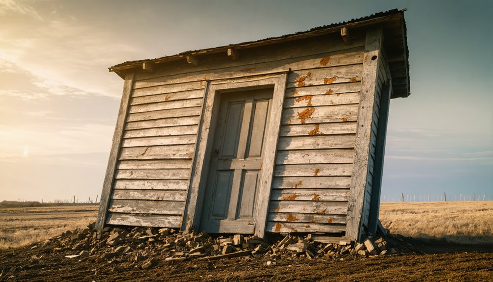
You’ll capture Lewisburg’s haunting essence best during the golden hours when low-angle light rakes across weathered wood and crumbling stone, revealing every crack and texture that time has carved into these structures.
Position yourself to frame the ruins against their overgrown surroundings—let massive oaks dwarf abandoned doorways and wild vegetation reclaim porches to show nature’s patient victory over human ambition.
Your lens becomes a preservation tool here, so shoot wide to document entire facades and their relationship to the landscape, then move close to record the architectural details that tell stories of the families who once called this ghost town home.
Best Lighting and Angles
As the sun dips toward the horizon, Lewisburg’s crumbling facades transform into a photographer’s canvas where light and shadow dance across weathered wood and rusted metal. Golden hour delivers balanced natural light that accentuates every texture on decaying surfaces, while low-angle rays create dramatic silhouette contrast against the Arkansas sky.
For capturing these abandoned structures at their finest:
- Position yourself to frame backlit silhouettes, letting building outlines cut sharp profiles against the glowing horizon
- Shoot from 90-degree angles to reveal dimensional details and underside textures
- Pack powerful flashlights for exploring dark interiors, bouncing light off floors for even illumination
- Mount your camera on a tripod for 15-30 second exposures that blend ambient moonlight with strategic light painting
Avoid midday’s harsh flatness—this ghost town rewards patient photographers who chase shadows.
Preserving Historical Context Visually
Mastering light and shadow means little if your images fail to tell Lewisburg’s story. You’ll need contextual captions that reference the 1868 Klan-militia burnings and Freedmen’s Bureau sites—ethical data collection demands historical accuracy.
Record GPS coordinates in your metadata to map 1844 incorporation-era foundations for researchers. Before shooting private ruins, understand legal requirements for site access; trespassing charges undermine preservation efforts.
Frame engraved Civil War markers alongside decayed structures to show temporal layers. Your non-invasive approach protects fragile artifacts while documenting what remains.
Black-and-white conversions strip away distraction, letting viewers focus on texture and form. Archive prints on acid-free materials—your photographs become historical records themselves, liberating forgotten narratives from obscurity.
Frequently Asked Questions
Why Did Lewisburg Residents Refuse to Fund the Railroad in 1866?
You’ll find Lewisburg’s residents were financially devastated after Union occupation drained their resources. Economic decline from wartime destruction left them unable to contribute, while lingering social tensions from the war’s aftermath made collective fundraising impossible in 1866.
What Happened to the Black Community After White Residents Abandoned Lewisburg?
You’ll discover the abandoned community became entirely Black by 1875. Despite white relocation, racial tensions persisted through KKK violence and militia conflicts. The freedmen’s resilience transformed Lewisburg into their own space until complete abandonment in 1925.
Are There Guided Tours Available at the Lewisburg Historic Site?
No guided tour availability exists at Lewisburg’s site—you’ll explore independently. Historical interpretation methods here rely on your own discovery through weathered remnants and fading traces. You’re free to wander, imagine, and piece together stories at your own pace.
Is Permission Required to Explore the Ruins on Private Property?
Yes, you’ll need permission. With 700+ acres of ghost towns now privately owned, landowner permission requirements are strict—trespassing risks legal consequences. Most sites lack public access policy, so you must contact owners before exploring these atmospheric ruins and crumbling foundations.
What Specific Buildings or Structures Are Still Visible at the Site?
You’ll discover crumbling foundations scattered through overgrown vegetation and remnant chimneys standing like silent sentinels. The train depot’s structure remains visible, while nature’s reclaimed most residential ruins, leaving only weathered wood fragments and architectural ghosts.
References
- http://freepages.rootsweb.com/~gtusa/history/usa/ar.htm
- https://en.wikipedia.org/wiki/Lewisburg
- https://www.hmdb.org/m.asp?m=170456
- https://kids.kiddle.co/Lewisburg
- https://encyclopediaofarkansas.net/entries/skirmish-at-lewisburg-6842/
- https://www.arkansasheritage.com/arkansas-register/south-howard-street-historic-district
- http://genealogytrails.com/ark/conway/history_overview.html
- https://encyclopediaofarkansas.net/entries/lewisburg-conway-county-2725/
- https://encyclopediaofarkansas.net/entries/conway-county-courthouse-7665/
- https://honors.uca.edu/wiki/index.php/Lewisburg