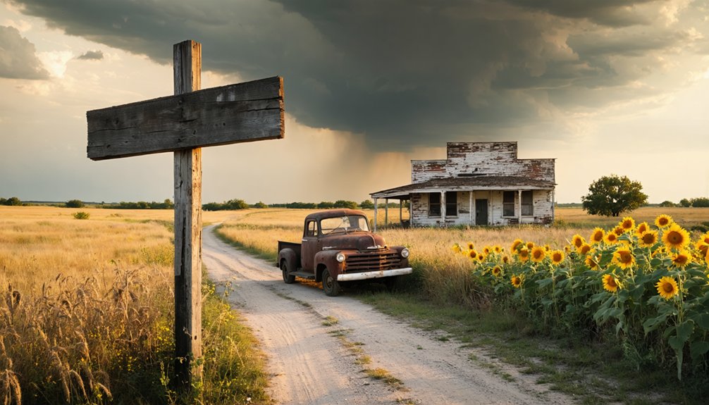
You’ll find Little Chief’s haunting remains 5 miles southeast of Burbank in Osage County, where 2,000 oil boom dreamers once crowded streets that barely exist today. Take US Highway 60 east from State Highway 18, using GPS coordinates 36.6658794°N to navigate, as modern maps mislead. The old Tacola Cloud Chief school still stands alongside crumbling store foundations and sidewalk fragments near Little Chief Creek, while a granite marker commemorates this vanished Carter Oil Company town that exploded with the Burbank Field’s 160 million barrels before collapsing by 1926—though there’s considerably more to discover about planning your complete ghost town route.
Key Takeaways
- Little Chief is located 5 miles southeast of Burbank in Osage County, accessible via US Highway 60 east from State Highway 18.
- Use GPS coordinates 36.6658794°N and the Burbank USGS topographic map, as modern maps may show inaccurate locations.
- Visit the old Tacola Cloud Chief school, crumbling store structures, sidewalk fragments, and a granite historical marker commemorating the town.
- The US Highway 60 bridge over Little Chief Creek provides a vital landmark in this remote countryside area.
- Little Chief’s boom-and-bust oil history saw population surge from 500 to 2,000 before economic collapse scattered residents.
The Rise and Fall of Little Chief: From Ranching Town to Oil Boom Settlement
Before oil derricks pierced the Oklahoma sky, the land around Little Chief belonged to cattle and cotton. You’d have witnessed ranches sprawling across the Kansas-Oklahoma border, where livestock operations ran Hereford cattle alongside hogs, dairy cows, and sheep. The Cross Bell Ranch alone commanded over 130,000 acres, shipping more cattle on the Santa Fe Railroad than anyone else.
Agricultural diversification kept these settlements thriving—wheat fields stretched toward orchards heavy with apples and pecans, while mule teams hauled baled hay across the prairie. The railroad brought nearly 500 people to this farming community.
Then oil struck. Population exploded to 2,000 practically overnight. Businesses mushroomed during the boom, but when wells ran dry, Little Chief joined Oklahoma’s ghost town roster, reduced to scattered foundations and memories. Like nearby Courtney Flats, the town faded when land privatization shifted ownership patterns and displaced the businesses that had given the community its lifeblood. Drilling crews and service businesses emerged with the oil economy, circulating money in new ways that transformed the traditional patterns of community life.
Understanding Little Chief’s Peak Population During the Burbank Oil Field Era
When oil exploded from the Burbank Field in 1920, Little Chief’s population surged from 500 farming families to 2,000 fortune-seekers packed into hastily constructed boarding houses and tent cities.
You’ll find this population boom mirrored the region’s transformation—nearby Fairfax swelled to 1,380 residents while Burbank claimed its own stake with 141 souls chasing black gold. The twelve-mile-long field pumped 160 million barrels worth $286 million during its heyday, creating instant millionaires and desperate workers alike.
But freedom came with a price. By 1926, production dropped by half, triggering an economic bust that scattered the dreamers. Within a decade, Little Chief’s temporary structures stood empty, abandoned to Oklahoma’s relentless wind and the ghosts of fortunes lost. Today’s Little Chief spans just 0.332 square miles, a stark reminder of how completely the boomtown collapsed. The town’s fate reflected how ambiguous place names across oil-boom territories often led settlers to the wrong destinations, contributing to the confusion and chaos of the era.
How to Find Little Chief: Location and Driving Directions in Osage County
You’ll find Little Chief’s ghostly remains at coordinates 36.6658794°N in the rolling grasslands of Osage County, where Little Chief Creek winds through abandoned oil field territory five miles southeast of Burbank.
To reach this forgotten settlement, drive east on US Highway 60 from its junction with State Highway 18, continuing 4.6 miles until you cross Little Chief Creek’s bridge. GPS coordinate accuracy proves essential here—modern mapping shows the hamlet near Remington and the old Carter Nine townsite, but ground-level markers have vanished into prairie grass.
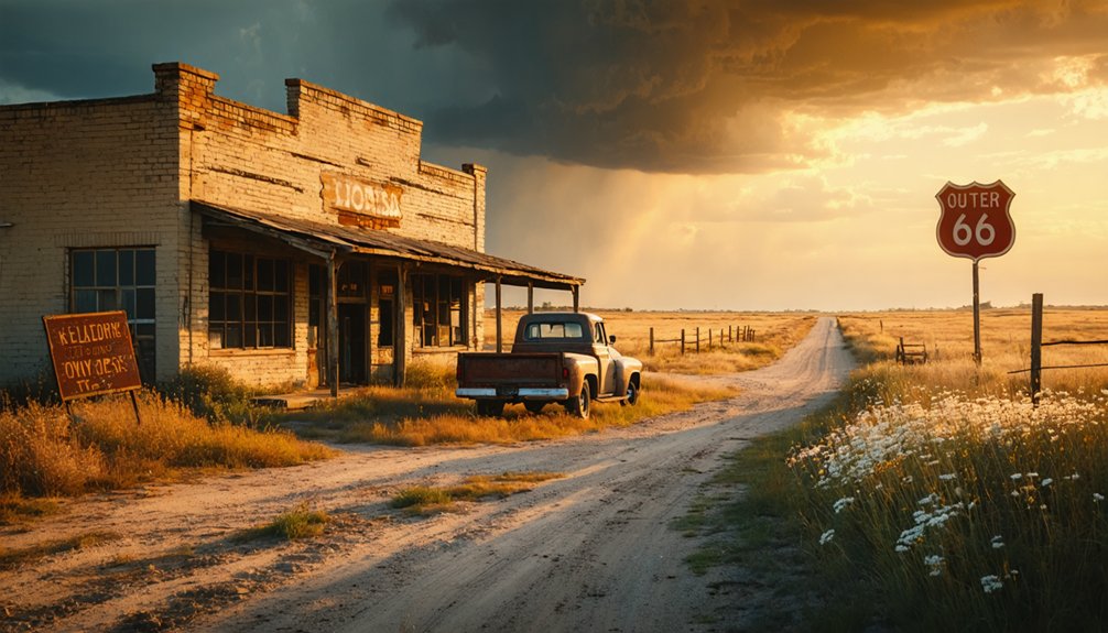
The Burbank USGS topographic map pinpoints the area best, while aerial photography locations reveal faint road traces threading through former boom-town blocks. The bridge carrying US Highway 60 over Little Chief Creek features Rural Principal Arterial classification, serving as a vital connection through Osage County’s remote countryside. Little Chief once supported a thriving oil industry and bustled with activity a century ago, before the inevitable decline left only memories scattered across the plains. Pack your adventurous spirit; these backroads demand respect and self-reliance as civilization feels wonderfully distant.
What Remains Today: Buildings and Structures Still Standing
Little Chief’s ghostly landscape offers only whispers of its boom-town past, where weathered remnants punctuate endless prairie grass like forgotten punctuation marks.
Time-worn relics scattered across windswept grasslands whisper stories of prosperity now faded into Oklahoma’s haunting prairie silence.
You’ll discover the old Tacola Cloud Chief school standing defiantly since 1960’s closure, its repurposed school facilities now serving as storage beneath an intact gymnasium roof. Multiple chimneys hint at harsh Oklahoma winters conquered with wood and coal.
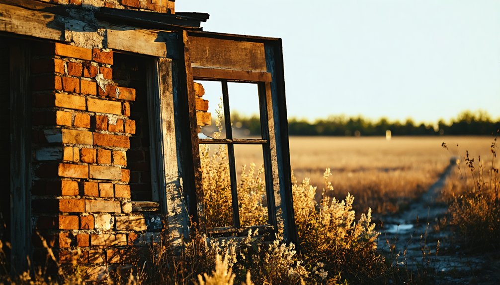
The crumbling store structures near Little Chief Creek have surrendered to time—what stood proudly since the 1930s now lies as scattered bricks across open ground.
A couple houses still cling to existence along County Road 5920, while sidewalk fragments and old foundations sketch Carter Oil Company’s vanished company town. Like many ghost towns across Oklahoma, abandonment came when residents relocated to be closer to larger cities. A granite historical marker by the Oklahoma Historical Society stands as the town’s official memory keeper. Most residents relocated to nearby Shidler, leaving behind these skeletal traces for adventurers seeking authentic abandonment.
Cloud Chief’s Unique Story: The 1892 Land Run and Tent City Beginnings
On April 19, 1892, Oklahoma’s prairies witnessed chaos orchestrated by ambition—over 25,000 hopefuls thundered across the Cheyenne-Arapaho Reservation at high noon, transforming 3.5 million acres of tribal land into a settler’s free-for-all. Among the dust and determination, land run participants staked claims on a 320-acre parcel designated as County H’s seat, originally named Tacola before becoming Cloud Chief.
Within weeks, a tent city setup materialized where nothing existed before—zero to 3,000 souls gambling on fresh starts. Canvas shelters dotted the landscape while settlers burrowed into the earth, constructing thirty-five dugouts by 1898. Fifty proper homes eventually rose from the grasslands. These weren’t government-planned communities—they were raw expressions of frontier independence, where you claimed what you could defend and built what you needed to survive. The Dawes Act of 1887 had allotted 160 acres to individual Indians before the remaining tribal lands were sold to the federal government, setting the stage for this dramatic land opening. The Cheyenne and Arapaho tribes had arrived in 1869 to reside on their reservation, establishing the territory that would later become the site of this historic land run.
Why These Towns Became Ghost Towns: Transportation and Economic Factors
Prosperity proved fleeting across Oklahoma’s prairies, where entire communities rose and fell with the whims of distant corporate boardrooms and railroad surveyors.
You’ll discover that single industry dependence sealed these towns’ fates—when oil wells ran dry or mining companies packed up, entire populations followed. Railroad routing decisions proved equally decisive: Kusa collapsed after tracks bypassed it for Henryetta, cutting off market access overnight.
Resource depletion impact hit hardest in places like Little Chief, where the Burbank Oil Field’s boom created instant towns that vanished just as quickly. Without economic diversity, these settlements couldn’t pivot when extraction ended. The toxic chat piles and 1,400 abandoned mineshafts left behind only accelerated the exodus, transforming thriving communities into windswept ruins.
Best Time to Visit and What to Expect on the Ground
Few ghost town expeditions require more careful planning than a visit to Little Chief, where spring’s mild temperatures between March and May offer your best window for exploration. You’ll find remnant structures visibility peaks during this season—moderate vegetation reveals foundations and scattered building materials without summer’s obscuring growth.
Fall presents another excellent option with clear sight lines and comfortable temperatures for extended ground surveys.
Expect weathered stone foundations marking former businesses, faded signs barely clinging to existence, and open fields where commerce once thrived. Since the site sits on private land, you’ll need landowner permission before exploring. Current residents often share stories about businesses their families remember.
Winter reduces cover but brings muddy seasonal road conditions that’ll challenge vehicle access on rural properties.
Nearby Ghost Towns Worth Adding to Your Route: Carter Nine, Foraker, and Grainola
Your exploration of Little Chief doesn’t need to end with a single ghost town—three compelling destinations lie within easy driving distance, each offering distinct chapters of Osage County’s turbulent oil boom history.
Three ghost towns within minutes of Little Chief reveal different fates from Oklahoma’s oil boom era.
Carter Nine (2.5 miles south of Shidler) now exists only in scattered concrete chunks hidden beneath prairie grass. This 1922 company town once housed 50 families before complete abandonment.
Three sites tell different survival stories:
- Carter Nine: Total disappearance—only sidewalk remnants mark where 50 company houses stood
- Foraker: Population crashed from 2,000 to 18, yet remains stubbornly incorporated
- Grainola: The decline of Grainola’s population mirrors countless oil towns—500 residents dwindled to 31
You’ll find the remnants of Carter Nine most haunting: a fenced community erased so thoroughly that maps still mistakenly show its existence.
Photography Tips and What to Look for at Abandoned Sites
When golden hour light filters through the skeletal remains of Little Chief’s abandoned structures, you’ll discover why photographers consider ghost towns among Oklahoma’s most rewarding subjects. Pack your wide-angle lens to capture vast emptiness, and bring a sturdy tripod for interior lighting techniques requiring 30-second exposures at f/8. Your flashlight becomes both navigation tool and creative instrument—paint light across forgotten corners while stars trace overhead.
Focus on intimate details: rusted door handles, peeling paint textures, and weathered signage tell richer stories than sprawling architectural shots. Avoiding common photographic pitfalls means arriving at dawn before others disturb pristine dust patterns, and bringing lens-cleaning supplies for Oklahoma’s persistent debris. Black-and-white processing enhances that timeless quality, transforming modern captures into historical narratives worth the journey.
Oklahoma’s 2,000 Ghost Towns: Part of a Larger Boom and Bust Legacy
Little Chief represents just one thread in Oklahoma’s sprawling tapestry of abandonment—a state harboring an estimated 2,000 ghost towns scattered across red earth and prairie grass. You’re exploring territory that ranks fifth nationally, where frontier economics dictated survival and statehood’s impact reshaped entire communities overnight.
These phantom settlements reveal America’s boom-and-bust DNA:
- Texas leads with 511 ghost towns, followed by California’s 346 and Kansas’s 308
- Pre-statehood liquor towns and mining camps vanished when resources dried up or laws changed
- Every state harbors at least one ghost town, totaling over 4,531 nationwide
Oklahoma’s abandoned settlements weren’t failures—they were freedom’s laboratories. Each site tested whether grit, grain, or gold could sustain life where nothing guaranteed tomorrow.
Frequently Asked Questions
Is It Legal to Enter the Remaining Buildings in Little Chief?
No, you can’t legally enter without permission. Like stepping into Narnia’s wardrobe uninvited, private property concerns and potential trespassing issues make unauthorized exploration criminal. Contact landowners first—freedom means respecting boundaries while seeking adventure responsibly.
Are There Any Safety Hazards Like Unstable Structures or Wildlife?
Yes, you’ll face serious structural stability issues with 86% of buildings undermined by mineshafts that could collapse anytime. Toxic chat piles create hazardous dust, while potential wildlife concerns include contaminated sinkholes and unstable ground throughout the area.
Do I Need Special Permits to Photograph the Abandoned Sites?
You’ll need private property access permission from landowners before photographing Little Chief’s ruins. Oklahoma doesn’t require photography permits on private land, but always secure permission first. Bring your photography equipment and respect boundaries—trespassing charges aren’t worth the shot.
Are There Nearby Facilities Like Gas Stations or Restrooms?
No facilities exist at Little Chief itself. You’ll need to plan ahead—Foraker (population 18) and Grainola offer minimal nearby amenities availability. Your best bet? Fuel up in Pawhuska before heading out, ensuring accessibility of facilities for your adventure.
Can I Take Artifacts or Souvenirs From the Ghost Town?
No, you can’t take souvenirs from Little Chief. Avoid removing artifacts—Oklahoma’s antiquities laws protect these relics, with serious penalties. Consider leaving the site undisturbed to preserve history for future explorers seeking their own authentic ghost town adventures.
References
- https://www.rideok.com/ghost-towns-of-oklahoma-cloud-chief/
- https://www.youtube.com/watch?v=pRIJ7Iq6-6g
- https://en.wikipedia.org/wiki/List_of_ghost_towns_in_Oklahoma
- https://www.okhistory.org/publications/enc/entry?entry=GH002
- https://www.ghosttowns.com/states/ok/littlechief.html
- https://gateway.okhistory.org/ark:/67531/metadc1593649/
- https://stonewallsaloonmuseum.com/local-history
- https://www.madillrecord.net/news/origins-little-city
- https://okqha.org/portfolio-item/mullendore-cross-bell-ranch/
- https://www.kcur.org/2023-11-07/killers-of-the-flower-moon-oklahoma-town-history


