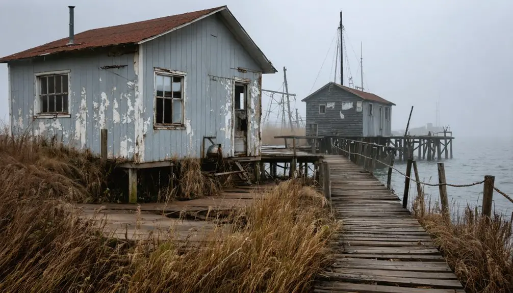
You’ll find Little Wolf’s ghost town site along the river at 44°25’20″N 88°54’05″W in central Wisconsin’s rolling farmland, roughly 40 miles northwest of Appleton off WI-54. What remains of this 1848 frontier settlement amounts to weathered foundation stones, subtle depressions where a hotel once stood, and the Little Wolf River still flowing past vanished sawmills and stores. Combine your visit with nearby Manawa’s parks and Fremont’s quirky CITGO station, and you’ll discover why this vanished community still whispers stories of frontier ambition and boom-to-bust tragedy.
Key Takeaways
- Little Wolf is located in central Wisconsin at coordinates 44°25’20″N 88°54’05″W, accessible via WI-54, WI-22, and U.S. Highway 10.
- Start from Waupaca to the southeast or use Manawa’s Fisherman’s Park and wayside rest areas for parking and trailhead access.
- Search for weathered stone foundations of Goldberg’s sawmill, Meiklejohn’s grist mill, and subtle depressions marking the former two-story hotel.
- Combine your visit with Marble ghost town eight miles north and Fremont fifteen miles south for a full day trip.
- Stop at Manawa’s Bridge Bar for refreshments after exploring the abandoned townsite along the Little Wolf River.
The Rise and Fall of Little Wolf: From Centerville to Ghost Town
When William Goldberg carved out his homestead along the Little Wolf River in 1848, he couldn’t have imagined that the bustling settlement he’d help create would vanish almost as quickly as it rose. Within a decade, this frontier outpost—first called Centerville, then Little Wolf—transformed into a thriving hub.
The early town economy flourished with sawmills, groceries, a smithy, and the Meiklejohn grist mill. You’d have found a two-story hotel, a schoolhouse, and Jack Brickley’s river bridge connecting commerce and community.
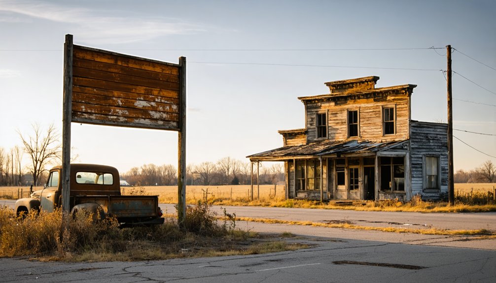
But by the 1870s, everything shifted. When competing mills emerged upriver and railroads bypassed Little Wolf for neighboring Manawa, the town’s fate was sealed. Today, only fading foundation stones preserve its town legacy, whispering tales of ambition swallowed by progress.
Key Historical Landmarks and What Remains Today
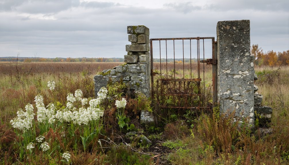
Standing at the coordinates 44°25′20″N 88°54′05″W today, you’ll strain to find evidence that a village ever existed here. The abandoned townsite features have vanished entirely—Goldberg and Mores’ 1849 sawmill, Peter Meiklejohn’s grist mill and two-story hotel, the 1857 schoolhouse where Miss Fortner once taught. Even the foundations that lingered until recently have disappeared.
You’re standing where early transportation infrastructure once defined commerce: Brickley Bridge spanned the river in 1858, connecting settlements straddling the waterway. The 1871 upriver lumbermill and 1873 Manawa railroad sealed Little Wolf’s fate, draining away its purpose. Now only the river remains, flowing past banks where smithies hammered, mills ground grain, and children learned their letters in frontier classrooms.
Getting There: Directions and Best Routes to the Site
You’ll find Little Wolf tucked into central Wisconsin’s rolling farmland at coordinates 44.423237°N, -88.897676°W, best reached by following WI-54 through Waupaca County’s patchwork of fields and woodlots.
The ghost town sits roughly 40 miles northwest of Appleton and 20 miles west of New London, where state highways give way to quiet county roads that wind through the Town of Little Wolf.
Your journey requires no interstate driving—just patient navigation along WI-54 or WI-22, where grain silos and weathered barns serve as landmarks guiding you toward this nearly forgotten settlement.
Highway Access Points
Tucked into the rural flatlands of central Wisconsin, Little Wolf sits at coordinates 44.423237°N, 88.897676°W—a ghostly remnant you’ll reach primarily through the small town of Manawa, your modern-day gateway to this vanished settlement.
Wisconsin Highway 54 serves as your main artery, cutting through Manawa from Green Bay (45 miles southeast) or Appleton (30 miles east). From there, county road accessibility becomes essential—you’ll navigate local routes that branch southward from Bridge Street toward the Little Wolf River bottomlands.
U.S. Highway 10 provides your west-east corridor option, while Highway 22 connects north-south traffic. These relevant historical routes mirror the 1873 railroad path that once brought settlers here. You’re driving where steam engines once hauled timber and dreams, following asphalt laid over wagon trails that fed this now-silent community.
Parking and Trail Options
When you arrive at the Little Wolf area, your parking options depend entirely on your chosen approach to this ghost town’s scattered remains. If you’re launching a paddle exploration, head to the wayside park off Highway 22/110 in Manawa, where easy access leads past the warehouse toward the baseball diamond.
For overnight adventures, certain DNR lots welcome backpackers and paddlers—just notify the property office with your vehicle details to avoid tickets. Be aware that overnight parking rules prohibit vehicles lingering beyond 48 hours without notice, and parking restrictions apply from 3 a.m. to 6 a.m. in some areas.
Always remove valuables from your vehicle, as these remote locations attract opportunistic thieves. Park during designated hours and respect posted signage throughout your ghost town expedition.
Since Little Wolf’s coordinates place you at 44°25’20″N 88°54’05″W in the heart of Waupaca County’s rural expanse, you’ll need solid landmarks to guide your approach through central-eastern Wisconsin’s maze of county highways.
The city of Waupaca, your primary gateway to the southeast, offers the last reliable services before venturing into backcountry. Study county road maps carefully—this isn’t GPS territory.
Outagamie County’s eastern border provides essential orientation, while Oneida County’s line marks your northern boundary. The region topography features gentle farmland punctuated by woodlots, making visual traversal challenging.
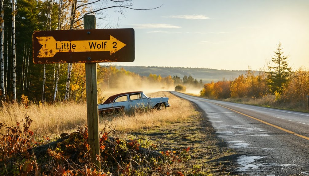
Marble ghost town, eight miles north at 44°33’45″N 88°52’15″W, serves as an excellent companion waypoint. You’re exploring freedom’s playground here, where self-reliance beats digital dependence every time.
What to Look for When Exploring the Former Settlement
As you navigate the overgrown landscape where Little Wolf once thrived, your eyes should scan the southwest bank of the river for weathered stone foundations—these are the skeletal remains of Goldberg’s sawmill and the Meiklejohn brothers’ grist mill that powered the settlement’s economy.
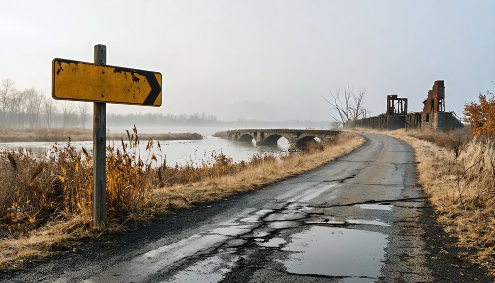
The river crossing itself tells a story; search for any traces of Jack Brickley’s 1858 bridge, though nature has likely reclaimed most evidence of this essential link.
Look for subtle depressions in the earth and scattered foundation stones that mark where the two-story hotel stood alongside the mill, forming the commercial heart of this vanished community.
Historic Mill Foundation Remnants
The stone foundations along both banks of the Little Wolf River tell the story of Little Wolf’s industrial heart—the Dewey-Silvieus Sawmill that once anchored this settlement’s economy. You’ll spot these stone ruins running parallel to the water, with dam remnants cutting across the brook behind the mill site. The fieldstone and brick construction reveals multiple layers, evidence of modifications throughout the mill’s operation.
On the southern bank, seek out Peter Meiklejohn’s 1857 grist mill foundations—among the longest-surviving structural remnants from the original settlement. These mill infrastructure remains showcase 19th-century engineering ingenuity, with penstock systems that once diverted water to power massive turbines. Each weathered stone marks humanity’s determined effort to build something lasting from wilderness.
Little Wolf River Crossing
Where Wolf River Drive dips toward the water south of Main Street, you’ll discover the crossing that funneled hundreds of pioneer families into Wisconsin’s frontier interior. This spot marks where wilderness met opportunity after the 1852 legislative proclamation opened Menominee lands for settlement.
Early crossing history reveals:
- William Goldberg claimed this territory in 1848, two years before official settlement began
- Jack Brickley’s 1858 bridge replaced treacherous ford crossings that tested pioneer determination
- Steamboats transformed this landing into a crucial artery for transporting settlers and supplies
- Half a billion board feet of logs floated past during the 1873 logging boom alone
- The public boat ramp now occupies ground where Menominee villagers lived for generations
Transportation options today include the riverside trail and fishing access, replacing the commercial traffic that once defined this gateway.
Original Settlement Location Markers
Standing where Wolf River Drive meets the water’s edge, you’ll find yourself tracing the footsteps of William Goldberg, who staked his claim here in 1848 when this bend in the river represented the absolute edge of American settlement. Wisconsin Registered Landmark Number 48 marks this pioneer entry point at coordinates 44° 15.527′ N, 88° 51.802′ W.
The historical marker design commemorates the June 1, 1852 opening date, though settlement began four years earlier. Marker placement considerations positioned it near vanished grist mill foundations and the two-story Meiklejohn hotel site.
You’ll discover sawmill remains along the southern township border where Goldberg and Mores built their 1849 operation. These scattered foundations reveal Centerville’s brief existence before its 1854 renaming to Little Wolf—tangible proof of dreams that faded into Wisconsin’s wilderness.
The Little Wolf River: Heart of the Lost Community
Flowing through the heart of what was once a thriving frontier settlement, the Little Wolf River carved more than just a channel through the Wisconsin wilderness—it carved opportunity itself. You’ll discover how this waterway powered sawmills and grist mills starting in 1849, transforming raw wilderness into civilization.
Where pioneers saw only wilderness and water, the Little Wolf River revealed the blueprint for an entire civilization.
The 1870s logging boom sent half a billion board feet downstream in a single year, but environmental devastation followed prosperity.
Today’s river ecosystem restoration tells a comeback story:
- Native brook trout returned after the last dam’s removal in 1926
- Rainbow trout introduction revitalized fishing opportunities
- Protected natural area showcases regenerating forests
- Charred hemlock stumps mark the logging era’s scars
- Fly fishing access points welcome modern adventurers
Community redevelopment plans now honor the river’s heritage while protecting what remains.
Combining Your Visit With Nearby Fremont and Manawa
While Little Wolf’s ghostly remnants whisper tales of frontier ambition, the living towns of Fremont and Manawa bookend your journey with warmth and sustenance. You’ll find Fremont fifteen miles south—a perfect basecamp where Union Star Cheese Factory beckons with cheese tastings that’ll fuel your explorations. Stock up at the CITGO station (Fremont’s quirky general store-meets-gas-pump) before venturing into the wild.
Manawa lies twenty minutes north, offering regional parks and Wolf River access for those craving solitude beyond the ghost town itself. Start mornings at Fisherman’s Park, spend midday chasing Little Wolf’s shadows, then return for paintball chaos or Bridge Bar’s cold brews. This triangle of discovery lets you dance between past and present, isolation and community, on your own untethered terms.
Best Times to Visit and What to Bring

Your triangle of discovery only succeeds if you time it right and pack smart. Spring and fall offer perfect weather patterns—mild temperatures between 45-65°F without summer’s oppressive humidity or winter’s harsh conditions. You’ll encounter clearer skies for photographing abandoned structures, though morning fog adds atmospheric mystery to your exploration.
Essential clothing and gear:
- Layered system: moisture-wicking base, fleece mid-layer, waterproof shell
- Sturdy waterproof boots for muddy gravel roads
- Insect repellent clothing for late summer waterway visits
- Offline maps and portable charger for spotty rural signals
- Binoculars and first-aid kit with tick tweezers
Avoid peak mosquito season in late summer. The gravel access roads dry best May through October, while winter demands chains and brings solitude—fewer travelers means these ghost towns become entirely yours.
Frequently Asked Questions
Are There Any Guided Tours Available for Little Wolf Ghost Town?
No formal tours exist, but you’ll discover Little Wolf’s secrets through self-guided tours and local historian interviews. With zero commercial operators, you’re free to explore this abandoned settlement’s haunting remains at your own adventurous pace.
Is Camping Allowed Near the Little Wolf River Site?
Camping isn’t allowed on Little Wolf River’s State Natural Area lands, but you’ll find private campgrounds nearby offering river access. You can explore fishing access points year-round, though seasonal accessibility varies. Wolf River Trips & Campground provides convenient riverside sites.
What Wildlife Might I Encounter While Exploring the Area?
Like silent shadows through morning mist, you’ll discover deer sightings along forest trails while bird watching opportunities abound—broad-winged hawks soaring overhead, great blue herons stalking wetlands, and ovenbirds calling from hemlock groves surrounding you.
Are There Any Local Museums With Little Wolf Artifacts or Exhibits?
You’ll discover Little Wolf’s past through historical society exhibits at both Iola and Waupaca museums. They preserve local archives documentation showcasing the area’s pioneer heritage, with artifacts telling stories of freedom-seeking settlers who built this vanished community.
Can I Access Private Property to See Foundation Remnants?
Don’t let curiosity lead you astray—you can’t access those foundation remnants without landowner permission. Privacy concerns and trespassing laws protect these historic sites on private property. Always seek explicit consent before exploring, or you’ll face legal consequences and hefty fines.