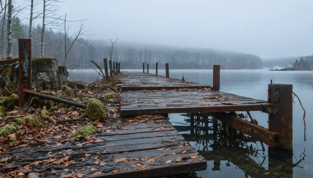
Your Love Canal visit centers on the 16-acre containment zone encircled by 2.4-meter barbed wire fencing, where monitoring wells track remediation of 22,000 tons of buried industrial waste. You’ll observe the stark contrast between the fenced toxic core and 260 revitalized homes beyond the perimeter, while empty streetscapes mark where 800 families evacuated in 1978. Areas 4-7 are now habitable, but residential use remains forever prohibited near the canal itself. The full story of uneven environmental justice outcomes and memorial landmarks awaits your exploration.
Key Takeaways
- Love Canal contains a fenced 16-acre toxic waste site surrounded by 260 resettled homes and empty streets marking 800 vanished residences.
- The barbed-wire perimeter lacks danger signs, displaying only “private property” markers that don’t warn about 22,000 tons of buried carcinogens.
- Areas 1-3 remain permanently uninhabitable industrial zones, while Areas 4-7 were declared safe for residential reoccupation in 1988.
- Key sites include the Love Canal Memorial honoring Lois Gibbs, Model City Ruins, and empty streetscapes with remaining foundations and fire hydrants.
- Fewer than 90 original families remain in this environmental justice landmark located near Niagara Falls’ tourist attractions.
The Forgotten History Behind the Fenced-Off Streets
Between 1942 and 1953, Hooker Chemical Company transformed an abandoned waterway into one of America’s most notorious toxic waste repositories, depositing nearly 22,000 tons of industrial refuse into what had been envisioned as a model suburb.
A decade of unchecked dumping converted an abandoned canal into 22,000 tons of industrial poison beneath a residential neighborhood.
The company buried at least twelve known carcinogens—including PCBs, dioxin, and chlorinated hydrocarbons—in 55-gallon drums before capping the 16-acre site with clay. They sold it to the Niagara Falls School Board for $1, cleverly inserting a liability disclaimer.
You’ll find the current environmental impacts still monitored through active leachate collection systems. The ongoing remediation efforts maintain synthetic liners and barrier drainage networks, controlling contamination that forced over 800 families from their homes.
Today’s fenced-off streets mark where government intervention came too late for residents who’d already suffered devastating health consequences.
What You’ll See When You Arrive at the Site Today
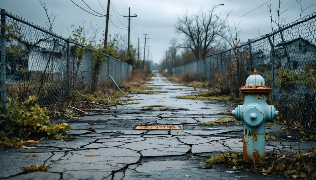
When you arrive at Love Canal today, you’ll encounter a stark contrast between containment and recovery. The central 16-acre remediation zone remains sealed behind 2.4-meter barbed wire fencing, its thick plastic liner and impermeable cap buried beneath clay and dirt, with monitoring wells visible through the chain-link barriers.
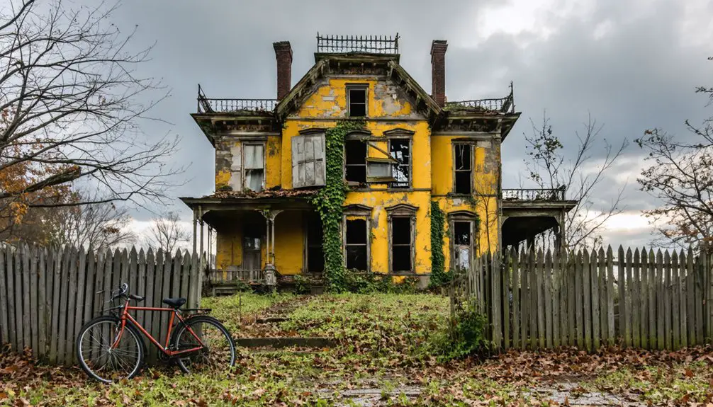
Beyond this restricted core, you’ll find an unexpected sight: revitalized neighborhoods where fewer than 90 of the original 900 families chose to remain, alongside abandoned streets on the west side that serve as silent testimony to the 950 families evacuated during the 21-year cleanup.
The Fenced-Off Containment Area
Upon arriving at Love Canal today, you’ll encounter a 2.4-metre high barbed wire fence encircling the most toxic 16-acre section of the former neighborhood. This barrier, installed following the 1978 public health threat declaration, permanently restricts access to the reburied canal beneath.
Chain link sections allow you to observe monitoring wells that track legacy contamination remediation progress. The fenceline restoration efforts created what resembles a gated compound for hazardous chemicals rather than a transparent memorial.
Conspicuously absent are “danger” signs—you’ll only find “private property” markers that fail to alert newcomers about the buried toxins. Behind this perimeter sits a thick plastic liner, clay cap, and leachate collection system maintaining containment over four decades.
The infrastructure prevents public entry while groundwater monitoring continues indefinitely.
Revitalized Homes and Streets
Beyond the barbed wire perimeter, the Love Canal neighborhood presents a stark geographic division between remediated zones and demolished sacrifice areas. North of the canal, 260 renovated homes sold to new homeowner experiences by 2004 demonstrate local community recovery’s tangible results. New York State’s $400 million cleanup enabled residential reoccupation in areas farthest from contamination sources. You’ll find inhabited streets with families unaware of the site’s toxic legacy.
As you explore the region, you may come across local legends about the history of beebe river ghosts, which are often shared around bonfires during summer evenings. These stories serve as a haunting reminder of the past and draw in thrill-seekers and history enthusiasts alike. The supernatural tales contribute to the unique character of the neighborhood, blending folklore with the realities of its environmental history.
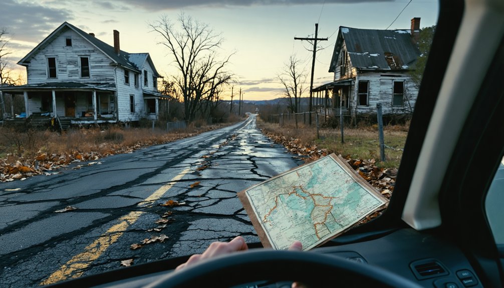
Conversely, abandoned roadways west of the canal stand empty—asphalt ribbons leading nowhere. Fewer than 90 original families remained east-side after demolitions, mostly elderly residents in isolated houses surrounded by vacant lots. The 150-acre eastern commercial zone now hosts light industrial facilities on remediated land. This geographic split reveals environmental justice’s uneven outcomes: some neighborhoods rebuilt, others permanently erased.
Today’s Love Canal encompasses approximately one square mile of southeastern Niagara Falls, stretching across what were once 36 square blocks bounded by natural and administrative barriers. The river to the south and creek to the north form natural boundaries where chemical migration halted.
You’ll find the core remediation zone enclosed by barbed-wire fencing, marked with hazard warnings prohibiting unauthorized access. However, remaining structures at Black Creek Village’s outer edges offer viewing opportunities from public roads.
Navigate this ghost town understanding these boundaries:
- Areas 1-3: Commercial/light industrial zones only—residential use forever prohibited
- Areas 4-7: Declared habitable in 1988, now resettled
- Monitoring wells: Surrounding the perimeter, tracking contamination
- Empty streetscapes: Fire hydrants and foundations marking 800 vanished homes
Your freedom to explore ends where sovereignty over public safety begins.
Nearby Landmarks and Memorial Points of Interest
Five landmarks anchor your understanding of Love Canal’s transformation from industrial ambition to environmental cautionary tale. The Model City Ruins reveal William T. Love’s 1890s vision—a partially-dug canal abandoned after economic collapse.
You’ll find the Love Canal Memorial honoring Lois Gibbs and the 1978 community uprising that forced federal intervention. At 99th Street and Read Avenue, containment zone boundaries mark where 800 families once lived atop Hooker Chemical’s toxic legacy.
Niagara Falls offers scenic overlooks connecting hydroelectric dreams to environmental nightmares, while Buffalo Niagara Waterkeeper provides historical context linking these tourist attractions. Each site documents how corporate negligence spawned Superfund legislation, transforming this ghost town into a proving ground for citizens demanding accountability over profit-driven concealment.
Essential Safety Precautions for Your Visit
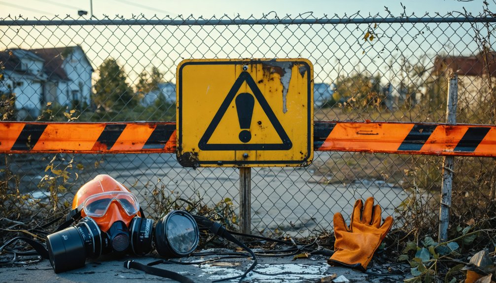
Although the 1978-1980 evacuation removed immediate residential populations, your visit to Love Canal’s perimeter requires understanding that the site remains an active Superfund containment zone rather than a conventional historic landmark. Exposure risks persist despite remediation efforts, demanding informed contamination avoidance strategies:
- Respect all physical barriers: The 10-foot containment fence and 22-acre clay cap system exist because over 80 toxic compounds, including benzene and dioxin, remain beneath the surface.
- Avoid basement-level structures: Chemical vapors concentrate in below-grade spaces where residents once experienced burns and respiratory distress.
- Never disturb soil or vegetation: Contaminated materials extend 20-22 feet deep in some areas.
- Observe from designated public zones: “Private property” signage marks restricted containment areas requiring ongoing NYSDEC oversight.
Where to Stay and What to Know Before You Go
When planning your visit to the Love Canal Disaster Memorial, you’ll find limited accommodation options in the immediate vicinity, with Sandstone Hollow Inn standing as the top-rated nearby resort offering shuttle services and flexible arrival times.
Access to the actual contaminated site remains strictly regulated by environmental authorities, requiring you to observe the area from designated public vantage points rather than entering restricted zones. Understanding these access limitations before departure will help you set realistic expectations for your historical documentation efforts while ensuring compliance with federal safety protocols still governing this Superfund site.
Nearby Accommodation Options
Your closest options include:
- Canal Side Inn – Pet-friendly suites with full kitchenettes, allowing extended stays for deeper historical exploration
- Arbor Inn of Clinton (9.1 km) – Perfect 5.0 rating with homestyle breakfast, ideal for contemplative mornings
- Sandstone Hollow Inn (14.6 km) – Best value option with shuttle service and knowledgeable staff
- Lockport Inn & Suites – Near Erie Canal Discovery Center, connecting you to broader regional industrial history
Budget-conscious travelers can leverage Niagara Falls accommodations like Econo Lodge ($129/night) when combining visits, though you’ll sacrifice the intimate, locally-focused experience smaller establishments provide.
Safety and Access Restrictions
Booking comfortable lodging means little if you can’t safely access the site—or worse, if you unknowingly expose yourself to health hazards that persist decades after the initial disaster. Love Canal remains a containment site with restricted zones bearing “Admittance by Permit Only” signs.
While “danger” warnings disappeared by 2013, eleven known carcinogens—including benzene and dioxins—contaminated the area historically. The 1978 Health Commissioner declared it a public threat, ordering pregnant women and children evacuated.
Today’s 22-acre clay cap and leachate collection system mitigate risks, yet groundwater seepage persists. Areas 1-3 remain suitable only for commercial use per 1988 findings. Personal protective equipment isn’t required for perimeter viewing, but avoid basements and soil contact. Understand potential health impacts before visiting this gated repository of industrial negligence.
Frequently Asked Questions
Can I Bring Children on a Visit to Love Canal?
You’d be risking *everything* bringing children to Love Canal. Despite remediation efforts, potential health concerns from decades of environmental impact remain documented. The site’s archival tragedy proves why independent exploration here demands serious caution—your family’s wellbeing isn’t negotiable.
Are There Guided Tours Available at the Love Canal Site?
No official guided tour options exist at Love Canal’s physical site. You’ll find site accessibility limitations restrict organized visits. Instead, access self-guided memorial walks, archival exhibitions at University at Buffalo, or virtual YouTube tours documenting this environmental justice landmark.
Is Photography Allowed Near the Fenced-Off Contaminated Areas?
Photography isn’t explicitly restricted near fenced areas, though you’ll find limited on-site signage visibility regarding specific rules. Drone photography restrictions likely apply given EPA oversight, but you’re free to document from public vantage points outside restricted zones.
What Health Symptoms Should I Monitor After Visiting Love Canal?
Like a silent alarm system, monitor for possible health issues including respiratory irritation, skin reactions, and headaches immediately after visiting. Document any symptoms carefully, as long-term health risks from chemical exposure can emerge years later.
Are Former Love Canal Residents Willing to Speak With Visitors?
No organized community outreach exists for visitor engagement. Former residents like Lois Gibbs became environmental justice advocates nationally, but there’s no evidence they maintain accessibility for tourists. You’d need independent research to contact activists personally.