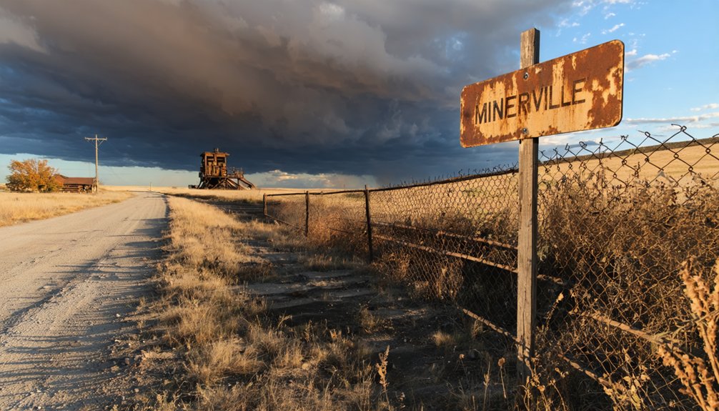
You’ll find Minersville’s haunting remains five miles south-southwest of Nebraska City, where weathered coal shafts and crumbling foundations tell the story of an 1880s boomtown lost to a devastating 1901 cave-in. Pack your 4WD vehicle with recovery gear, topographic maps, and sturdy boots before traversing the primitive dirt roads winding through unstable bluffs. Summer visits offer the best conditions for exploring scattered structures and the obscured cemetery. There’s much more to discover about safely maneuvering this forgotten landscape.
Key Takeaways
- Minersville is located 5 miles south-southwest of Nebraska City, with the municipal airport 2 miles west as a reference point.
- A 4WD vehicle with winch, tow straps, and tire repair kit is mandatory for navigating primitive roads and unstable terrain.
- Summer visits are recommended to avoid harsh Nebraska winters and improve road conditions through the bluffs and cave-in zones.
- Bring topographic maps for navigation since interpretive signage is absent and landmarks like the cemetery are difficult to locate.
- Pack emergency supplies, sturdy boots, gloves, and safety flags while maintaining self-reliance due to the remote, deteriorated conditions.
The Rise and Fall of a 19th Century Mining Boomtown
In the early 1860s, prospectors stumbled upon a coal deposit near a small Nebraska village that would reshape its destiny—though not in the way anyone hoped. The coal deposit significance proved meager from the start, yet it sparked enough excitement to rename the town in 1864 and draw settlers south of Nebraska City.
You’ll find the community had already been laid out in 1855, growing rapidly with Jacob Dawson’s newspaper, the Wyoming, launching in 1856. Community cohesion during boom times created a vibrant hub—grain businesses, mercantile trade, and a bustling post office operated alongside real estate dealings by 1880. The miniature gold mine featured at Omaha’s 1898 Trans-Mississippi Exposition would have dwarfed what Minersville’s modest operations ever achieved.
But poor-quality coal couldn’t sustain this frontier dream. Mining declined, silence crept in, and a devastating 1901 shaft cave-in sealed Minersville’s fate. Today, Minersville joins other distinct geographical locations sharing the same name across different states.
What Remains of Minersville Today
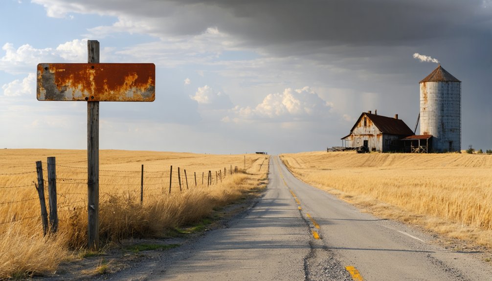
When you arrive at Minersville today, you’ll find a landscape stripped nearly bare—just a handful of weathered structures standing where a bustling mining town once thrived. The exact buildings you can explore aren’t well documented, but roadside guides confirm the site remains accessible for ghost town enthusiasts willing to venture 5 miles south-southwest of Nebraska City.
You’ll need to manage your expectations: most of what defined this 1860s boomtown has crumbled into the prairie, and even the cemetery’s location has been lost to time. Among the visible remains, you can still spot deteriorating coal shafts that hint at the mining operations that once drove the town’s economy. Like other ghost towns across Nebraska, the relationship between nature and the empty structures creates a haunting atmosphere that visitors find both mysterious and memorable.
Structural Remains and Ruins
- Deteriorating coal shafts marking the 1860s mining operations that gave the town its name
- Building foundations detectable in aerial photographs across deserted residential zones
- Railroad rights-of-way from the 1874 Midland Pacific Railway line cutting through former townsite
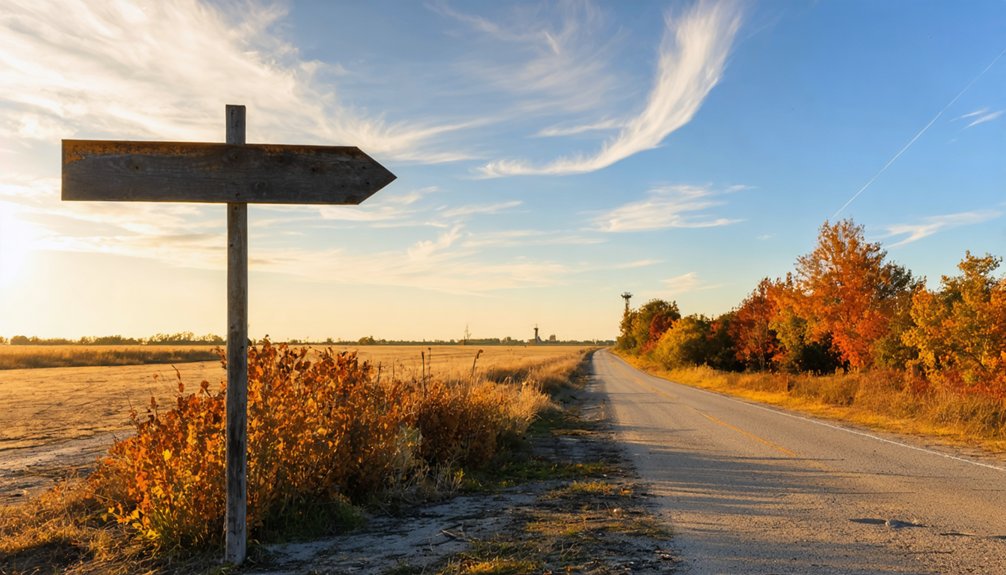
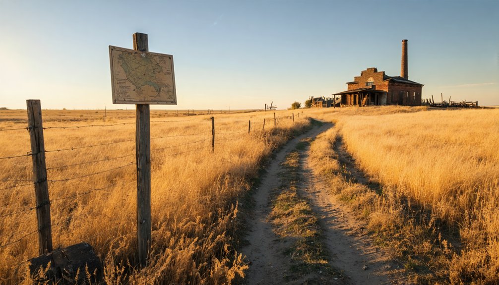
The absence of interpretive signage needs addressing makes navigation challenging, yet this rawness appeals to freedom-seekers. You’ll wander ghostly legends among crumbling infrastructure where the general store, blacksmith shop, and Congregational church once anchored community life before abandonment claimed everything. An active railroad line now converted to a hiking trail passes through the area, offering visitors a unique way to explore the remnants while following the transportation corridors that once brought prosperity to the region. Look for isolated grain elevators standing sentinel over the prairie, their orientation against the county road grid revealing Minersville’s railroad heritage and serving as unmistakable markers of this once-thriving settlement.
Accessing the Ghost Town
Your journey to what’s left of Minersville begins 5 miles south-southwest of Nebraska City, where crumbling foundations give way to the practicalities of actually reaching this remote site. You’ll drive south through open farmland, traversing regional roads that cut through Nebraska’s rolling terrain.
The Nebraska City Municipal Airport sits 2 miles west—useful if you’re flying in for your informal town exploration.
Once there, you’ll find sparse structures scattered across forgotten ground where coal mines once operated. The real challenge? Locating the obscured cemetery location that hasn’t been reliably spotted in years. No marked trails guide you, no services await. This ghost town demands self-reliance and sharp wayfinding skills.
Park where ground permits, grab your GPS, and prepare to search independently through Nebraska’s haunting rural landscape.
Getting There: Routes and Road Conditions
Reaching Minersville requires genuine backcountry navigation skills and a vehicle that can handle punishment. You’ll traverse south from Nebraska City through increasingly primitive roads that once served as former transportation routes during the mining town’s population decline. These dirt tracks wind through bluffs where coal shafts still threaten stability beneath your wheels.
Your essential gear:
- 4WD vehicle – mandatory for maneuvering cave-in zones and deteriorated mining roads
- Topographic maps – grid reference 4 marks your destination precisely
- Summer timing – Nebraska’s brutal winters make these routes impassable
The terrain demands respect. Historical shaft collapses from the 1901 disaster created unpredictable road conditions you’ll encounter. Print those topo maps beforehand; GPS signals get sketchy in these bluffs where civilization surrendered decades ago. The town’s location in the bluffs south of Nebraska places it within Otoe County’s most rugged terrain. If you’re exploring other ghost towns in the region, head 10 miles south of Brownville on Highway 67, then 5 miles east on 64 to reach St. Deroin in Indian Cave State Park.
Essential Gear for Your 4WD Adventure
The right equipment transforms this ghost town expedition from reckless gamble into calculated adventure. Your 4WD needs a winch and tow straps—these bluff roads don’t forgive bog-downs. Pack tire repair kits for terrain that’ll chew through rubber near those coal shafts. Vehicle maintenance requirements demand inspection-ready headlights, taillights, and brakes matching your VIN, especially for out-of-state rigs.
Emergency preparedness essentials include first-aid kits (cave-ins happened here), flashlights for exploring downtown remnants, and waterproof storage protecting electronics from Nebraska’s temperamental weather. Load GPS coordinates and offline topo maps—cell service dies in remote Otoe County. Throw in a compass for those winding roads south of Nebraska City. Don’t skip sturdy boots and gloves when inspecting the cemetery and shaft areas. If you’re bringing an ATV or UTV for exploring trails around Minersville, mount a day-glow bicycle safety flag extending at least five feet above ground on the rear. Before heading out, verify your insurance requirements meet Nebraska standards—proof of financial responsibility isn’t optional on these backcountry routes. This isn’t Disney; it’s legitimate backcountry exploration.
Best Time to Visit the Ghost Town
You’ll find Minersville most accessible during summer months when dry conditions keep the 4WD trails passable and daylight stretches late into the evening. Winter brings snow and ice that can trap even experienced drivers on those bluff-side roads, transforming a historical adventure into a survival situation.
I’ve learned that timing your visit for early September delivers the sweet spot—cooler temperatures around 80°F, firm ground beneath your tires, and none of the mud-slicked ruts that make spring travel a gamble.
Summer Weather Offers Accessibility
Your adventure benefits from three critical summer advantages:
- Minimal precipitation following May’s 4.92-inch peak guarantees firm trails
- Extended daylight hours maximize coal shaft and cemetery discovery time
- Reduced wind speeds from April’s 19 mph gusts improve navigation accuracy
Winter’s 25°F temperatures and unpredictable moisture make 4WD access treacherous. Summer’s visitor comfort factors extend beyond temperature—dry paths let you focus on locating dilapidated structures and the post-1901 remnants without wrestling seasonal hazards that’d steal your freedom to roam.
Avoiding Winter Road Hazards
Winter’s grip transforms Minersville’s access roads into treacherous gauntlets that’ll test even experienced drivers. December through March brings relentless snowfall and prolonged cold snaps that keep secondary routes frozen solid for weeks. While main highways get cleared within days, road maintenance schedules prioritize arterial routes—leaving the backcountry paths to Minersville dangerously neglected.
You’ll find yourself crawling at visibility-crushing speeds through white-out conditions, risking getting stuck miles from help. Even when Lincoln’s streets look passable, those rural access routes remain slick death traps. Your freedom to explore ghost towns demands respecting winter’s authority—save Minersville for warmer months when adventure doesn’t require a rescue team.
Trail Conditions by Season
Timing your Minersville expedition right makes the difference between discovering hidden coal shafts and cursing through axle-deep mud. Summer delivers ideal seasonal visibility through dry conditions and maximum daylight for exploration. You’ll navigate 4WD tracks confidently while spotting remnants downtown and along the bluffs.
Spring brings challenges with high river flood risk near the Missouri and rutted paths that’ll test your vehicle’s limits. Winter’s frozen ground firms trails, but snow buries grid roads and shortened days cut exploration time short.
Your seasonal strategy:
- Summer: Peak season—dry roads, clear sightlines to structures
- Fall: Acceptable alternative with cooling temps, stable terrain
- Spring/Winter: Avoid unless you’re monitoring NDOT’s 511 system religiously
Check live road conditions before committing your weekend to Nebraska’s backroads freedom.
Exploring the Steamboat Trace Trail
Stretching 21 miles along an abandoned railroad corridor, the Steamboat Trace Trail cuts through some of southeastern Nebraska’s most dramatic terrain between Nebraska City and Brownville. You’ll pedal past towering sandstone bluffs carved with century-old inscriptions near Peru, where the route hugs the Missouri River’s edge. The flat, crushed limestone surface makes for easy riding through wooded corridors of cottonwood and oak that provide welcome shade on summer days.
Keep your eyes sharp for local wildlife viewing—deer, wild turkeys, and even bobcats inhabit these bluffs. The trail’s scenic overlooks reveal endless farmland stretching toward the river. You’ll find trailheads with parking and restrooms at Arbor Station, Peru, and Brownville. No permits required, just voluntary donations to maintain this wild ribbon of freedom.
Finding the Coal Shafts and Historic Downtown
You’ll spot the deteriorating coal shafts scattered across the northeast section, marked by sunken depressions and crumbling timber frames where men once descended into 7 to 35-inch seams of lignite. The original downtown sat near these mining operations, though you’ll find only foundation stones and weathered wood fragments where the general store, saloon, and blacksmith shop once stood along the dirt streets.
Bring a GPS device loaded with the coordinates 40°35′49″N 95°47′21″W, as overgrown vegetation now conceals most structural remains from the 1860s settlement.
Locating Original Shaft Sites
The crumbling coal shafts sit tucked into the bluffs above where Minersville’s downtown once thrived, roughly 5 miles south-southwest of Nebraska City in Otoe County. Locating original mine entrances requires determination—these deteriorating structures blend into the hillside after 120+ years of abandonment. You’ll find mapping remaining shaft locations challenging since vegetation has reclaimed much of the site.
When searching for the shafts, focus on three key areas:
- Bluff faces overlooking the Missouri River where miners accessed coal seams
- Downtown’s dilapidated structures marking the old commercial district
- Depressions and unnaturally flat areas indicating collapsed tunnels
Downtown Ruins Exploration
Wandering through Minersville’s skeletal remains feels like stepping onto a forgotten movie set where nature reclaims civilization one brick at a time. You’ll find crumbling foundations where the general store, post office, and saloon once bustled with miners’ voices. The Congregational church—gone now—stood among these weathered ruins near Camp Creek’s 1858 frame building.
Your downtown decay analysis reveals how completely a thousand-person town can vanish. Brick fragments mark where the blacksmith hammered horseshoes, while prairie grass swallows entire blocks. The lost cemetery location haunts explorers; burial grounds exist somewhere within this tangle of decay, identities erased by time’s indifference.
Pack your GPS and sturdy boots—these unmarked ruins demand careful navigation. You’re tracking ghosts through shoulder-high weeds, piecing together stories written in scattered stone.
Safety Considerations for Abandoned Mine Areas
- Never enter vertical shafts or test covered openings
- Avoid water-filled quarries—their frigid depths and slippery walls make escape nearly impossible
- Watch for old explosives; deteriorated dynamite detonates from simple contact
Carbon monoxide killed three gold miners who ventured too deep. You’ve got freedom to explore, but use it wisely—respect these deadly ruins from a distance.
Nearby Historic Sites Along the Missouri River
Beyond Minersville’s crumbling foundations, the Missouri River carves a 390-mile path through Nebraska, linking dozens of historic sites that’ll transform your ghost town detour into a full-blown expedition. Launch your boat at Nebraska City’s ramp (mile marker 363) after exploring the Lewis & Clark Visitor Center’s life-size keelboat replica and 79-acre riverside trails.
Fort Atkinson near Fort Calhoun reveals where 1,000 soldiers once garrisoned America’s first western military post—reconstructed barracks and ongoing archaeological digs expose foundations from the 1820s. Time your visit with Nebraska City’s annual apple festivals at Arbor Lodge State Historical Park, or paddle north to Bellevue’s Haworth Park ramps at mile marker 601, Nebraska’s oldest continuous settlement. Each stop peels back another layer of frontier history.
Making the Most of Your Southeast Nebraska Trip
Your Missouri River exploration sets the stage for Southeast Nebraska’s deeper treasures—and you’ll need more than a weekend to scratch the surface of this region’s 1,000,000+ annual visitors’ worth of attractions. Strategic planned stops during the trip transform a ghost town visit into an unforgettable adventure.
Your nearby attractions worth visiting should include:
- Arbor Day Farm’s Tree Adventure at 2611 Arbor Ave., Nebraska City—tackle the Treetop Village after exploring Minersville’s remnants
- Kimmel Orchard & Vineyard at 5995 G Road for apple cider donuts and wine
- Robbers Cave at 925 Robbers Cave Road, Lincoln (book tours ahead)
I’ve learned the hard way: fill your tank before leaving Nebraska City. These backroads don’t forgive poor planning, but they reward curiosity with authentic frontier experiences.
Frequently Asked Questions
Are There Camping Facilities Near Minersville or Along the Steamboat Trace Trail?
You’ll find camping at Lake Minatare SRA and Two Rivers SRA near the trail, offering scenic overlooks and hiking trails. Both provide electric hookups, showers, and primitive sites. You’re free to explore Nebraska’s rugged panhandle from these comfortable basecamp locations.
Can I Find the Cemetery That Hasn’t Been Located in Recent Years?
You’ll face a challenging adventure finding what time’s reclaimed. Despite historical preservation efforts and your determination to locate unmarked grave locations, the cemetery remains elusive. You’re welcome to explore, but success isn’t guaranteed in this forgotten landscape.
Is It Legal to Explore the Abandoned Coal Shafts and Downtown Buildings?
You’ll face trespassing risks on private property without owner permission, creating legal liability concerns. Those unstable shafts and crumbling buildings aren’t worth criminal charges or injury. Seek landowner consent first—it’s your ticket to exploring responsibly and safely.
What Wildlife Might I Encounter in the Wetlands and River Bluffs?
You’ll discover diverse waterfowl populations alongside white-tailed deer, river otters, and rare whooping cranes. The bluffs showcase unique prairie wildflowers, while wet meadows shelter sharp-tailed grouse and northern harriers—untamed wildlife thriving where civilization once stood.
Are Guided Tours Available for Minersville or Surrounding Ghost Towns?
No guided tours exist for Minersville itself—you’ll explore independently using historic maps. However, nearby Saint Deroin offers private tour options by calling 402-873-3115. Most Nebraska ghost towns reward adventurous travelers with self-guided tours through haunting, forgotten landscapes.
References
- https://www.ghosttowns.com/states/ne/minersville.html
- https://www.newspapers.com/article/nebraska-daily-news-press/190098945/
- http://www.kancoll.org/books/andreas_ne/otoe/otoe-p20.html
- https://www.perunebraska.org/ourroots
- https://visitnebraska.com/trip-idea/explore-7-authentic-ghost-towns-nebraska
- https://ncmystery.mywebpad.net/?p=58
- https://en.wikipedia.org/wiki/Minersville
- https://northomahahistory.com/2023/05/30/a-history-of-the-mines-and-mining-building/
- https://www.onlyinyourstate.com/trip-ideas/nebraska/ne-ghost-towns-road-trip
- https://history.nebraska.gov/finding-nebraskas-ghost-towns/


