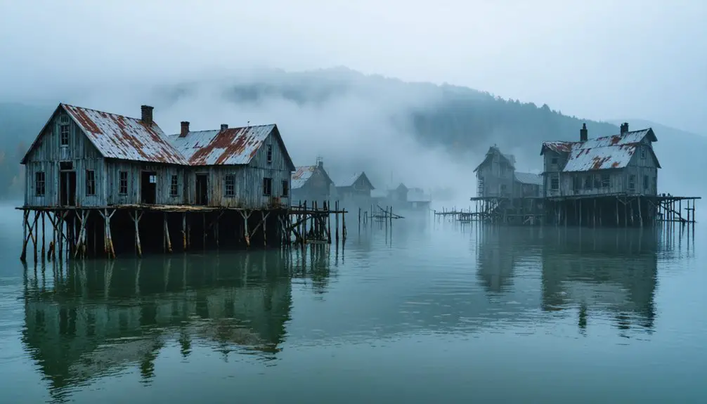
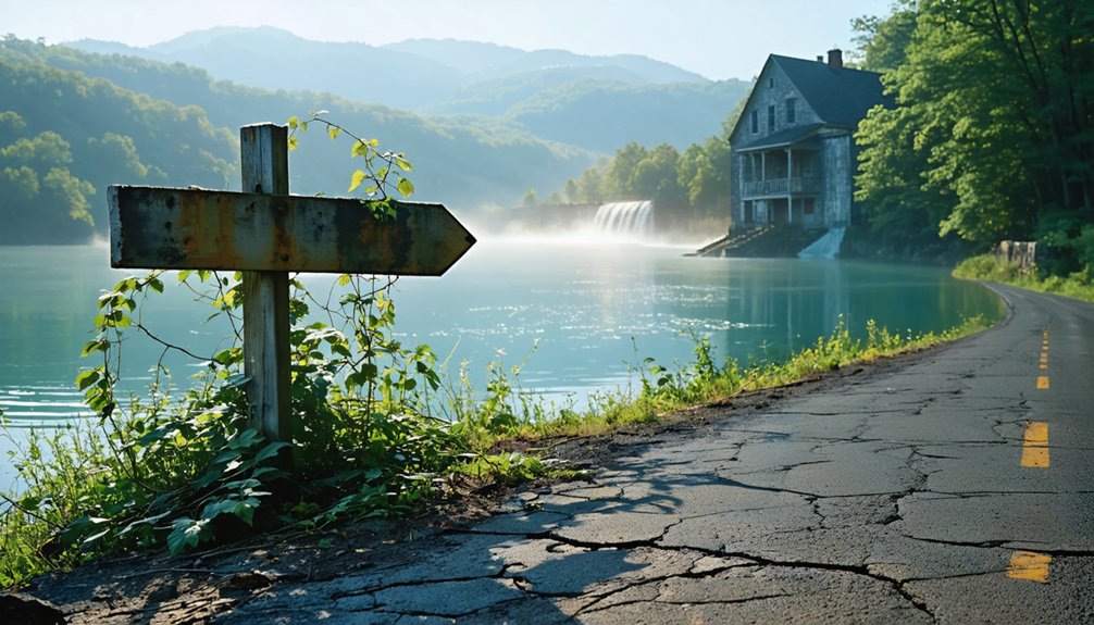
You’ll find Morganton’s ghost beneath Tellico Lake’s surface, accessible via East Coast Tellico Parkway and Morganton Road west of Greenback. Target GPS coordinates 35.64333°N, 84.22722°W for the best vantage point above the submerged ruins. Late summer and early fall offer ideal water levels to spot brick foundations and wagon ruts emerging from the mud—remnants of what was once East Tennessee’s busiest river port before the TVA’s controversial dam project sent this Civil War-era trading hub to its watery grave in 1979. The full story reveals why Congress defied the Supreme Court to flood this historic site.
Key Takeaways
- Morganton is submerged beneath Tellico Lake after the 1979 Tellico Dam construction flooded the historic Civil War-era river trading hub.
- Navigate to East Coast Tellico Parkway and Morganton Road junction west of Greenback, using GPS coordinates 35.64333°N 84.22722°W.
- Visit during late summer or early fall when low water levels provide the most reliable views of submerged ruins.
- The site contains archaeological remains spanning 12,000 years, including Civil War fortifications and Cherokee settlements like Chota.
- Observe only from designated areas as the Tennessee Valley Authority manages this protected archaeological site.
The Rise and Fall of a River Trading Hub
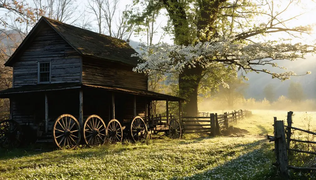
Long before interstates carved through East Tennessee, the Little Tennessee River served as the region’s liquid highway, and at its banks, Morganton emerged from wilderness into prosperity.
You’d have witnessed flatboats laden with whiskey and hemp gliding toward New Orleans while steamboat transportation innovations revolutionized commerce by 1831. Despite occasional land transaction disputes following the Cherokee’s 1798 cession, merchants built distilleries, hemp factories, and silversmith shops along muddy thoroughfares.
By the 1830s, you couldn’t find a busier exchange point upstream—steamboats couldn’t navigate beyond Morganton’s shallow waters, making it essential for regional trade. The town even boasted a doctor, cabinet shop, and wagon factory, serving the daily needs of its growing population.
Then railroads changed everything. When the Louisville and Nashville Railroad chose nearby Greenback in 1890, Morganton’s death warrant was signed. The Morganton Ferry, the last, folded in 1961 after the bridge near Niles Ferry became toll-free in 1947. The Tellico Dam’s construction finally erased what commerce abandoned: a once-thriving community reclaimed by Tennessee’s waters.
Morganton’s Strategic Importance During the Civil War
War transformed Morganton’s commercial wharves into military choke points. You’ll find this Little Tennessee River hub controlled strategic shipping routes that both armies desperately needed. The Confederates fortified Rocky Ford crossing with hastily-built breastworks, knowing whoever held the river controlled supply lines feeding the indispensable railway links of the East Tennessee & Virginia Railroad.
On April 17, 1865, Union General Gillem’s cavalry brigades smashed through three hundred Home Guard defenders after Colonel Walton’s cannon fired its fourth retreat signal. The two-hour firefight left Confederate bodies floating downstream. When Federal forces rode in, they torched courthouse records and seized massive stockpiles of corn and bacon—provisions meant for Lee’s starving army. Local collaborators, including enslaved people seeking freedom, guided Union troops through town, settling old scores. Union artillery disabled the sole Confederate field piece under Lieutenant George West’s command, eliminating the defenders’ only effective long-range weapon. Earlier conflicts had bloodied the region when Confederate guerrillas raided Scott County farms in October-November 1862, burning houses and capturing civilians before Union forces pushed them back across the Cumberland Mountains.
Archaeological Discoveries Beneath Tellico Lake
Before Tellico Lake’s waters rose in 1979, you could’ve walked the same ground where Cherokee villagers traded at the Tellico Blockhouse and soldiers manned Fort Loudoun in 1762. Emergency archaeological surveys in 1978 raced against the reservoir’s fill date, uncovering 12,000 years of continuous occupation—from deeply stratified Early Archaic camps to the Treaty of Holston’s 1794 fortification that once regulated passage into Cherokee territory.
The Tennessee Valley Authority funded excavations in summer 1977, with field crews working from a camp on Highway 72S that featured individual wooden cabins and separate laboratory facilities despite temperatures exceeding 100°F during the field season. During the 1969 excavation at Chota, archaeologists discovered Amostatoa’s grave, whose remains were later reinterred above the original burial site.
Today, those artifacts rest in collections at McClung Museum, while the sites themselves lie beneath 30 feet of water, preserved but forever inaccessible.
1978 Emergency Survey Efforts
When TVA’s Tellico Dam project began acquiring land in the 1960s, University of Tennessee archaeologists raced against time to document what would soon lie beneath 16,500 acres of water. Their extensive excavations from 1967 to 1981 revealed 12,000 years of human history—a multi year timeline that captured everything from ancient Archaic camps to Cherokee council houses built atop prehistoric platform mounds.
Their emergency surveys saved irreplaceable evidence from villages like Tanasi, Chota, and Toqua before flooding erased them forever. At Icehouse Bottom, they documented countless generations who’d called this valley home. Even Fort Loudoun’s original British fortifications required salvage excavations before reconstruction. Three hundred thirty farms disappeared, but these determined archaeologists preserved what bureaucrats and bulldozers couldn’t: the stories buried in Tennessee soil. The concrete gravity dam was completed in 1975, shortly before the reservoir began filling and submerging the documented sites forever. Today, visitors can walk the reconstructed fort at Fort Loudoun State Historic Area, which was rebuilt in 1979 to showcase its colonial military history.
Artifacts From 1762 Discovered
Among the hundreds of sites these archaeologists documented, Morganton’s townsite yielded an unexpected treasure in 1978—artifacts dated to 1762, more than three decades before the first official Euro-American settlers supposedly arrived. You’re looking at evidence that rewrites pre settlement history, pushing back occupation dates to when Cherokee land claim still dominated these valleys.
The University of Tennessee team unearthed projectile points and colonial-era materials that tell a story authorities didn’t want recorded. These finds mirror discoveries at the nearby Tellico Blockhouse, suggesting covert activity during a period when this territory belonged exclusively to the Cherokee.
Before Tellico Lake swallowed Morganton in 1979, excavators preserved these remnants of forbidden history—tangible proof that someone walked these ridges long before any treaty granted them permission. This distinct geographical location shares its name with other Morganton communities across North Carolina, Montana, Vermont, and West Virginia.
Cherokee Village Connections Found
The University of Tennessee’s shovels first bit into Chota’s earth in 1969, and what emerged over the next five years would fundamentally alter how historians understood Cherokee civilization in these valleys. You’ll find evidence of 783 features—refuse pits, postmold patterns from 31 structures, and 91 burial sites that revealed the cultural significance of Chota as a political nerve center.
Among thousands of artifacts, archaeologists identified Chief Oconostota’s grave by wire spectacles, a detail that humanizes these ancient grounds. Archaeological preservation methods salvaged what they could before 1979’s flooding, but you’re standing above a drowned world. The sites weren’t destroyed—just locked beneath Tellico Lake’s surface, waiting like held breath. The TVA arranged 15 years of archaeological digs that included not only Chota but also the neighboring village of Tanasi, ensuring the Cherokee legacy would be documented before the dam’s completion.
The TVA Dam Project That Changed Everything
You’ll find that Tellico Dam’s construction sparked one of the environmental movement’s most famous legal battles—a tiny endangered snail darter fish halted the TVA’s bulldozers in 1978, giving archaeologists a critical window to excavate Morganton’s remains.
During that legal pause, researchers raced against time to document what lay beneath the site before the dam’s gates closed forever. The standoff between preservationists and developers became national news, though ultimately the dam prevailed, flooding both ancient Cherokee towns and the remnants of Morganton’s ferry crossing in 1979.
Tellico Dam Legal Battle
In 1973, construction crews working on what would become TVA’s 68th dam hit an unexpected snag—a three-inch fish nobody had seen before. The snail darter population in the Little Tennessee River became the unlikely hero in a David-versus-Goliath legal showdown that reached the Supreme Court.
You’d think a tiny fish wouldn’t stand a chance against federal bulldozers, but the Endangered Species Act had teeth. When the Court ruled 6-3 to halt construction in 1978, it sent shockwaves through Washington. The government actually chose wildlife over “progress.”
Congress wasn’t having it. They swiftly passed a congressional exemption, overriding the ruling and finishing the dam anyway. Morganton disappeared beneath the reservoir—proof that sometimes even Supreme Court victories can’t stop bureaucratic momentum.
Archaeological Survey Before Flooding
Before the reservoir gates slammed shut forever, University of Tennessee archaeologists raced against time in 1978 to document what would soon disappear beneath Tellico Lake. Their preservation efforts uncovered artifacts dating back to 1762—projectile points and early American relics that proved Morganton’s historical significance extended far beyond its 170-year ferry operation.
You’ll find parallels between these discoveries and nearby Tellico Blockhouse excavations, though this was merely a test survey. The team couldn’t conduct full excavations; litigation had temporarily stalled the dam, but everyone knew flooding was inevitable.
What Remains Above Water Today
The ghost towns beneath Tennessee’s reservoir system left behind scattered artifacts that tell stories of erasure and resilience. While Morganton itself disappeared beneath Tellico Lake‘s surface, you’ll find remnants of similar drowned communities throughout the region that challenge visitor access restrictions.
Exploring these forgotten places can be particularly rewarding during the best seasons for visiting tennessee ghost towns. As the leaves change in the fall, the scenery adds a touch of beauty to the haunting history of these sites. Spring also offers a chance to witness wildflowers blooming over the remnants, providing a stark contrast to the tales of abandonment.
The history of Morganton ghost town serves as a poignant reminder of the lives and communities that once thrived in this now-submerged landscape. As you delve deeper into the area, you’ll uncover stories of families who were forced to abandon their homes, creating a rich tapestry of both loss and nostalgia. Visitors often leave with a renewed appreciation for the past and the resilience of those who faced such profound changes.
What You Can Still Explore:
- Danville’s Grain Elevator – Kentucky Lake’s lone sentinel rising defiantly from the water
- Elkmont’s Stone Chimneys – Haunting markers along Little River and Jakes Creek trails
- 19 Preserved Elkmont Buildings – National Park Service preservation initiatives saved these structures from demolition
- Noeton’s Relocated Church – Baptist congregation’s rebirth after Cherokee Lake claimed their original home
These tangible connections to Tennessee’s submerged past remind you that even government projects couldn’t completely erase communities determined to leave their mark.
Best Times to View the Submerged Ruins
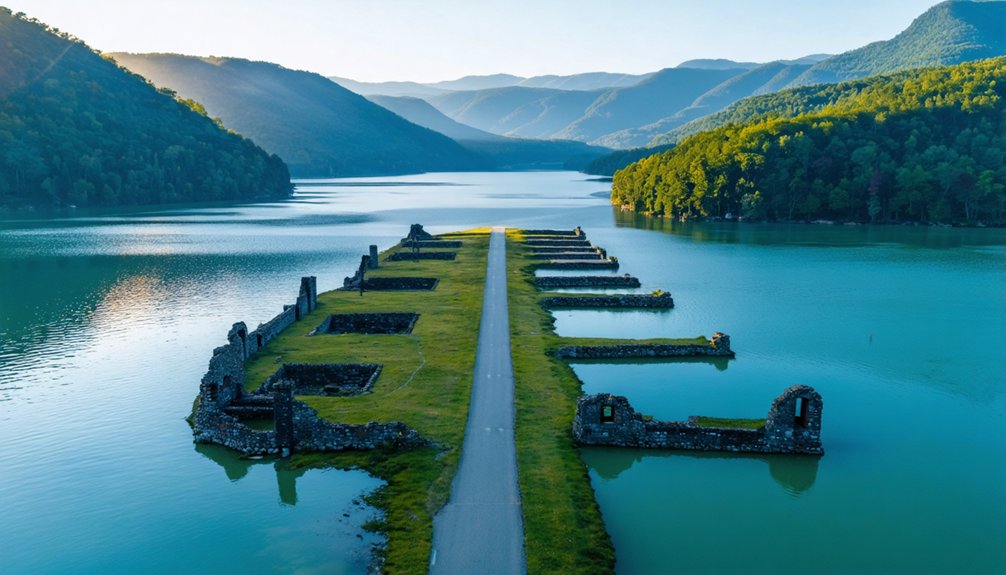
While water levels dictate what you’ll actually see at Morganton’s submerged site, timing your visit between late summer and early fall offers the most reliable viewing conditions. You’ll find water retention at its peak during summer months, creating ideal seasonal viewing conditions when the reservoir holds steady.
I’ve watched paddlers drift slowly over submerged historical markers when levels drop below 2.5 feet, exposing deadfall that marks where structures once stood. The relaxed pace lets you scan the riverbed thoroughly without fighting currents.
River temperatures staying below 50 degrees year-round mean you won’t be swimming for closer looks, but clearer autumn skies enhance visibility through the water’s surface. Pack layers—you’ll want extended viewing time over sites submerged since those 1966 excavations.
How to Reach the Former Townsite
Finding Morganton’s watery grave requires traversing to the junction where East Coast Tellico Parkway meets Morganton Road, just west of Greenback in Loudon County. You’ll navigate territory where Cherokee blazed trees once marked mysterious mines, now watching over submerged streets and forgotten riverboat docking sites.
Where Cherokee trail markers once guided miners to hidden veins, Tellico’s waters now conceal an entire town’s vanished commerce and dreams.
Your route breakdown:
- Target coordinates 35.64333°N 84.22722°W on your GPS for precise positioning above the ruins
- Follow Morganton Road westward toward the Little Tennessee River’s embrace
- Scout TVA-managed access points along the shoreline for ideal viewing angles
- Respect archaeological preservation efforts by observing from designated areas only
The Tennessee Valley Authority oversees this drowned landscape 13.7 miles upstream from Bakers Creek’s confluence. You’re tracking history that settlers claimed in 1796, now resting beneath rippling currents.
The Cemetery Overlook and Local Legends

Perched above Tellico Lake‘s rippling surface, Morganton Cemetery stands as the lone sentinel of a civilization that surrendered to progress in 1979. You’ll find yourself walking among weathered headstones while fog creeps across the water below, carrying whispers of the past.
Local folklore traditions speak of atmospheric anomalies on misty mornings—the whining of ferry horses and creaking pontoon bridges echoing from Sherman’s 1863 crossing. There’s no scientific proof, but you’ll understand why settlers believed these tales when dawn breaks and mist blankets the submerged townsite.
A Civil War marker commemorates the general’s strategic river crossing, where his troops salvaged wood from abandoned buildings. The Presbyterian church that once stood nearby has vanished, leaving only stories and stones.
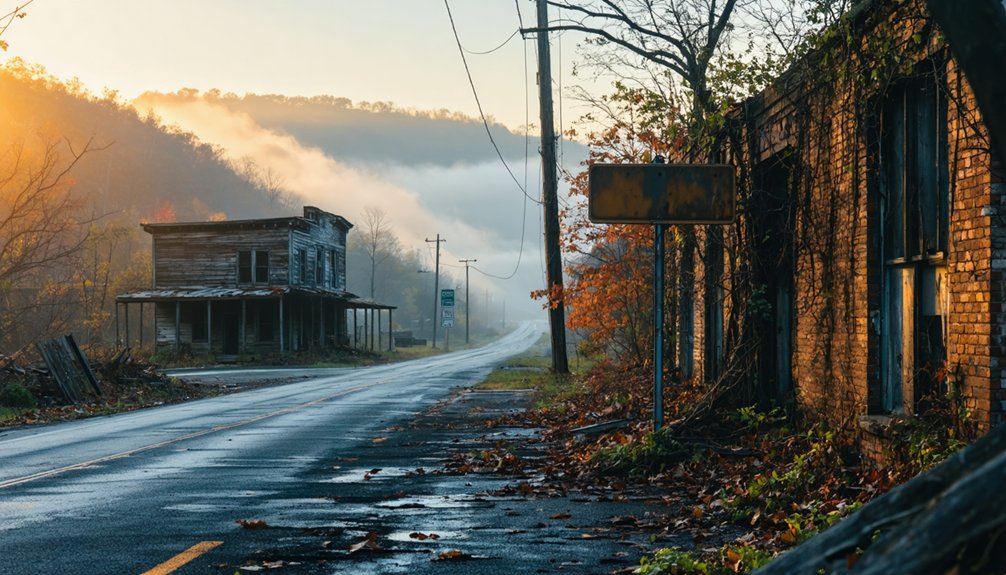
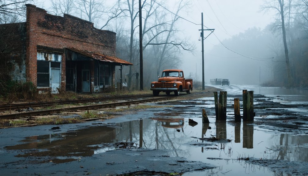
Nearby Ghost Towns Worth Exploring
Beyond Morganton’s flooded streets, Tennessee’s landscape conceals a network of abandoned communities, each with its own story of economic collapse, natural disaster, or government intervention.
Ghost Towns Within Day-Trip Distance:
- Elkmont – Eight miles from Gatlinburg, this former logging camp and resort features crumbling cabins accessible via short trails. You’ll find abandoned farmsteads and moonshine distilleries hidden among the hollows.
- Loyston – Submerged beneath Big Ridge State Park’s reservoir, this underwater town’s remnants still rest on the lake bottom, a record of displacement.
- Old Jefferson – Razed for a flood that never came, this Murfreesboro ghost represents bureaucratic overreach.
- Sucktown – Along the Tennessee River, this rough dam-worker settlement hosted conflicts between locals and immigrants. Minimal ruins remain.
Frequently Asked Questions
Are There Any Safety Concerns When Viewing the Submerged Ruins?
Yes, you’ll face deep water hazards and submerged debris that threaten boats and swimmers. Strong currents, sudden TVA water releases, and unmarked underwater structures create real dangers. You’ll need permission during drawdowns to explore safely.
Can You Launch Boats or Kayaks to Explore the Underwater Townsite?
You’ll find excellent sunken vessel accessibility at Morganton’s public boat ramp, where you can launch kayaks or motorboats to explore the submerged townsite. Underwater visibility conditions vary with lake levels—check TVA drawdown schedules for prime exploration opportunities.
What Photography Equipment Works Best for Capturing the Submerged Structures?
You’ll want waterproof housings for underwater photography of submerged buildings, plus drone photography captures stunning aerial perspectives of the flooded town. Action cameras like GoPros work brilliantly for shallow exploration, giving you creative freedom to document Morganton’s haunting remains.
Are There Any Guided Tours Available for Morganton’s Ghost Town Site?
You won’t find traditional guided walking tours at Morganton’s submerged site, but you’ll discover self-guided audio tours covering nearby Elkmont’s ghost town instead. Park rangers offer seasonal programs there, letting you explore Appalachian history at your own pace.
Is Overnight Camping Permitted Near the Cemetery Overlook or Lake Shore?
No overnight camping’s permitted at Cemetery Overlook or Lake Shore. You’ll need to explore local hiking trails and scenic overlook views during daylight, then head to designated campgrounds nearby where you’re free to pitch your tent legally.
References
- https://www.tnmagazine.org/tennessees-underwater-ghost-towns/
- https://www.vanshaver.com/morganton_underwater7422.htm
- https://kids.kiddle.co/Morganton
- https://www.youtube.com/watch?v=2WUe3xISerw
- https://sites.rootsweb.com/~tnalhnco/Blount/Morganton.html
- https://www.hmdb.org/m.asp?m=69381
- https://kingsportspirit.com/2025/09/30/tennessee-in-10-minutes/
- https://monroerecords.org/genealogy/monroe-county-tennessee-history/
- https://tngenweb.org/loudon/history/hist.html
- https://www.carolana.com/NC/Civil_War/1865_04_17_morganton.html