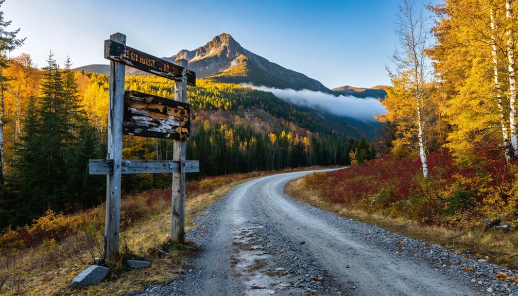
Your ghost town road trip to Mount Mansfield begins along Route 7, winding north through Vermont’s forgotten settlements before reaching the state’s highest peak at 4,393 feet. You’ll navigate five distinct trails ascending past abandoned communities carved into impossibly steep terrain, where brutal winters defeated early settlers. The mountain’s distinctive “Sleeping Giant” profile rises above hardwood forests that change into rare alpine tundra, while mystical landmarks like Wampahoofus Trail and the lost Frenchman’s Pile reveal deeper stories of Abenaki legends and logging-era folklore waiting to unfold.
Key Takeaways
- Access Mount Mansfield via Route 7 north to I-89, with northern approach from Bennington using Route 9.
- Visit between late June and early December when trails are seasonally accessible for optimal hiking conditions.
- Choose from five distinct summit routes to the 4,393-foot peak, ranging from popular trails to steep scrambles.
- Explore Wampahoofus Trail climbing 2,831 feet from Butler Lodge to the Forehead summit through mythical terrain.
- Experience Vermont’s only alpine tundra with panoramic views and the distinctive sleeping giant ridgeline profile.
The Forgotten Settlement: Mansfield’s Ghost Town History
High on the rugged slopes of Vermont’s tallest peak, two ambitious settlements once clung to existence against impossible odds. Mansfield Town and neighboring Sterling were chartered on Mount Mansfield’s steep, inaccessible terrain—land that would ultimately defeat even the burliest pioneers.
These early settlement efforts faced relentless challenges: slopes too severe for farming, trails too treacherous for commerce, winters too brutal for comfort. The settlers who chose this wilderness life endured strenuous labor, but economic survival factors eventually proved insurmountable. Both communities eventually became ghost towns, their territories carved into the present-day towns that now surround the mountain.
Today, the mountain’s distinctive profile resembling a sleeping giant’s face continues to captivate visitors who come to explore both its natural beauty and its layered history of human ambition and retreat.
Legends and Lore of the Sleeping Giant
From certain vantage points around Stowe and Morrisville, Mount Mansfield’s eastern ridgeline transforms into something far more evocative than mere geology—a perfect human profile stretches across the sky, complete with forehead, nose, lips, chin, and Adam’s apple.
This geological marvel sparked folklore origins dating to 1858, when locals recorded tales of a weary giant who walked northward, lay down to rest, and never awoke. The Abenaki knew this peak as Mozodepowadso, linking it to their chief Moosalamoo and legends of Gici Awas—giant hairless bears roaming the summit. The town of Mansfield was chartered in 1763, with the mountain inheriting its name from the settlement rather than from its distinctive profile.
You’ll find echoes of protective giant narratives throughout New England, where similar sleeping figures became spiritual guardians. These stories weren’t mere entertainment—they preserved Indigenous beliefs and later fueled successful 1920s-30s campaigns against destructive quarrying operations. Like other legendary peaks, Mount Mansfield creates a spectacular canvas during sunset, casting its silhouette against the Vermont sky.
Mystical Landmarks: Wampahoofus Trail and Frenchman’s Pile
Beyond the ridgeline’s sleeping giant, Mount Mansfield harbors a peculiar trail named for a creature that defies logic and gravity in equal measure. The Wampahoofus Trail honors the gyascutus—a mythical beast with uneven legs designed for one-directional mountain travel. Established in 1935, this black diamond path climbs from Butler Lodge through rugged scrambles where Professor Ray Buchanan spotted a rock formation mimicking the creature’s profile. You’ll navigate 2,831 feet of challenging terrain, following cryptic trail markers through alpine tundra toward the Forehead’s summit.
While Frenchman’s Pile remains absent from official records—an uncharted rock formation lost to time—the Wampahoofus legacy endures. This folklore emerged during Vermont’s peak logging period, when over 1,200 sawmills operated across the state. Here, lumberjack folklore meets Vermont’s oldest long-distance trail, where clockwise or counterclockwise, you’ll choose your own circular path through these mountain mysteries. The trek requires first completing the 1.8 mile Butler Lodge Trail from the Stevensville Trailhead before accessing the Wampahoofus itself.
Getting There: Access Points and Town Boundaries
Winding through Bennington County’s southern wilderness, Glastenbury sprawls across 36 square miles of primarily National Forest land—a ghost town whose 27,000 acres contain more memories than residents. You’ll find northern access via Route 9 from Bennington, where forest roads branch toward Somerset Reservoir’s free campground.
As you continue your journey, you’ll discover other ghost towns to explore in Vermont that tell stories of the past. Places like Ruins at Glastenbury and Tyler Place offer a glimpse into Vermont’s rich history and the resilience of those who once called these areas home. Each site is an invitation to wander and reflect amid the captivating beauty of Vermont’s wilderness.
Four-wheeler trails snake through prickers toward derelict bridges and old town roads leading to cellar holes. From the south, Long Trail sections climb past Bickford Hollow’s overgrown trails to Glastenbury Mountain’s 3,748-foot summit, where a stone cairn pierces the fog above treeline.
The town boundaries stretch from Route 7 westward into Windham County’s depths, adjoining Somerset and Woodford in Vermont’s largest uninhabited expanse. The state disincorporated Glastenbury and nearby Somerset in 1937 due to their dwindling populations. Your road trip north to Mount Mansfield runs 100 miles via Route 7 to I-89. Stop at the Underhill Country Store for provisions before tackling the Rock Garden Trail, where hikers have reported strange encounters in the late afternoon shadows.
As you explore the hidden corners of this enchanting state, you might stumble upon ghost towns in Vermont history that reveal the stories of those who once called these areas home. Each abandoned structure and overgrown path speaks volumes about a time long past, inviting you to imagine the lives that were lived here. With each step, the echoes of distant laughter and industry may seem to linger in the air, providing a haunting backdrop to your adventure.
What to Expect on Your Mountain Adventure
Mount Mansfield’s 4,393-foot summit awaits with five distinct routes, each delivering different challenges across terrain that shifts from hardwood forests to exposed alpine tundra. You’ll encounter trail difficulty levels ranging from the popular Long Trail’s 5.4-mile approach to Laura Cowles’ steep scrambles up rocky stream beds.
Sunset Ridge offers the most exposed ridgeline hiking—thrilling on clear days but treacherous when weather turns. Your summit reward? Vermont’s only true alpine tundra spanning 200 acres, with panoramic views that stretch across multiple valleys. When viewed from the east or west, the mountain reveals a human profile with distinct features including forehead, nose, and chin—with The Chin marking the highest point. Seasonal accessibility runs late June through early December, though you can dodge crowds by arriving before 9:30 AM.
Expect 2,300 to 2,700 feet of elevation gain and hiking times between four to eight hours, depending on your chosen route. Parking fills quickly, so plan to pay the $4 per person entrance fee at Underhill State Park with cash only.
Frequently Asked Questions
Are There Any Visible Ruins or Structures Remaining From the Ghost Town?
You’ll discover extensive cellar foundations, stone walls, and abandoned buildings scattered throughout the settlement. Historical artifacts like quarry pits, mill ruins, and mysterious stone cairns await your exploration. Dense vegetation now reclaims these haunting structures, creating an adventurer’s paradise.
What Hiking Difficulty Level Should Visitors Expect on Mount Mansfield Trails?
You’ll tackle varying terrain difficulty from moderate to strenuous across Mount Mansfield’s peaks. Trail blazing challenges include technical scrambles, exposed rock faces, and steep elevation gains—perfect for adventurers craving freedom beyond groomed paths and predictable landscapes.
When Is the Best Season to Visit Mount Mansfield?
Summer through early fall offers the best conditions, with prime foliage season in early October delivering spectacular colors. You’ll experience breathtaking summit views spanning the Adirondacks and Lake Champlain without battling spring’s mud or winter’s whiteouts.
Are Camping or Overnight Accommodations Available Near the Mountain?
You’re in luck! Nearby campgrounds like Underhill State Park and Brewster River offer tent sites with mountain access. Local bed and breakfasts dot the valleys below, while backcountry lodges await adventurous backpackers seeking summit ridge experiences.
Do I Need Special Permits to Hike Mount Mansfield Trails?
You won’t need special permits for individual day hikes on Mount Mansfield trails. Trail regulations don’t impose equipment requirements either. Just avoid mid-April through Memorial Day when trails close for vegetation protection, preserving your future freedom to explore.
References
- https://urbanpostmortem.wordpress.com/2015/03/04/the-strange-wampahoofus/
- https://www.vermonter.com/origin-mount-mansfield/
- https://happyvermont.com/2014/10/23/glastenbury-ghost-town/
- https://www.onlyinyourstate.com/experiences/vermont/ghost-town-vt
- https://obscurevermont.com/tag/ghost-town/
- https://www.uvm.edu/femc/attachments/project/999/reports/1995032.pdf
- https://www.vermonter.com/ghost-hike-vermont/
- https://creators.spotify.com/pod/profile/shannon8780/episodes/Mt–Mansfield–Wampahoofus–Glastenbury-Vermont-e2i2cn8
- https://marabouranch.com/legend-sleeping-giant/
- https://www.compassvermont.com/p/does-mt-mansfield-look-like-its-namesake


