Your ghost town road trip to Mountain View requires traversing Georgia Highway 83’s forgotten agricultural corridor, where this former stagecoach stop met its unusual end through legislative execution rather than economic decline. You’ll need sturdy boots, N95 respirators, and offline maps to safely explore the 1830s Chappell Mill ruins, one-room schoolhouse, and New Hope fieldstone foundations reclaimed by nature. The route from Interstate 75 passes several vanished communities, and the complete story of Mayor Ray King’s corruption reveals why this incorporated town simply ceased to exist.
Key Takeaways
- Access Mountain View via Georgia Highway 83, using I-75 as the main north-south approach through metropolitan Atlanta.
- Wear sturdy boots, cut-resistant gloves, long sleeves, and N95 respirators to safely explore deteriorating structures and contaminated ruins.
- Bring topographic maps, offline GPS apps, and two-way radios since remote areas have unreliable cell signals.
- Explore Chappell Mill’s 1830s timbers, the one-room schoolhouse, and New Hope fieldstone foundations with visible house outlines.
- Plan for minimal road maintenance and seasonal hazards along this abandoned railroad town corridor near Forest Park.
What Makes Mountain View a Hidden Gem Among Georgia Ghost Towns
While most travelers flock to well-documented sites like Dahlonega, Georgia’s forgotten settlements offer something far more compelling—the raw, unvarnished remnants of communities that time genuinely abandoned. You’ll discover authentic ghost towns scattered across North Georgia’s landscape, each preserving distinct chapters of American history.
Scull Shoals showcases visible walls from Georgia’s first paper mill and a four-story textile factory that once employed 500 workers. High Falls’ abandoned factory ruins hide along unexplored hiking trails in the state park, revealing Georgia’s unluckiest industrial town. Auraria’s crumbling general store stands as physical evidence of America’s first major gold rush, predating California by seventeen years. At its peak in 1840, over two hundred people lived in this boomtown nestled between the Chestatee and Etowah Rivers. Wrightsboro preserves an 1810 Methodist church alongside a cemetery, remnants of a unique Quaker settlement founded in 1768 that became a ghost town by 1920. These sites remain largely untouched, offering you genuine exploration beyond sanitized historical markers and tourist-packed attractions.
Essential Supplies and Safety Gear for Your Ghost Town Adventure
Before you venture into Mountain View’s abandoned structures and overgrown pathways, you’ll need to outfit yourself like the early settlers who once traversed these rugged Appalachian foothills. Sturdy leather boots with ankle support proved essential for 19th-century prospectors maneuvering rocky terrain, and they’re equally critical today as you explore crumbling foundations and uneven ground where wooden boardwalks have long since rotted away.
Your smartphone’s GPS won’t always function in these remote hollows where cell towers are scarce, so pack a physical map and compass—the same tools that guided wagon trains through these mountains generations ago. Download offline maps to your smartphone before departing, ensuring you can navigate even when cellular service disappears in the deep mountain valleys. Keep a tire pressure gauge in your vehicle to monitor conditions on the rough backroads leading to these isolated sites, as unpaved approaches can quickly deflate tires and leave you stranded miles from assistance.
Protective Clothing and Footwear
When prospectors and settlers first ventured into Mountain View’s rugged terrain during the 1800s gold rush, they quickly learned that inappropriate footwear could end an expedition—or a life. Today’s explorers face different hazards, but the principle remains unchanged. Steel-toe boots with thick, non-slip soles protect against nails, broken glass, and unstable surfaces while providing essential ankle support. Waterproof construction keeps you mobile through water-logged sites.
Your hands need cut-resistant gloves—nitrile or leather work best—to guard against rusty metal and debris while maintaining dexterity. Long sleeves and pants form your first defense against contamination risks from mold, asbestos, and chemical residues. Pack an N95 respirator for airborne particles. A high-lumens LED headlamp ensures visibility in dark structures and keeps your hands free for navigation. Remember that proper gear selection distinguishes experienced urban explorers from those unprepared for the challenges of abandoned environments. These safety protocols aren’t restrictions—they’re what enable you to explore abandoned spaces on your terms.
The dense Appalachian foothills surrounding Mountain View’s abandoned settlements have swallowed countless unprepared visitors who trusted their smartphone’s GPS into dead zones where cell towers can’t penetrate the mountain ridges. You’ll need layered navigation solutions that don’t depend on connectivity.
Essential tools include:
- Topographic maps and compass – Time-tested technology that never loses signal
- Smartphone apps for offline navigation downloaded before departure with cached regional maps
- Radio communication devices for backcountry like two-way radios or satellite messengers
- Power banks and solar chargers to maintain device functionality during extended explorations
These ghost town routes follow old logging roads and railroad beds where 19th-century settlements vanished. Your independence depends on self-reliance—when exploring these forgotten communities, assume you’re genuinely alone. Pack an iPod or MP3 player loaded with music since radio signals deteriorate significantly in remote areas between towns. Always ensure you’ve downloaded offline maps to your navigation app before venturing into areas where connectivity becomes unreliable.
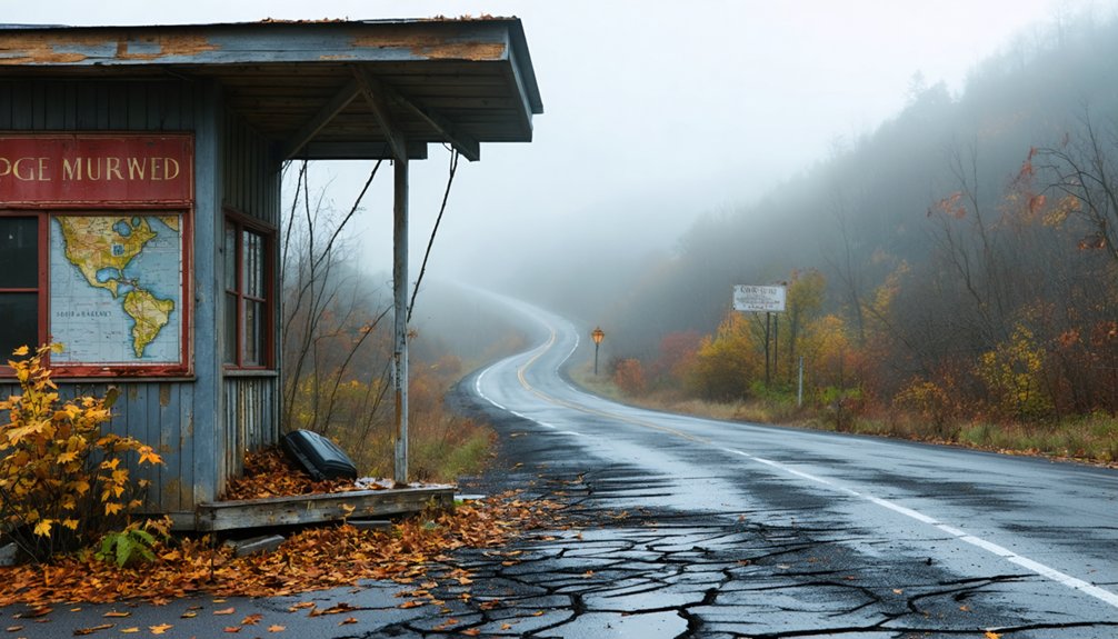
Your journey to Mountain View begins along Georgia Highway 83, the same rural corridor that once connected thriving agricultural communities before the railroad’s bypass left them frozen in time. You’ll navigate by landmarks rather than street signs—a weathered cement block building past the trestle, vacant houses marking what locals still remember as town center, all within the ghost town corridor near Athens where ZIP code 30080 anchors your search.
The route demands attention to seasonal conditions, as these back roads through Clarke and Hancock counties see little maintenance since the post office closed in late 1972, leaving nature to reclaim what progress abandoned. Along this same highway, you’ll pass through the remnants of other vanished communities like Shady Dale and Machen, where Machen’s post office operated until the late 1960s before succumbing to the same fate as Mountain View. Notable among Georgia’s abandoned settlements is Scull Shoals in Morgan County, one of the earliest communities established in the region before meeting a similar destiny.
Primary Highway Access Routes
Traversing to Mountain View requires understanding how decades of airport expansion fundamentally rewrote the region’s transportation geography. Your journey through northwest Clayton County navigates landscapes where aviation development displaced traditional routes that once served stagecoach travelers and railroad passengers.
Primary access corridors include:
- Interstate 75 provides your main north-south approach through metropolitan Atlanta with multiple Clayton County exits
- Georgia Highway 54 and Highway 138 offer alternative eastern approaches from surrounding communities
- Forest Park’s arterial roads connect you to Mountain View’s eastern boundaries
- County roads from Fulton’s southern edge allow northern suburban access
Airport security perimeter navigation and restricted zone access considerations shape your modern routing—GPS directions may conflict with actual road availability. The community’s western edge adjoins Hartsfield-Jackson’s property, demanding awareness of aviation-related access limitations that wouldn’t appear on historical maps.
GPS Coordinates and Landmarks
Pinpointing Mountain View’s exact location demands precision coordinates that guide you to 33.641778°N 84.390194°W, where this ghost settlement occupies a narrow corridor in northwest Clayton County. You’ll find yourself wedged between Hartsfield-Jackson Airport’s western boundary and Forest Park’s eastern limits, tracing remnants of the Macon and Western Railroad’s first station south of Atlanta.
The historical significance emerges through Confederate Lt. Gen. William Hardee’s temporary headquarters during the 1864 Atlanta Campaign. The Rough and Ready Tavern marks your gateway landmark—a former stagecoach stop that witnessed frontier commerce.
On clear days, you’ll understand the settlement’s naming: Stone Mountain’s unique geology rises twenty miles eastward, its granite dome punctuating Georgia’s piedmont horizon like a territorial beacon for travelers seeking unmarked paths.
Seasonal Road Condition Considerations
The journey to Mountain View’s historical coordinates transforms dramatically when winter storms sweep across Georgia’s piedmont, turning modern highways into treacherous corridors that mirror the challenges faced by Confederate supply wagons during Hardee’s 1864 occupation. Weather conditions demand the same strategic planning once required by supply trains traversing these routes.
When hazardous road conditions emerge, you’ll need to:
- Stick to major thoroughfares like I-20 rather than secondary roads where black ice forms on bridges and shaded areas
- Postpone travel until daylight when ice becomes visible
- Monitor GDOT roadway sensors for real-time conditions
- Carry emergency supplies: blankets, water, flashlight, and jumper cables
GDOT crews deploy 1.6 million pounds of salt across northern Georgia, treating hot spots with brine units and specialized plows to maintain passage through these historically significant territories.
Historical Background: The Rise and Fall of Mountain View
Long before Mountain View became synonymous with scandal and airplane noise, it emerged as Rough and Ready, an essential crossroads named for either the Rough and Ready Tavern or Bagley House—a stagecoach stop connecting Macon to Georgia’s upper reaches. The site hosted the first railroad station south of Atlanta on the Macon and Western Railroad, cementing its transportation legacy.
After incorporating in 1956, the city harbored 2,100-3,000 residents but quickly descended into chaos. Mayor Ray King‘s four terms brought charges of bribery, nepotism, and assault. Political instability culminated when Governor Jimmy Carter suspended police powers over speed trap allegations.
Economic decline accelerated as Atlanta’s aviation department acquired properties under eminent domain, displacing residents fleeing relentless jet noise. The Georgia General Assembly repealed Mountain View’s charter in 1978, erasing twenty-two years of turbulent municipal existence.
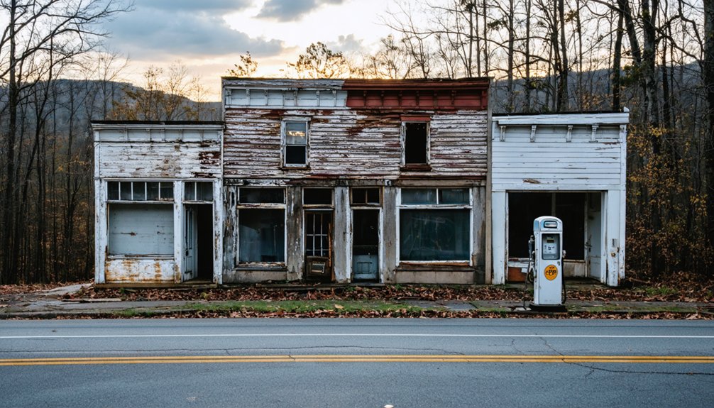
What Remains: Structures and Ruins You Can Still Explore
Scattered across former Mountain View’s landscape, remnants of 19th-century settlement tell stories older than the doomed municipality itself. You’ll discover architectural details that reveal pioneer ingenuity against Georgia’s unforgiving terrain.
Stone doorways frame empty air where generations once gathered, their stories weathered into Georgia’s stubborn red clay.
The exploration includes:
- Chappell Mill ruins – weathered 1830s timbers rest above an impressive rock wall foundation, with grinding stones still visible on the second floor
- One-room schoolhouse remains – original board and batten siding preserved beneath later additions, stove pipe dock intact
- Tiny courthouse footprint – traceable foundation integrated within the community site
- New Hope fieldstone foundations – house outlines with brick fireboxes extending toward the river
The natural setting has reclaimed these structures, where plastered walls crumble and scattered stone doorways lead nowhere, offering you unrestricted passage through Georgia’s forgotten past.
Photography Opportunities and Best Times to Visit
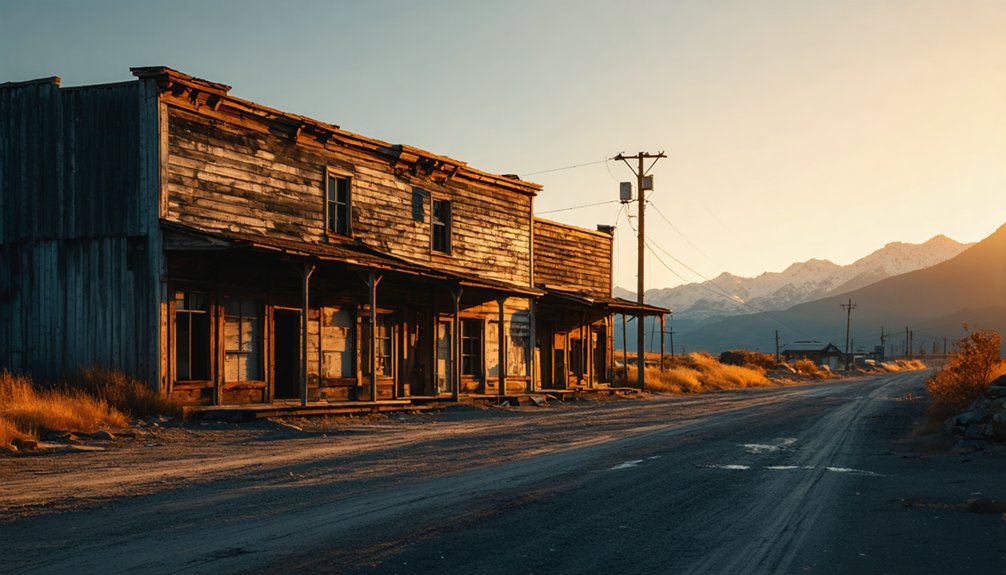
Golden hour transforms Mountain View’s ruins into a photographer’s canvas, when amber light catches weathered timber grain and casts long shadows across fieldstone foundations. You’ll capture ideal shooting conditions during early morning fog that clings to decaying structures, adding mystery to your visual storytelling techniques.
Spring and fall offer excellent lighting without harsh summer glare obscuring architectural details.
Pack wide-angle lenses for contextual shots placing ruins within Georgia’s countryside, and macro capabilities for texture work on peeling paint and rusted metal. Overcast days eliminate contrast problems while enhancing the melancholic atmosphere these abandoned sites deserve. Winter’s bare trees reveal hidden structures summer foliage conceals. You’re documenting American decline and resilience—frame compositions that honor both the town’s vibrant past and its inevitable surrender to time’s relentless march.
Nearby Ghost Towns to Add to Your Itinerary
While Mountain View anchors your ghost town exploration, Georgia’s abandoned settlements form a constellation across the state’s northern and central counties that rewards the dedicated road tripper.
The history of Mountain View, Georgia reveals a tapestry of stories woven through the lives of its former residents. As you wander its quiet streets, remnants of the past beckon, whispering secrets of a vibrant community that once thrived. Exploring these abandoned places not only connects you to a bygone era but also ignites the imagination with the possibilities of what once was.
Consider these lesser known ghost towns worth adding to your itinerary:
- Auraria – William Dean’s 1832 gold rush settlement near Dahlonega, now reduced to a crumbling general store where Auraria Road meets Castleberry Bridge Road
- Scull Shoals – Georgia’s first paper mill site in Oconee National Forest, where overgrown ruins and visible walls tell stories of flood-cursed ambition
- High Falls – Industrial ghost town within state park boundaries, featuring 1904 dam and nature-reclaimed bridge supports ideal for aerial photography perspectives
- Wrightsboro – 1768 Quaker settlement preserving an 1810 Methodist Church and Revolutionary War cemetery among scattered homestead foundations
Property Boundaries and Legal Considerations for Visitors
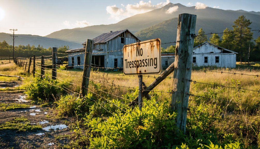
Ghost town exploration carries romantic appeal until you find yourself confronting a locked gate or an irate landowner. Understanding property line disputes becomes essential when venturing into Georgia’s abandoned settlements. Historical boundary survey challenges complicate matters—Camak’s survey never aligned precisely with the 35th latitude north, and Montgomery’s Corner connects survey lines that created ownership confusion lasting generations.
You’ll need research tools before stepping onto contested ground. The LandGlide app uses GPS to reveal current property lines, owners, and parcel data in real-time. General Land Office Records provide federal land documents with interactive mapping. Topographic maps from 1900 help identify old roads that bypass modern routes, guiding you toward publicly accessible paths rather than private property where lawsuits between owners have established strict boundaries around ghost town ruins.
Local Legends and Stories From Mountain View’s Past
Long before Mountain View earned its name, the surrounding North Georgia mountains echoed with tales of sudden fortune and crushing disappointment from nearby Auraria’s gold rush days. Dr. Stephenson’s famous chant “There’s millions in it!” drew thousands of miners to these hills in 1832, creating intriguing local lore that still resonates today.
The haunting community demise of Auraria offers cautionary tales:
- Hastily built log cabins faded as quickly as miners’ hopes diminished
- Dahlonega’s selection as county seat in 1833 triggered a mass exodus
- The newspaper’s closure severed crucial community connections
- Depleted geology and western gold fever delivered the final blow
You’ll find remnants along Auraria Road—a historical marker, decrepit buildings, and an old general store standing as silent witnesses to unbridled ambition.
Frequently Asked Questions
Are There Any Restaurants or Gas Stations Near Mountain View Ghost Town?
You’ll find dining options within 3-5 miles, including Main Street Grill and Hawg Wild BBQ, plus gas stations nearby. Local lodging areas like Hiawassee offer restaurants preserving Appalachian heritage, ensuring you’re fueled for your independent exploration adventure.
Can I Camp Overnight at Mountain View or Nearby Ghost Town Sites?
You can’t camp at Mountain View ghost town itself due to historical preservation efforts, but you’ll find excellent nearby campgrounds offering outdoor recreational activities. Mountain View Campground and Blue Ridge sites provide perfect base camps for exploring Georgia’s abandoned settlements.
Fall is considered one of the best seasons for visiting Georgia ghost towns, as the crisp air and vibrant foliage create a picturesque setting for exploration. Additionally, the cooler temperatures are ideal for hiking and capturing photographs of these historical remnants. Make sure to bring a camera to document the unique structures and artifacts you’ll encounter along the way.
Is Cell Phone Service Available in the Mountain View Area?
Picture pioneers clutching smartphones instead of compasses—you’ll find spotty cell coverage quality in Mountain View’s remote terrain. Cellular data speeds depend heavily on your carrier and exact location, so download maps beforehand for true independence.
Are Guided Tours of Mountain View Available or Only Self-Guided Exploration?
Mountain View offers only self-guided exploration—no formal guided history tours exist. You’ll experience complete freedom wandering the abandoned townsite independently, discovering visitor experiences through crumbling structures and imagining the community’s vanished past at your own pace.
What Medical Facilities Are Closest to Mountain View in Case of Emergency?
You’ll find nearest hospital locations include Mountain Lakes Medical Center and Northeast Georgia Medical Center Lumpkin within reasonable distance. When exploring remote ghost towns, you’ll want to map potential medical evacuation routes beforehand, ensuring your independence doesn’t compromise safety.
References
- https://www.atlasobscura.com/places/corpsewood-manor
- https://roughdraftatlanta.com/2021/05/23/travels-with-charlie-georgias-ghost-towns-slideshow/
- https://www.thedahloneganugget.com/news/tv-show-feature-local-ghost-towns
- https://flagpole.com/news/news-features/2013/10/23/exploring-georgias-ghost-towns/
- https://www.youtube.com/watch?v=lWuzg7uY5Wg
- https://www.youtube.com/watch?v=_FIbQ4XMCWs
- https://vanishinggeorgia.com/tag/georgia-ghost-towns/
- https://lisamrussell.substack.com/p/auraria-georgias-golden-ghost-town
- https://www.youtube.com/watch?v=hW4R7F_l9cM
- https://www.youtube.com/watch?v=GbGwjlNtilk