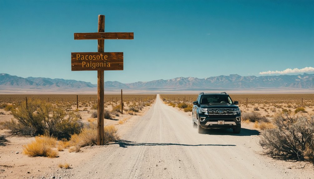
You’ll find Mowry City‘s crumbled adobe remnants along the Mimbres River in Luna County, roughly 25 miles north of Deming at coordinates 34.307144, -106.018066. Plan your visit during March-May or September-November when temperatures hover in the 50s-70s, perfect for exploring this 1860s settlement that collapsed under Apache raids and Civil War abandonment. The site sits on private ranch land, so respect property boundaries while discovering scattered grave markers, eroded foundations, and ghost street markers that hint at ambitions never realized—alongside nearby Shakespeare, Lake Valley, and Mogollon for a thorough southwestern ghost town adventure.
Key Takeaways
- Mowry City sits along the Mimbres River, 25 miles north of Deming at coordinates 34.307144, -106.018066 on private ranch land.
- Visit during March-May or September-November for ideal temperatures in the 50s-70s Fahrenheit and minimal crowds.
- Access the site from Deming following the historic Southern Overland path and Cooke’s Wagon Road route.
- Expect crumbled adobe ruins, pioneer cemeteries, and scattered street markers with minimal preservation and challenging access.
- Combine your trip with nearby ghost towns including Shakespeare, Lake Valley, Mogollon, and Organ for a complete experience.
The Rise and Fall of Mowry City’s Mining Era
When eastern investors heard Sylvester Mowry‘s name in 1858, they thought of Arizona mining wealth and opportunity. New Mexico promoters capitalized on that fame, launching Mowry City in 1860 as a strategic bet on westward expansion. You’ll find this ghost town’s story mirrors countless boom-and-bust cycles across the frontier.
The gold discovery impact at nearby Pinos Altos sparked genuine promise. Sherod Hunter and other prospectors rushed in, establishing mills and trading posts that rivaled Fort Cummins. But the Bascom Affair changed everything. Apache campaigns decimated operations while Civil War troop withdrawals left settlements exposed. Labor shortage challenges became insurmountable as miners fled to safer territories.
Where to Find Mowry City on Your New Mexico Map
You’ll find Mowry City tucked along the Mimbres River in Luna County, roughly 25 miles north of Deming where Cooke’s Wagon Road once crossed this remote stretch of southwestern New Mexico.
The ghost town sits within a constellation of abandoned settlements—Fort Cummings lies 20 miles to the east, while Ojo de Vaca Station marks a point 16 miles to the southwest. This corridor along the old Southern Overland route clusters several forgotten outposts together, making Mowry City an ideal anchor point for exploring multiple ghost towns in a single expedition.
Geographic Coordinates and Landmarks
Tucked into the high desert of southwestern New Mexico, Mowry City rests approximately 25 miles north of Deming in what’s now Luna County—though this ghost town’s administrative boundaries have shifted like desert sands over the decades, moving from Doña Ana County to Grant County before settling in Luna. You’ll pinpoint it at coordinates 34.307144, -106.018066, where the Mimbres River once sustained Lieutenant Mowry’s settlement.
The elevation changes dramatically across this rugged terrain, situated twenty miles west of Fort Cummings and eighteen miles west of Cooke’s Spring Station. With Mexico’s proximity to the border defining the southern horizon, you’re exploring country where stagecoach routes and wagon roads carved civilization’s first tentative marks into unforgiving wilderness—a landscape that still radiates raw, untamed character.
Route Access From Deming
The journey to Mowry City begins in Deming, Luna County‘s bustling seat where I-10 and US Highway 70 converge at the crossroads of southwestern New Mexico’s high desert. From these deming transportation links, you’ll head roughly 25 miles north through rugged terrain that once channeled prospectors and mail carriers.
The route follows the historic Southern Overland path that connected through Slocum’s ranch and Fort Cummins, tracing shadows of Cooke’s Wagon Road. Look for Luna County ghost town markers on your map indicating the Mimbres River crossing point. Though an abandoned railroad once served this corridor, today you’ll navigate dirt roads branching from modern highways, seeking that elusive spot where W. H. Wiley & Company’s stagecoaches once thundered toward Silver City and Pinos Altos.
Nearby Ghost Town Clusters
Luna County harbors six principal ghost towns scattered across its sun-scorched terrain, with Mowry City anchoring the northern reaches alongside Gage, Mimbres, Myndus, Nutt, and Ojo de Vaca Station.
You’ll find these skeletal settlements clustered along what once served as the Butterfield Overland Mail route, creating a natural loop through southwestern New Mexico’s abandoned crossroads. The Mimbres River corridor links several sites, while modern trail networks follow historic wagon roads connecting Fort Cummings twenty miles east to Cooke’s Spring Station beyond.
Nearby mining districts including Silver City and Pinos Altos lie northwest of this ghost town constellation, accessible via remnant stage roads that branched from Mowry City’s former hub. This concentrated geography lets you explore multiple sites without backtracking through empty desert—perfect for maximizing your off-grid exploration time.
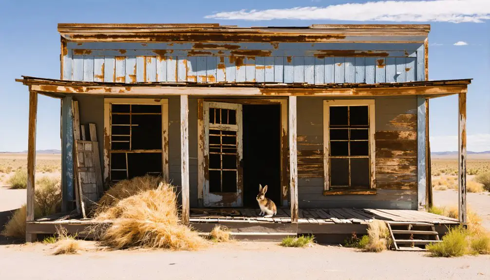
What Remains at the Mowry City Site Today
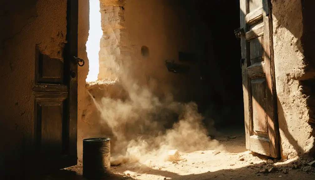
Visitors approaching Mowry City today will find precious little remaining of the optimistic 1860s settlement that once promised riches along the Mimbres River. Crumbled adobe remnants dot the landscape where promotional schemes and Apache conflicts ended dreams of prosperity.
You’ll navigate eroded ranch roads to reach scattered foundations and collapsed walls that erosion has reclaimed over 160 years. Several pioneer cemeteries mark the harsh reality faced by early settlers, with scattered pioneer grave markers standing as silent testimony to the dangerous frontier life.
The site sits on private ranch land, making access challenging and preservation minimal. Street markers offer tantalizing hints of the grid that never materialized. What you’ll discover is nature’s patient victory over abandoned ambition—a raw, unvarnished ghost town experience.
Best Time of Year to Visit Southwestern New Mexico Ghost Towns
Planning your expedition to Mowry City and neighboring ghost towns requires careful consideration of New Mexico’s dramatic seasonal shifts. You’ll find ideal shoulder season weather during March through May and September through November, when temperatures hover comfortably in the 50s to 70s Fahrenheit. These months let you explore mining ruins without southwestern desert extremes that limit summer hiking.
Fall stands out as your prime window—September through October delivers perfect exploration conditions with reduced summer crowds that typically pack accessible sites. Spring’s March and April offer similar advantages with minimal tourist traffic. You’ll encounter fewer visitors at places like Mogollon and Chloride during these periods.
Winter brings snow to northern elevations and restricts high-country access, while summer’s monsoon storms and peak-season congestion complicate your adventure into New Mexico’s abandoned settlements.
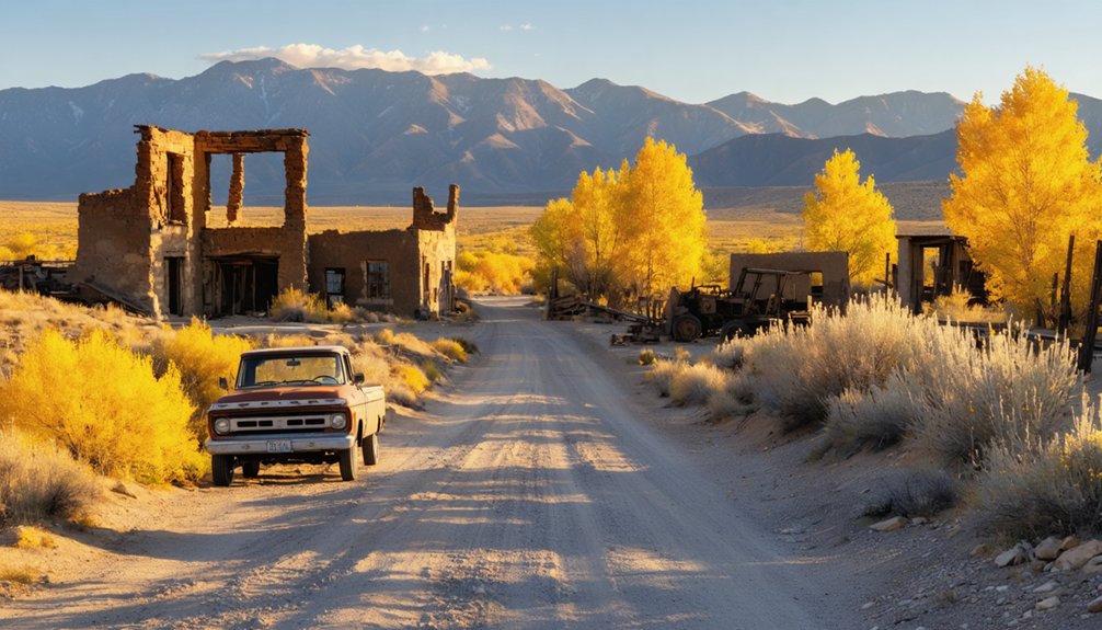
Nearby Ghost Towns to Add to Your Itinerary
Beyond Mowry City’s crumbling foundations, southwestern New Mexico conceals dozens of forgotten mining settlements that’ll transform your ghost town excursion into a multi-day adventure. You’ll discover nearby ghost towns scattered across Luna, Grant, and Doña Ana counties, each offering distinct regional historic insights into the territory’s boom-and-bust mining era.
Essential stops worth exploring:
- Shakespeare (Hidalgo County) – This privately-owned 1862-1929 mining camp preserves authentic buildings from its lawless heyday
- Lake Valley – A visitor-friendly site where you can freely wander among weathered structures
- Mogollon – Spectacular mountain setting where gold operations sustained nearly 60 years of prosperity
Plan your route to include Cambray’s 1892 remnants and Gage’s abandoned streets. Organ, just 14.5 miles from Las Cruces, peaked at 1,800 residents during its 1900s mining frenzy.
Essential Gear and Supplies for Desert Ghost Town Exploration
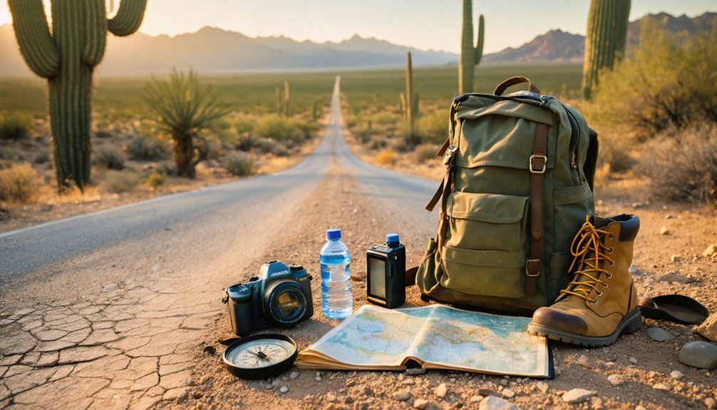
Exploring Mowry City’s crumbling adobe walls and rusted mining equipment demands proper preparation for New Mexico’s unforgiving desert environment. You’ll need reliable navigation tools to track unmarked roads, sun protection to combat intense UV radiation at high elevation, and photography gear to capture the haunting beauty of structures frozen in time.
Pack your essentials strategically—the nearest services are miles away, and cell coverage disappears once you leave the highway.
Reliable navigation and communication gear transforms a potentially dangerous desert expedition into a manageable adventure when you’re tracking down remote ghost towns like Mowry City. The Garmin GPSMAP 67i withstands Luna County’s brutal conditions while guiding you 25 miles north of Deming through terrain where cell towers don’t exist. Its satellite communicator features enable two-way messaging and SOS alerts via Iridium’s global network, essential when exploring former Butterfield Overland Mail routes along the Mimbres River.
Essential tech for your expedition includes:
- Offline mapping apps like Gaia GPS with preloaded New Mexico topo maps for ghost town navigation without data
- Weather forecasting capabilities that download flash flood warnings for Mimbres crossings
- Two-way radios providing 35-mile range across desert flats for group coordination
Battery life exceeding 180 hours guarantees you’ll stay oriented throughout multi-day explorations.
Sun Protection and Hydration
When the Chihuahuan Desert sun beats down on Mowry City’s crumbling adobe walls, you’ll face UV radiation levels that can burn exposed skin in under 15 minutes. Armor yourself with long-sleeve, moisture-wicking shirts and wide-brim hats offering UPF 50+ protection. Apply broad-spectrum SPF 50+ sunscreen liberally—one shot glass worth—every two hours, focusing on ears, nose, and lips.
Dehydration prevention demands carrying one gallon of water per person daily, more when temperatures exceed 100°F. Sip one liter hourly during exploration, supplemented with electrolyte tablets to replace minerals lost through sweat. Insulated hydration bladders keep water cool for four-plus hours in relentless heat.
Your skin protection extends beyond sunscreen—pack cooling towels, aloe vera, and UV-protective arm sleeves. This ghost town rewards the prepared explorer.
Photography and Documentation Equipment
Your survival gear keeps you safe, but capturing Mowry City’s haunting beauty demands equally thoughtful preparation. A DSLR with high ISO capability handles the desert’s dramatic light shifts, while wide-angle lenses (14-24mm) frame expansive ruins against endless horizons. Pack fast glass—f/2.8 or wider—for dark interior explorations without limitations.
Essential documentation gear:
- Sturdy tripod for 30-second exposures during golden hour and star-trail sessions
- Flashlight doubles as navigation tool and focus aid in pitch-black structures
- Rocket blower and sensor swabs for field cleaning techniques against relentless dust
Lighting considerations transform ordinary shots: light painting with colored gels reveals architectural details, while infrared filters create otherworldly atmospheres. Backup batteries and a secondary camera body guarantee you’ll never miss that perfect moment when abandonment whispers its stories through your lens.
Understanding Property Boundaries and Access Restrictions
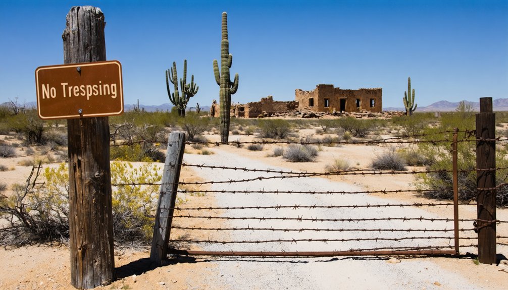
Before you venture into the desert backcountry surrounding Mowry City’s ruins, you’ll need to navigate a complex web of property ownership that’s shifted dramatically since miners first staked claims along the Mimbres River. The site’s location has changed jurisdictions from Doña Ana to Grant County, and finally Luna County—complicating modern boundary determination.
Multiple data sources can help you stay legal: Grant County Assessor’s EagleWeb tracks current parcels, while Regrid offers polygon boundaries across 33 New Mexico counties. Land id™ displays precise property lines on mobile devices for real-time ownership verification in the field.
Photography Tips for Capturing Historic Mining Structures
The crumbling adobe walls and weathered stone foundations of Mowry City demand careful attention to light and timing—your best shots will emerge during golden hour when warm tones saturate the east-facing ruins and transform ordinary slag piles into textured landscapes worth capturing.
Golden hour illuminates Mowry City’s adobe ruins, casting warm tones across weathered foundations and transforming industrial slag into compelling photographic subjects.
Master lighting variations by shooting overcast days for detailed textures or twilight for dramatic furnace silhouettes. Essential equipment accessories include a tripod for cemetery photography, polarizing filters to tame glare on metallic remnants, and wide-angle lenses for expansive compositions.
Composition strategies that elevate your shots:
- Frame intact structures using rule of thirds with hillside backdrops
- Position slag heaps in foreground to create depth toward building clusters
- Shoot low angles to emphasize smelter scale against the untamed landscape
Respect the 10-foot boundary from unstable walls while exploring your creative vision.
Combining Ghost Town Tours With Outdoor Recreation

Few adventures blend history and wilderness as seamlessly as pairing Mowry City’s mining remnants with southern New Mexico’s diverse terrain—where you’ll transform a simple ghost town visit into a multi-day exploration spanning high-altitude forests, desert canyons, and riparian corridors.
Base yourself at Patagonia Lake State Park‘s campgrounds near Harshaw, accessing nearby nature trails that wind through Organ Mountains’ Dripping Springs ruins where mule deer roam and phainopepla call.
Mogollon’s 7,000-foot elevation in Gila National Forest delivers dramatic cliffsides with zero cell service—pure disconnection. Lake Valley’s self-guided tours through schoolhouse and chapel (Monday-Thursday) complement afternoon hikes spotting canyon towhees. Geronimo Trail Guest Ranch combines Dwelling Canyon’s 1930s tin encampment with wilderness camping. These visitor experiences prove ghost town exploration demands more than windshield time—it requires boots, binoculars, and backcountry instincts.
Historical Context: Apache Conflicts and Civil War Impact
When Sylvester Mowry purchased the Patagonia mine in 1860, he couldn’t have anticipated how violently his timing would collide with two simultaneous conflicts—one between North and South, the other between Apache defenders and Anglo-American intruders on sacred ground.
Mowry’s 1860 purchase placed him at the violent intersection of Civil War chaos and Apache resistance to mining encroachment.
Mining expansion impacts transformed peacefully-disposed bands like the Mimbres into fierce resisters. The Chiricahua considered the Santa Rita Mountains sacred, defending them through relentless raids. When Union forces evacuated southern Arizona forts in July 1861, civil war vulnerabilities left settlers catastrophically exposed.
You’ll find evidence of this bloody convergence in Mowry’s graveyard:
- Fifteen of seventeen graves hold Apache attack victims, not natural deaths
- Mills and Stevens ambushed just four miles from settlement by warriors hidden in canyon brush
- Between 1863-1865, systematic massacres devastated the mining community
The frontier briefly belonged to the Apache again.
Frequently Asked Questions
Are Guided Tours Available for Mowry City and Surrounding Ghost Towns?
You won’t find guided tours availability for Mowry City itself—it’s pure self-exploration territory. Nearby Shakespeare requires scheduled tours, while Madrid offers easy self-guided audio walks. The walking tour difficulty varies, but most routes suit adventurous spirits seeking unstructured discovery.
What Cellular Service Coverage Exists in the Mowry City Area?
You’ll face limited cellular service in remote Mowry City. Cell tower availability is sparse in this isolated area, resulting in minimal to no coverage. Cellular data speeds won’t support navigation or communication—download maps offline before venturing into this wilderness.
Can Visitors Collect Artifacts or Mining Relics From the Site?
No, you can’t collect artifacts or mining relics from Mowry City. Artifact preservation laws protect these sites, and the historical significance of relics depends on maintaining their original context for future explorers and researchers to experience authentically.
Are Overnight Camping Facilities Available Near Mowry City?
You’re out of luck for camping directly at Mowry City. However, nearby ranches offering lodging provide rustic accommodations, while seasonal RV campground availability exists in surrounding areas. You’ll need to plan ahead for overnight stays during your ghost town adventure.
What Safety Precautions Should Visitors Take Regarding Abandoned Mine Shafts?
Stay on marked trails and guarantee proper footwear when exploring. You’ll want to avoid unstable structures, never enter shafts, and respect all barriers. Keep your distance from vertical openings—they’re often hidden beneath vegetation and crumbling rock.