Plan your Muldoon ghost town adventure between June and October when mountain roads open and weather cooperates. You’ll drive Seaman Creek Road from Bellevue or Croy Creek Road from Hailey, needing 4WD for steeper mining areas. The abandoned site rewards explorers with four massive charcoal kilns, crumbling mill ruins, and scattered concrete slabs marking where miners once lived. Watch for contaminated soil around slag piles, and bring water since services don’t exist for miles around this high-desert landscape where ambition met its limits.
Key Takeaways
- Access Muldoon via Seaman Creek Road from Bellevue or Croy Creek Road from Hailey; four-wheel-drive required for steep mine areas.
- Visit between June and October for best conditions; BLM routes close November 16 through May 14 due to snow.
- Explore multilevel mill ruins, concrete building slabs, four charcoal kilns, and black slag piles from 1880s smelter operations.
- Standard vehicles handle valley routes year-round, but spring snowpack and winter ice create hazardous driving conditions at elevation.
- Soil contamination from lead and arsenic remains at the site; exercise caution around slag piles and former processing areas.
The Rise and Fall of a Silver Mining Boomtown
The Muldoon Mine burst onto Idaho’s mining scene in 1881 with the kind of silver-lead deposits that made prospectors’ eyes light up—rich surface veins gleaming with possibility. By mid-1882, you’d have found a thriving camp at 7,799 feet, complete with sawmill, permanent buildings, and two 40-ton smelters processing ore worth $345,000 by 1883. The Philadelphia & Idaho Mining & Smelting Company installed cutting-edge electric lighting before Boise even had it.
But freedom from dependence on capital investment proved impossible. Ore processing challenges mounted as irregular veins played out and the isolated location demanded expensive imports. That brutal 26-mile wagon haul to Bellevue cost $8 per ton, killing profits on borderline ore. By 1911, only twenty miners remained attempting what ambition couldn’t sustain.
Getting to Muldoon: Routes and Road Conditions
Reaching Muldoon demands commitment—this isn’t a ghost town you’ll stumble upon while cruising Idaho’s highways. You’ll tackle graded Seaman Creek Road from Bellevue, climbing over Muldoon Summit before descending into the valley. Alternatively, try Croy Creek Road near Richardson Summit if you’re approaching from Hailey. Standard vehicles handle the valley routes fine, but accessing the mines clinging to steep mountainsides requires four-wheel-drive.
Timing matters decisively here. Spring’s lingering snowpack difficulties can block high-elevation roads through June, while winter brings serious icy road hazards that’ll test even experienced mountain drivers. Summer and early fall offer your best window. Remember, some mines sit on private land—respect posted boundaries. Pack detailed topo maps, because cell service won’t save you if you’re turned around.
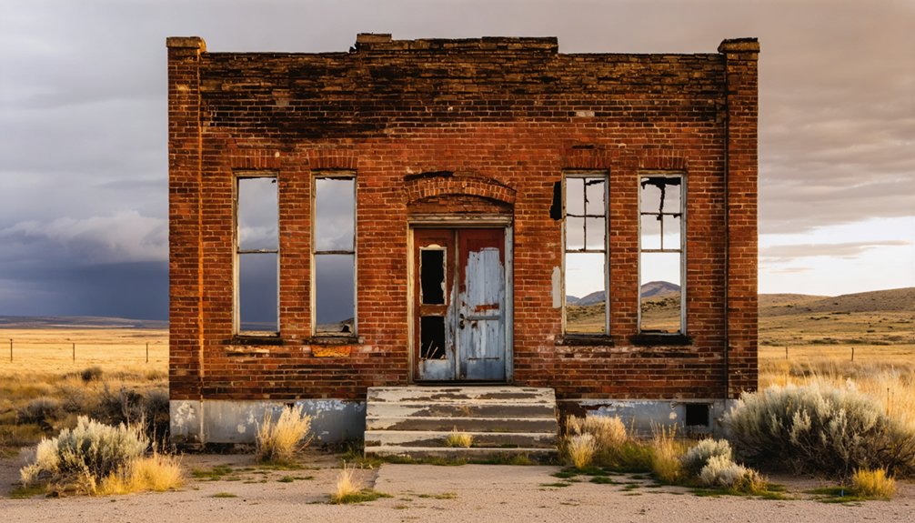
What Remains at the Ghost Town Site Today
Muldoon’s remains tell a story of hasty abandonment rather than gradual decay. When ore depletion and the 1887 smelter sale served as town abandonment triggers, residents packed everything and relocated buildings to Arco overnight.
You’ll find the multilevel mill ruins dominating the canyon—the massive structure once processed ore from nearby mines until 1888. Scattered concrete slabs mark where bunkhouse bedrooms and kitchens stood, while black slag piles testify to two 40-ton smelters’ operations from 1882.
The ghost town demolition process was thorough: residents stripped everything valuable, leaving only cement wall remnants and mining debris. Today’s contaminated soil contains lead and arsenic, so expect toxic dust clinging to your shoes and clothing as you explore.
Exploring the Charcoal Kilns and Slag Piles
About a mile upcanyon from Muldoon’s mill ruins, you’ll spot four massive beehive structures rising twenty feet against the sagebrush hillside—the surviving charcoal kilns that once fed an insatiable smelter.
Walk through the ground-level doors where workers stacked forty cords of Douglas fir, then sealed the chambers for week-long burns that transformed wood into fuel. These parabolic domes represent 1880s energy production technologies at their peak—sixteen kilns churning out 50,000 bushels monthly.
Peer inside to see restoration work that preserved original 1885 dimensions. The scattered slag piles nearby tell another story: residue from processing Viola Mine’s lead-silver ore. Transportation methods were primitive but effective—wagons hauling 400-bushel loads thirteen miles to Nicholia, risking spontaneous combustion if charcoal wasn’t properly cured. Touch the brick walls. They’re solid freedom.
Best Times to Visit and Weather Considerations
You’ll find Muldoon’s 2WD-accessible roads open year-round, though each season paints the ghost town in dramatically different light. I’ve watched September’s golden aspens frame crumbling stone kilns and returned in July when wildflowers pushed through old slag piles under endless sunshine.
Winter brings serious snow and ice—temperatures plunging into the 20s—while spring through fall offers the sweet spot of passable roads and comfortable exploration from May’s thaw through October’s amber glow.
Seasonal Access and Conditions
The remote desert plateau surrounding Muldoon transforms dramatically with each season, and timing your visit wrong means you won’t get there at all. BLM routes shut down November 16 through May 14, trapping the ghost town behind locked gates meant to protect wildlife and prevent soil damage.
You’ll find freedom during summer and fall when roads open fully, but spring brings unpredictable conditions—avalanche danger in higher elevations and flood risk from snowmelt can strand you. Winter access exists only for tracked over-snow vehicles, though some areas prohibit even snowmobiles. The Stinking Springs closure runs December 15 to May 1, weather-dependent.
Plan for June through October when you’ll navigate freely without bureaucratic barriers blocking your exploration.
Peak Visiting Months
Fall delivers Muldoon’s finest visiting window, when September’s golden light slants across weathered cabins and October’s crisp air carries no hint of the wildfire smoke that plagues summer months. You’ll find ideal hiking conditions on mountain trails leading to the ghost town, with firm ground underfoot and temperatures hovering comfortably between 50-70°F during daylight hours.
Spring runs a close second among quieter months, offering wildflower-dotted approaches through Craters of the Moon country and accessible roads once snowmelt clears by late May. Summer tempts with extended daylight for exploration, but you’ll share narrow dirt roads with peak-season crowds and potentially choke on smoke from regional fires. Pack layers regardless—evening temperatures plummet fast in Idaho’s high country, even when afternoon sun bakes those century-old structures.
Nearby Historic Mining Sites Worth Adding to Your Trip
While Muldoon itself stands frozen in time as a weathered ghost town, the surrounding mountains harbor a network of historic mines that shaped Idaho’s silver boom era. You’ll find the Minnie Moore Mine near Bellevue, where prospectors traced ore fragments uphill to discover veins averaging 102 ounces of silver per ton.
The Livingston Mine on Boulder Creek pulled $650,000 from the earth between 1926 and 1930—real wealth that built empires. Head toward Rock Creek for undiscovered mine sites like Uhrig Mine, where mining exploration legends still whisper through abandoned shafts. Fish Creek Mines processed four hundred tons during their heyday, while Copper Basin’s properties sparked revival attempts in 1891.
Pack sturdy boots and respect the dangers these crumbling portals present.
Essential Gear and Preparation Tips
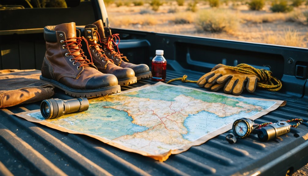
Adventure through Idaho’s abandoned mining country demands respect for both history and harsh reality. Your rig needs high-clearance capability—those 15 miles of tire-sucking mud and rocky switchbacks won’t forgive soft suspension. Consider vehicle modifications like reinforced skid plates and all-terrain tires before tackling this route.
Pack emergency backup supplies: spare tire, jack, basic tools, first aid kit. Cell service vanishes in the Owyhees, so bring GPS units and detailed topos. You’ll need weatherproof layers—mountain conditions shift fast. Fuel up completely; there’s no bailout station midway.
Throw in camera gear for capturing preserved structures and that windswept cemetery. Camping equipment extends your exploration window. Water, food, headlamps—these aren’t suggestions. This country rewards preparation and punishes assumptions.
Private Land Boundaries and Access Permissions
Before you venture into Muldoon’s crumbling structures and overgrown trails, understand this: the tangled web of ownership here will test your research skills as much as the terrain tests your rig. The USGS locations remain unverified, and those claim maps you’re studying? They’re starting points, not gospel.
Navigate the ownership maze:
- The Muldoon Mine sits on Sawtooth National Forest land at 7,799 feet
- Property ownership designations show general areas only—they don’t reveal claim status
- Private parcels hide within government boundaries on US Topo maps
- AcreValue plat maps source Idaho tax assessor data for landowner verification
- Mines near Broadford Road and south of Croy Creek demand permission before entry
You’ll find the preserved Post Office, slag piles, and kiln remains accessible, but always verify boundaries first.
Frequently Asked Questions
Are There Camping Facilities Near Muldoon Ghost Town?
No designated camping facilities exist at Muldoon itself, but you’ll discover primitive camping sites throughout the surrounding Little Wood River region. You can explore rugged Pioneer Mountain terrain via designated hiking trails while experiencing true backcountry freedom.
Can I Bring My Dog to Explore the Site?
Pet-friendly policies aren’t officially documented for Muldoon’s ruins, but you’ll find most Idaho ghost towns welcome supervised dog activities. Keep your pup leashed while exploring crumbling structures—freedom means respecting both history and your adventurous companion’s safety.
Are Guided Tours Available for Muldoon?
Guided tours aren’t offered at Muldoon—you’re free to roam independently. Self-guided exploration is recommended, letting you discover crumbling cement slabs, black slag piles, and charcoal kilns at your own pace, creating your own adventure through Idaho’s mining past.
Is Cell Phone Reception Available in the Area?
You’ll find limited signal strength in Muldoon’s remote terrain. AT&T offers your best connectivity options with 69.7% coverage, while T-Mobile provides moderate service. Verizon struggles here, so you’ll want backup plans for staying connected off-grid.
Where Can I Find Food and Gas Before Visiting?
You’ll find gas and local diner options in Bellevue or Picabo along US 20 before reaching Muldoon. Stock up at grocery stores nearby in these small towns—they’re your last chance for supplies before venturing into remote territory.