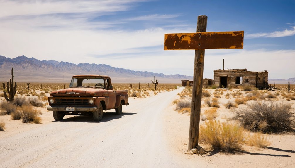
You’ll need high-clearance 4WD to reach Nadeau’s haunting ruins, where Remi Nadeau’s legendary 20-mule teams once hauled silver ore across 200 miles of unforgiving desert. The 28-mile trail through Panamint Valley challenges even experienced adventurers with rocky washes and twisted canyon walls. Gas up in Trona before heading out—this remote 1870s freight station offers scattered stone foundations, crumbling adobe walls, and weathered cemetery markers that tell stories of California’s silver boom. The surrounding landscape holds secrets worth discovering.
Key Takeaways
- Access requires high-clearance 4WD vehicle through rocky washes; fuel up in Trona before departure as services are limited.
- Navigate via 28-mile National Recreation Trail through Panamint Valley; northern approach uses Beatty and CA-190 through Trona-Wildrose intersection.
- Expect 1870s freight station ruins, stone foundations, adobe walls, cemetery markers, and abandoned mine shafts at the site.
- Bring quality camera equipment to document the sparse historical record; harsh desert light creates dramatic photography conditions.
- Plan for remote desert conditions with no nearby amenities; site sits in rugged terrain between historic mining areas.
Historical Significance of Nadeau and the Silver Mining Boom
The discovery of Cerro Gordo in 1865 transformed the barren slopes above Owens Lake into Inyo County’s richest mineral bonanza, ultimately yielding $17 million in silver, lead, and zinc. You’ll find this remote strike created unprecedented freighting infrastructure challenges across 200 miles of desert separating mine from market.
Remi Nadeau’s legendary 20-mule teams conquered these obstacles, hauling eighteen tons of bullion daily at peak production in 1874. His supply chain innovations revolutionized desert transport—eighty teams of fourteen mules each pulled three high-sided wagons loaded with $50,000 worth of ore down treacherous Yellow Grade Road. These convoys moved 200 tons monthly through Los Angeles, consuming 2,500 tons of barley annually. The 700-mile route to Salt Lake City required 35 days each way, establishing Nadeau’s freighting operations across multiple territories. The town’s population peaked at 1,500 people during the height of mining activity.
When silver veins exhausted by decade’s end, Nadeau’s freighting empire dissolved, leaving ghost towns scattered across the Mojave.
The Legacy of Remi Nadeau and Desert Freighting Operations
Behind every ton of silver bullion that descended Yellow Grade Road stood a French-Canadian entrepreneur whose innovations would permanently alter desert commerce. Remi Nadeau transformed wilderness into profitable trade routes using 20-mule teams that conquered 200-mile round trips through unforgiving Mojave terrain.
French-Canadian innovation conquered 200 miles of Mojave wilderness, transforming silver transport into an empire that redefined desert commerce forever.
His 19th century business practices revolutionized freight operations—establishing way stations, harvesting Owens Lake salt for his animals, and moving 1,000 tons monthly at peak capacity.
You’re exploring remnants of an empire that generated over $500,000 annually while supporting 300+ employees. Nadeau’s cultural impact on region extended beyond commerce; he connected isolated mining camps to Los Angeles, fueling the city’s growth during the 1870s boom.
His abandoned adobe warehouses whisper tales of freedom-seeking prospectors dependent on his wagons for survival supplies and fortune-making ore shipments. The comprehensive history of these operations spans 276 pages in Crest Publishers’ 1992 edition, complete with maps and vintage photographs documenting the freight empire. His works capture 1950s nostalgia while chronicling California’s transformative mining era through meticulous research of historical documents.
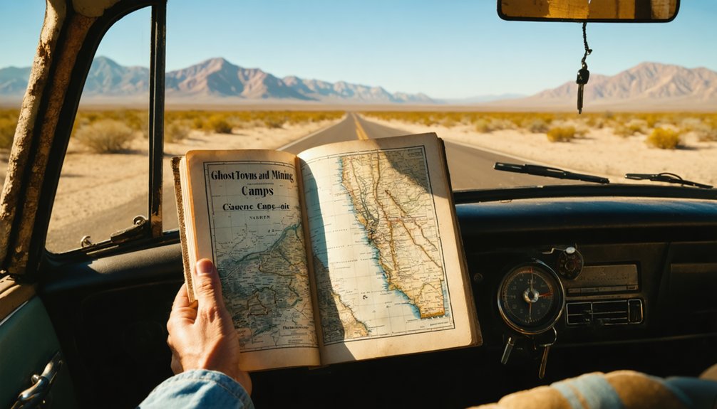
Getting to Nadeau: Routes Through Inyo County and Owens Lake
When you’re plotting your route to Nadeau’s ghost town remnants, you’ll navigate a 28-mile National Recreation Trail that slices through Panamint Valley’s stark expanse, flanked by the Argus Range’s weathered peaks to the west and the Panamint Range’s towering wall to the east. Access from Inyo County parallels Remi Nadeau’s historic freighting corridor linking Cerro Gordo mines to Owens Lake’s dry bed.
The southern trailhead (35.996884, -117.337234) demands high-clearance 4WD through rocky, rutted washes. From northern approaches via Beatty and CA-190, you’ll cross the Trona-Wildrose intersection marked by prominent P105 signage. The trail passes through Stone Canyon, where you’ll encounter twisted layers of sedimentary rock at the canyon entrance. You’ll need to gas up in Trona before reaching the trailhead, as the only other fuel stops are located in Trona and Panamint Springs. Spring, fall, and winter offer favorable passage through this ephemeral desert ecology, though accessibility challenges persist—unmaintained sections face rockfall, and Google Maps misleadingly labels portions as “Hadue.”
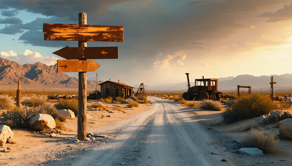
What Remains at the Nadeau Ghost Town Site Today
When you arrive at the Nadeau site, you’ll find scattered stone foundations and crumbling adobe walls that mark where buildings once stood against the desert floor. The weathered remnants tell stories of the 1870s freight station that served nearby mines, with enough structure remaining to photograph the layout of this once-vital supply hub.
Bring your camera to capture the way afternoon light cuts through doorframes that open to nothing but sagebrush and mountain views. While muddy black and white photos from earlier guidebooks don’t do these sites justice, modern photography equipment can capture the haunting beauty that draws ghost town enthusiasts to these remote locations. Consider browsing genealogical databases and resources to uncover whether your ancestors had connections to this historic freight station and the mining operations it served.
Visible Structural Remnants
A weathered landscape of crumbled adobe and scattered stone greets visitors who venture to Nadeau’s windswept site today. You’ll discover adobe wall fragments jutting from the desert floor, their earth-toned surfaces eroded by decades of harsh elements.
Stone foundations outline where boardinghouses and residences once bustled with mining activity. Isolated chimney stacks stand as skeletal sentinels across the terrain, marking former homesteads now returned to dust.
Cellar pits from homes expose underground storage spaces, while tailings piles and abandoned mine shafts dot the surrounding hillsides. The main street’s alignment remains traceable through foundation patterns and debris fields.
Near the town’s edge, you’ll find the cemetery with weathered markers and the schoolhouse foundation—tangible connections to families who carved out lives in this unforgiving landscape seeking fortune and independence. For those interested in exploring more ghost towns throughout the state, Remi Nadeau’s Ghost Towns and Mining Camps of California provides a comprehensive guide to these historic sites.
Among these fascinating remnants is a collection of unique ghost town attractions in Copperfield that draw visitors eager to delve into the past. From abandoned storefronts to dilapidated mining equipment, each site tells a story of ambition and hardship. Exploring these locations offers a profound understanding of the region’s history and the enduring spirit of its early settlers.
Photographic Documentation Available
Photographic records of Nadeau have proven scarce throughout the decades, making visual documentation of this remote site particularly valuable for researchers and ghost town enthusiasts. You’ll find limited historical images in Remi A. Nadeau’s photographic collection, though these primarily showcase other California mining camps rather than this specific location.
If you’re planning to capture your own visual documentation, you’re fundamentally contributing to a sparse historical record. Bring quality camera equipment—the harsh desert light creates challenging conditions but rewards prepared photographers with dramatic shadows and textures. Your images might become reference materials for future explorers. Consider documenting charcoal kilns, foundation remnants, and landscape features from multiple angles. This independent documentation helps preserve Nadeau’s story before erosion claims what little remains.
Nearby Ghost Towns and Mining Camps Worth Visiting
Your journey to Nadeau opens the door to exploring several remarkable ghost towns scattered across the Eastern Sierra and Death Valley regions.
Within a reasonable drive, you’ll find Cerro Gordo’s silver-mining ruins perched high in the Inyo Mountains, where preserved structures like the Belshaw House tell stories of 19th-century fortune seekers.
Beyond these mountain remnants, destinations like Calico and Skidoo offer their own distinct mining legacies, each representing different chapters in California’s boom-and-bust mining era. Nearby Panamint City’s remnants still endure in the Panamint Range, where you can explore stone walls, a brick stamp mill, and remnants of the town’s former smelter.
Cerro Gordo Mountain Ruins
Perched at 8,500 feet in the remote Inyo Mountains, Cerro Gordo’s sprawling ruins tell the story of California’s largest silver and lead producer, where Mexican prospectors first struck silver near Buena Vista Peak in 1865.
You’ll discover 22 structures scattered across 400 privately-owned acres, including the 1870s Belshaw House and miles of tunnels from $500 million in mineral wealth exploitation.
The town’s violent social dynamics defined its peak years—averaging one murder weekly among 500 residents, miners slept behind sandbag barriers against stray bullets.
Today’s remnants include ore cars, wooden tramway towers, and zinc-era machinery. The American Hotel burned in 2020, but you can rent historic buildings overnight.
From this elevation, you’ll witness commanding views spanning Owens Valley to Death Valley’s eastern reaches.
Calico’s Silver Boom Legacy
Three prospectors stumbled upon silver-streaked outcroppings in Wall Street Canyon during March 1881, and their discovery transformed Calico into California’s largest silver producer within just five years.
You’ll find remnants of over 500 mines that once honeycombed these hills, generating $13-20 million in silver before the 1890s panic crashed prices from $1.31 to just 63 cents per ounce.
Calico’s economic shift from boom to bust happened swiftly—profitable mining ceased by 1896, and the post office shuttered two years later.
Today, Calico’s continued tourism thrives as California’s official silver rush ghost town, where you’ll explore authentic mine tunnels, witness staged gunfights, and wander through five original structures alongside faithful replicas.
It’s freedom to experience history without corporate sanitization.
Skidoo and Death Valley
While Calico showcases California’s silver heritage, Death Valley’s remoteness harbored its own precious metal secrets. You’ll find Skidoo perched at 5,689 feet on Tucki Mountain’s southwestern flank, where 700 fortune-seekers once extracted $1.6 million in gold. The skidoo gold mining operation boasted Death Valley’s only water-powered stamp mill, fed by pipes from distant Telescope Peak.
Today, you’ll navigate unpaved roads requiring high-clearance vehicles to reach scattered ruins—mill remains, a dozen visible mine shafts, and weathered equipment sprawling across surrounding hills. The original townsite’s vanished, but you can explore a thousand abandoned mines dotting the landscape.
Plan an hour-long drive from Highway 190, and you’ll discover why this became Death Valley’s longest-lived camp before ore depletion silenced its machinery in 1917.
Using Ghost Towns and Mining Camps of California as Your Guide
Remi A. Nadeau’s exhaustive guidebook serves as your essential companion for exploring California’s abandoned mining territories. His Stanford and UC Santa Barbara credentials shine through detailed historical research covering 1848-1856’s peak gold rush period.
Nadeau’s Stanford-backed research transforms abandoned mining sites into accessible adventures through California’s 1848-1856 gold rush legacy.
You’ll discover black and white photographs, maps, and precise directions to Nevada City, Volcano, Calico, and dozens more forgotten settlements. The book documents native American influences on early prospecting methods and mining techniques evolution from simple pans to complex hydraulic operations.
Beyond historical narratives about Christmas celebrations and outlaw escapades, Nadeau provides practical information about what remains visible today. Use the included maps to plot your Route 49 adventure, connecting multiple ghost towns in sequence.
The bibliography and index enable deeper exploration of sites that capture your imagination during this freedom-seeking journey through California’s wild mining past.
Best Times to Visit and What to Bring for Your Desert Exploration
Before you venture into Nadeau’s unforgiving desert landscape, you’ll need to master the delicate timing that separates adventure from ordeal. Fall and winter offer your best window—cooler temperatures transform brutal summer days exceeding 114°F into manageable exploration conditions. Plan early morning departures to catch sunrise vistas before afternoon heat intensifies.
Your freedom depends on proper preparation. Pack layered clothing for 40°F temperature swings, protective sun gear for relentless UV exposure, and wind-resistant outerwear for 50mph gusts. Your 4WD vehicle needs high clearance for washed-out trails requiring rock-stacking navigation. Load emergency supplies, NOAA weather radios, and abundant water reserves.
Consult trip planning resources before departure—post-rain conditions can transform passages into impassable canyons. Allocate 4-5 hours minimum, departing at dawn to maximize daylight hours.
Frequently Asked Questions
Are There Any Entrance Fees to Visit Nadeau Ghost Town?
You won’t find entrance fees at Nadeau Ghost Town—it’s freely accessible across open desert terrain. However, preservation efforts here are minimal, so you’ll discover authentic ruins untouched by commercialization, offering true exploration freedom amid California’s weathered mining history.
Is Camping Allowed Near the Nadeau Site Overnight?
Yes, you’ll find dispersed camping along Nadeau Trail on BLM land. It’s primitive dry camping without public restrooms availability or services, so you’ll need complete self-sufficiency. Nearby campgrounds like Calico Ghost Town offer developed facilities if preferred.
What Cell Phone Coverage Can I Expect in This Area?
You’ll find yourself in connectivity limbo—cell tower proximity is sparse in Nadeau’s remote desert location. Expect minimal to no data network reliability. AT&T and Verizon offer your best chances, though coverage remains unpredictable in this backcountry freedom zone.
Are the Structures at Nadeau Safe to Explore or Enter?
The structures aren’t safe to enter due to structural integrity concerns from decades of decay and desert exposure. There’s no historical preservation efforts here, so you’ll find crumbling walls, unstable floors, and serious collapse risks throughout the abandoned site.
Do I Need a Four-Wheel Drive Vehicle to Reach Nadeau?
No, you won’t need four-wheel drive to reach Nadeau. The dirt road access is rated easy, though high clearance recommended for traversing occasional ruts. Your adventure-ready SUV will handle this scenic route just fine.
References
- https://homesteadmuseum.blog/2019/09/19/through-the-viewfinder-views-from-the-nadeau-block-los-angeles-ca-1885/
- https://www.goodreads.com/book/show/112858.Ghost_Towns_and_Mining_Camps_of_California
- https://archive.org/details/ghosttownsmining0000nade
- https://www.abebooks.com/first-edition/Ghost-Towns-Mining-Camps-California-Nadeau/4536332966/bd
- https://online.ucpress.edu/ch/article/45/4/359/30334/Review-Ghost-Towns-and-Mining-Camps-of-California
- https://en.wikipedia.org/wiki/Remi_Nadeau
- https://booksrun.com/9780962710421-ghost-towns-and-mining-camps-of-california-4th-revth-edition
- https://westadamsheritage.org/remi-nadeau
- https://homesteadmuseum.blog/2020/06/24/the-silver-mining-boom-town-of-cerro-gordo-and-the-workman-and-temple-families-1873-1875/
- https://mtnmouse.com/california/inyob03cerro_gordo_2_mining_history.html


