Plan your Nicksville visit for spring or fall when temperatures hover between 50-75°F, avoiding summer’s oppressive heat and winter’s ice storms. You’ll drive nine miles north of Sallisaw on deteriorating gravel roads that demand high clearance and commitment. Pack water, layered clothing, and offline maps since cell service vanishes in this remote location. The forest has completely reclaimed the 1828 settlement, leaving no visible foundations where the Cherokee Nation’s oldest post office once stood—though the empty ground holds archaeological secrets beneath two centuries of overgrowth that reward those who understand what they’re seeking.
Key Takeaways
- Nicksville is located nine miles north of Sallisaw in Sequoyah County, accessible via gravel roads requiring high-clearance vehicles.
- No structures or foundations remain visible; the 1828 settlement has been completely reclaimed by dense forest and vegetation.
- Visit during spring or fall when temperatures range between 50-75°F to avoid summer heat and winter ice storms.
- GPS coordinates and offline maps are essential as cell service is limited and no directional signs mark the site.
- Pack water, layered clothing, and respect archaeological preservation by photographing rather than collecting artifacts from the area.
Nicksville’s Brief But Significant History in Cherokee Nation
Before the Trail of Tears etched its tragic path across American history, a small settlement called Nicksville emerged as an unlikely harbinger of the Cherokee Nation‘s future in Oklahoma.
You’ll find this ghost town’s story intertwined with pre removal land cessions that pushed Western Cherokees westward in the 1810s. When Arkansas’s white settlements encroached too close, the federal government cleared the area in 1829, and Dwight Mission claimed Nicksville’s improvements that May.
Though the town vanished quickly—its post office lasted barely a year—it witnessed the groundwork for post removal governance formation. Here, scattered Cherokee groups would eventually unite under the 1839 constitution, transforming fragmented communities into a sovereign nation that still thrives today. The Cherokee originally inhabited the southeastern US, with ancestral lands spanning Alabama, Georgia, Tennessee, and the Carolinas before their forced westward migration. The Cherokees had created a new national capital at New Echota in Georgia in 1825, establishing a center of government before their removal westward.
Getting to Nicksville: Routes and Road Conditions
The ghost of Nicksville lies roughly nine miles north of Sallisaw in Sequoyah County, where paved roads give way to gravel and the GPS signal grows uncertain. You’ll need to embrace old-school navigation here—printed maps and local knowledge trump digital convenience.
The main approach follows county roads that wind through Cherokee Nation land, their conditions varying with Oklahoma’s temperamental weather. Spring rains transform these passages into mud-slicked challenges, while summer bakes them into washboard surfaces that rattle your suspension. Road accessibility depends on your vehicle’s clearance and your willingness to commit. For reference, nearby Bartlesville sits in northeastern Oklahoma at coordinates 36.752045, -95.963654, offering a comparison point for understanding the state’s rural geography. Westville town to the west provides another landmark at 35.99, -94.57 for travelers orienting themselves in the region.
Route alternatives exist through neighboring properties, though permission and locked gates may redirect your plans. This isn’t a destination for the cautious—it’s for those who understand that reaching forgotten places requires accepting uncertain paths.
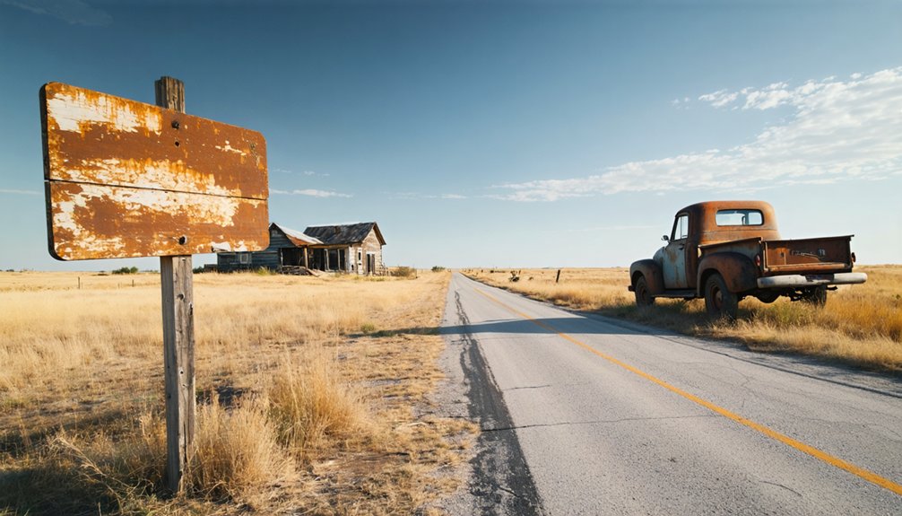
What to Expect at Oklahoma’s Oldest Ghost Town Site
When you arrive at Nicksville, you’ll find nothing but silent earth where Oklahoma’s first county seat once stood. The forest has reclaimed every trace of the 1828 settlement, leaving only overgrown clearings and perhaps a weathered historical marker to acknowledge what vanished here.
Reaching this isolated site means traversing rough backroads through Sequoyah County’s remote countryside, where modern maps offer little guidance to a town that dissolved nearly two centuries ago. This barren site offers no visible foundations or structures, as the land has completely returned to its natural state. Like many of Oklahoma’s estimated 2,000 ghost towns, Nicksville represents a settlement that completely disappeared from the landscape.
No Standing Structures Remain
Unlike many ghost towns that leave behind weathered foundations or crumbling walls, Nicksville offers nothing but empty ground where Oklahoma’s oldest post office once stood. You’ll find no trace of the buildings that housed General John Nicks’ namesake settlement from 1828 to 1829. The site has vanished completely, mirroring other abandoned Oklahoma locations like Doaksville and Womack.
The remains is potential—archaeological finds waiting beneath the soil could reveal remnant artifacts from this brief chapter of frontier history. You’re free to explore barren terrain where the Dwight Mission once educated Native American students. The Indian school operated from 1829 at this remote location north of present-day Sallisaw. Perhaps a historical marker guides you, though even that’s uncertain. This emptiness defines true ghost towns: places where time erased everything except memory and the freedom to imagine what once was. Natural disasters like flooding and tornadoes have created numerous ghost towns across Oklahoma, permanently erasing settlements from the landscape.
Overgrown Terrain and Markers
Nearly two centuries of neglect have transformed Nicksville into a landscape where prairie grasses and tangled brush swallow every trace of human habitation. You’ll find yourself pushing through dense vegetation overgrowth that varies dramatically with seasons—spring brings impenetrable greenery, while winter reveals slightly more ground.
The original street patterns exist only in historical maps you’ll need beforehand, as nature’s reclaimed every foundation and marker. Weather-battered debris lies scattered beneath your feet, demanding careful navigation around environmental hazards like hidden depressions and rotted wood.
Oklahoma Historical Markers might guide you to the general vicinity, but don’t expect directional signs pointing toward specific structures. You’re entering genuine wilderness where the 1828 settlement has utterly dissolved into woodland and prairie—bringing GPS coordinates becomes essential for finding anything meaningful. This Cherokee Nation site represents one of the earliest European-style settlements in what became Oklahoma territory. The Oklahoma Historical Society maintains research materials and publications about the site’s significance through their Chronicles of Oklahoma and other historical documentation.
Remote Rural Access Challenges
Getting to Nicksville demands serious preparation, as you’re venturing toward Oklahoma’s oldest ghost town along rural routes that haven’t seen maintenance crews in decades. You’ll navigate backroads with limited signage through sparse populations where cell service vanishes and gas stations become distant memories.
This 1828 Cherokee Nation settlement requires genuine exploration:
- Unmarked turns appearing suddenly along crumbling asphalt where pavement surrenders to gravel
- Dead-end roads forcing unexpected reversals through overgrown corridors of blackjack oak
- Washed-out bridges demanding creek crossings that’ll test your vehicle’s clearance
You won’t find tourist amenities or convenient parking lots here. The isolation that killed Nicksville protects what remains—weathered foundations and forgotten graves accessible only to those willing to abandon modern comforts for authentic discovery.
Best Times to Visit and Weather Considerations

You’ll find Nicksville most welcoming during spring’s mild awakening or fall’s golden retreat, when temperatures hover between 50-75°F and the skies stretch clear above the abandoned settlement.
Summer’s oppressive heat and humidity can drain the adventure from exploration, while winter’s ice storms transform rural access roads into treacherous passages.
The greatest threat lurks in spring’s tornado season and late summer’s flash floods—the same violent weather that helped drive settlers from these forsaken streets generations ago.
Seasonal Weather Patterns
Planning a ghost town road trip means timing your adventure with Oklahoma’s dramatic seasonal shifts. You’ll find prime conditions during spring and fall when transitional temperatures create ideal exploring weather. These shoulder seasons deliver minimized severe weather compared to summer’s relentless heat—where you’ll endure 60-plus days above 90°F—or winter’s unpredictable snowfall and biting winds.
Picture your perfect ghost town expedition:
- Spring mornings with temperatures climbing from 62°F to 74°F as you photograph abandoned storefronts
- October afternoons enjoying 85°F highs while wandering through crumbling foundations
- November exploration at comfortable 62°F as crimson leaves frame decaying structures
Winter’s 28°F lows and summer’s oppressive 94°F humidity will test your resolve. Choose freedom over discomfort—visit when nature cooperates with your wanderlust.
Avoiding Flood Conditions
Oklahoma’s skies can transform from brilliant sunshine to catastrophic deluge within hours, turning your ghost town adventure into a dangerous scramble through rising waters. You’ll want to avoid May and June entirely—these months have released, discharged, or triggered devastating floods, including the 2019 Arkansas River disaster that caused $7.6 billion in damage and forced evacuations across 25 towns.
Before departing, conduct thorough flood risk analysis of your route, particularly near Neosho-Grand River areas where historical crests exceeded 15,000 cubic feet per second. Check water level monitoring stations for eastern Oklahoma, where rainfall exceeding 10 inches has repeatedly triggered emergencies. Your freedom to explore Nicksville depends on respecting nature’s power—one 5-inch downpour can strand you indefinitely.
Exploring Other Abandoned Settlements in the Area
Beyond Nicksville’s crumbling foundations, a constellation of forgotten settlements dots the landscape across five surrounding counties, each one whispering its own story of boom and decline. You’ll find Sequoyah County’s Blackgum, Box, and Brushy—empty crossroads marked only by nearby historic markers and overgrown cemetery gates. LeFlore County holds Skullyville’s 1831 cemetery and Zoraya’s Choctaw origins, while Muskogee County’s Oktaha preserves post office ruins from 1872.
Across five Oklahoma counties, 2,000 ghost towns stand as silent monuments to vanished dreams and depleted resources.
Your treasure-hunting route might include:
- Cottonwood’s southeastern approach from Muldrow, where roofless buildings cast shadows across abandoned foundations
- Brushy’s northeastern path from Sallisaw, revealing rubble-strewn streets nature’s reclaiming
- Zoraya’s isolated cemetery, where undiscovered treasure sites persist in local lore
Each location offers freedom to wander Oklahoma’s estimated 2,000 ghost towns—silent chronicles to resource depletion and forgotten dreams.
Essential Tips for Ghost Town Exploration in Sequoyah County
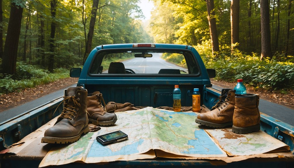
Before you set out across Sequoyah County’s dusty backroads, you’ll need more than enthusiasm and a full tank of gas. Pack water for those sweltering Oklahoma summers, and bring layered clothing for unpredictable weather shifts. Your 2WD vehicle will handle the terrain, but download offline maps—cell service disappears fast out here.
Respect the archaeological survey potential of sites like Nicksville. Don’t disturb structural remains or artifacts; they’re irreplaceable pieces of Cherokee Nation history. Document what you find through photographs instead of souvenirs. Cultural heritage preservation depends on explorers who tread lightly.
Combine your Nicksville visit with Marble City’s quarry sites for a fuller picture of how settlements evolved and vanished. Early morning light reveals hidden foundations best, and you’ll beat the oppressive afternoon heat.
Frequently Asked Questions
Are There Any Guided Tours Available for Nicksville Ghost Town Visits?
You’ll find absolutely zero guided historical walking tours for Nicksville—it’s a forgotten relic. No self-guided audio tours exist either. You’re free to explore this vanished town solo, wandering through windswept fields where history whispers through abandoned ruins.
What Photography Equipment Works Best for Documenting Overgrown Ghost Town Sites?
You’ll need full-frame cameras with in-body stabilization for handheld shots, wide-angle lenses capturing dramatic emptiness, and sturdy tripods enabling long exposures. Master low light photography settings and camera stabilization techniques to reveal decay’s haunting beauty through shadow-rich compositions.
Can I Camp Overnight Near the Nicksville Ghost Town Location?
You can’t camp at Nicksville itself—private land blocks overnight stays. Your freedom lies elsewhere: primitive campsites scatter across nearby public lands, while hiking trails nearby lead through wild country where you’ll find undisturbed solitude beneath Oklahoma stars.
Are Metal Detectors Allowed for Artifact Hunting at the Site?
Metal detectors aren’t allowed at Nicksville—it’s protected Cherokee Nation land where artifact hunting is prohibited. You’ll face serious fines under ARPA. Metal detector usage guidelines and permitted artifact collection activities require tribal authorization you won’t obtain.
What Cell Phone Coverage Can I Expect in Remote Sequoyah County?
Remote exploration feels liberating until signals vanish. You’ll find Verizon delivers 96.9% coverage with reliable cellular data speeds throughout Sequoyah County, ensuring emergency contact options remain accessible even when chasing ghost town adventures off beaten paths.
References
- https://kids.kiddle.co/List_of_ghost_towns_in_Oklahoma
- https://www.okhistory.org/publications/enc/entry?entry=GH002
- https://en.wikipedia.org/wiki/List_of_ghost_towns_in_Oklahoma
- https://www.youtube.com/watch?v=FZJc5Ivk2J4
- https://www.potawatomi.org/blog/2021/04/09/remembering-potawatomi-ghost-towns/
- http://sites.rootsweb.com/~oktttp/ghost_towns/ghost_towns.htm
- https://www.ghosttowns.com/states/ok/ok.html
- https://lib.ou.edu/sites/default/files/WPAHistoricSitesandFederalWritersProject.pdf
- https://blog.nativehope.org/the-history-of-the-cherokee-nation
- https://www.nps.gov/articles/the-trail-of-tears-and-the-forced-relocation-of-the-cherokee-nation-teaching-with-historic-places.htm


