
You’ll need historical plat maps and a GPS loaded with offline data before heading to southern Pawnee County, where cornfields have completely swallowed North Summerfield’s foundations. Start by studying USGS topographic maps from different decades to spot where streets once crossed, then knock on farmhouse doors for permission since you’re traversing private land. Check your vehicle’s tire pressure and fluids—these remote gravel roads don’t forgive breakdowns. The sections below reveal exactly where to search and what neighboring ghost towns deserve stops along your route.
Key Takeaways
- North Summerfield lies near the Kansas-Nebraska border in Pawnee County, just north of Summerfield, Kansas, along Highway 99.
- Study historical plat maps, USGS topographic surveys, and census data to locate former foundations now hidden beneath farmland.
- Load GPS with offline maps and carry paper atlases, as the remote location offers limited cellular service and navigation.
- Obtain landowner permission before exploring, as the ghost town site sits entirely on private agricultural property with enforced trespass laws.
- Visit nearby pioneer cemeteries for preserved grave markers, the only remaining tangible evidence of North Summerfield’s vanished settlers.
Discovering the History of North Summerfield’s Rise and Fall

While the prairie winds whisper across empty fields where North Summerfield once stood, the town’s story has faded into Nebraska’s dusty archives with frustratingly few traces left behind.
You’ll find virtually no records documenting this settlement’s founding date, peak population, or the influential local figures who shaped its brief existence. The causes of North Summerfield’s demise remain equally mysterious—whether railroad bypass, drought, economic collapse, or simple isolation sealed its fate.
What you’re left with is the ultimate ghost town mystery: a place so thoroughly erased that even historians can’t piece together its narrative. You’ll need to become your own detective, searching through county records, cemetery stones, and old-timers’ memories to uncover fragments of this vanished community’s past. Like many abandoned Nebraska settlements, North Summerfield left behind questions about what once thrived on these now-empty plains. Nearby settlements like Lindy, Tewsville, and Addison also vanished from the prairie, their close proximity to one another raising questions about whether these towns competed for the same dwindling resources or served different purposes in the region’s development.
Pinpointing the Exact Location in Pawnee County
The empty highways of southeastern Pawnee County won’t reveal North Summerfield’s secrets easily. You’ll need to become a detective, calculating GPS coordinates near where Nebraska Highway 99 meets the Kansas border. This vanished settlement once stood just miles north of Summerfield, Kansas, in Nebraska’s forgotten corner where mapping regional boundaries becomes your essential tool.
Look for the intersection of dusty farm roads that spider across this windswept prairie. Your smartphone’s map app might show nothing but cropland, but that’s precisely where communities disappeared. Focus your search along routes connecting Table Rock and Steinauer, where the county’s southern edge kisses Kansas. The southern terminus also marks where K-99 ends and Nebraska Highway 99 begins, creating a seamless continuation across state lines. Pawnee County serves as a name shared by multiple counties across the United States, making it essential to specify you’re searching in Nebraska’s southeastern region.
Old property records and township surveys offer better clues than modern navigation. The freedom to explore means accepting that some destinations exist only in memory and courthouse documents.
What Remains at the North Summerfield Site Today
Virtually nothing stands at North Summerfield’s former site except endless rows of corn and soybeans that have swallowed every trace of human habitation. You’ll find no crumbling walls, no broken windmills marking old corners, no cement-covered caves from schoolhouses. The prairie has completely reclaimed this settlement.
What you can discover nearby:
- Preserved pioneer grave markers in small cemeteries dotting the countryside, offering the only tangible connection to settlers who once called this place home
- Remnants of former community structures reduced to subtle depressions in fields where foundations once anchored homes and businesses
- Faint wagon ruts visible during certain light conditions, revealing where dusty streets once bustled with activity
You’ll need sharp eyes and imagination to reconstruct what thrived here before nature erased it from Nebraska’s landscape. Unlike some ghost towns that met their end through government acquisition, North Summerfield simply faded as residents gradually departed for better opportunities elsewhere.
Essential Preparation Tips for Your Ghost Town Visit
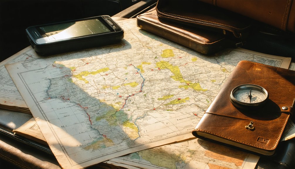
Before you load the car, spread out historical plat maps and county surveys on your kitchen table—these documents reveal where foundations once stood and help you distinguish crumbling schoolhouses from farmsteads. You’ll want both a GPS loaded with offline maps and a paper atlas marked with your waypoints, because cell towers thin out dramatically once you pass the last Casey’s General Store on Highway 20. Ensure your vehicle is road-ready by checking tire pressure, fluid levels, and keeping a spare tire accessible, as rural Nebraska offers few emergency services between towns. Inspect engine lights before departure to confirm no maintenance warnings could strand you miles from the nearest mechanic.
Remember that Nebraska’s ghost towns often sit on private land, so knock on farmhouse doors to ask permission; most ranchers will share stories about the old townsite while pointing you toward the safest path through their pastures.
the best seasons for visiting nebraska ghost towns are typically spring and fall when the weather is mild, allowing for comfortable exploration. during these times, the vibrant colors of the landscape also add to the haunting beauty of the abandoned sites. be sure to plan your trip around seasonal events or local gatherings that celebrate these historical places, as they can enhance your experience.
Research Historical Maps First
When you’re plotting your journey to North Summerfield’s abandoned streets, spreading out a collection of historical maps across your kitchen table transforms abstract research into tangible discovery. Your map analysis techniques should compare USGS topographic editions from different decades—the 1899 survey versus later printings reveal what disappeared between publications. Cross-reference these with Sanborn Maps showing exact building footprints and street layouts.
Essential resources for your reconnaissance:
- USGS historical collections (1892-1940) document Nebraska’s settlement patterns at scales from 1:62,500
- County plat maps pinpoint property divisions and early infrastructure
- Railroad network maps explain why towns thrived or vanished
Pair these cartographic treasures with historical census data tracking population shifts. You’ll spot ghost towns before your boots hit the prairie dust. OldMapsOnline’s digital archive provides searchable access to these Nebraska cartographic sources, streamlining your pre-trip research process. The U.S. Geological Survey published all public domain maps featured in these collections, making them freely accessible for researchers and ghost town enthusiasts.
The gravel crunches beneath your tires as cell service flickers to nothing somewhere past Pawnee City—that’s when you’ll appreciate the Garmin GPS unit mounted to your dashboard. Load offline maps through Gaia GPS before departure, marking North Summerfield’s coordinates while you’ve got Wi-Fi.
Toss a waterproof Nebraska State Highway Map in your passenger seat as backup—digital screens fail, but paper endures prairie thunderstorms. Pack redundant navigation tools: a baseplate compass calibrated for Nebraska’s 3.5-degree magnetic declination pairs perfectly with USGS topographic maps showing historical sites. Don’t gamble on device longevity.
Reliable battery packs with 10,000mAh capacity keep your GPS running through 20-hour exploration days. Add a satellite communicator like Garmin inReach for SOS capability when you’re miles from the nearest farmhouse. Modern Summerfield sits along Highway 99 with roughly 150 residents, a far cry from its 1910 peak of 554 people.
Respect Private Property
Crumbling farmhouses tempt urban explorers with their peeling wallpaper and forgotten dinner plates, but Nebraska’s trespass laws don’t care about your Instagram aesthetic. You’ll face real penalties for unauthorized entry, even if properties look abandoned. Respect property owners’ rights by staying on public roads unless you’ve obtained permission before visiting.
Ghost town etiquette demands:
- Scout from highways first – overgrown vegetation and deteriorating structures don’t equal legal access
- Knock on doors within a mile radius – current landowners often control multiple parcels including ruins
- Document permission in writing – verbal agreements vanish when deputies arrive
Pioneer cemeteries remain your legal exception under Nebraska Statute 12-808.01, granting pedestrian access regardless of private ownership. These burial grounds offer authentic history without the trespassing charge, letting you explore freely while honoring both the deceased and living landowners.
Combining North Summerfield With Other Nearby Abandoned Towns
You’ll find North Summerfield sits at the heart of Pawnee County’s ghost town triangle, with Pishelville and Pebble within easy driving distance along dusty section roads that still follow the original township grid.
I once mapped a sunrise-to-sunset loop through central Nebraska’s abandoned railroad stops—Brewster, Roscoe, and Dunning—watching grain elevators and empty storefronts emerge from the prairie like weathered tombstones.
Plan your route using Highway 75 and SH 60 as anchors, connecting clusters that tell the complete story of frontier ambition and railroad decline across a single unforgettable day.
Multi-Town Route Planning
Mapping out a multi-town ghost town expedition transforms North Summerfield from a solitary destination into the anchor point of a haunting journey through Nebraska’s forgotten railroad era. You’ll want multi town mapping tools showing abandoned Burlington stops like Anselmo, Dunning, and Brewster stretching west through central Nebraska’s emptiness.
as you delve deeper, exploring north summerfield’s haunted history reveals eerie tales of long-gone residents and mysterious occurrences that still linger in the air. the stories told by locals and the legends surrounding the area create a rich tapestry that makes each stop on your journey feel alive with the past. uncovering these narratives adds an unforgettable layer to your adventure through the serene landscapes and forgotten tracks of Nebraska.
Archival research leads reveal southeast clusters—Steele City, Belvidere, Carlton—where 1870s railroad dreams dissolved into prairie wind.
Consider these route combinations:
- Northern Loop: Cross into Kansas, circle back through Cass County sites along Highway 75, six miles south of Nebraska City
- Central Arc: 150-mile sweep through Anselmo’s peak-era structures and Dunning’s twelve remaining residents
- Southeastern Chain: Follow alphabetically-named railroad towns where abandoned main streets await your footsteps
Each configuration offers maximum exploration freedom without backtracking.
Regional Ghost Town Clusters
North Summerfield anchors a dense constellation of railroad-era casualties across Pawnee and neighboring counties, where abandoned townsites cluster within fifty miles of each other like fallen dominies from Nebraska’s territorial ambitions. You’ll discover distinct river town patterns along the Missouri—Summervill’s 187 unsurveyed acres, California City from 1856, Oroppos at the Platte-Missouri junction—all washed away by floods that erased early ford communities.
Meanwhile, railroad era settlements like Oreapolis, Pishelville, and Morrillville create inland routes where you can explore blacksmith shops operational until 1954, abandoned dancehalls, and the stunning Bohemian National Cemetery’s artistic markers. These towns rose together during the 1870-1890 expansion and fell synchronously when agricultural collapse met automotive freedom in the 1930s, leaving you perfect multi-stop itineraries through Nebraska’s unfenced past.
Best Resources for Researching Nebraska Ghost Town Routes
Before setting off across Nebraska’s windswept plains in search of forgotten settlements, you’ll want to anchor your journey in solid historical documentation. The Nebraska Historical Archives at history.nebraska.gov offers original plats and 1937-1962 publications detailing sites like California City and vanished counties. These primary sources reveal exact coordinates—like St. Peters on Section 12, Township 9, Range 13—that modern GPS can’t find.
Essential ghost town trail guides include:
- County NeGenWeb sites for Knox, Otoe, and Nemaha records with cemetery locations and oral histories
- VisitNebraska.com’s seven authentic ghost towns featuring rebuilt settlements and Oregon Trail markers
- YouTube visual routes showing actual road conditions from Belvidere through Carlton’s alphabetical progression
Cross-reference these resources before you roll. Freedom means knowing which abandoned coal shafts require 4WD and which cemeteries hide along accessible 2WD backroads.
Frequently Asked Questions
Are There Any Safety Concerns When Exploring North Summerfield’s Abandoned Site?
Danger whispers through every weathered beam. You’ll face crumbling infrastructure and unstable structures that threaten collapse without warning. Overgrown vegetation hides pitfalls, while remote location means help’s hours away. Tread carefully—freedom includes respecting nature’s reclaimed territory.
What Is the Best Time of Year to Visit North Summerfield?
Visit North Summerfield during fall’s golden September-October window. You’ll enjoy comfortable 60-75°F temperatures, minimal tourist visitation trends, and cleared vegetation revealing hidden foundations. Seasonal weather patterns provide perfect road conditions while avoiding summer’s oppressive heat and winter’s brutal isolation.
Do I Need Permission to Access the North Summerfield Ghost Town Area?
No specific permissions are required, but you’ll want to respect property ownership boundaries and follow local regulations. Most ghost town remnants sit on private land, so staying on public roads keeps you legally free to explore.
Are There Nearby Accommodations or Services for Visiting Ghost Town Explorers?
You’ll find limited nearby dining options and services in this remote area, so pack supplies. Contact the local historical society beforehand—they’re welcoming folks who’ll share directions and stories. Valentine’s accommodations make an excellent base camp for your adventure.
Can I Find Artifacts or Souvenirs at the North Summerfield Site?
You won’t find souvenirs—the site’s abandoned and protected. Artifact preservation guidelines prohibit removing items from the location. While you might dream of vintage item collection, respect private property boundaries and document your discoveries through photography instead.
References
- https://history.nebraska.gov/wp-content/uploads/2017/12/doc_publications_NH1937GhostTowns.pdf
- https://www.youtube.com/watch?v=redtU6GT-BY
- https://history.nebraska.gov/finding-nebraskas-ghost-towns/
- https://www.youtube.com/watch?v=l3s2qhSxis8
- https://legendsofkansas.com/summerfield-kansas/
- https://visitnebraska.com/trip-idea/explore-7-authentic-ghost-towns-nebraska
- https://freepages.rootsweb.com/~gtusa/history/usa/ne.htm
- https://en.wikipedia.org/wiki/List_of_ghost_towns_in_Nebraska
- https://negenweb.us/knox/stories/ghosttowns.htm
- https://www.onlyinyourstate.com/experiences/nebraska/ghost-town-cemetery-ne


