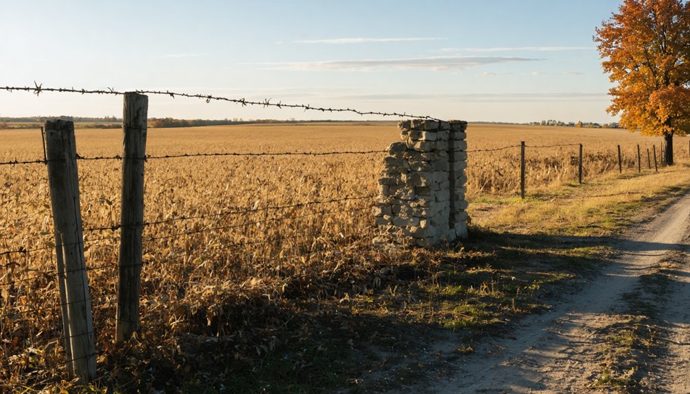
You’ll need personal transportation to reach Old Evansville in rural Randolph County’s Mississippi River bottomlands, where cell signals fade among farmland and river bluffs. Navigate to coordinates 38° 05′ 13.80″ N, -89° 56′ 1.19″ W to find the solitary skeletal structure that’s the settlement’s last original building. Scattered mining artifacts emerge from crop fields, while legends of James A. Flowers’ burning coal shed and Samuel Mason’s river pirate operations haunt the landscape where coal once fueled a roaring 1920s boom that extracted quarter-million-ton hauls before the seams ran dry and prosperity vanished.
Key Takeaways
- Located in rural Randolph County, Illinois at coordinates 38° 05′ 13.80″ N, -89° 56′ 1.19″ W along Mississippi River bottomlands.
- Personal vehicle required as public transit unavailable; expect no cell signal in remote countryside farmland areas.
- One weathered skeletal building remains with scattered mining artifacts; no preserved mills or mining structures survive today.
- Explore legends of James A. Flowers’ burning coal shed and Samuel Mason’s Cave-in-Rock outlaw operations nearby.
- Visit remnants of 1920s coal mining boom town that extracted 250,000 tons before seams exhausted.
Getting to Old Evansville: Directions and Access Points

Finding Old Evansville requires a journey into Randolph County’s rural heartland, where this forgotten settlement rests along the Mississippi River bottomlands of southwestern Illinois.
Old Evansville slumbers in Randolph County’s forgotten bottomlands, a riverside ghost town where Illinois history quietly surrenders to time and wilderness.
You’ll navigate to coordinates 38° 05′ 13.80″ N, -89° 56′ 1.19″ W, venturing off well-traveled routes into countryside where cell signals fade and independence prevails. Public transit availability doesn’t exist here—you’ll need your own wheels to reach this remote ghost town.
The adventure demands self-reliance as you wind through farmland and river bluffs. There aren’t formal entry requirements or visitor centers; this isn’t a preserved tourist attraction but rather an authentic slice of abandoned Americana.
Come prepared with GPS coordinates, printed maps, and a full tank. The roads less traveled await those willing to seek them.
What Remains of the Mining Town Today
When you arrive at Old Evansville’s location today, you’ll find precious little of the once-thriving mining community that existed here. A solitary structure—weathered and skeletal—stands as the settlement’s last original building, silently marking where hundreds once lived and worked.
Scattered throughout the surrounding crop fields, you can still spot occasional mining artifacts that surface after plowing: rusted tools, pottery shards, and fragments of the town’s coal-dusted past.
Last Standing Original Structure
Although Evansville’s identity as a “ghost town” proves difficult to substantiate, the village’s original commercial heart has largely vanished from the rolling hillsides above the Kaskaskia River. You won’t find preserved industry structures from the pioneering milling operations that once defined this settlement. The N & P Milling Company’s revolutionary roller process facility has disappeared entirely, replaced by modern agricultural businesses like Gateway Farm Service that continue the river transport tradition without historical architecture.
Considerably, you’ll discover no evidence of mining operations here—Evansville’s prosperity stemmed from flour production rather than extracting coal or minerals from southern Illinois earth. The 1811 townsite Andrew White selected persists in layout, but the physical remnants of frontier commerce have surrendered to time’s relentless advance, leaving only landscape contours and historical records to mark where commerce once flourished.
Artifacts in Crop Fields
The contradiction between Evansville’s milling heritage and the physical evidence scattered across today’s farmland reveals a persistent historical confusion. You’ll find equipment scatters that tell mining stories—pickaxes, shovel heads, and mine cart wheels emerging from tilled soil.
Agricultural impacts expose fluorite chunks, galena nodules, and coal slag where plows break through former waste dumps. Railroad spikes and timber fragments from transport lines surface alongside immigrant-era pottery from seventeen-language communities. The fields yield industrial debris: brick fragments from boomtown foundations, millstone pieces, and Prohibition glassware.
Crushed tailings erode into crop rows while abandoned prospecting pits dimple the landscape. You’re walking through layered history where coal seams still break surface, and vitrified slag chunks mark forgotten operations that defined this vanished community.
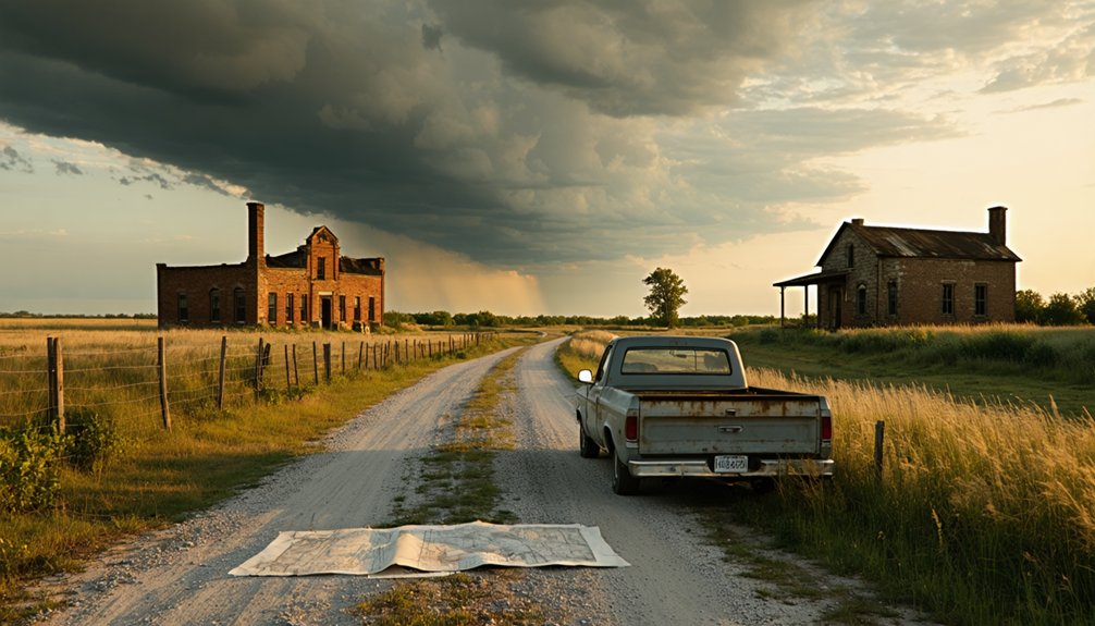
The Rise and Fall of a Coal Mining Community
The coal beneath Evansville’s streets fueled a roaring transformation during the 1920s, when underground tunnels stretched like veins beneath the community and miners extracted quarter-million-ton hauls that powered the region’s industrial hunger.
You’ll find that prosperity proved fleeting—the richest seams eventually exhausted themselves, leaving behind hollowed earth and dwindling purpose. As the coal disappeared, so did the miners, their families, and the bustling main streets, until only weathered foundations marked where a thriving town once stood.
1920s Mining Boom Era
Long before Evansville emerged as a coal mining settlement, French explorers Louis Joliet and Père Marquette glimpsed Illinois’s buried wealth in 1673 when they spotted coal outcrops jutting along the Illinois River near Utica. By 1810, enterprising souls like William Boone hauled coal from Big Muddy River outcroppings to distant markets.
The real explosion came in 1864 when a Braidwood farmer struck coal drilling for water, triggering a rush that transformed northern Illinois. Large corporations swooped in, buying land and sinking shafts using room and pillar mining methods. Towns materialized overnight as miners flooded in from Pennsylvania and Europe.
Resource Depletion and Exodus
Beneath Evansville’s bustling streets, miners carved an intricate honeycomb of tunnels that would doom the very prosperity they’d created. By the 1960s, depleted coal seams forced mines to close permanently, leaving unstable voids 30-200 feet deep beneath towns like Newburgh and Chandler. Mining’s economic toll devastated communities when production plummeted from over 250,000 tons annually in 1909 to nothing.
You’ll find social impacts on families evident in the abandoned streets where boom towns like nearby Braidwood once housed 8,000 residents. Wage cuts slashed daily earnings from $7.50 to $5.00 while seasonal unemployment ravaged household incomes. Workers fled seeking opportunity elsewhere, transforming vibrant communities into ghost towns.
Today, Warrick County remains among Indiana’s most active subsidence areas, where unsealed mine shafts threaten to swallow buildings whole—a crumbling monument to extraction’s hidden costs.
The Ghost of James A. Flowers and the Burning Coal Shed
Local legend speaks of James A. Flowers and his mysterious connection to a burning coal shed, though you’ll find this tale exists only in whispered folklore. Unverified ghost sightings have circulated among paranormal enthusiasts, yet no historical records substantiate these claims. The story remains tantalizingly elusive—exactly what draws independent explorers to such forgotten places.
You won’t discover documented evidence linking Flowers to Old Evansville’s decline. The lack of primary sources means separating fact from fiction becomes impossible. This absence of verification doesn’t diminish the town’s haunting atmosphere; it enhances it. You’re free to interpret the ruins through your own lens, unbound by academic constraints. Whether Flowers existed or represents collective memory’s creative interpretation, his phantom presence epitomizes how ghost towns generate mythology from abandonment’s void.
Samuel Mason’s Cave and Outlaw Legends
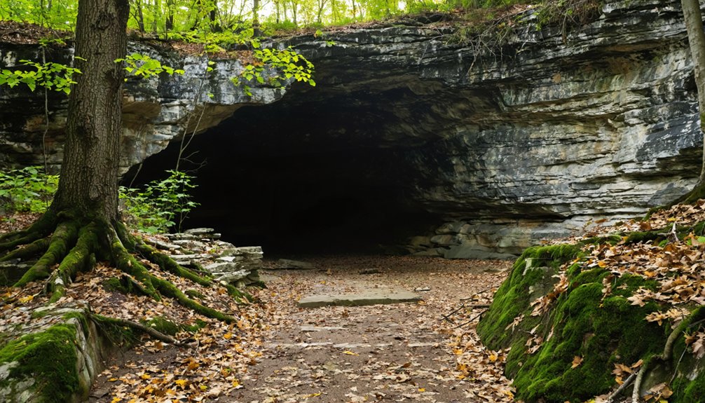
While James A. Flowers haunts Old Evansville, you’ll find darker legends downstream at Cave-in-Rock. Samuel Mason transformed this natural fortress into “Cave-Inn-Rock” around 1797, establishing a sophisticated outlaw gang structure that controlled the Ohio and Mississippi Rivers.
His river pirate operations ran like a brutal business—henchmen lured flatboats, stripped merchandise, and ambushed survivors returning via Natchez Trace. The cave served as gambling den, brothel, and criminal headquarters where Mason’s crew enjoyed perfect advantage over unsuspecting travelers.
Though legends claim the notorious Harpe Brothers worked alongside Mason, pushing victims off bluffs above the cave, no historical evidence confirms their collaboration. Eventually, increased river traffic and law enforcement drove Mason out. His severed head later warned other would-be pirates against choosing outlaw freedom.
Best Times to Visit and What to Bring
From Mason’s dark river empire to your own exploration, Old Evansville welcomes visitors year-round along that quiet dead-end road near the Saline River. Spring and fall offer ideal visitation periods with moderate temperatures for wandering exposed croplands where historical artifacts surface.
Summer heat intensifies quickly across these open fields, while winter demands road condition verification before venturing out.
Remote location logistics require preparation: pack sturdy boots for uneven terrain, sun protection for shadeless expanses, and sufficient water since you’re miles from services. Bring your metal detector—coins and relics hide beneath surrounding crop fields. A camera captures remaining structures and your discoveries.
From Equality, follow Jones Lake road south, turn left past the Saline River bridge, then navigate to the three-way junction. Two-wheel-drive vehicles handle this route comfortably.
Exploring Nearby Historic Sites in Saline County
Beyond the remnants of Old Evansville, Saline County reveals layers of pioneer settlement and geological wonder that transform your ghost town visit into an extensive historical journey. You’ll discover historic preservation efforts at Saline Creek Pioneer Village, where the 1877 Pauper House anchors eleven structures documenting frontier life. The county’s ongoing archeological explorations earned recognition through markers highlighting the Carrier Mills Archaeological District and Lakeview Settlement’s African American heritage.
Don’t miss Old Stone Face—an iconic geological formation accessible via a 1.6-mile trail offering moderate challenge and spectacular ridge views. At Harrisburg’s Saline County Area Museum, you’ll examine artifacts spanning decades of settlement, from salt works operated under government lease to pioneer cabins. Six National Register sites await your exploration, each revealing how independent settlers carved communities from wilderness.
Frequently Asked Questions
Are There Any Safety Concerns When Exploring Old Evansville’s Abandoned Areas?
Yes, you’ll face serious dangers. Warrick County ranks among Indiana’s top four subsidence zones, where abandoned mine shafts collapse without warning. Structural integrity concerns and trespassing risks make exploring these crumbling, contaminated ruins genuinely hazardous to your health.
Can Visitors Metal Detect in the Crop Fields Near the Town?
You’ll need landowner permissions before metal detecting in those crop fields. While artifacts abound throughout Old Evansville’s agricultural areas, respect private property rights and take proper metal detecting precautions to guarantee you’re exploring legally and safely.
Is Old Evansville on Private Property or Public Land?
Old Evansville sits on public land managed by Illinois, so you won’t face trespassing concerns while exploring. The FEMA buyout transferred private properties to public ownership, preserving the area’s historical significance for visitors seeking authentic ghost town experiences.
Are Overnight Camping or Ghost Hunting Activities Permitted at the Site?
Overnight camping isn’t permitted at Old Evansville due to local ordinances and historical preservation efforts. While you’ll find overnight hiking opportunities elsewhere in Illinois, ghost hunting here remains unregulated—though you should respect quiet hours and avoid disturbing the site.
What Cellular Service or Emergency Resources Are Available in the Area?
You’ll find cell coverage options spotty at best in this remote ghost town—think 1800s communication vibes. Emergency services availability requires driving to nearby populated areas. Check T-Mobile’s rural maps beforehand, and always pack satellite backup devices.