You won’t find Orsino’s ghost on any map because NASA’s bulldozers erased it in 1962, transforming homesteads into Launch Complex 39. Today’s “Orsino” near 28°31’39″N, 80°39’56″W is just strip malls and subdivisions where the original settlement once stood three feet above sea level. The authentic ghost towns lie along former State Road 3—Courtenay, Allenhurst, and others slowly abandoned after timber depletion and the 1894-1895 freezes. You’ll discover what’s actually accessible and what NASA still guards.
Key Takeaways
- Orsino is not an authentic ghost town; it’s a functioning unincorporated community with strip malls and suburban subdivisions.
- The original settlement was bulldozed by NASA in 1962 for Kennedy Space Center expansion, leaving no historic ruins.
- Located at 28°31’39″N, 80°39’56″W along Florida’s Space Coast near Merritt Island at 3 feet elevation.
- Modern Orsino offers affordable housing for space industry workers, not weathered foundations or abandoned streets to explore.
- Launch pads and the Vehicle Assembly Building now occupy where the historic community once stood.
Discovering Orsino’s Location and Historical Significance
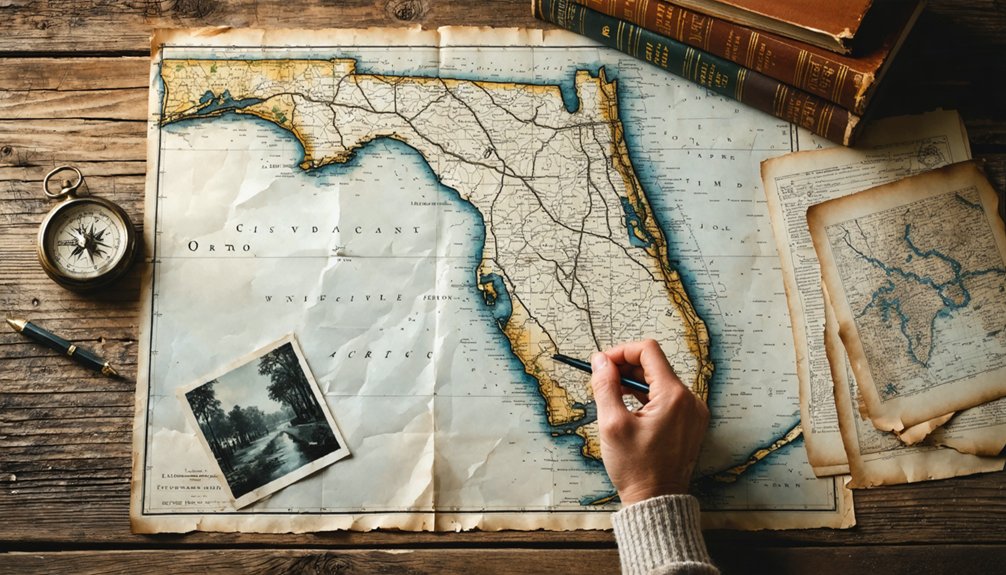
Tucked along Florida’s Space Coast at coordinates 28°31’39″N, 80°39’56″W, Orsino occupies a sliver of Brevard County’s coastal landscape where the Atlantic Ocean meets a labyrinth of hammocks and tidal creeks. You’ll find this forgotten settlement 1.4 kilometers from Merritt Island’s peninsula, where geographic isolation factors sealed its fate—no major highways pierce this terrain, just remnants of old state roads mapped since 1936.
The Kennedy Space Center looms nearby, yet Orsino couldn’t leverage that proximity. Economic decline factors multiplied as neighboring Courtenay, 6-9 kilometers southwest, absorbed whatever commerce existed. Standing at mere 3 feet elevation, you’re surrounded by Tea Hammock, Cedar Hammock, and East Creek—natural barriers that once defined boundaries but ultimately strangled growth.
Understanding Why Orsino and Neighboring Communities Vanished
You’ll find that Orsino’s disappearance wasn’t a gradual decline—NASA bulldozers erased it almost overnight when Kennedy Space Center claimed Merritt Island in 1962, forcing families like the Roy Roberts household to watch their homes hauled past the massive Vertical Assembly Building.
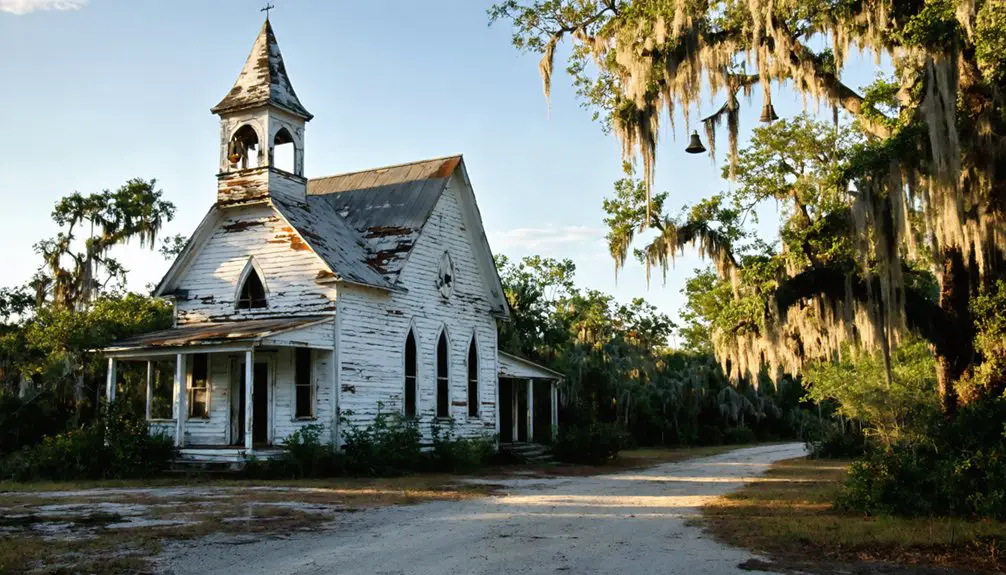
While space exploration sealed Orsino’s fate, its neighbors along State Road 3—Allenhurst, Wilson, and Shiloh—had already been dying slow deaths from depleted timber stands and collapsed turpentine operations. The great freezes of 1894-1895 had delivered the first blow decades earlier, wiping out citrus groves and leaving behind only unmarked graves in places like Oriole Cemetery, where tiny headstones from 1891-1895 mark the children who didn’t survive influenza and a frontier without doctors.
Kennedy Space Center Expansion
Why did Orsino disappear from Florida’s maps? You’re standing where NASA’s ambitions literally erased communities. When the space program needed room for the massive Saturn V rocket in 1961, officials acquired over 200 square miles of Merritt Island land. Your freedom-loving predecessors had no choice—government expansion consumed entire towns.
The land acquisition impacts hit hard starting in 1962. Families who’d built lives here watched bulldozers replace orange groves with launch pads. Space center operations demanded the Vehicle Assembly Building, constructed from 1963 to 1965, and Launch Complex 39’s facilities.
By the time Apollo 4 launched in November 1967, Orsino had vanished completely.
Today, you’ll find rocket launch sites where neighbors once gathered, a stark reminder of progress’s price.
Natural Resource Depletion Impact
Beyond NASA’s bulldozers, environmental degradation pushed Orsino’s survivors away. You’ll discover soil depletion effects everywhere—sand mining stripped the Atlantic Coastal Ridge bare, forcing operations westward past Highway 1.
Logging and clearing disrupted the flatwoods’ natural cycles, leaving fractured habitats struggling to recover. Road construction carved deep borrow pits like Red Dome (1963-1971), scarring land that still needs replanting decades later.
Groundwater overexploitation impacts hit harder than most realize. The Floridan aquifer couldn’t sustain the relentless demand as drainage projects drained half the Everglades for development. Sinkholes punched straight through karst plains, funneling pollutants directly into drinking water supplies.
Combined with Brevard’s landfill contamination and stormwater runoff, you’re looking at an ecosystem that simply couldn’t support communities anymore. Freedom meant leaving.
Environmental Disasters and Displacement
Multiple catastrophes erased Orsino from the map, but nothing hit harder than Kennedy Space Center’s 1962 construction blitz. You’ll find zero trace of this community today—every structure razed, all property annexed. The environmental impacts were absolute: Orsino, Wilson, Allenhurst, and Shiloh completely displaced for launch facility completion. Only Roy Roberts’ home survived, relocated past the Vertical Assembly Building like some museum piece.
The 1890s freezes had already weakened these settlements. You can see it in the infant graves dated 1891-1895—health consequences from agricultural collapse and population decline. Burials spanning 1835-1893 tell the story of communities fighting environmental odds.
Then came the final blow. Allenhurst’s fishing shacks demolished for debris field radius. Now you’ll need security clearance just to glimpse where thousands once called home.
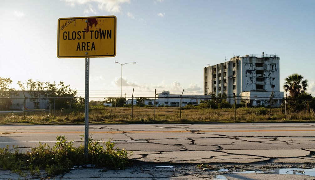
What Remains of Orsino Today
When you pull off the highway searching for Orsino’s ghostly remnants, you’ll find strip malls and suburban subdivisions instead of crumbling ruins. Modern transportation infrastructure connects this area seamlessly to Titusville and the Kennedy Space Center, erasing any isolation that might’ve doomed similar communities.
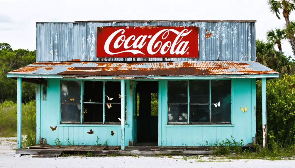
Relocation patterns here favor influx rather than exodus—space industry workers and retirees choose Orsino’s affordable housing over costlier coastal neighborhoods.
You won’t discover weathered foundations or overgrown streets. No historical markers commemorate a tragic past because there isn’t one. The landscape reveals working driveways, fresh paint, and occupied homes. Unlike authentic ghost towns with zero populations and hazardous conditions, Orsino thrives as an unincorporated community. Your road trip freedom ends at functioning neighborhoods rather than atmospheric decay—disappointing for ruin hunters, but honest about what actually remains.
Exploring Nearby Florida Ghost Towns Worth Visiting

You’ll find some of Florida’s most haunting abandoned settlements within a few hours’ drive of Orsino, each with its own story of boom and collapse.
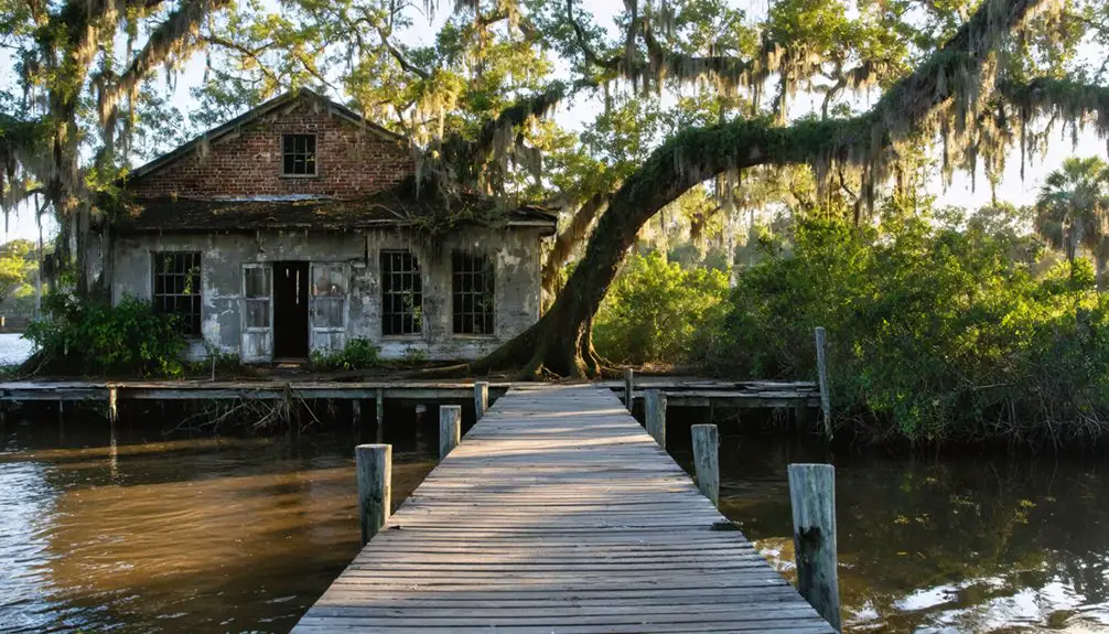
Fort Dade sits crumbling on Egmont Key at Tampa Bay’s entrance, where brick roads once carried 300 soldiers past a movie theater and tennis courts before the military abandoned it in 1923.
Cedar Key transformed from a bustling island port with 500 residents into a ghost town when railway builders chose a different route, leaving salt works and shipyards to decay along the Gulf Coast waterways.
Historic Logging Town Ruins
Beyond Orsino’s weathered remnants, Florida’s backwoods conceal two remarkable logging ghost towns that defined the state’s timber boom era.
You’ll find Centralia in Hernando County, where a massive sawmill once processed cypress into crates until the forests vanished in the 1920s. The mill pond and embankment still mark where loggers floated timber through old-growth groves. Today’s overgrown paths reveal this forgotten logging past within the Chassahowitzka Wildlife Management Area.
Madison County’s Ellaville tells a similar tale. George Franklin Drew’s 500-worker sawmill dominated the Suwannee River until fires and floods finished what depleted forests started. By 1900, both operations ceased permanently.
You can’t remove artifacts or metal detect—it’s illegal on state land. But these repurposed industrial ruins offer raw glimpses into Florida’s timber legacy.
Coastal Communities and Waterways
Florida’s coastal ghost towns tell stories of boom-and-bust cycles driven by water—whether from hurricanes, space-age progress, or the simple depletion of resources that drew settlers in the first place.
You’ll find these water transportation hubs scattered along forgotten routes where early industrial development once thrived. Allenhurst sat strategically on Haulover Canal, connecting Indian River and Mosquito Lagoon for sport fishermen. Stiltsville rose from Biscayne Bay’s waves on wooden stilts, serving chowder and rumored rum to adventurous boaters.
Both communities understood water’s power—Allenhurst vanished for Kennedy Space Center’s debris field, while Stiltsville’s clubs endured hurricane after hurricane until incorporation into Biscayne National Park sealed their fate. Today, you’ll need boat ramps and 4WD vehicles to explore what water giveth and taketh away.
Planning Your Route Through Former State Road 3 Communities
Since Kennedy Space Center absorbed most of these communities in 1962, you’ll need to piece together this ghost town route from accessible fragments rather than a continuous drive. Start at Oak Hill where US 1 meets the former State Road 3, then follow Courtenay Parkway south through what remains.
You can still explore Allenhurst via dirt roads off the parkway—look for the boat ramp and manatee platforms marking where fishing industry decline ended a thriving sports community. At Wilson’s former crossroads with State Road 402, agricultural economy shifts and space-age annexation erased the lumber hub entirely.
End at Orsino near State Road 405, where even this “terminal settlement” never quite materialized before vanishing completely into restricted federal property.
Essential Tips for Visiting Kennedy Space Center Restricted Areas
While exploring the ghost towns swallowed by Kennedy Space Center satisfies historical curiosity, you’ll need to navigate considerable bureaucracy to actually see where Orsino and its neighbors disappeared. Book the $75 Cape Canaveral Early Space Tour at least five days ahead—Tuesdays, Thursdays, and Fridays only.
You’ll register with security between 8:45-10 a.m., present government ID (passports for international visitors), and surrender any firearms, knives, or drones at the gate. Visitor health and safety protocols require closed-toe shoes and passing through metal detectors. The restricted area accessibility includes wheelchair lifts on buses, though you must be 14 or older to participate.
Tours vary with launch schedules, so what vanished communities you’ll glimpse depends on operational whims that day.
Frequently Asked Questions
Are There Any Guided Tours That Include Ghost Towns Near Kennedy Space Center?
No guided tours to nearby ghost towns exist here. Four communities vanished for space exploration! You’ll need to explore independently, discovering the historical significance of Orsino’s remains through dirt roads and self-guided adventure near Kennedy Space Center’s boundaries.
What Historical Documents or Photographs of Orsino Still Exist Today?
You’ll find historical photographs of Orsino at the Florida Historical Society Library’s 10,000-image collection and State Archives’ Florida Memory database. Abandoned town records, including postal documents from 1915-1918, survive in Brevard County’s archives and FamilySearch databases.
Can Former Residents or Descendants Visit the Old Orsino Site?
You can visit Orsino’s site where SR 405 meets Old A1A, though no structures remain. KSC owns the surrounding property with public access allowed. Contact North Brevard Historical Society for visiting policies and historical records access beforehand.
Were Any Artifacts From Orsino Preserved Before the Town Was Razed?
No preserved architectural remnants or archaeological excavation findings from Orsino exist in public records. You’ll find the site was simply abandoned and reclaimed by nature, leaving no documented artifacts in museums or historical collections to explore today.
What Other Florida Ghost Towns Are Accessible Without Special Permission?
Florida harbors over 100 ghost towns—you’ll find accessible sites like Ellaville at river junctions, Fort Dade on Egmont Key, abandoned phosphate mining towns inland, and forgotten coastal settlements like Eldora where citrus groves once thrived before nature reclaimed them.