Plan your Pearl Valley ghost town adventure for late September through early October, when clear roads and fall colors create ideal conditions for exploring this remote mining site. You’ll navigate Highway 55 from Boise into the Boise National Forest backcountry, following unpaved Forest Service roads to weathered 1900s-era structures and the famous Checkmate Mine’s 600-foot shaft. Pack detailed maps, layered clothing, and 1-1.5 gallons of water per person daily—this isolated location demands complete self-sufficiency. The following guide covers everything from navigation details to photography opportunities awaiting along this historic corridor.
Key Takeaways
- Pearl Valley’s ghost town features weathered mining structures from its 1867-1908 gold rush, including the historic 600-foot-deep Checkmate Mine.
- Access via Highway 55 from Boise through Horseshoe Bend, following ponderosa pine forests along unpaved backcountry roads to the site.
- Visit late September through early October or June for optimal weather, accessible roads, and fewer crowds before winter snow closes access.
- Bring detailed maps, GPS backup, 1-1.5 gallons water per person daily, high-calorie foods, and layered clothing for temperature swings.
- Respect no trespassing signs and avoid hazardous collapsed structures; environmental contamination and prosecution risks exist throughout the abandoned site.
Pearl Valley’s Gold Rush Origins and Mining Heritage
When prospectors struck gold in Idaho’s Pearl district on December 7, 1867, they triggered a cycle of boom and bust that would define the region for decades. You’ll discover that early placer miners working the 1870s faced challenging ore mining conditions, extracting lean deposits with primitive hand mortars and horse arrastras.
The district’s fortune shifted dramatically after the Panic of 1893, when collapsing silver prices redirected attention to gold. Between 1894 and 1908, operations flourished—annual production soared from $30,000 to $80,000. The Checkmate mine exemplified the era’s ambition, descending 600 feet through six levels, where rich veins yielded five ounces of gold per ton.
However, inadequate gold extraction methods ultimately doomed most operations, ending the boom by 1910. The district’s estimated total gold production reached $1 million, or approximately 20,000 ounces, with the majority extracted between 1900 and 1907. At its peak, the mining community supported 3 mercantile stores, a butcher shop, 4 saloons, 2 hotels, one church, a fire station, and an Odd Fellows Lodge.
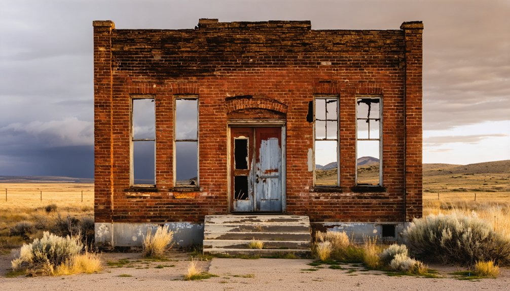
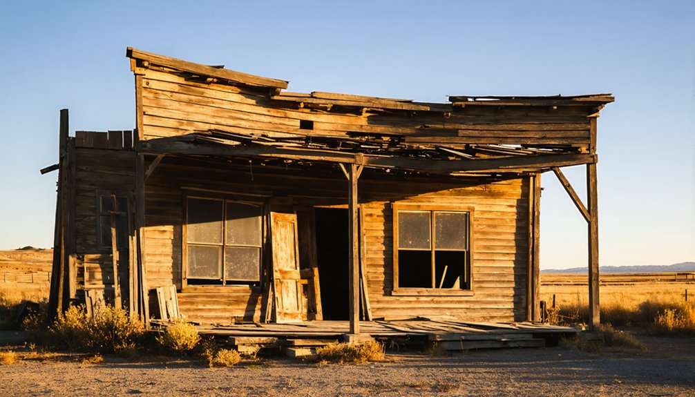
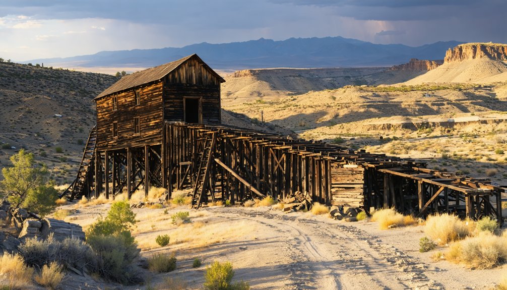
What Remains at the Pearl Ghost Town Site Today
The boom that brought Pearl to life ended abruptly in 1910, leaving behind a scattered collection of weathered structures that cling to the canyon walls at 4,153 feet elevation. You’ll find no organized town center—just a string of crumbling foundations where three mercantile stores, four saloons, two hotels, and a church once thrived. Mining ruins dominate the landscape, slowly deteriorating over a century of abandonment.
While drone footage and historical markers document what’s left, you can’t freely explore. Multiple no trespassing signs warn that unprotected hazardous structures could collapse without warning. Untreated environmental hazards from old mining operations contaminate the soil and dust. Dust can stick to shoes and clothing, carrying contamination far from obvious piles. The road dead-ends near private property, and trespassing risks both prosecution and injury. Just a few miles away, the historic town of Wallace offers a safer glimpse into Idaho’s mining heritage. Pearl remains the town time forgot—visible but off-limits.
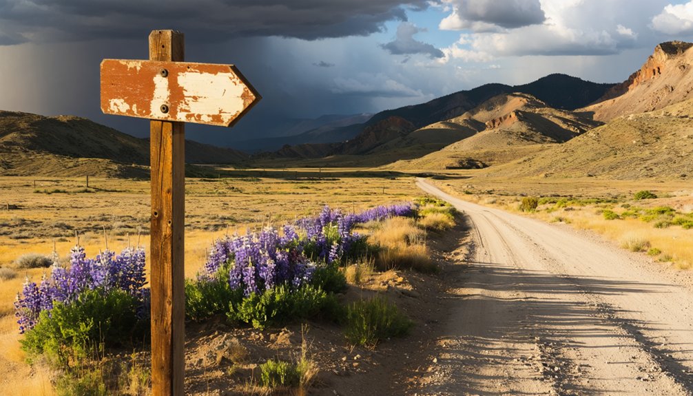
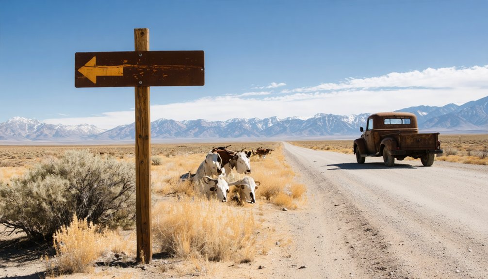
Getting to Pearl: Directions and Route Planning
Your journey to Pearl begins in Idaho’s Treasure Valley, where you’ll chart a course north from Boise toward the rugged country beyond Horseshoe Bend. The route traces Highway 55 along the Payette River’s winding canyon, climbing through ponderosa pine forests as civilization gradually fades in your rearview mirror.
This 60-mile stretch transforms from urban sprawl to backcountry wilderness, setting the stage for your ghost town exploration in the remote reaches of Valley County. The region’s geological foundation includes sediments from the ancient Laurentia continent, which collected along a passive continental margin for over a billion years. Pearl represents one of many ghost towns in the Western United States that draw historians and adventurers to Idaho’s backcountry.
Among these lesser-known sites, the ghost town attractions in Twin Springs offer a unique glimpse into the past, showcasing remnants of early mining activities and the lifestyles of pioneers. Visitors often find themselves captivated by the stories woven into the ruins, prompting exploration and reflection. As the sun sets, the eerie quietude of Twin Springs adds an element of mystique, inviting adventurers to uncover its hidden tales.
Starting From Boise Area
From Boise, you’ll commence on a straightforward yet scenic journey that traces Idaho’s high desert terrain before climbing into mountain country. Take I-84 East toward Mountain Home, then exit at 95 onto US-20 East for an 82.4-mile stretch that unfolds across sagebrush flats and volcanic landscapes.
When you reach the junction, turn left onto Highway 75 North, passing through Hailey before reaching Ketchum—your gateway to backcountry exploration.
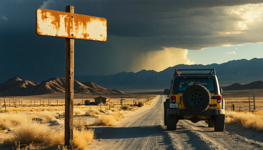
Check traffic conditions through Idaho Transportation’s website before departure, especially during winter when snowstorms can close passes without warning. Wildlife crossings demand constant vigilance year-round. While route alternatives exist through various mountain passes, this primary corridor offers reliable access with modern amenities scattered along the way. Budget roughly 2 hours 45 minutes, though weather and road conditions dictate your actual travel time. Consider combining your trip with exploration documentaries that showcase spectacular photography of western landscapes. If you’re coming from the southeast, the drive from Twin Falls takes approximately 1 hour 45 minutes.
After leaving Ketchum’s ski resort country behind, you’ll backtrack south on Highway 75 before cutting west toward Idaho City—the historic mining hub that serves as your eastern gateway to the Horseshoe Bend route.
From there, you’ll tackle the spectacular 30.1-mile stretch through the Salmon River Mountains on a well-maintained National Forest road that’s surprisingly accessible to both 4WD and 2WD vehicles. The route provides access to hundreds of miles of off-roading, hiking, and mountain bike trails throughout the Boise National Forest.
Check road conditions before departing, as spring runoff and seasonal weather can transform this passage. Real-time traffic updates prove invaluable when traversing remote forest service roads. For detailed route planning, ViaMichelin calculates estimated travel time while accounting for current road conditions and traffic.
The route follows the Payette River downstream, dropping from mining country elevations to Horseshoe Bend’s 2,604 feet. You’ll trace the river’s namesake U-turn where it pivots from southward to northward flow—a geographical quirk that’s guided travelers since gold rush days.
Best Time of Year to Visit Pearl Valley
When planning your ghost town adventure to Pearl Valley, timing can transform your experience from challenging to extraordinary. Late September through early October marks the ideal shoulder season timeline, delivering clear roads, vibrant fall foliage, and virtually empty trails. You’ll explore mining remnants without battling summer crowds or winter’s treacherous conditions.
The best seasons for visiting Idaho’s ghost towns enhance the allure of these historical sites. You can fully immerse yourself in the stories of the past as you wander through the remains of old buildings and forgotten streets. Additionally, the cooler temperatures make for a more comfortable exploration, allowing you to appreciate the scenic landscapes and rich history without distraction.
Spring presents another compelling window, with wildflowers blanketing the Sawtooths and waterfalls thundering from snowmelt. However, visitation patterns spike during summer months, creating congested campgrounds and packed trails that constrain your freedom to roam.
Winter’s heavy snow blocks access entirely, while late fall brings freezing temperatures by October’s end. June and September offer the sweet spot: comfortable temperatures, accessible roads, and uncrowded conditions that let you experience Pearl Valley’s haunting beauty on your own terms.
Essential Supplies and Preparations for Your Trip
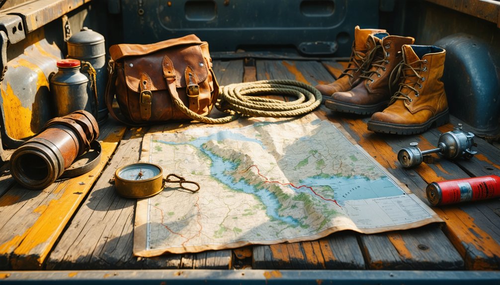
Your journey to Pearl Valley demands careful preparation, as this remote ghost town sits miles from the nearest services along unpaved backcountry roads. You’ll need detailed maps—both GPS and paper backups—since cell service disappears long before you reach the weathered buildings, plus layered clothing to handle Idaho’s dramatic temperature swings between scorching afternoons and frigid desert nights.
As you explore the region, consider visiting some ghost towns near Albion, Idaho, which offer a glimpse into the past and a sense of adventure. Each abandoned site tells a story, making for fascinating photography and a unique opportunity to connect with history. Remember to respect the sites and leave no trace as you uncover the secrets of these forgotten places.
Stock your vehicle with ample water and non-perishable foods, because the isolated stretches between you and civilization mean self-sufficiency isn’t optional—it’s survival.
Before you set out for Pear Valley, you’ll need to arm yourself with the right maps—this isn’t a destination you’ll find on Google Maps. Specialized mapping tools are essential: grab topographic maps showing Meadow Creek’s confluence with the East Fork South Fork Salmon River, plus GNIS aerial photos marking any remaining structures.
The Gold Fever Prospecting Idaho Ghost Towns Map Set features plastic overlays comparing 1800s layouts to present-day terrain—invaluable for traversing the remote terrain when you’re exploring nine air miles southeast of Yellow Pine. Since Pear Valley sits deep in the Frank Church Wilderness, cross-reference your topos with historical maps from Longitude Maps’ 5-map series showing early mining camps like Forest Grove and Midnight Camp. These layers of geographic intelligence become your lifeline where trails disappear.
Weather-Appropriate Clothing Essentials
Temperature fluctuation management demands versatility at Pear Valley’s 3,747-foot elevation. Bring sun hats for July’s 88°F afternoons and insulated beanies for December’s 21°F mornings.
Quality hiking boots handle rocky terrain while keeping feet comfortable through temperature shifts. Don’t forget sunglasses and sunscreen—high-desert sunshine intensifies at elevation, even during cooler months when you’d least expect it.
Food and Water Provisions
Since Pear Valley’s isolation leaves you miles from the nearest functioning store, water becomes your most critical cargo. Water scarcity concerns demand you pack 1-1.5 gallons per person daily, plus radiator reserves for high-elevation drives.
Emmett, nine miles west, offers your last resupply point before Pearl Road swallows civilization.
Your essential provisions checklist:
- Purification gear – tablets, filters, or UV devices for Salmon River creek water
- High-calorie foods – energy bars, nuts, jerky providing 2,000-3,000 daily calories
- Bear-proof storage – mandatory containers or rope for 10-foot-high hangs
- Waterproof packaging – dry bags protecting provisions during creek crossings
Food sources availability vanishes completely after Pearl’s 2004 demolition. Pack every meal you’ll need—this backcountry respects only the self-reliant.
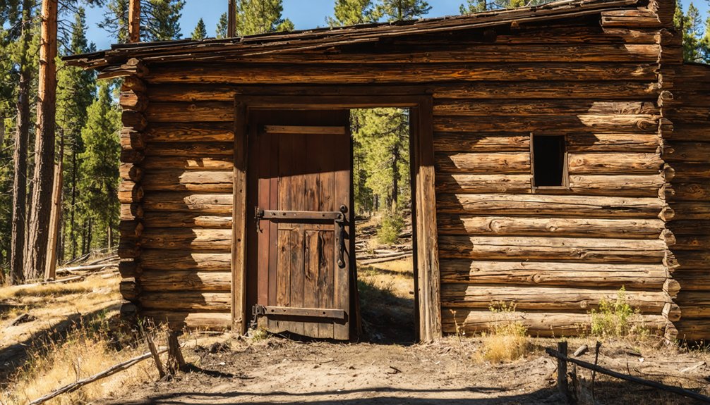
Exploring the Historic Pearl Mining District
The Pearl Mining District springs to life through weathered remnants scattered across Idaho’s rugged landscape, where a chance discovery on December 7, 1867, set the stage for decades of boom-and-bust cycles. You’ll trace the path of placer miners who first struck ore in Willow Creek, though serious mining operations didn’t commence until the 1893 economic panic rekindled prospectors’ dreams.
The district’s historical significance peaked between 1894 and 1908, when miners extracted $80,000 worth of ore annually. You’ll discover the Checkmate Mine’s impressive 585-foot shaft and imagine the bustling camp that once supported three mercantile stores, four saloons, and two hotels. What started as a single cowboy cabin beneath cottonwood trees transformed into a thriving community driven by fortune-seekers chasing Idaho’s mineral wealth.
Combining Pearl With Other Nearby Idaho Ghost Towns
While Pearl’s weathered foundations anchor your exploration of Idaho’s mining heritage, the surrounding region discloses a constellation of ghost towns that’ll transform your single-site visit into an unforgettable backcountry odyssey.
As you venture deeper into these ghost towns in Idaho, you’ll encounter remnants of lives once lived, tales of fortune and despair etched into the very landscape. Each abandoned building holds a history waiting to be uncovered, offering a glimpse into a time when these towns thrived. The echoes of the past resonate through the quiet streets, inviting you to explore further and connect with the enduring spirit of the region.
The history of Pear Valley, Idaho, unfolds as you wander through its abandoned streets and crumbling facades. Each stone and timber tells a story of the pioneers who once called this place home, their aspirations etched in the fabric of the valley. As you stand amidst the ruins, the whispers of the past beckon you to imagine a bustling community, alive with ambition and dreams.
Comprehensive itinerary options within striking distance:
- Bonanza & Bayhorse – Seven miles apart in Custer County, these silver mining remnants offer multi-site visit logistics perfection with 15+ preserved structures at Bayhorse
- Gilmore – Push north toward Montana’s border to witness Lemhi County’s pioneer-era artifacts and mining relics
- Silver City – Venture southwest to Owyhee County’s remote 6,000-foot elevation settlement with year-round residents and 2,500-soul boom-town history
- Chesterfield – Break from mining narratives at this southeastern agricultural Mormon community for perspective diversity
Each destination rewards your independence with authentic frontier encounters unmarred by commercialization.
Photography Tips and Safety Considerations
Capturing Pearl’s haunting beauty demands specialized gear that’ll transform weathered wood and rusted metal into compelling visual narratives. Pack your wide-angle lens for sweeping main street vistas, a sturdy tripod for long-exposure star trails, and prime lenses to immortalize intimate details—peeling paint, vintage bottles, weathered cemetery markers.
Golden hour bathes abandoned saloons and schoolhouses in dramatic shadows, while cross-lighting through broken windows creates ethereal effects.
Before you venture out, proper equipment handling protects your camera from dust infiltration in crumbling structures. Research access restrictions beforehand—trespassing citations aren’t worth the shot. Safety protocols enforcement matters: avoid unstable floors, watch for rattlesnakes in summer months, and never use steel wool photography techniques that risk wildfire ignition.
Navigate washout-prone roads cautiously, and always respect “No Trespassing” postings while hunting your perfect abandoned composition.
Frequently Asked Questions
Are There Any Entrance Fees or Permits Required to Visit Pearl?
No entrance fees exist for Pearl’s ghost town remnants, but you’ll need permission if crossing privately owned land. Check access routes beforehand and explore nearby camping options for your adventure base while respecting property boundaries and wilderness regulations.
Can I Camp Overnight Near the Pearl Ghost Town Site?
You’ll find camping opportunities near Pearl’s scenic vistas and historical landmarks, but you must use designated sites on surrounding public lands. Remember the 14-day limit, stay 200 feet from water sources, and always pack out your trash.
Are Restrooms or Facilities Available at the Pearl Valley Location?
No restrooms or facilities exist at Pear Valley—it’s a primitive ghost town site. You’ll find only weathered structures in various states of decay. There’s no availability of water either, so pack everything you’ll need for your adventure.
Is Cell Phone Service Available in the Pearl Valley Area?
Cell phone service is extremely limited in Pearl Valley’s remote location. You’ll likely find minimal to no cell tower coverage in this isolated area, so don’t count on remote connectivity. Plan accordingly and prepare for going off-grid.
Are Dogs and Pets Allowed at the Pearl Ghost Town Site?
Yes, you’ll find pet-friendly policies at Pearl ghost town sites, though leashed dogs are required throughout. There aren’t designated off-leash areas due to wildlife presence, but your furry companion can explore alongside you on trails.
References
- https://www.youtube.com/watch?v=bijPI1s7ilI
- http://freepages.rootsweb.com/~gtusa/history/usa/id.htm
- https://www.thegoldminehotel.com/ghost-towns-and-haunted-places-in-idaho
- https://motoidaho.com/articles/gold-mining-ghost-towns-near-boise/
- https://westernmininghistory.com/towns/idaho/pearl/
- https://www.gemcountymuseum.org/history-Pearl-index.html
- https://visitidaho.org/things-to-do/ghost-towns-mining-history/
- https://yellowpinetimes.wordpress.com/2019/08/25/idaho-history-aug-25-2019/
- https://gem.idgenweb.org/history-pearl.html
- https://www.hmdb.org/m.asp?m=119237