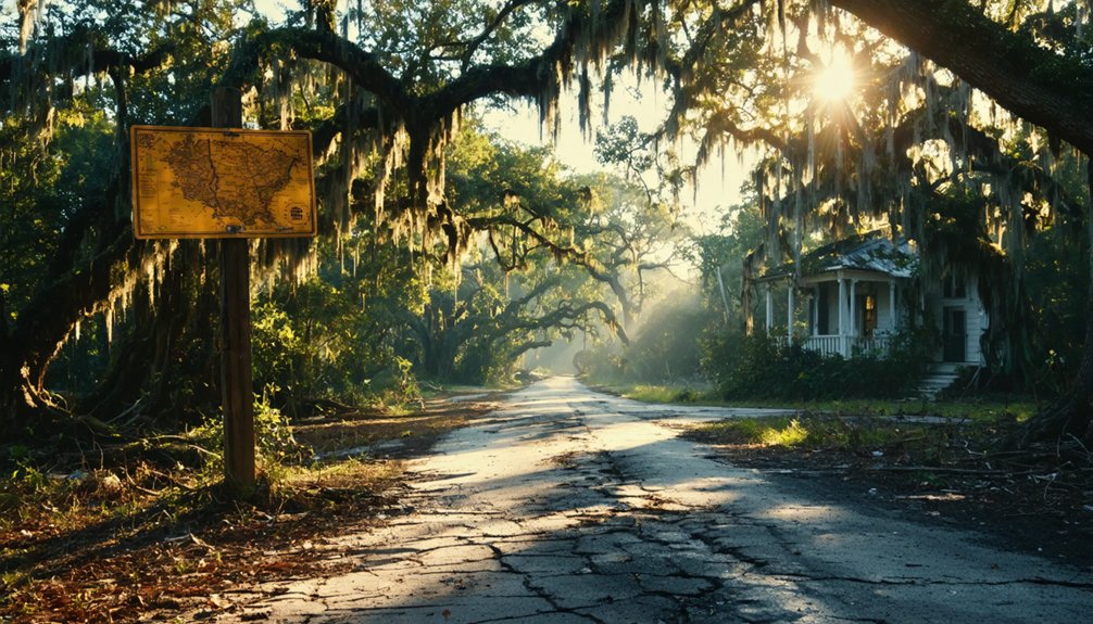
You’ll find the ghostly remnants of Peason along Highway 118 east of Hornbeck, accessible through the 74,309-acre Peason Ridge Wildlife Management Area located 14 miles north of Leesville. Visit during October mornings when hunting season access opens and temperatures stay comfortable between 59-79°F. You’ll need a self-clearing permit before exploring the crumbling foundations and old cemetery where locals claim ghostly train whistles still echo through the pines. The following sections reveal how to coordinate your visit around Fort Polk’s military training schedule and discover what transformed this once-thriving lumber town into Louisiana’s most haunting roadside mystery.
Key Takeaways
- Access Peason Ridge via LA 117, LA 8, LA 17, LA 118, or LA 478, located 14 miles north of Leesville.
- Visit in October or during fall/spring hunting seasons for optimal weather and accessibility to the 74,309-acre area.
- Explore remnants along Highway 118 east of Hornbeck, including abandoned structures, foundations, and the old cemetery.
- Obtain a mandatory self-clearing permit and coordinate with Fort Polk’s Joint Readiness Training Center regarding military exercise schedules.
- Leave all artifacts undisturbed and verify access status before departing, especially during August-September training blackout dates.
The Rise and Fall of a Lumber Boom Town
In 1916, two ambitious lumber barons looked at 40,000 acres of virgin pine forest in Sabine Parish and saw opportunity. A.J. Peavy and R.J. Wilson formed their partnership, establishing a town that would bear their combined names—Peason.
By 1918, you’d have witnessed the largest pine lumber operation west of the Mississippi roaring to life, churning out 4 million board feet monthly. The community dynamics shifted rapidly as 1,500-2,000 people flocked here for work and fortune. The company never laid off workers even during the Great Depression, a remarkable feat in an era of widespread unemployment. The economic impact rippled through Louisiana’s backcountry until 1935, when the timber ran out.
The company built its own Christie and Eastern Railroad to haul lumber from Peason to Sandel and eventually Kurthwood, creating a vital transportation artery through the piney woods.
What those crosscut saws and mule teams couldn’t predict was how quickly abundance turns to ghost town—just seventeen years from first whistle to silence.
Getting to Peason Ridge Wildlife Management Area
Where virgin pine forests once thundered with steam whistles and saw blades, you’ll now find 74,309 acres of regenerated wilderness spanning three parishes—Natchitoches, Sabine, and Vernon. Reaching this backcountry requires traversing rural Louisiana highways:
- LA 117 cuts straight through the WMA from south to north
- LA 8 and LA 17 serve as your primary access arteries
- LA 118 and LA 478 provide interior routes once you’re inside
Located 14 miles north of Leesville, the area sits adjacent to Kisatchie National Forest. The approximate elevation reaches 302 feet above sea level across the management area. Before exploring, you’ll need a self-clearing permit—mandatory for all activities. Check in at the WMA station on Highway 117 near Cantonment. Parking availability varies by location, with additional stations at Coon Hunters Barn and Tank Trail. During deer season, daily check-in and check-out become non-negotiable. The WMA encompasses the communities of Bellwood, Gorum, and Mink, remnants of the area’s lumber town past.
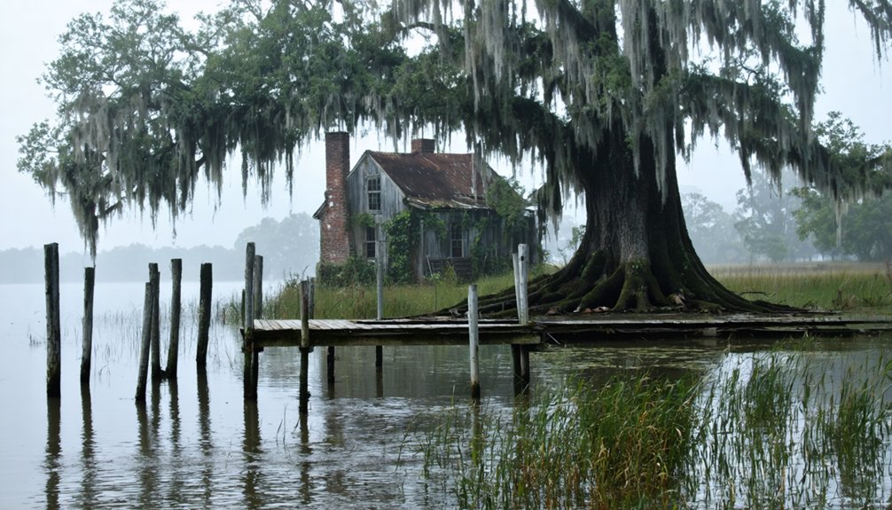
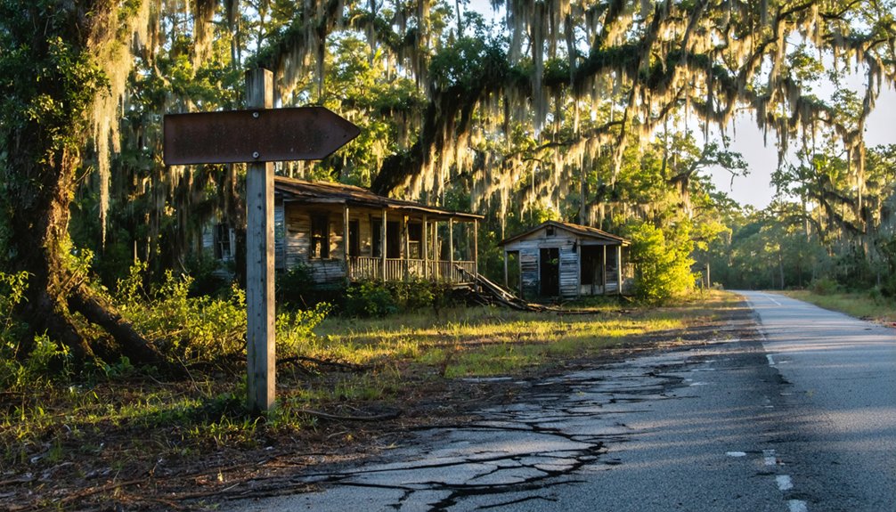
What Remains of the Once-Thriving Community
Standing at the intersection of Highway 118, eight miles east of Hornbeck, you’ll struggle to imagine 2,000 people once called this stretch of piney woods home. Yet abandoned structures whisper their stories—crumbling foundations where the commissary sold goods on credit, roadbeds where logging trains rumbled toward Sandel.
You’ll find the old cemetery easiest, its weathered stones marking families who stayed when others chased work to Florida.
Local legends speak of ghostly train whistles echoing through the pines, though military restrictions limit your exploration. The 1940s government seizure transformed Peason into a training ground, and today’s public access remains seasonal. The U.S. government acquired the land for military training purposes, forcing entire families to relocate and abandon the community they’d built.
Time your visit for low-growth months when church foundations emerge from undergrowth, revealing fragments of this self-contained sawmill empire that vanished within a generation. Like many Louisiana communities, Peason thrived on the abundance of longleaf pine before the trees were depleted.
Best Times to Visit and Access Restrictions
Planning your visit to Peason means working around Fort Polk’s training calendar—you can’t just show up when the mood strikes. The Louisiana Department of Wildlife and Fisheries posts open dates for Peason Ridge Wildlife Management Area, typically aligning with hunting seasons in fall and spring when the military grants public access.
Exploring the area may also lead you to discover hidden gems, such as abandoned buildings in Peason, Louisiana, that tell stories of the past. These remnants of history can provide unique photographic opportunities and insights into the region’s former life. While the wildlife management area offers a chance for outdoor activities, the allure of these structures invites curiosity and adventure.
If you’re drawn to the overgrown cemeteries where families like the Peasons still rest, those crisp October mornings offer the best combination of accessibility, comfortable temperatures, and light that filters perfectly through the pines onto weathered headstones. The town was named for the PEAvy-wilSON Lumber company that once operated a mill here and maintained railroad connections extending as far as Lecompte. Like Bodie in California, some believe removing artifacts from abandoned settlements can bring bad luck, so visitors should leave everything as they find it.
Military Exercise Schedule Coordination
Though Peason Ridge’s weathered historical marker stands as a silent invitation to explore, the reality of visiting this ghost town demands careful choreography around live artillery fire and year-round military exercises. Fort Polk’s Joint Readiness Training Center operates continuously, with no public sample training schedules released. You’ll need to:
- Contact the Joint Readiness Training Center directly for current off limits zones during exercises and rare public access windows
- Monitor Fort Polk’s official announcements for training blackout dates, particularly August-September when large-scale maneuvers peak
- Verify access status via Louisiana Myths and Legends Byway markers before departing
Expect tactical disruptions along rail lines and roads near Leesville. Locals report fleeting moments of tranquility between rotations—your only opportunity to walk where twenty-five families once lived before 1941’s permanent eviction. The facility emerged from the original 1940-1941 Louisiana Maneuvers that transformed this region into America’s premier combat training ground. The maneuvers involved nearly half a million troops, making it the largest field exercise in U.S. Army history at that time.
Seasonal Weather Considerations
When abandoned ruins meet unpredictable Louisiana weather, your expedition to Peason becomes a delicate dance between mild windows and sudden downpours. Spring and fall deliver ideal touring conditions—you’ll find temperatures hovering between 59-79°F, perfect for exploring crumbling structures without extreme heat bearing down. Yet precipitation trends warn of afternoon showers, with rain chances spiking to 51% during peak hours.
Winter’s 70°F days tempt wanderers, though overcast skies cast dramatic shadows across forgotten buildings. Summer’s persistent cloudiness and frequent rain create atmospheric backdrops but complicate navigation through overgrown paths. Time your arrival for morning hours when precipitation radar shows clearer patterns. Those 5 mph winds won’t disturb your photography, and low UV means you’re free to roam without excessive sun protection weighing you down.
Cemetery Access Periods
- Check Louisiana Department of Wildlife and Fisheries for current open periods before departure
- Respect all posted boundaries—trespassing isn’t just illegal, it’s genuinely dangerous
- Pack navigation tools for remote dirt roads leading to crumbling church foundations
- I’ve watched fellow explorers turned away at gates, their road trips wasted by poor planning. Unlike accessible New Orleans cemeteries offering predictable hours, Peason demands reconnaissance.
- These forced 1940s displacement sites require patience, preparation, and respect for boundaries.
Nearby Historic Sites Worth Exploring
The ghost town of Peason might draw you in, but the surrounding region holds treasures that span millennia of human history. Head north to Poverty Point, where ancient burial mounds rise from Louisiana earth like monuments to a civilization that thrived 3,400 years ago. You’ll walk trails between five massive earthworks that once housed 5,000 people in what archaeologists believe was a bustling trade center.
As you explore these historical sites, consider venturing to other ghost towns to visit in Louisiana, each with its own unique story and charm. The remnants of these once-thriving communities invite you to ponder the lives and dreams that shaped them, offering a glimpse into a bygone era. Additionally, the local folklore surrounding these towns adds an intriguing layer to your journey, making for an unforgettable experience.
Closer to Peason, Lafayette’s Acadian Cultural Center offers cultural heritage experiences through ranger-guided boat tours on Bayou Vermilion. In St. Martinville, you’ll discover one of America’s oldest churches and architectural gems from the 1765 Acadian settlement. Each site reveals layers of Louisiana’s complex past—no guided tours required, just your curiosity and open road.
Tips for Respectful Ghost Town Exploration
Before you step onto the cracked foundations of Peason’s abandoned structures, you’ll need to master the unwritten code that separates respectful explorers from reckless trespassers.
Mastering the unwritten explorer’s code means honoring history’s fragile remnants while protecting your right to discover what remains.
These preservation guidelines protect both Louisiana’s heritage and your freedom to explore:
- Research ownership through county records before visiting—secure explicit permission for private land to avoid legal complications that’ll end your adventure abruptly.
- Document without disturbing—photograph weathered artifacts in place rather than pocketing them, honoring ethical guidelines that keep sites accessible for future wanderers.
- Leave zero trace—fill any holes you’ve dug, remove modern trash only, and avoid weakened floorboards near structure centers.
I’ve watched too many ghost towns close permanently because careless visitors couldn’t follow basic respect protocols. Don’t be that person who ruins it for everyone seeking authentic historical connections.
Frequently Asked Questions
What Amenities Are Available for Visitors at Peason Ridge Wildlife Management Area?
You’ll find self-guided hiking trails winding through wild ecosystems, plus designated parking for RVs and motorcycles. However, there aren’t picnic area amenities here—camping’s prohibited. You’re free to explore marked trails, but you’ll need that self-clearing permit first.
Are There Any Guided Tours Available for Exploring Peason’s Historic Remnants?
No guided tours offered exist for Peason’s ruins—the military still controls access. You’ll need self-guided walking tours during limited seasons, respecting the abandoned cemeteries and crumbling foundations that whisper stories of displaced families from the 1940s.
What Safety Precautions Should Visitors Take When Exploring the Ghost Town?
You’ll need to wear appropriate footwear for rugged terrain and bring emergency supplies like water, maps, and bug spray. Respect military boundaries, avoid trespassing on restricted land, and never disturb artifacts or cemeteries during your adventure.
Is Camping or Overnight Stays Permitted in the Peason Area?
You can’t camp directly on Peason Ridge WMA, but nearby campground availability exists at Pearson Camp on Highway 167. Consider private property considerations when exploring. Adjacent Kisatchie National Forest lands welcome dispersed camping for true backcountry freedom.
Where Is the Nearest Town to Purchase Supplies Before Visiting Peason?
Florien’s your closest bet for supplies, just minutes away with nearest grocery stores and local gas stations. Hornbeck’s another solid option 8.7 miles west. Stock up before heading into Peason’s wild, forgotten territory—you’ll need it.
References
- https://thebayouinsider.substack.com/p/ghost-towns-and-forgotten-roads-louisianas
- https://en.wikipedia.org/wiki/Peason
- https://kids.kiddle.co/List_of_ghost_towns_in_Louisiana
- https://www.sfasu.edu/heritagecenter/9916.asp
- https://louisianagenealogygirl.wordpress.com/2021/03/23/sawmill-towns/
- https://www.sfasu.edu/heritagecenter/9709.asp
- http://files.usgwarchives.net/la/sabine/history/peason.txt
- https://vernonparishjournal.com/2025/11/07/rickey-robertson-to-present-program-on-historic-sawmill-town-of-peason/
- https://vernonparish.org/about-us/history/logging-in-vernon-parish/
- https://www.topozone.com/louisiana/sabine-la/park/peason-ridge-state-wildlife-management-area/