Base yourself in Lone Pine to explore five distinct ghost town routes radiating across Inyo County’s high-desert mining legacy. You’ll need a high-clearance vehicle for washboard roads leading to Cerro Gordo‘s preserved silver camp, Darwin‘s rusted smelters, and Keeler‘s railroad remnants. Stock emergency supplies—winter snow lingers through May, and afternoon thunderstorms materialize quickly. Respect private property at Cerro Gordo by scheduling tours in advance. The routes vary from 10-mile circuits to challenging climbs exceeding 5,000 feet, each revealing different chapters of California’s mineral-extraction past that transformed these mountains into a landscape of abandoned ambitions.
Key Takeaways
- Use Lone Pine as your base camp to access five distinct ghost town routes including Cerro Gordo, Darwin, and Keeler.
- Bring a high-clearance vehicle for unpaved roads; pack emergency supplies like chains, blankets, water, and a shovel year-round.
- Cerro Gordo requires advance permission from owner Brent Underwood; schedule guided tours through caretakers for building access.
- Check Inyo County road conditions before departure, especially for winter snow or afternoon thunderstorms near Lone Pine.
- Explore the Dolomite Loop (10 miles), Whitney Portal Road (12 miles), or Beveridge (23.9 miles) for varying difficulty levels.
Understanding the Mining Heritage of Inyo County’s Ghost Towns
The windswept peaks of Inyo County’s mountain ranges conceal a mining legacy that transformed California’s eastern frontier into one of the West’s most productive mineral districts. You’ll discover a story beginning in 1861, when Mexican prospectors first struck gold in scattered lode deposits across the Panamint and Inyo ranges.
Between 1880 and 1959, these mountains yielded 496,000 ounces of gold alongside over $150 million in silver, lead, zinc, and copper. The Darwin district alone produced two-thirds of California’s lead output. Key infrastructure developments emerged as operations like Beveridge supported populations of 60 workers, while mining technology innovations enabled extraction from complex ore bodies containing multiple metals.
Each abandoned shaft you’ll encounter represents freedom-seeking prospectors who carved fortune from unforgiving terrain.
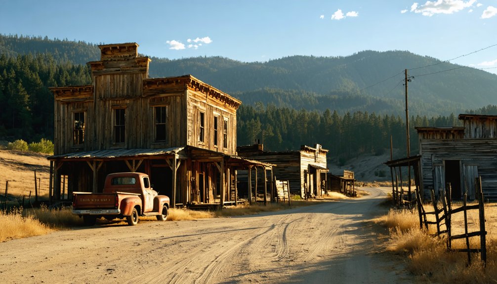
Cerro Gordo: California’s Best-Preserved Silver Mining Town
Silver veins threading through Buena Vista Peak drew Mexican miner Pablo Flores and his compatriots to this windswept summit in 1865, where they discovered ore assaying at $300 per ton—a fortune in the remote Inyo Mountains.
Early adobe smelting operations using crude vasos evolved dramatically when Mortimer W. Belshaw arrived in 1868, transforming Cerro Gordo into California’s largest silver producer. By 1869, you’ll find that nearly 4,000 miners had carved over 30 miles of tunnels through the mountain, shipping 340 tons of silver bullion to Los Angeles.
The later copper smelter construction and multiple facilities processed minerals worth over $500 million in today’s currency. Though water shortages and depleted veins ended the boom by 1877, this ghost town remains remarkably preserved—a record/memoir/chronicle to the fortune-seekers who conquered these peaks.
Darwin: From Boomtown of 45,000 to Lone Survivor
When Dr. Darwin French discovered silver here in 1874, he couldn’t imagine his namesake town would swell to 3,500 souls before crashing spectacularly. You’ll find a community that’s weathered everything:
- The 1878 smallpox epidemic that sent residents fleeing
- An 1879 arsonist’s fire destroying hotels and 14 businesses
- Economic collapse forcing survivors north to Bodie
Today’s Darwin claims just 35 residents—artists, writers, and freedom-seekers drawn to absolute isolation. The changing demographics tell their own story: median age 63.6, few children, zero future redevelopment prospects.
You’ll wander past rusted Defiance smelter remnants and decaying downtown buildings, untouched by restoration efforts. This isn’t commercialized nostalgia—it’s raw authenticity 22 miles southeast of Keeler, where desertion defines the landscape.
Keeler: Railroad Hub and Gateway to Mountain Mines
You’ll find Keeler huddled against the eastern Sierra Nevada foothills, where the Carson and Colorado Railroad’s narrow gauge tracks once terminated at the edge of a now-vanished Owens Lake.
This remote outpost transformed from a dusty freight wharf into a critical railroad junction, connecting silver-rich mountain mines to the outside world through “The Slim Princess” locomotive and its twice-weekly runs.
Today’s windswept remnants reveal how quickly prosperity disappeared when the ore ran out and lake waters receded, leaving behind rusting rails and weathered buildings that mark where the rails met the mountains.
Early Settlement and Transport
The settlement’s evolution unfolded through three pivotal moments:
- March 1872 Lone Pine earthquake altered Swansea’s shoreline, forcing expensive wharf extensions
- Belshaw’s steamship Bessie Brady operated as the lake’s sole vessel throughout the 1870s
- 1884 cloudburst buried struggling Swansea under debris flows, ending its competition
Julius Keeler arrived in 1879, transforming this freight landing into a legitimate town.
Carson and Colorado Railroad
While Swansea crumbled under mudslides, a far more ambitious transportation venture was taking shape sixty miles north. The Carson and Colorado Railroad‘s narrow gauge tracks reached Keeler in August 1883, transforming the sleepy Owens Lake settlement into an essential hub. You’ll find where 293 miles of three-foot rails once connected Nevada’s mining camps to California’s silver strikes, nicknamed the “Slim Princess” for its slender gauge.
Mining technology advancements made Keeler indispensable—tramways and steamers hauled ore from Cerro Gordo’s high-altitude mines down to waiting railcars. The railroad influence on local economy expanded beyond precious metals; Inyo Development Company shipped tons of soda extracted from Owens Lake. Southern Pacific acquired this engineering marvel in 1900, keeping it operational until 1960 when trucks finally conquered what rails had ruled.
Visiting Keeler Today
Standing at the windswept crossroads where Highway 136 meets Keeler’s dusty main street, you’re confronted with a landscape transformed beyond recognition—Owens Lake’s vast white alkali expanse stretches where steamers once churned across blue water. This skeletal railroad town offers unmatched ghost town photo opportunities among authentic remnants:
- Railroad remnant significance comes alive at the preserved station and stationmaster’s house, where boxcars-turned-residences and the Plymouth diesel locomotive rust beside inspection pits
- “End of the Line” plaque commemorates the 1883 narrow gauge arrival and legendary “Slim Princess” engine
- Cerro Gordo aerial tram terminus (1908) marks the mountain gateway connection
You’ll find no services here—bring everything. The isolation and authenticity reward those seeking unvarnished Western history without tourist crowds or restrictions.
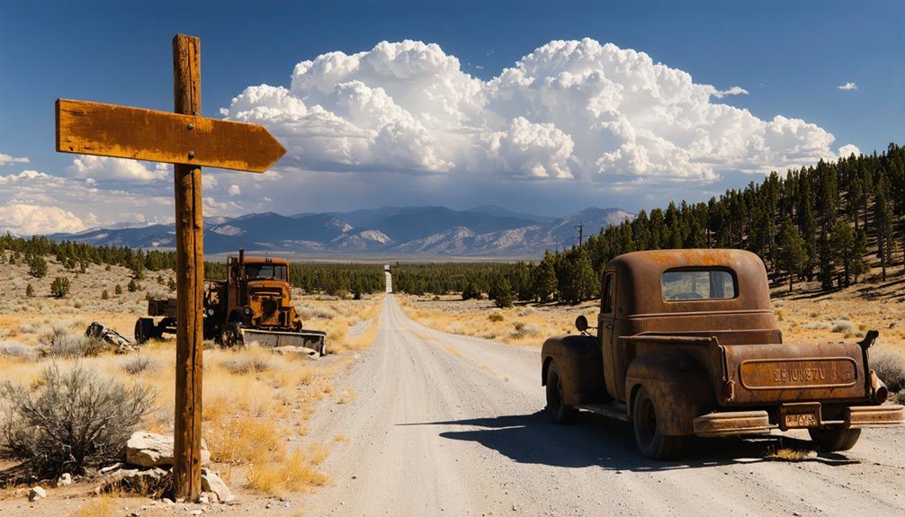
Essential Road Conditions and Vehicle Requirements
Reaching Pine’s remote location demands a high-clearance vehicle capable of handling unpaved, washboard roads that wind through the rugged Eastern Sierra terrain.
You’ll navigate rocky passages and seasonal stream crossings that become treacherous during spring snowmelt and summer monsoons, when flash flooding can transform dry washes into impassable barriers within minutes.
Winter brings additional challenges—snow and ice coat these backcountry routes, making chains and proper tire equipment essential for safe passage through elevations that hover around 7,000 feet.
High-Clearance Vehicle Necessity
Before you set out on this ghost town odyssey through Eastern California’s backcountry, understand that your vehicle choice will determine which historic sites you’ll actually reach. Sedans won’t cut it—you’ll need genuine high clearance for these routes.
One of the most intriguing destinations is the ghost towns around Cuyamaca City, where remnants of the past tell stories of gold miners and settlers. As you navigate the rugged terrain, be sure to keep an eye out for the unique flora and fauna that have adapted to this harsh, yet beautiful environment. Each stop offers a glimpse into the history that shaped the region, making it a truly unforgettable journey.
Critical high-clearance requirements:
- Talc City Road demands clearance for shelf roads, boulders, and tight 180-degree turns at 17.5 miles
- Cerro Gordo’s 8-mile climb requires 4WD capability through hairpin turns ascending to 8,000 feet
- Saline Valley’s 25-mile stretch features rocks, squeezes, and remote terrain climbing toward 9,000 feet
Appropriate vehicle maintenance and all terrain tire importance can’t be overstated. Fuel up in Lone Pine—there’s nothing beyond. Check Inyo County road status before departing, as conditions change drastically with seasons.
Seasonal Weather Challenges
When winter storms sweep through Eastern California’s high country, your meticulously planned ghost town expedition can transform into an impassable maze of closed passes and mandatory chain controls. SR 270 to Bodie, SR 108 Sonora Pass, and SR 120 Tioga Pass all shut down with snowfall, demanding alternative routes.
Master winter driving safety tips before departing: slow below 55 mph on icy roads, maintain extended following distances, and keep your windshield clear. Stock emergency essentials—booster cables, blankets, water, shovel. R3 chain requirements mean nobody’s exempt, regardless of vehicle type.
Spring weather preparedness remains equally critical through May, with afternoon thunderstorms materializing near Lone Pine. Never accelerate through flooded crossings, and deflate tires slightly for enhanced snow traction. Your freedom depends on respecting these mountain conditions.
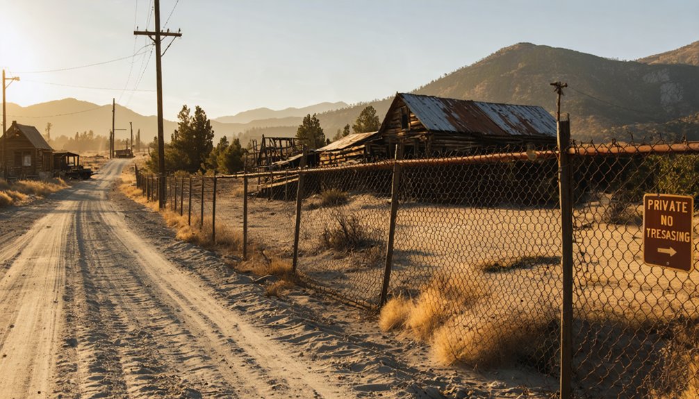
Unlike many ghost towns scattered across the American West, Cerro Gordo isn’t a place where you can simply park and wander at will. Since its 2018 private purchase for $1.4 million, the entire site—buildings, land, and mineral rights—operates under strict access protocols. You’ll need advance permission from owner Brent Underwood or his caretakers before setting foot on the property.
To visit respectfully while maintaining community relationships:
- Contact owners directly before your trip to request entry clearance
- Schedule guided tours through the on-site caretaker for building access
- Never remove artifacts or enter structures without accompaniment
This controlled approach protects the restored American Hotel, saloon, and bunkhouse from looting while preserving the town’s authentic character. The remoteness that once isolated miners now guarantees thoughtful exploration.
Best Routes and Distances From Lone Pine Base Camp
Lone Pine serves as your tactical staging ground for exploring five distinct ghost town routes that fan outward like spokes from a wheel, each offering vastly different terrain, difficulty levels, and historical rewards.
The Dolomite Loop route overview presents your easiest option—a 10-mile circuit starting at Highway 395’s junction with 136. You’ll spot the quarry’s massive holes at 5.7 miles and reach company town ruins at 6.7 miles. For ancient history, the petroglyphs site details require parking at 9.4 miles and hiking northwest along a steep ridge.
Whitney Portal Road climbs west to 8,300 feet over 12 miles, while Beveridge demands serious commitment—23.9 miles with 5,108 feet of elevation gain. Owenyo’s railroad ruins lie north via Narrow Gauge Road, accessible for quick exploration.
Frequently Asked Questions
What Accommodations Are Available for Overnight Stays Near These Ghost Towns?
You’ll find diverse camping options from RV parks to tent sites, plus cozy bed and breakfasts in Lone Pine. Choose between budget motels, historic lodges, or rustic accommodations that capture the Old West spirit you’re seeking.
Are There Guided Tours Available for Cerro Gordo and Darwin?
Cerro Gordo offers public tours availability daily from 9am-5pm with knowledgeable caretakers like Robert and Jonathan leading explorations. Guided tour schedules run for $10 per person. Darwin currently lacks organized tours, requiring independent exploration instead.
What Safety Precautions Should Visitors Take in Abandoned Mining Areas?
Flooded quarries cause more deaths nationally than any other abandoned mine hazard. You’ll want to bring protective gear like sturdy boots and helmets, avoid unstable structures entirely, stay clear of open shafts, and never enter water-filled areas during your exploration.
Can Visitors Collect Rocks or Artifacts From the Ghost Town Sites?
No, you can’t collect rocks or artifacts from ghost town sites. You’ll respect their historical significance by leaving everything untouched. If you’re planning commercial photography, obtain necessary permits beforehand to preserve these treasured places for future explorers.
What Is the Best Time of Year to Visit These High-Elevation Locations?
You’ll find absolutely *perfect* conditions visiting during fall when autumn foliage changes paint the Sierra gold, or spring when weather conditions create ideal exploring temperatures. Summer works beautifully too, though winter snow blocks high-elevation ghost town routes completely.


