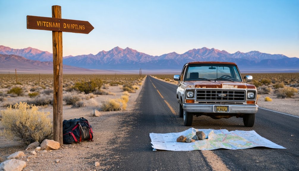
You’ll find Piute ghost town at coordinates 35°17’20″N 115°06’12″W in Lanfair Valley, east of Mojave National Preserve. The 25-mile drive from Needles deteriorates progressively, climbing from 2,000 to 4,100 feet through creosote flats and volcanic ridges—high clearance vehicles are essential. Scattered wooden remnants, collapsed mill structures, and rusted mining equipment mark where Lieutenant Jacob Hess discovered high-grade ore in 1865. Summer offers the most dependable access, though flash floods can wash out roads without warning. There’s considerably more to discover about traversing these backcountry routes and exploring what remains.
Key Takeaways
- Start from Needles and follow Piute Crossing Road for 25 miles through progressively deteriorating terrain requiring high-clearance vehicles.
- Visit Fort Piute and Piute Spring to see ancient petroglyphs featuring wavy patterns and inverted stick figures.
- Explore scattered wooden remnants, collapsed mill structures, and abandoned mining equipment throughout the former Gold Rush camp.
- Bring GPS coordinates and check BLM for current road conditions, as unmarked trails and seasonal washouts occur.
- Plan for summer travel and complete self-sufficiency when exploring this remote Mojave National Preserve area ghost town.
Getting to Piute: Location and Access Routes
Tucked into the unforgiving folds of northeast San Bernardino County, Piute ghost town sits at coordinates 35°17′20″N 115°06′12″W, where the Mojave Desert’s vastness swallows the remnants of old mining dreams.
You’ll find this skeletal outpost near Hart ghost town in Lanfair Valley, positioned east of the Mojave National Preserve‘s boundary. The historic Mojave Road—that legendary artery connecting San Bernardino to Fort Mojave—cuts through this territory, passing south through the Piute Range. These backcountry roads demand respect: high clearance vehicles handle the terrain best.
Fort Piute marks your southeastern landmark near Piute Spring, while mining relics scatter the landscape like forgotten promises. At 4,045 feet elevation, Lanfair Valley’s Joshua trees stand sentinel over your approach, their twisted forms pointing toward freedom’s horizon.
What Remains: Exploring the Ghost Town Today
When you reach Piute’s windswept plateau, you’ll find only scattered wooden remnants and rusted metal fragments poking through sagebrush—a stark contrast to the preserved structures at nearby Calico. The mining camp’s original buildings have largely collapsed into the desert floor, leaving behind foundation stones, ore cart rails, and the occasional standing wall that frames the Mojave’s vast emptiness.
Beyond these weathered relics, faint trails wind into the surrounding mountains where prospectors once hauled silver ore down rocky passages that remain passable for determined hikers willing to scramble over loose talus.
Abandoned Mining Structures
The skeletal remains of Piute’s mining empire sprawl across the mountainsides in various states of decay, offering a haunting glimpse into the town’s industrial past. You’ll discover collapsed mill structures where five-stamp mills once thundered, their concrete foundations still gripping the earth. Abandoned mining equipment—crusher mechanisms, rail pieces, and steam engine remnants—lies scattered like industrial fossils.
The underground workings extend deep into the mountains, their portals framed by deteriorating timbers and waste rock piles that tell stories of extraction methods. Stone storage rooms guard mine entrances, while office buildings still clutch desks and equipment pedestals. Each site reveals different preservation levels; some cabins stand partially intact while others exist merely as lumber piles, creating an archaeological timeline of boom and abandonment.
Historical Artifacts and Relics
Scattered across Piute’s desolate terrain, thousands of artifacts tell overlapping stories of indigenous settlement and mining-era ambition. You’ll discover glass seed beads numbering over 230 at winter house sites, marking historical trade routes that connected Paiute communities. Metal buttons, wire nails, and Levi Strauss rivets lie half-buried alongside fire-fractured grinding stones and obsidian points.
At Fort Piute, ancient petroglyphs showcase wavy line patterns and inverted stick figures—religious ceremonial artifacts conveying death and spiritual transformation.
What you’ll find wandering freely:
- Charred wickiup remnants intentionally burned, with carbonized fabric and melted glass marking the Paiute tradition of destroying dwellings after death
- Mining-era domestic relics including wood-burning stoves and bottle collections abandoned mid-use
- Petroglyphic complexes with centuries-layered patina revealing multi-generational sacred storytelling
Accessing Remote Mountain Trails
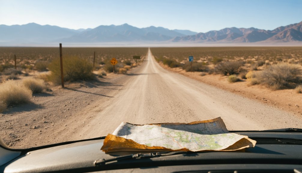
Reaching Piute’s remnants demands commitment—you’ll navigate 25 miles of progressively deteriorating road from Needles, where asphalt surrenders to graded dirt along BLM Route NS050. Your four-wheel-drive will earn its keep as Piute Crossing Road dissects the 48,080-acre wilderness, climbing from 2,000 feet through rocky foothills toward 4,100-foot peaks.
4WD accessibility challenges intensify beyond maintained sections, where seasonal washouts erase previous tracks. I’ve found that unmarked wilderness trails branch without warning—GPS coordinates become essential when hunting for Fort Piute’s crumbling walls near Fenner Spring.
Before committing, contact the BLM office for current conditions; winter storms transform passable routes into impassable quagmires overnight. Summer offers your most reliable window, though you’re entirely self-sufficient once you leave Needles’ last fuel station behind.
Gold Rush History: The Rise and Fall of Piute Mining
When Lieutenant Jacob Hess traced glittering placer gold up Pine Canyon in January 1865, he couldn’t have known his initial discovery would birth an entire mining district. Five miles in, he struck the Bully Boy and Webster ledges—high-grade ores mixing gold, silver, lead, and copper that sparked a prospecting frenzy across these untamed mountains.
Lieutenant Jacob Hess’s 1865 discovery of high-grade ore in Pine Canyon ignited a prospecting frenzy across the untamed mountains.
Peak production volumes came from legendary operations:
- The Deer Trail Mine, discovered in 1878, became one of Utah’s richest producers for years
- Wedge and Dalton mines yielded $900 gold nuggets—some preserved as treasured souvenirs
- Annie Laurie and Sevier Mines pushed boundaries deeper into remote territory
Fort Piute and the Mojave Road Connection
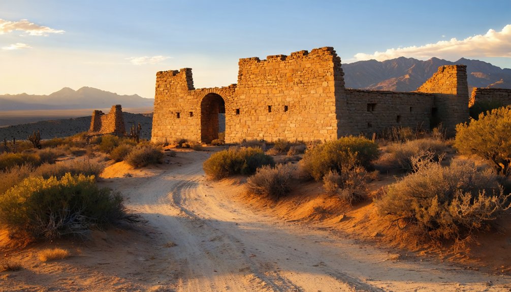
Long before Piute became a ghost town, the U.S. Army built Fort Piute in 1866 above Piute Creek’s year-round waters. You’ll find stone walls that once sheltered infantry protecting mail carriers and emigrants on the legendary Mojave Road—a prehistoric trail blazed by Mojave Indians trading with California’s coast.
The Army manned this remote outpost for just one year, guarding travelers from conflicts until 1871. When the mining boom decline arrived with railroads in 1885, the fort’s purpose vanished.
Today, you can reach these ruins via rough 4×4 trails from I-40, discovering wagon ruts and petroglyphs near piute creek native settlements. The rerouted road now protects the creek’s cottonwoods, but you’ll still taste frontier freedom standing where soldiers once watched the empty desert.
Best Time to Visit and What to Bring
Your adventure to Fort Piute’s crumbling stone walls demands careful timing—the Mojave Desert doesn’t forgive poor planning. Target February through March when weather variations favor exploration: highs reach comfortable 67-74°F while winds stay manageable at 7-8 mph. Summer’s brutal 96°F heat transforms ruins into furnaces.
February through March offers Fort Piute’s sweet spot: 67-74°F temperatures and calm winds before summer’s punishing heat arrives.
Essential gear for self-reliant explorers:
- Layered clothing to handle 30°F temperature swings between dawn patrol and midday scrambles
- Rain protection for October-April’s 60-80 inch wet season—storms materialize fast
- Sturdy boots with aggressive tread for traversing crumbling foundations and loose talus
Follow these clothing recommendations: pack that light jacket even for summer visits when fog rolls unexpectedly through canyons. October through March brings precipitation risk, so waterproof essentials aren’t optional—they’re survival.
Abandoned Mines and Historic Structures to Discover

Beyond Fort Piute’s weathered ramparts, the Piute Mountains conceal a two-mile belt of gold-bearing veins that spawned fortunes and failures across three boom cycles. You’ll find the Bright Star and Gwynne mines, which extracted over $1.3 million in gold, their crumbling stamp mill foundations still clinging to hillsides near Claraville. Hidden mine entrances pierce granite slopes where old stagecoach routes once carried ore to distant smelters.
Search out the Amalie Mine’s decaying stamp mills, last operational in 1936, and explore remnants of uranium workings scattered across the terrain. Near Havilah, crusher remains and grist mill ruins mark civilization’s brief foothold. You’ll spot residence foundations where miners once dreamed of strikes, their hopes crystallized in abandoned shafts that pierce the earth like forgotten promises.
Nearby Ghost Towns Worth Exploring
Your journey through the Inyo Mountains reveals Claraville just down the road from Piute, though most of its original buildings were dismantled and moved to nearby Keeler decades ago, leaving only foundation stones and mining debris scattered across the hillside.
The surrounding peaks hide dozens of smaller mining camps—weathered cabins clinging to slopes at 7,000 feet, their corrugated metal roofs glinting in the desert sun like forgotten coins. You’ll need a high-clearance vehicle and detailed topo maps to reach these remote sites, where rusty ore carts still sit on century-old tracks leading into collapsed tunnels.
Claraville’s Historic Buildings Relocated
When Claraville’s miners abandoned their weathered cabins and storefronts in the late 1860s, the buildings didn’t simply collapse into the dusty earth—several were dismantled board by board and hauled to the Bakersfield Pioneer location, where they’d serve new purposes far from the played-out goldfields.
Today’s structure archaeology reveals how resourceful pioneers salvaged entire buildings rather than waste valuable lumber. Unfortunately, conservation efforts face challenges—comprehensive records identifying which specific structures made the journey simply don’t exist.
What you’ll discover about these relocated buildings:
- Original purposes remain mysteries, though mining camp construction typically included saloons, boarding houses, and supply stores
- Hand-hewn timber speaks to 1860s craftsmanship that prioritized function over permanence
- Each weathered board carried stories of boom-time prosperity and inevitable abandonment
Limited documentation means you’re exploring genuine historical puzzles.
Inyo Mountains Mining Camps
Rising from the scorched floor of Owens Valley, the Inyo Mountains concealed some of California’s richest silver deposits—and the ghost towns that sprang up to chase them tell stories far grander than Piute’s modest camp.
Cerro Gordo dominated them all. Pablo Flores struck silver there in 1862, and by 1872, eleven mines were pulling $300-per-ton ore from the mountainside. The mining operations scale was staggering—37 miles of tunnels eventually snaked through the peaks, including the 8,100-foot Estelle tunnel that pierced straight through half the range.
Labor conditions challenges matched the mining’s intensity. Miners sandbagged their bunks against stray bullets from payday shootouts. No church, school, or jail existed—just competing brothels, saloons, and assay offices serving men who’d fought indigenous resistance and Army intervention to claim their silver.
Photography and Artifact Hunting Tips
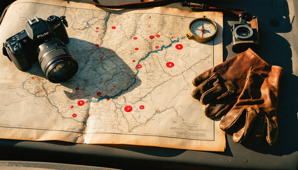
While most ghost town photographers chase the dramatic ruins of Bodie or Calico, Piute sits quietly in the high desert, waiting for those willing to venture off the beaten path. You’ll find undisturbed compositions here, where weathered wood tells stories through your lens.
Capture Piute’s essence with these approaches:
- Experiment with low camera angles to emphasize the vast emptiness surrounding crumbling foundations—shoot upward to contrast human remnants against endless sky
- Study artifact identification before your trip; recognizing square nails, purple glass, and hand-forged metal enriches your photographs with historical context
- Document, don’t disturb—photograph items exactly where you find them, preserving their archaeological value for future explorers
Remember: California law protects these sites. Your photographs become the artifacts you’ll treasure.
Safety Considerations for Desert-Mountain Terrain
The Piute Mountains don’t announce their dangers with warning signs—they reveal them through crumbling mine shafts that appear as shadows in the afternoon sun and rattlesnakes coiled beneath wood planks you’re about to photograph. Terrain conditions shift from stable ridgeline to ankle-twisting wash without warning.
I’ve learned to scan rock outposts at Fort Piute for both artifacts and wildlife sightings—a bighorn sheep startled me during golden hour last autumn. Pack double your water estimate; this desert strips moisture faster than you’ll notice.
Check footing constantly around those picturesque dry washes lined with catclaw acacia—flash floods carve them smooth, making them deceptively slick. During hunting season near Fenner Spring, wear bright colors. The nearest help sits 25 miles away in Needles.
Frequently Asked Questions
Are There Any Fees Required to Visit Piute Ghost Town?
The best things in life are free—you’ll pay no parking fees or admission at Piute Ghost Town. There aren’t visitor amenities here, just raw desert freedom among weathered stone ruins where you’ll explore untamed canyon landscapes completely unrestrained.
Can I Camp Overnight Near Piute in Sequoia National Forest?
Yes, you can camp overnight near Piute using primitive campsites in Sequoia National Forest. You’ll find dispersed camping spots with hiking trails nearby, but you’ll need a free campfire permit and must follow the 14-day limit.
What Wildlife Might I Encounter in the Piute Mountains Area?
You’ll encounter diverse wildlife including coyotes and rattlesnakes in classic Mojave terrain. Bighorn sheep and deer frequent Piute Creek’s waters, while desert tortoises, jackrabbits, and roadrunners roam freely across this untamed wilderness—true desert freedom awaits.
Is Cell Phone Service Available in and Around Piute?
You’ll find limited cell coverage around Piute, with AT&T practically nonexistent on trails and poor data speeds even at elevated overlooks. Verizon works best, but you’re still mostly off-grid—ideal for disconnecting completely.
Are Guided Tours of Piute Ghost Town Available for Visitors?
No guided tours available here—you’ll forge your own path through Fort Piute’s crumbling walls. Self-guided exploration options let you roam freely across this remote wilderness, discovering abandoned ruins at your own adventurous pace without restrictions.


