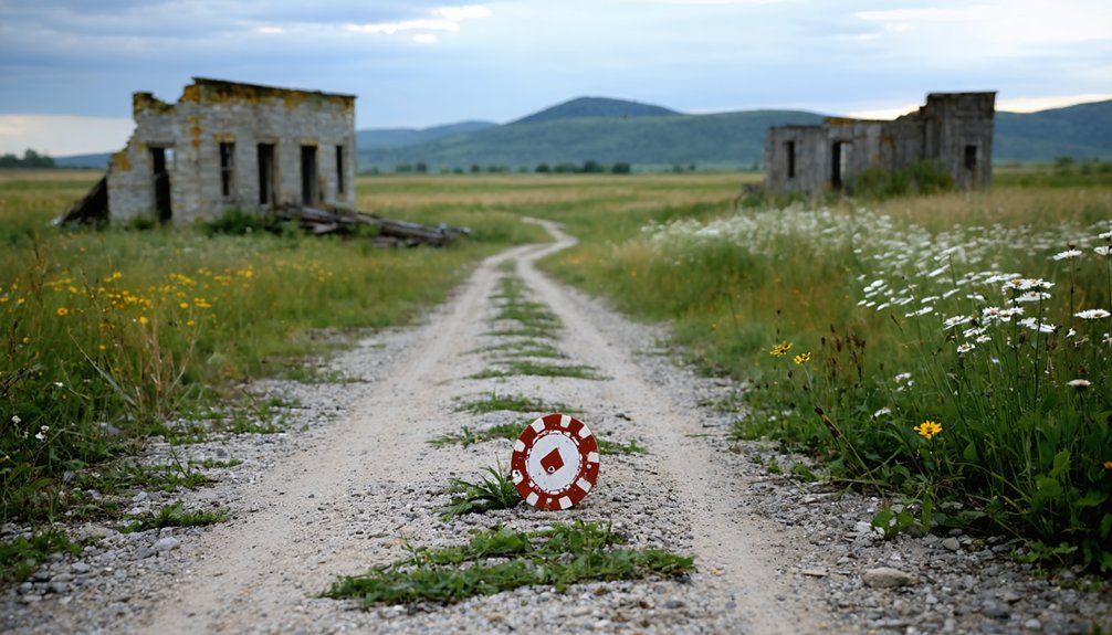
You’ll find Pokerville’s haunting remains two miles west of Blue Mounds at the intersection of East Brigham Road and County Highway ID—just an hour southwest of Madison. Once home to 500 gambling souls in the 1850s, this notorious lead-mining town met its end after an 1852 Indian attack and railroad bypass. Today, three structures still stand among crumbling foundations and an abandoned mine shaft. Pack your camping gear and prepare for seasonal road conditions, because the surrounding region holds even more forgotten Wisconsin history.
Key Takeaways
- Pokerville is located two miles west of Blue Mounds at East Brigham Road and County Highway ID, approximately one hour southwest of Madison.
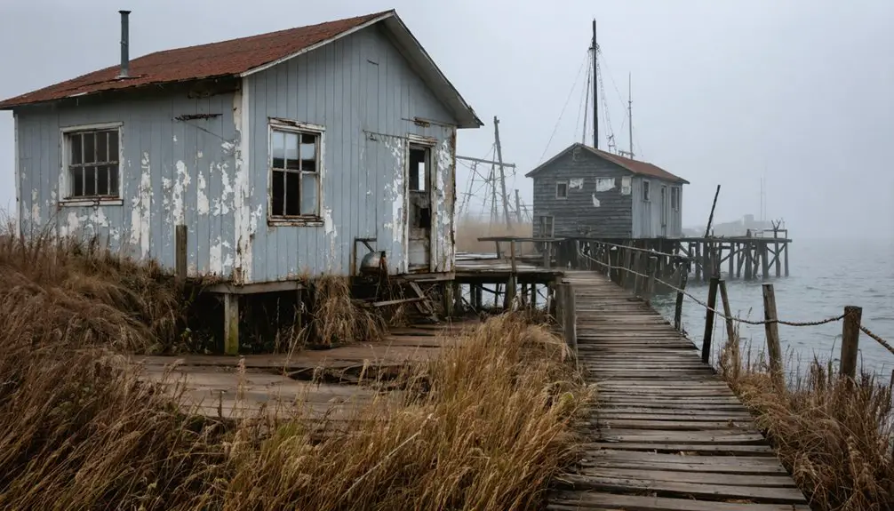
- The site features three standing structures, an abandoned lead mine, old steps, crumbling foundations, and remnants from a 1940s campground conversion.
- Standard 2WD vehicles can access the location year-round, though seasonal conditions vary with winter snow and fall exploration weather.
- Nearby attractions include Blue Mounds Village, Pendarvis, Fort Crawford Museum, Bevans Lead-Zinc Mine, and Mineral Point’s 1856 Railroad Depot.
- No public transportation exists; visitors should pack camping gear and prepare to explore overgrown foundations and weathered tombstones at their own pace.
The Wild Origins of Pokerville: From Blue Mounds West to a Gambling Hub
Two miles west of present-day Blue Mounds, Ebenezer Brigham staked his claim in 1828, drawn by rumors of lead deposits beneath Wisconsin’s rolling hills. The English prospector couldn’t have imagined what would follow.
By the mid-1800s, his settlement had transformed into something notorious—a raw-edged community of 500 souls named for its dubious attractions: card games that ran until dawn, brothels, and whiskey flowing freely after dark.
This wasn’t your typical frontier town. During the prosperous mining era, Pokerville became the territory’s wildest stop, positioned deliberately on the most traveled road around. You’d find rowdy miners gambling away their earnings alongside farmers, merchants, and drifters—all seeking fortune or escape. The settlement’s reputation spread fast: if you wanted entertainment without judgment, you headed west to Pokerville.
The 1852 Indian Attack That Changed Everything
Pokerville’s reputation for lawlessness made it plenty of enemies, but the settlement’s end came from an unexpected direction. In 1852, a devastating attack shattered the community’s wild frontier spirit.
In 1852, an unexpected and devastating attack brought Pokerville’s lawless frontier era to an abrupt and violent end.
While historical records remain scarce, the aftermath permanently altered the settlement’s fate.
What is known about the attack’s impact:
- The brutal assault forced residents to abandon their established homesteads and businesses
- Community resiliency post attack proved insufficient to rebuild the gambling hub
- The relocation effort aftermath scattered survivors across southwestern Wisconsin
- No organized attempt to reestablish Pokerville ever materialized
You’ll find scant documentation about specific details—casualties, causes, or the attack itself remain frustratingly unclear. What’s certain: this single event transformed a thriving frontier settlement into Wisconsin’s most intriguing ghost town, leaving only whispers of its wild past.
How the Railroad Sealed Pokerville’s Fate in the 1880s
After surviving the 1852 attack and limping along for nearly three decades, the final blow came from an unlikely source—progress itself. Around 1880, railroad surveyors chose a route two miles east of Pokerville, near Blue Mounds. You can imagine the panic when residents realized their town wouldn’t get rail access.
Rail dependent economic decline hit immediately—those 500 souls who’d built livelihoods around the stagecoach route watched trade evaporate overnight.
Abandoned businesses following bypass became Pokerville’s new identity. Shop owners packed up and followed the steel rails to nearby settlements. Without freight connections or passenger service, even the toughest gamblers and merchants couldn’t make it work. By the late 1880s, Pokerville joined dozens of Wisconsin ghost towns that bet everything on location—and lost.
Finding Pokerville: Locating the Ghost Town West of Blue Mounds
You’ll find Pokerville’s remains approximately two miles west of present-day Blue Mounds, where East Brigham Road intersects with County Highway ID—a quiet crossroads that once marked Dane County’s earliest town center.
The site sits roughly an hour southwest of Madison, accessible by standard 2WD vehicles along roads that transform with Wisconsin’s seasons. Grid 9 on regional maps marks the location where 500 residents once gambled and mined lead along the busy trail to Milwaukee.
Historical Location and Coordinates
The ghost town of Pokerville sits quietly in Dane County, Wisconsin, just two miles west of the living community of Blue Mounds. You’ll find the historical center at the intersection of East Brigham Road and County Highway ID—an accessible location with excellent grid coordinates for modern navigation.
This site once supported thriving mining operations serving 500 residents along the Lead Mine Trail from New Diggings to Milwaukee. Here’s what defines this location:
- Road Access: Any 2WD vehicle handles the approach roads
- Grid Rating: Scores 9/10 for accessibility
- Physical Markers: At least three structures and an abandoned mine remain
- Historical Route: Positioned along a major territorial travel corridor
The campground conversion in the 1940s preserved some features before the site reverted to pasture.
Accessing the Site Today
Getting to Pokerville requires nothing more than a reliable vehicle and basic navigation skills. You’ll find the abandoned settlement at the intersection of East Brigham Road and County Highway ID, two miles west of present-day Blue Mounds. Standard 2WD vehicles handle the approach perfectly—no specialized equipment needed for site accessibility.
The location sits along the historic Lead Mine Trail route, where gravel county roads wind through Dane County’s flat terrain. Vehicle requirements remain minimal, though winter snow can occasionally challenge standard cars. Fall offers the best visiting conditions, avoiding humid summer heat and icy winter roads.
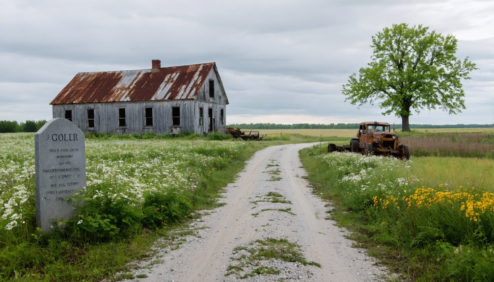
With no public transit options, you’re on your own schedule. Three structures still stand among the ruins, alongside an abandoned lead mine. The campground conversion from the 1940s left traces you can still explore today.
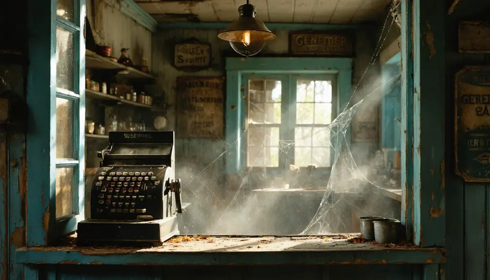
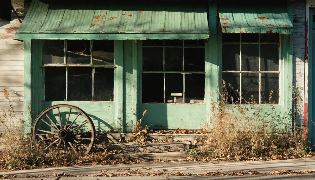
What Remains at the Pokerville Site Today
When you arrive at the intersection of East Brigham Road and County Highway ID today, you’ll find yourself standing at what was once Pokerville’s bustling center—now just quiet farmland two miles west of modern Blue Mounds. The remnant building condition tells a story of nature reclaiming the site, with only fragments of a once-thriving community of 500 souls.
Where 500 souls once bustled, only quiet farmland remains—nature slowly erasing the memory of Pokerville’s vibrant past.
What you can still discover:
- Three standing structures scattered across the property, their exact purpose lost to time
- An abandoned lead mine that sparked the town’s original boom
- Old-school steps leading nowhere, alongside crumbling building foundations
- The 1940s campground conversion has left its own layer of history
The isolation offers something rare: freedom to explore Wisconsin’s forgotten past without crowds or restrictions.
Getting There: Directions and Route Planning From Dane County
From Madison, you’ll head southwest on US-151 for about 25 miles before cutting through the rolling hills near Barneveld—I’ve made this drive half a dozen times, and the landscape shift from urban sprawl to farmland happens fast.
Your GPS coordinates (43.021754, -89.853321) will lead you to the Pokerville Trail area at 1535 feet elevation, accessible via WI-78 and County Road F in roughly 45 minutes.
If you’re collecting ghost town sites, consider adding nearby Military Ridge settlements to your route, since they trace the same historic corridor that once connected these vanished communities.
Best Routes From Madison
Since Pokerville sits just 28 miles west of Madison in the same county, you’ll find the drive surprisingly straightforward—though the ghost town’s remote location belies its proximity to the state capital.
Your best route:
- Take US-18 West from Madison, rolling through Verona’s outskirts where suburbia fades to farmland
- Continue through Mount Horeb, watching for the distinctive trolls marking Norwegian heritage
- Near Blue Mounds, turn north onto County Highway ID
- Follow East Brigham Road to the intersection marking Pokerville’s heart
I’ve driven this dozens of times—40 minutes of highway freedom with zero public transportation options available. Seasonal driving conditions matter: winter snow blankets these back roads, while fall offers perfect exploration weather. The entire route accommodates 2WD vehicles year-round, making this abandoned settlement accessible to any adventurer with wheels.
Nearby Ghost Town Stops
While Pokerville anchors your ghost town exploration, the surrounding region hides several abandoned settlements worth adding to your route. Pendarvis sits one hour southwest of Madison, showcasing remarkably preserved Cornish immigrant structures that’ll transport you to 1840s mining life. You’ll find authentic stone cottages and interpretive displays that bring Wisconsin’s lead mining heritage to life.
Dane County harbors additional historic sites within easy driving distance, making coordinated itineraries practical for a single day trip. Other regional ghost towns scattered across southern Wisconsin offer varied experiences—from isolated foundations overgrown with prairie grass to partially standing structures whispering stories of frontier ambition.
Consider specialized ghost town tourism tours if you’re seeking expert-guided experiences. These organized trips connect Wisconsin’s forgotten settlements into compelling narratives about pioneer resilience and economic boom-bust cycles.
Blue Mounds Village: Exploring What Rose From Pokerville’s Ashes
After the 1852 Indian attack shattered their community, Pokerville’s survivors didn’t simply scatter—they dragged their homes, barns, and dreams two miles east to the protective shadow of Blue Mounds.
When danger struck in 1852, Pokerville’s settlers hauled their entire lives—homes, barns, and all—two miles east to safety.
This early settlement history created today’s village, where you’ll discover what determination looks like in timber and stone. When the Chicago and North Western Railway bypassed Pokerville in 1881, economic decline factors sealed the old town’s fate while breathing life into Blue Mounds.
You can explore:
- Repurposed 19th-century buildings housing modern shops and cafes
- Rolling hills that attracted German and Norwegian homesteaders
- Historic cheese factory sites from dairy farming’s golden era
- The railway depot location that determined which settlement survived
Walk these streets knowing you’re standing where freedom-seekers rebuilt everything from scratch.
Nearby Historical Sites Worth Adding to Your Itinerary
Your exploration of Blue Mounds reveals just one chapter in southwestern Wisconsin’s rich frontier story. Head north to Prairie du Chien, where Fort Crawford Museum connects you to the region’s military past—Chief Black Hawk’s story unfolds here alongside territorial records. Visiting genealogical resources at the Prairie du Chien Public Library and Crawford County Clerk helps trace your own connections to this untamed landscape.
Southwest, Platteville’s 1845 Bevans Lead-Zinc Mine lets you descend into the tunnels that drew fortune-seekers westward. The Mining Museum documents this extractive heritage that shaped the territory.
Don’t miss Dickeyville Grotto‘s glittering monument to frontier faith, or Mineral Point’s 1856 Railroad Depot—Wisconsin’s oldest. Each site enrichens your understanding of the forces that built and abandoned settlements like Pokerville, exploring Native American history through artifacts and interpretive displays.
Primrose and Springdale Townships: Governor La Follette’s Birthplace and Beyond
Just beyond Pokerville’s vanished streets, you’ll find Primrose Township, where “Fighting Bob” La Follette was born in a log cabin on June 14, 1855—a site that marks the humble beginnings of Wisconsin’s progressive governor and U.S. Senator.
The rolling countryside around Primrose and neighboring Springdale still flows with the freshwater springs that drew settlers in 1844, the same landscape that shaped these townships into dairy farming strongholds.
You’re driving through territory where Anna Tasher crafted the first Wisconsin Swiss cheese in her farmhouse basement before the Tashers built their factory in 1878, transforming immigrant homesteads into an economic powerhouse.
Governor La Follette’s Primrose Roots
As you wind through the rolling farmland of Primrose Township in southwestern Dane County, it’s hard to imagine this quiet rural landscape produced one of America’s most transformative political figures. Robert “Fighting Bob” La Follette was born here on June 14, 1855, in a humble log cabin that shaped his understanding of ordinary Americans’ struggles.
La Follette’s childhood memories of Primrose included:
- Loss and resilience – His father died when he was just one year old
- A new beginning – His mother remarried in 1862, moving the family to Argyle
- Strict upbringing – His 70-year-old stepfather brought rigid discipline
- Educational pursuit – These experiences fueled his passion for social justice
The Primrose township legacy lives on through Wisconsin’s progressive reforms that champions of liberty still celebrate today.
Springdale’s Natural Water Features
When you explore the gently undulating terrain beyond La Follette’s birthplace, you’ll discover that Springdale Township’s defining characteristic is its abundance of natural springs and waterways that carved through the Driftless landscape. These groundwater sources bubble up from limestone bedrock, creating cold-water streams that wind through oak savannas and prairie remnants.
You’ll notice how seasonal stream flow varies dramatically—robust torrents during spring snowmelt transform into gentle trickles by August. The township’s namesake springs once attracted settlers seeking reliable water supplies, and today they sustain unique ecosystems where brook trout thrive in crystal-clear pools.
As you venture along forgotten roads toward Pokerville, watch for seeps along hillsides where ferns and wildflowers cluster around moisture—nature’s markers pointing to the underground reservoirs that make this region distinctive.
Historic Dairy Farming Legacy
The rolling hills of Primrose and Springdale Townships tell a story written in barn beams and milk cans—a tale that begins in 1844 when William Harlow became Springdale’s first white settler, followed two years later by Primrose’s pioneering dairy farmers in 1846.
You’re standing where “Fighting Bob” La Follette was born in 1855, in a log cabin that epitomized this dairy farming frontier. This landscape witnessed remarkable transformation:
- Dairy herd management revolutionized after Stephen Babcock’s 1890 butterfat test enabled quality-based payments
- Dairy processing innovations spread rapidly—Tashers built Primrose’s cheese factory in 1878
- Wisconsin’s dairy cattle exploded from 245,000 (1867) to 1,460,000 (1912)
- By 1915, Wisconsin dominated national butter and cheese production
The University of Wisconsin’s College of Agriculture championed silos and pasteurization, while New York transplants and European immigrants transformed exhausted wheat fields into profitable dairy operations.
Combining Your Trip With Other Wisconsin Ghost Towns
Wisconsin’s southwestern region transforms into a compelling ghost town corridor once you venture beyond Pokerville. You’ll find Pendarvis’s preserved buildings just 30 miles away, where Cornish miners abandoned their limestone structures chasing California gold.
Dover sits closer at 25 miles—a temperance colony that died when railroads chose different routes. Pleasant Ridge’s African American history tells a powerful story of formerly enslaved people who built their community around 1850, thriving until 1959.
I’ve mapped this route countless times, and you’ll cover serious ground heading northeast 80 miles to Plainfield, where Ed Gein’s disturbing legacy remains. Each stop reveals different chapters of Wisconsin’s forgotten past. Pack camping gear—these remote sites don’t offer hotels, and you’ll want flexibility exploring overgrown foundations and weathered tombstones at your own pace.
Frequently Asked Questions
Are There Any Guided Tours Available for Pokerville Ghost Town Visits?
No guided tours exist for Pokerville Ghost Town visits. You’ll explore abandoned buildings independently, respecting preservation efforts. The nearest organized ghost tour operates in Bayfield, offering expert-led paranormal experiences if you’re seeking structured adventures beyond self-guided exploration.
What Safety Precautions Should Visitors Take When Exploring the Abandoned Site?
You’ll want to wear protective gear like sturdy boots and gloves, avoid unstable structures with crumbling walls, and bring first aid supplies. Travel with friends, pack GPS devices, and respect property boundaries—freedom means exploring responsibly and safely.
Is Camping Allowed Near the Pokerville Ghost Town Location?
You won’t find WiFi hotspots here, but camping isn’t officially permitted at Pokerville’s actual ruins. You’ll need to check nearby campgrounds like Blue Mound State Park or scout local accommodations in the area for your basecamp instead.
What’s the Best Time of Year to Visit Pokerville Ghost Town?
Fall’s your best bet for exploring Pokerville’s preserved historical buildings. You’ll enjoy ideal weather conditions—crisp air, comfortable temperatures, and stunning foliage—perfect for photographing those remaining structures and wandering the abandoned lead mine without weather extremes limiting your adventure.
Are There Any Parking Facilities Available at the Pokerville Site?
No formal parking exists—you’ll find roadside pull-offs along the rural intersection. There’s zero paved parking lot availability, and accessibility for disabled visitors remains challenging. I’ve parked on grassy shoulders, embracing the unstructured, adventurous spirit this forgotten settlement offers explorers.